
(Оптимізована для пристроїв з невеликим екраном)
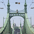
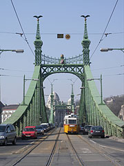
Liberty Bridge (aka Freedom Bridge, "Szabadság híd") - Будапешт, Угорщина
При натисканні:
Натисніть на зображеннями!
-

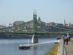
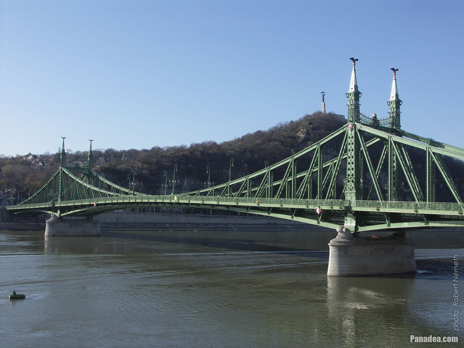
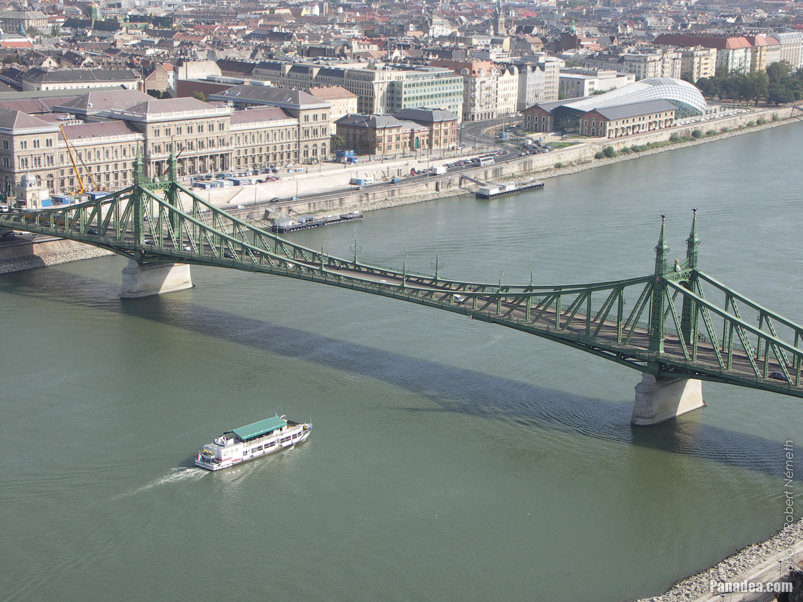
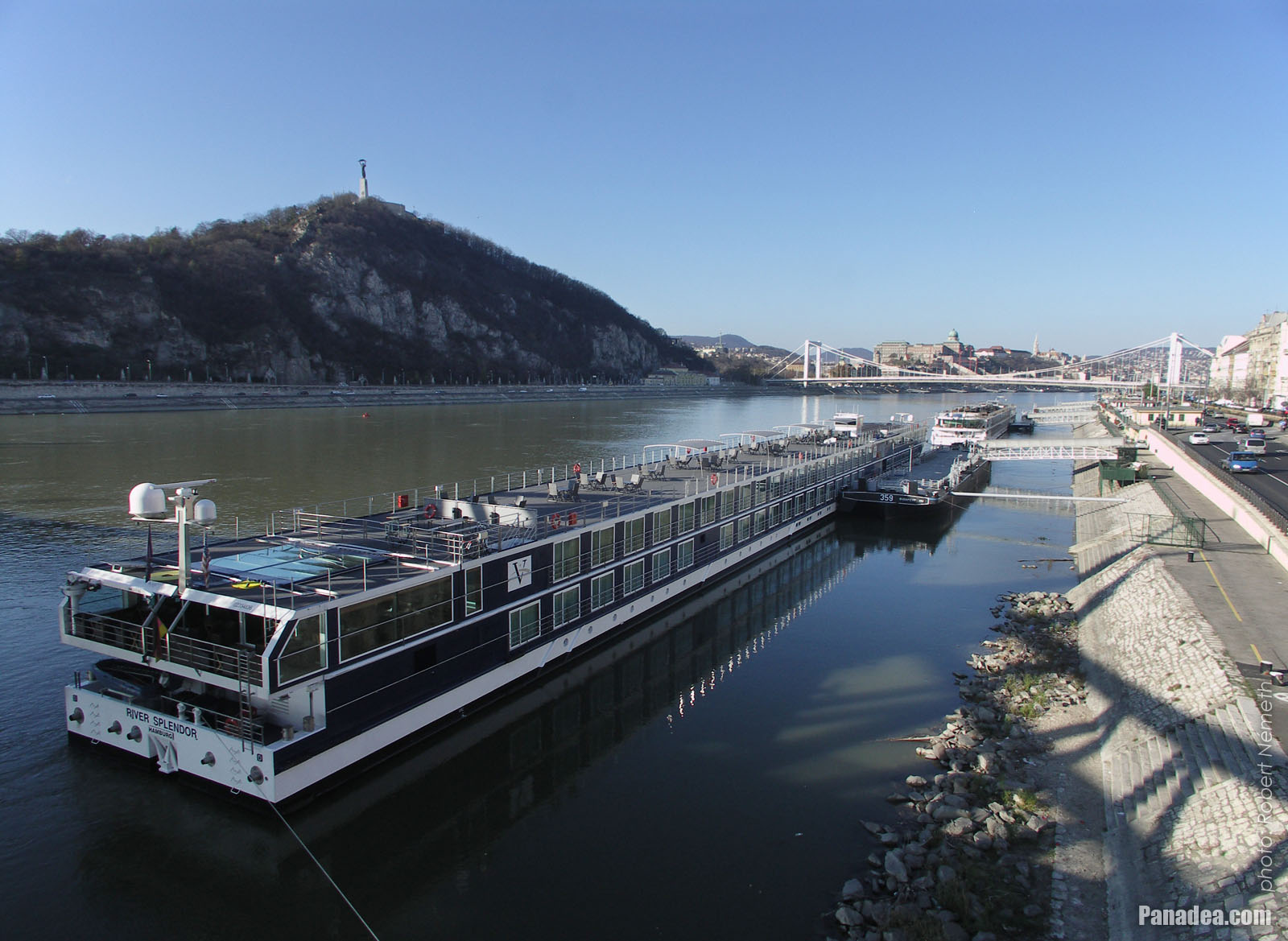
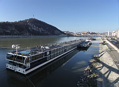
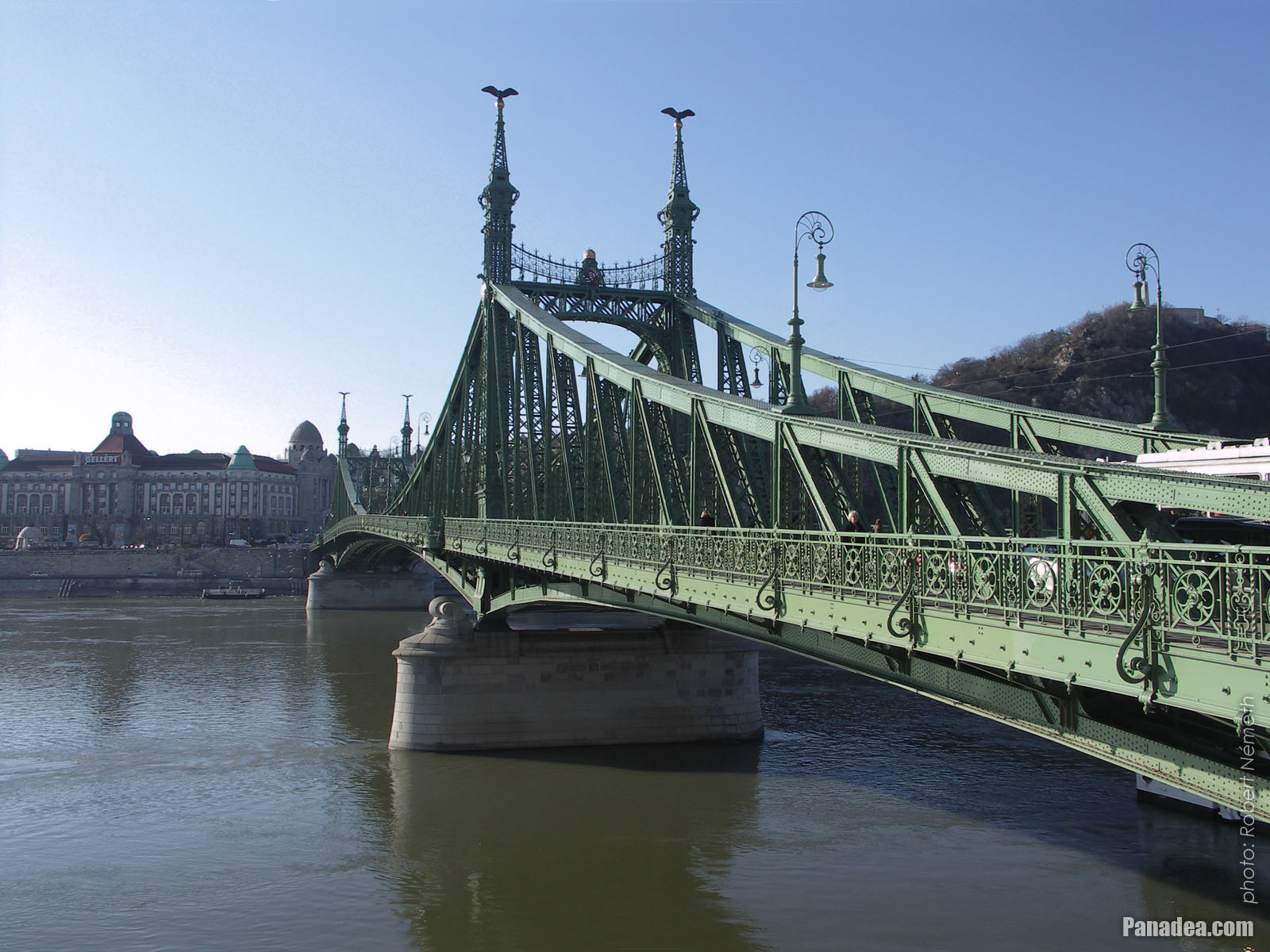
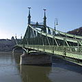
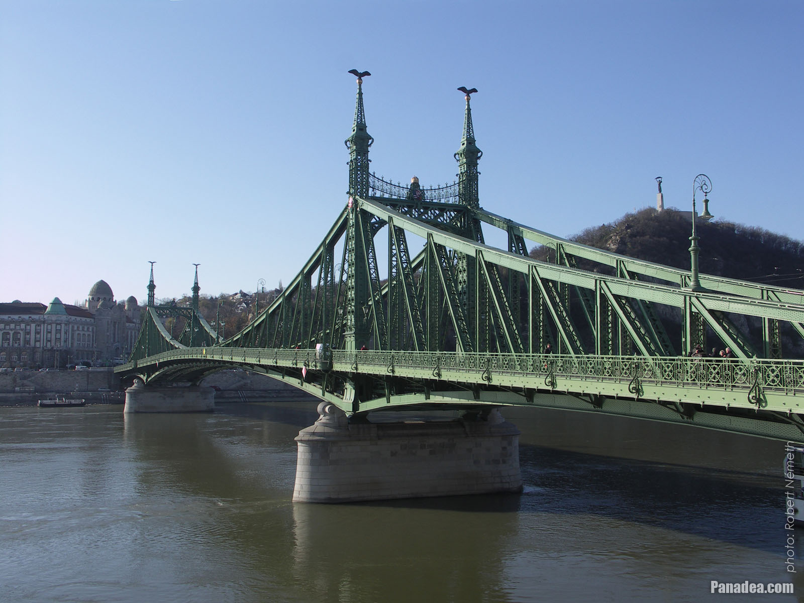
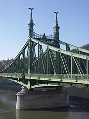
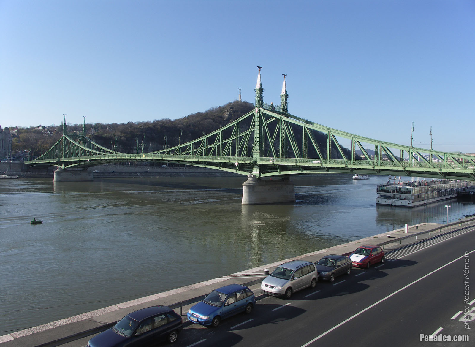
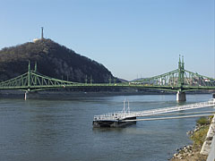
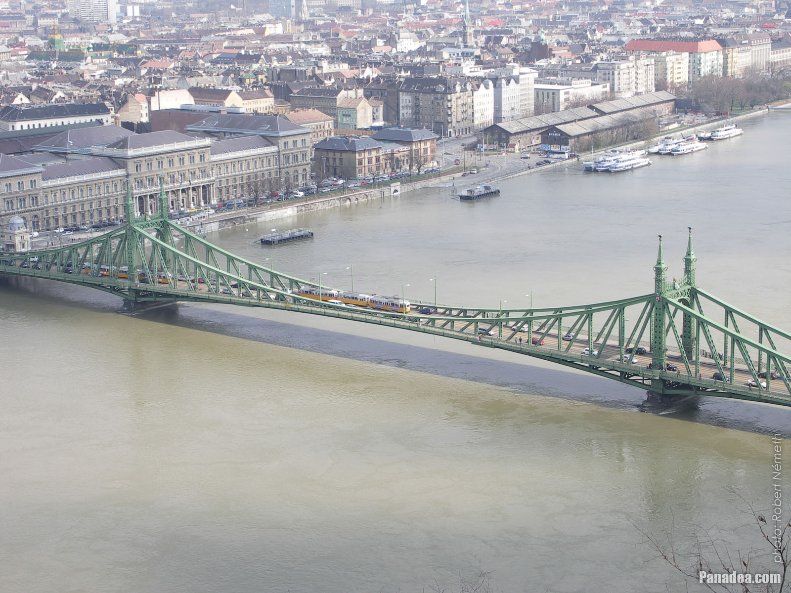
The Liberty Bridge of Budapest ("Szabadság híd") over the Danube River and in front of the Gellért Hill ("Gellért-hegy")
Дата фотозйомки: 20132013
Створено: Роберт Немет
Модель камери: Konica Minolta Dimage A200
Будапешт, Угорщина
-

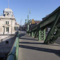
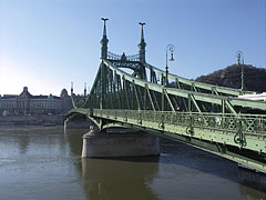
The Pest-side tower (pylon) of the Liberty Bridge ("Szabadság híd") in front of the Gellért Hill
Дата фотозйомки: 20132013
Створено: Роберт Немет
Модель камери: Konica Minolta Dimage A200
Будапешт, Угорщина
-

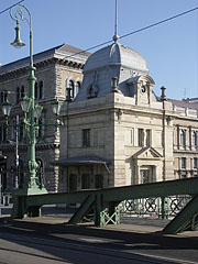
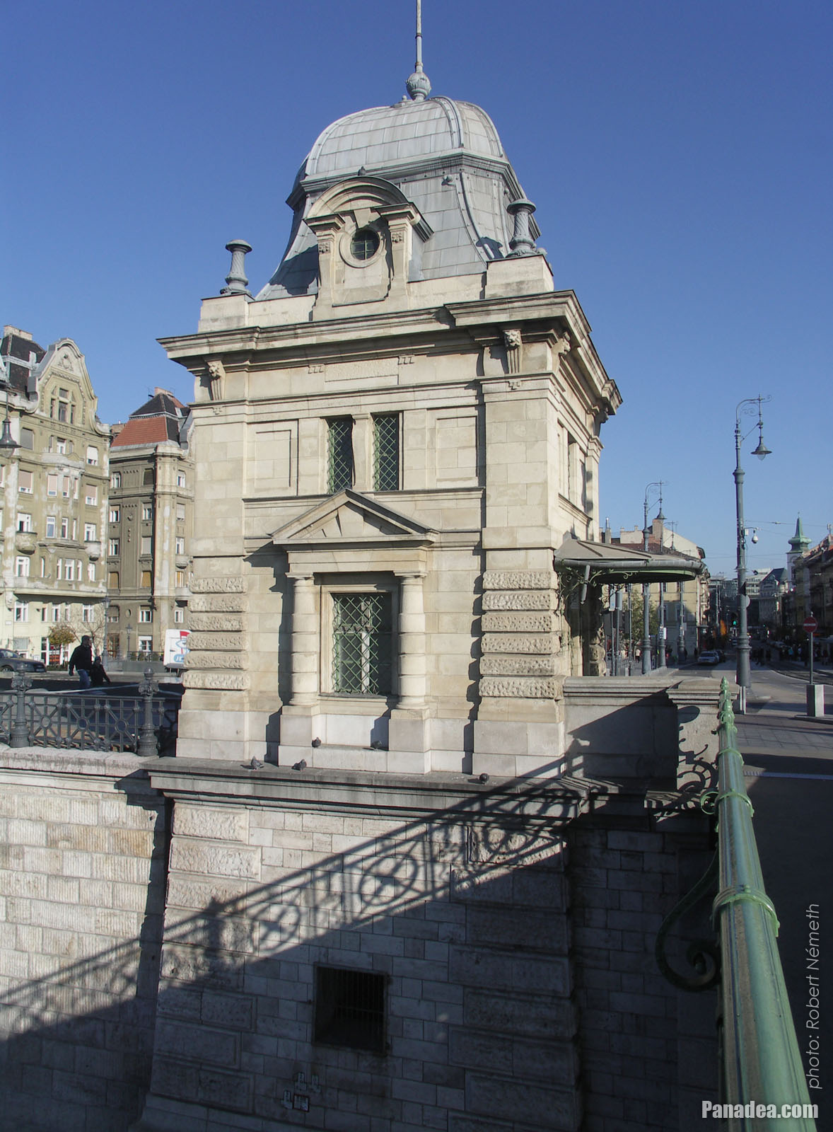
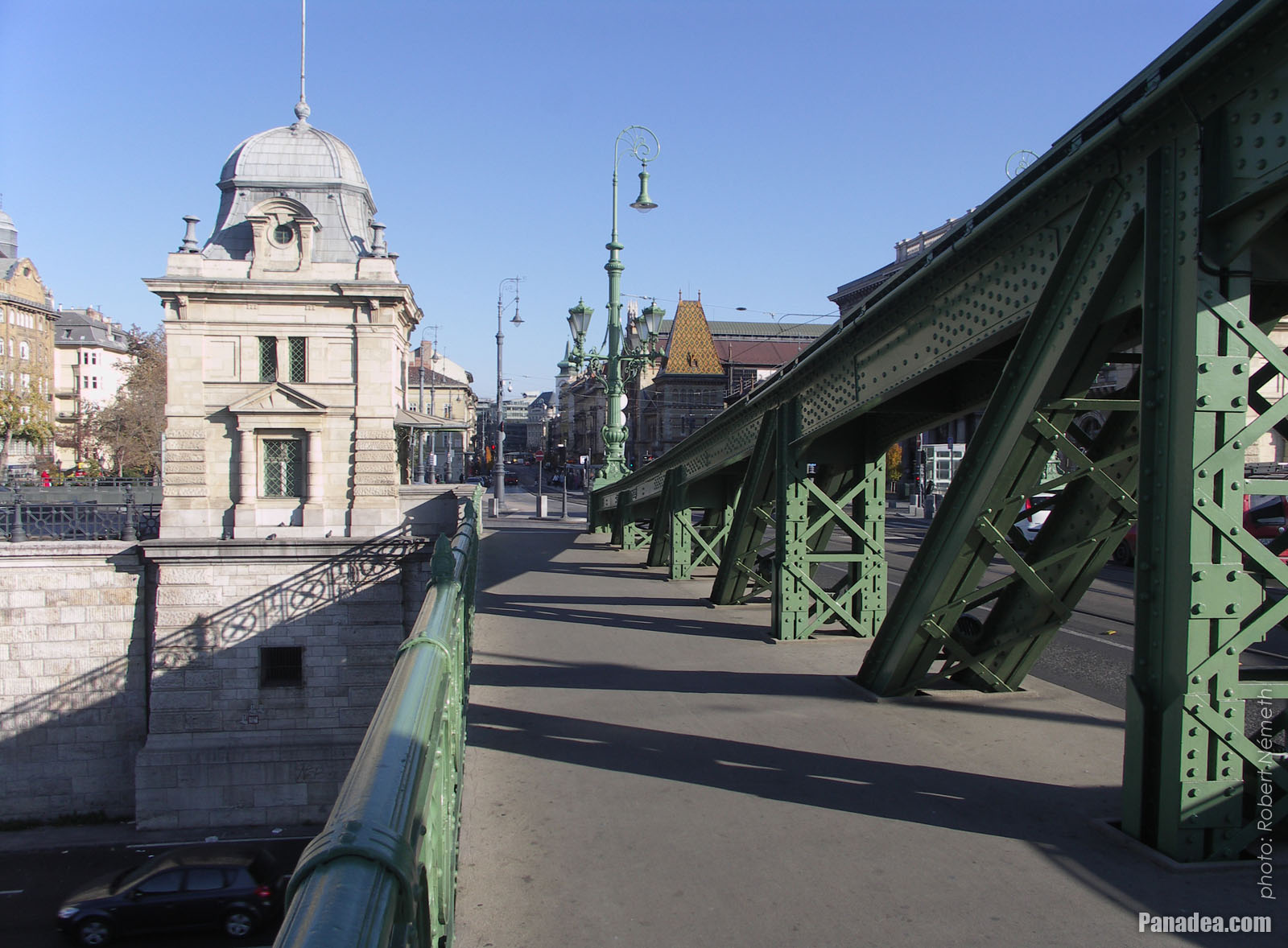
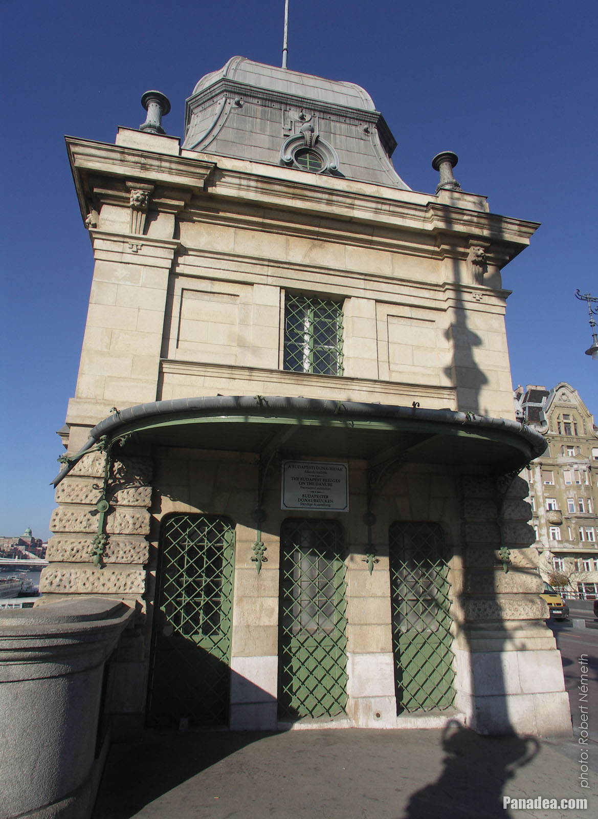
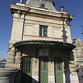
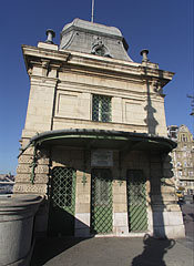
Former customs house at the Pest side of the Liberty Bridge ("Szabadság híd")
Дата фотозйомки: 20132013
Створено: Роберт Немет
Модель камери: Konica Minolta Dimage A200
Будапешт, Угорщина
-
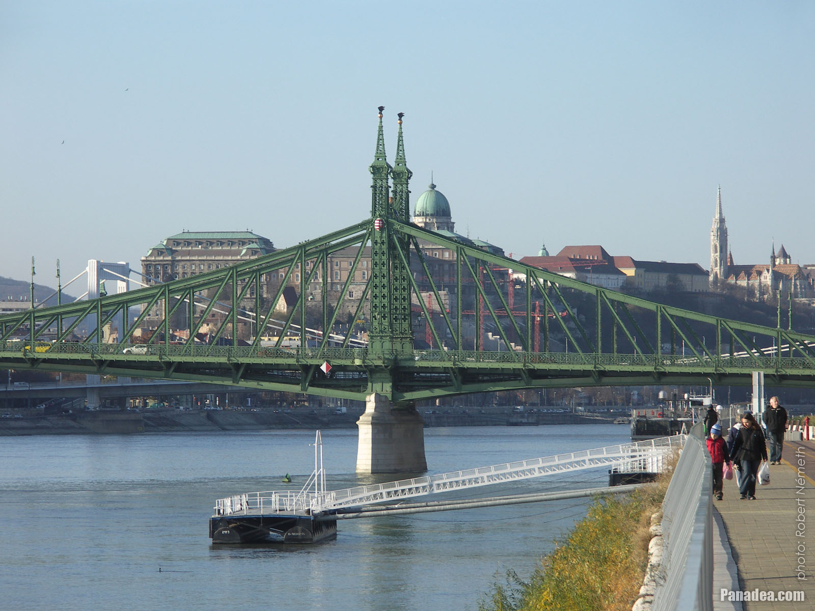
The sight of the Liberty Bridge ("Szabadság híd") and the Buda Castle Quarter from the promenade on the Danube bank in Pest
Дата фотозйомки: 20132013
Створено: Роберт Немет
Модель камери: Konica Minolta Dimage A200
Будапешт, Угорщина
-

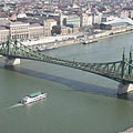
The view of the Liberty Bridge from the Pest bank of the Danube
Дата фотозйомки: 20062006
Створено: Роберт Немет
Модель камери: Konica Minolta Dimage A200
Будапешт, Угорщина
-

The Liberty Bridge ("Szabadság híd") over the Danube River, as seen from the Gellért Hill
Дата фотозйомки: 20112011
Створено: Роберт Немет
Модель камери: Konica Minolta Dimage A200
Будапешт, Угорщина
-

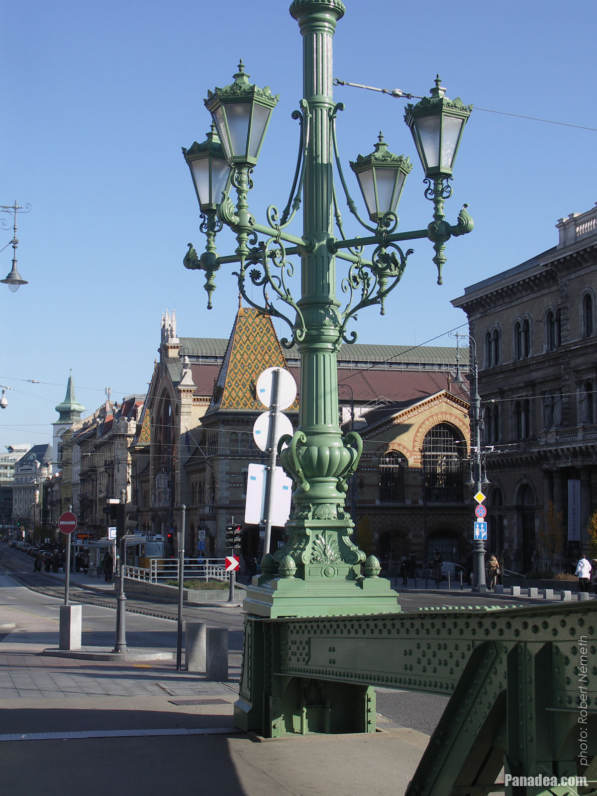
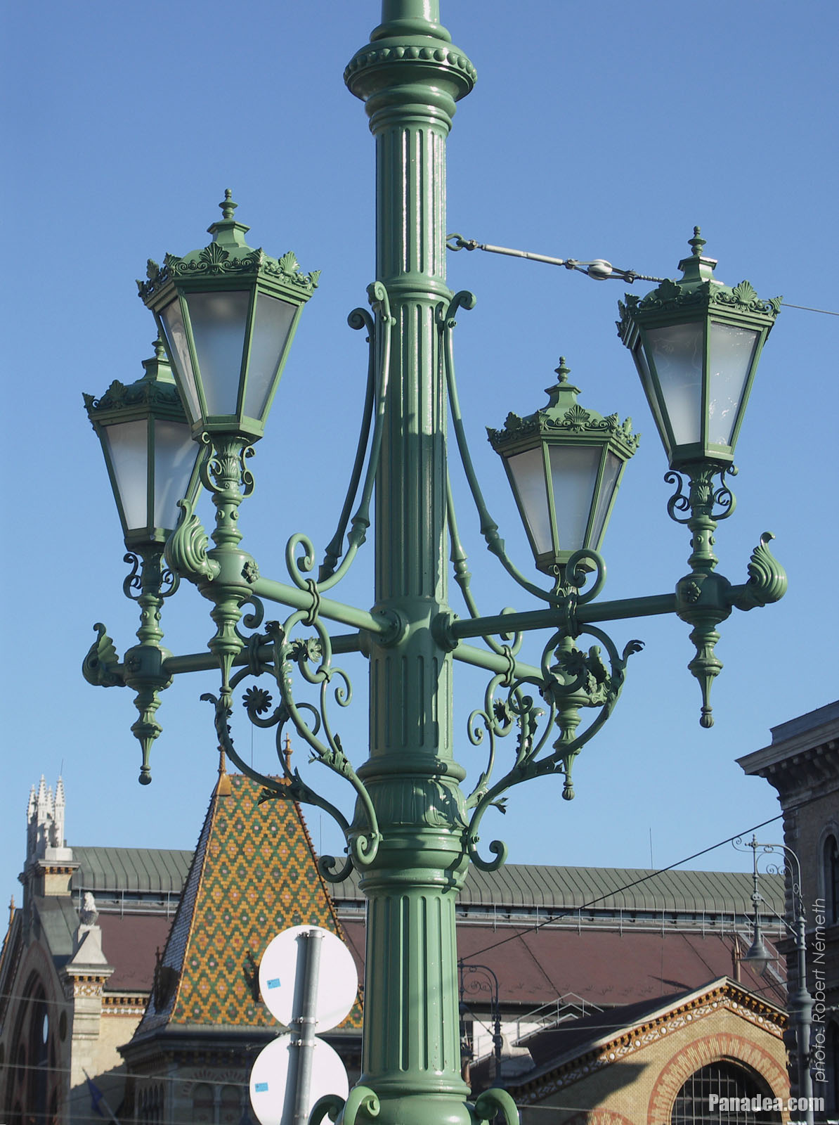
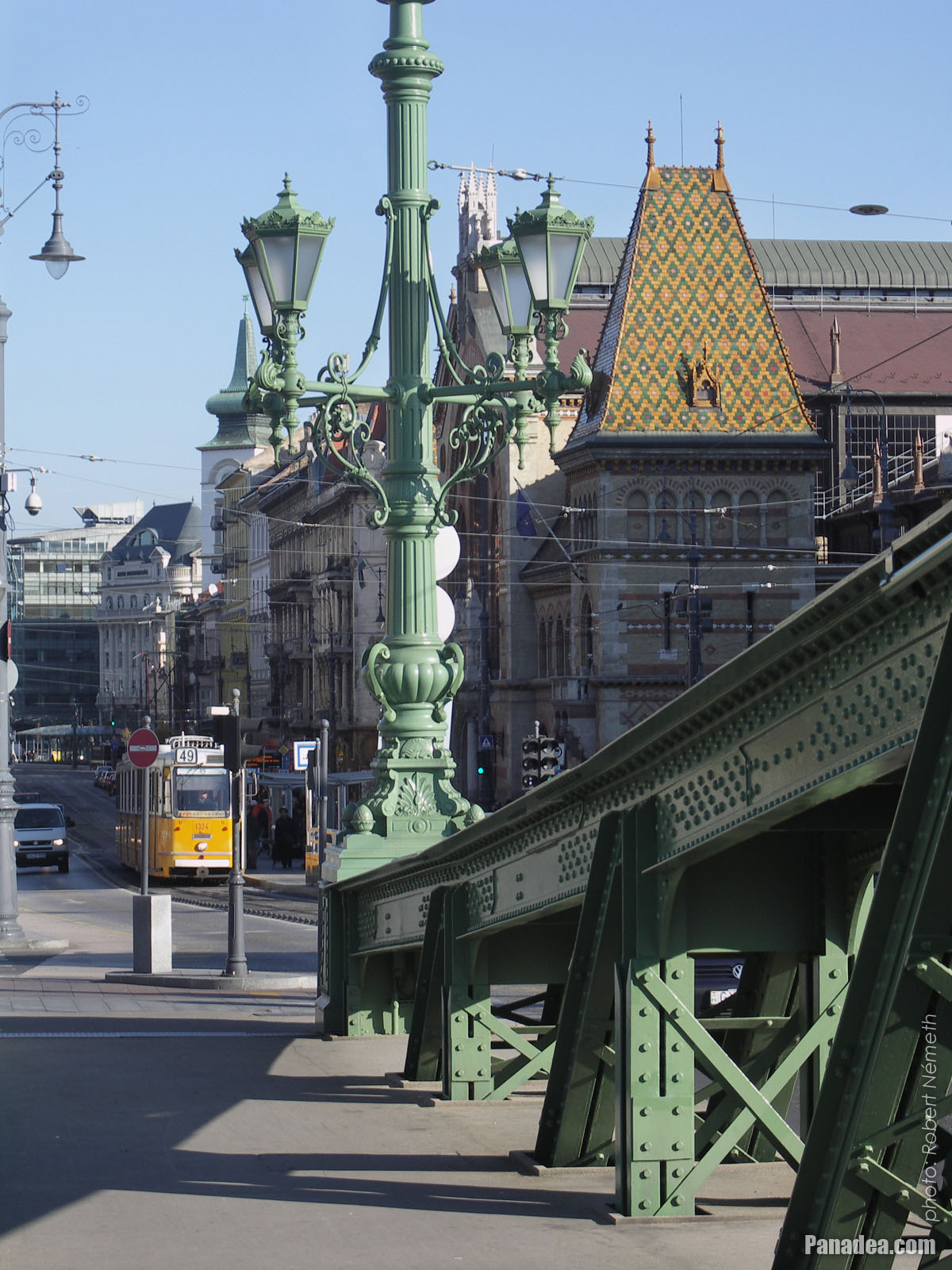
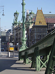
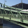
One of the ornate four-way lamp posts of the Liberty Bridge
In the background it is the Central Market Hall.
Дата фотозйомки: 20132013
Створено: Роберт Немет
Модель камери: Konica Minolta Dimage A200
Будапешт, Угорщина
-
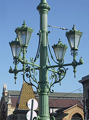
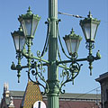
Ornate four-way lamp post on the Liberty Bridge ("Szabadság híd")
Дата фотозйомки: 20132013
Створено: Роберт Немет
Модель камери: Konica Minolta Dimage A200
Будапешт, Угорщина
-
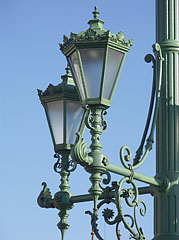
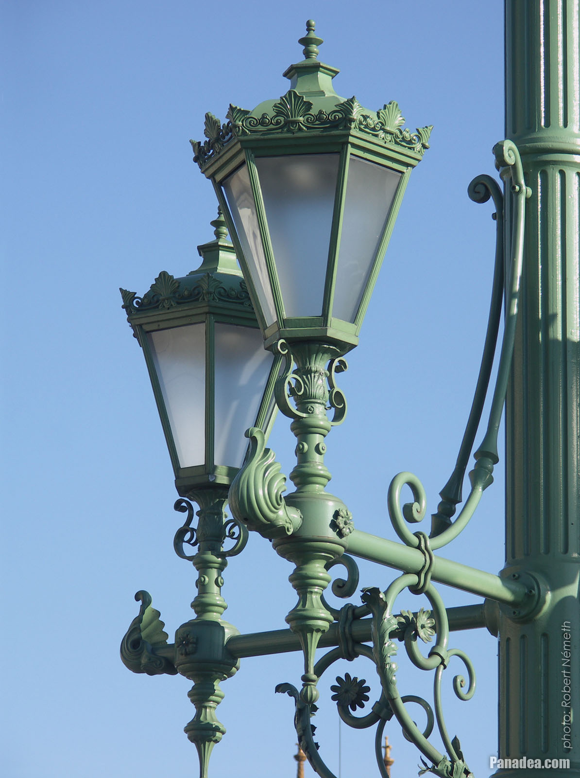
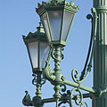
Some lamps of the Liberty Bridge
Дата фотозйомки: 20132013
Створено: Роберт Немет
Модель камери: Konica Minolta Dimage A200
Будапешт, Угорщина
-
The other former customs house of the Liberty Bridge ("Szabadság híd"), in front of the main building of the Corvinus University
Дата фотозйомки: 20132013
Створено: Роберт Немет
Модель камери: Konica Minolta Dimage A200
Будапешт, Угорщина
-
The foot of the Gellért Hill viewed from the Liberty Bridge ("Szabadság híd")
Дата фотозйомки: 20132013
Створено: Роберт Немет
Модель камери: Konica Minolta Dimage A200
Будапешт, Угорщина
The foot of the Gellért Hill viewed from the Liberty Bridge ("Szabadság híd") - Будапешт, Угорщина -
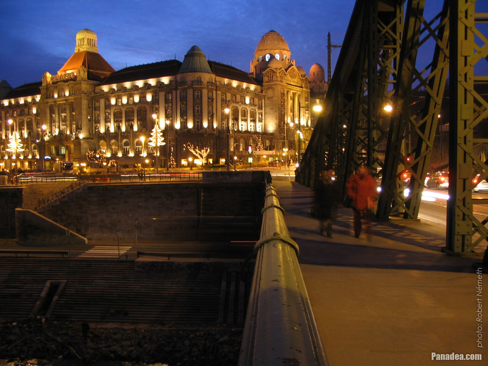
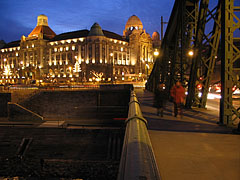
The end of the Liberty Bridge ("Szabadság híd") and the lower embankment on the Pest side of the river
Дата фотозйомки: 20132013
Створено: Роберт Немет
Модель камери: Konica Minolta Dimage A200
Будапешт, Угорщина
The end of the Liberty Bridge ("Szabadság híd") and the lower embankment on the Pest side of the river - Будапешт, Угорщина -
The Pest-side end of the Liberty Bridge ("Szabadság híd")
Дата фотозйомки: 20132013
Створено: Роберт Немет
Модель камери: Konica Minolta Dimage A200
Будапешт, Угорщина
The Pest-side end of the Liberty Bridge ("Szabadság híd") - Будапешт, Угорщина -
The view of the Liberty Bridge ("Szabadság híd") towards Buda
Дата фотозйомки: 20132013
Створено: Роберт Немет
Модель камери: Konica Minolta Dimage A200
Будапешт, Угорщина
The view of the Liberty Bridge ("Szabadság híd") towards Buda - Будапешт, Угорщина -
The connection of the Liberty Bridge ("Szabadság híd") on the Pest riverside
Дата фотозйомки: 20132013
Створено: Роберт Немет
Модель камери: Konica Minolta Dimage A200
Будапешт, Угорщина
The connection of the Liberty Bridge ("Szabadság híd") on the Pest riverside - Будапешт, Угорщина -
The Pest-side end of the Liberty Bridge ("Szabadság híd"), and the main building of the Corvinus University in the background
Дата фотозйомки: 20132013
Створено: Роберт Немет
Модель камери: Konica Minolta Dimage A200
Будапешт, Угорщина
The Pest-side end of the Liberty Bridge ("Szabadság híd"), and the main building of the Corvinus University in the background - Будапешт, Угорщина -
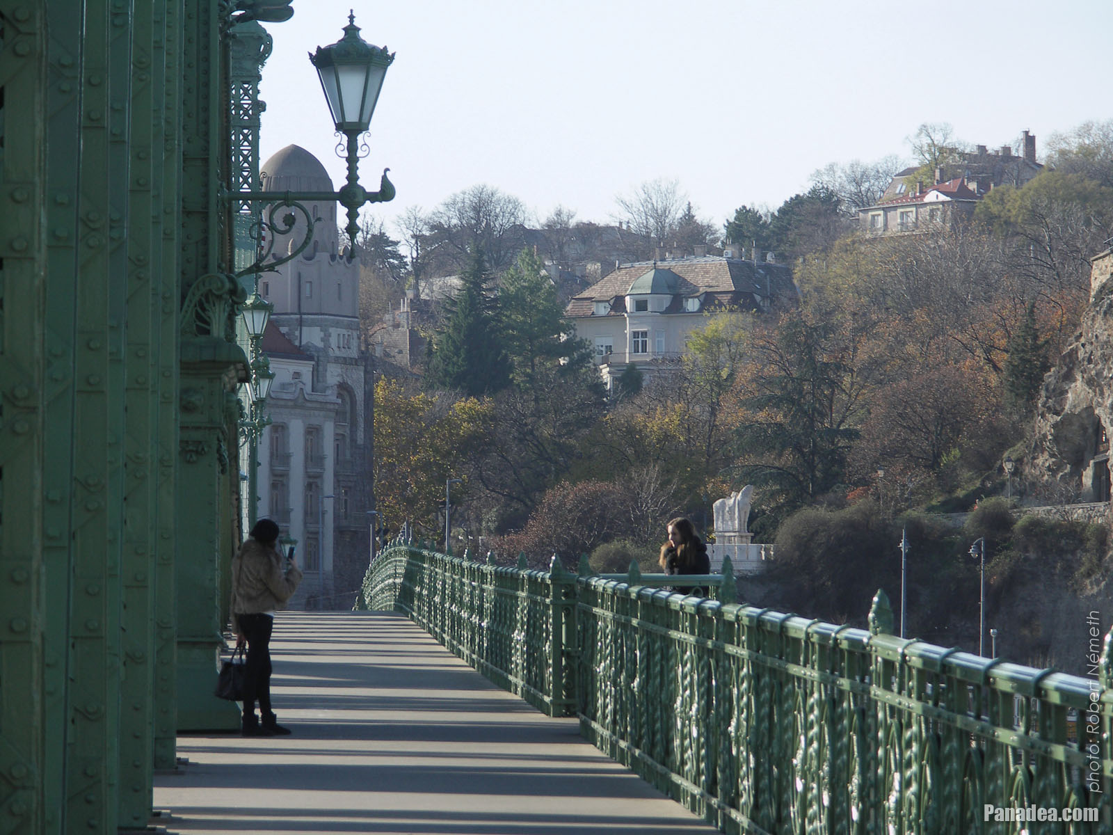
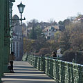
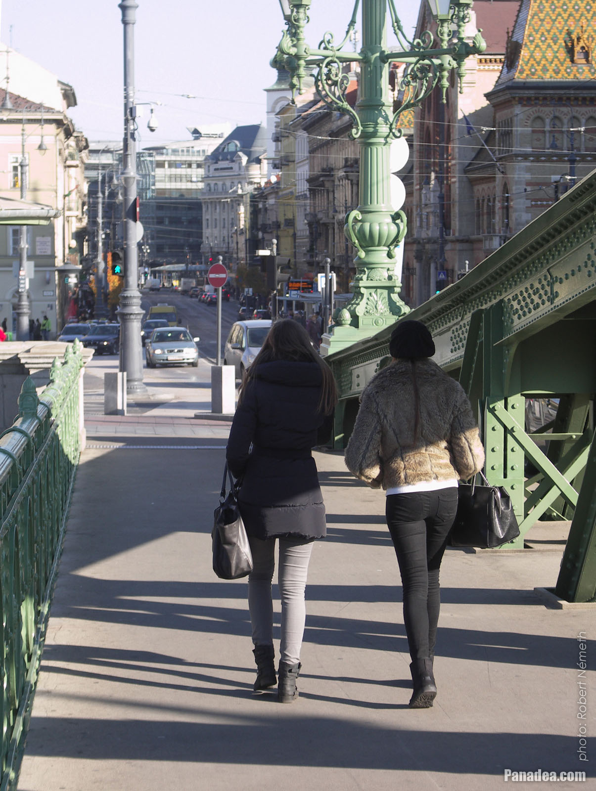
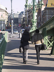
Passers-by on the Liberty Bridge ("Szabadság híd")
Дата фотозйомки: 20132013
Створено: Роберт Немет
Модель камери: Konica Minolta Dimage A200
Будапешт, Угорщина
Passers-by on the Liberty Bridge ("Szabadság híd") - Будапешт, Угорщина -
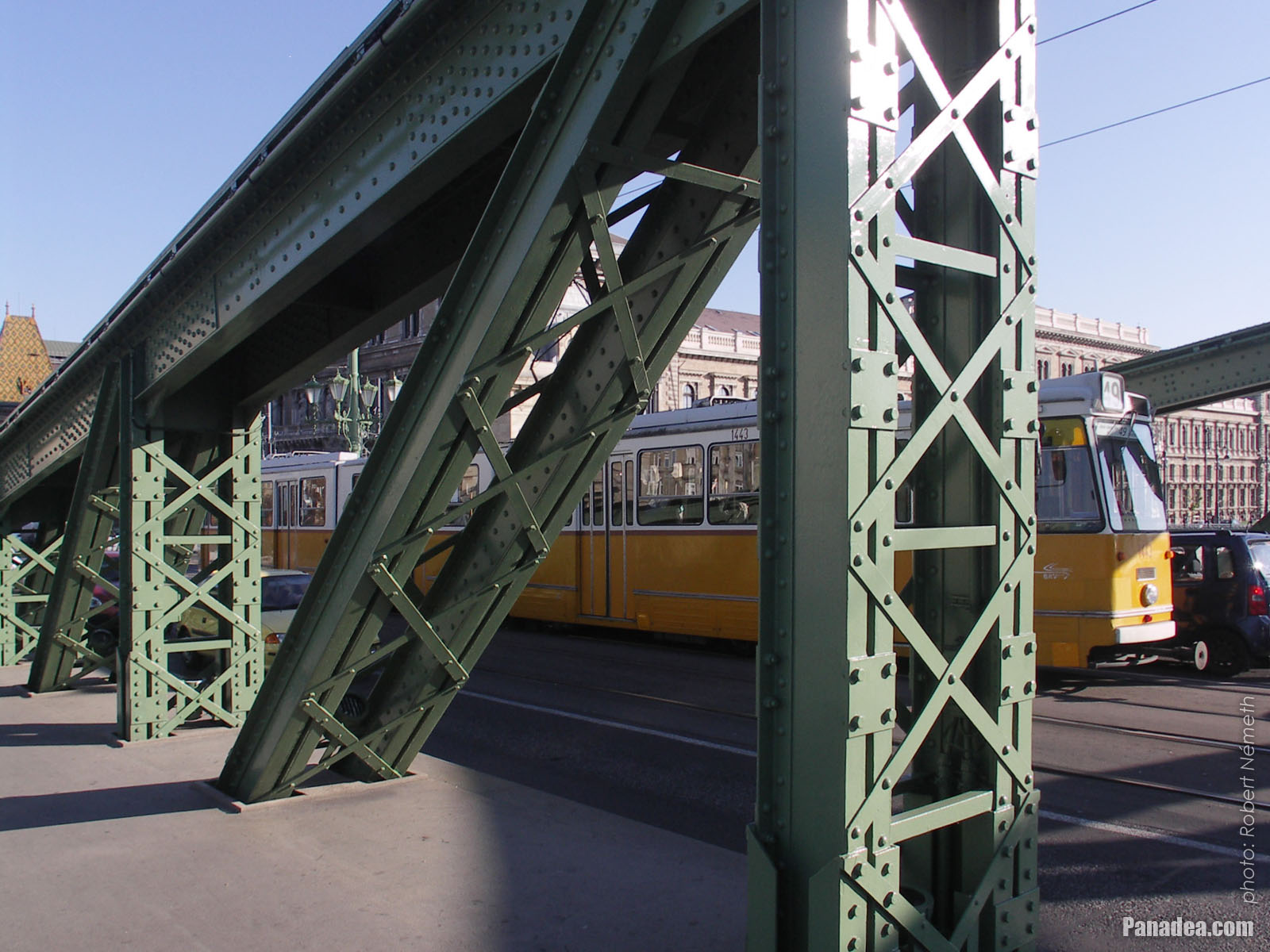
A tram on the Liberty Bridge
Дата фотозйомки: 20132013
Створено: Роберт Немет
Модель камери: Konica Minolta Dimage A200
Будапешт, Угорщина
A tram on the Liberty Bridge - Будапешт, Угорщина -
The sight from the Libery Bridge northwards: the Danube River, the Gellért Hill, the Elisabeth Bridge and the Buda Castle
Дата фотозйомки: 20132013
Створено: Роберт Немет
Модель камери: Konica Minolta Dimage A200
Будапешт, Угорщина
The sight from the Libery Bridge northwards: the Danube River, the Gellért Hill, the Elisabeth Bridge and the Buda Castle - Будапешт, Угорщина -
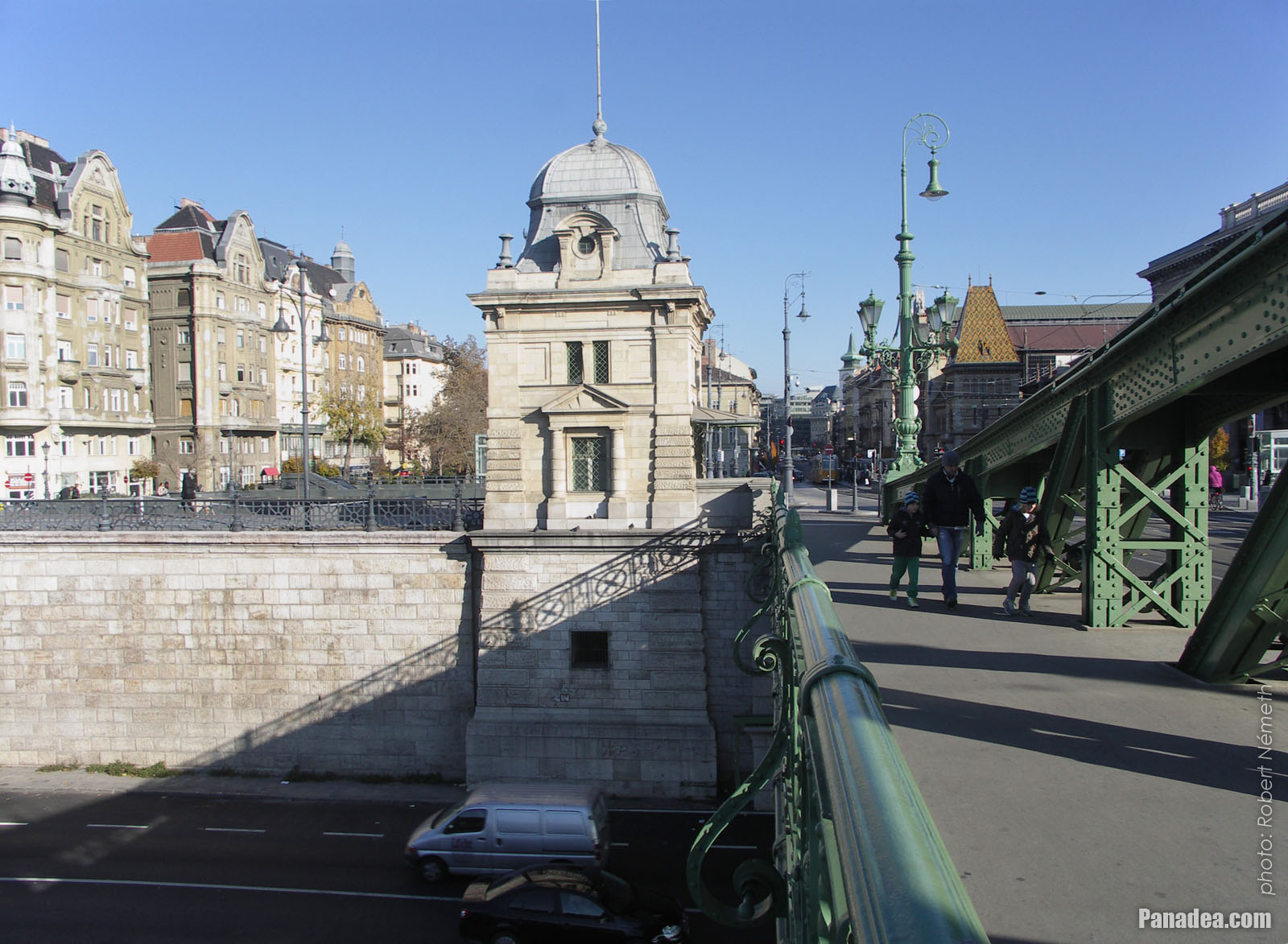
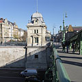
Old customs house, today museum with exhibition that presents the Danube bridges of Budapest
Дата фотозйомки: 20132013
Створено: Роберт Немет
Модель камери: Konica Minolta Dimage A200
Будапешт, Угорщина
Old customs house, today museum with exhibition that presents the Danube bridges of Budapest - Будапешт, Угорщина -
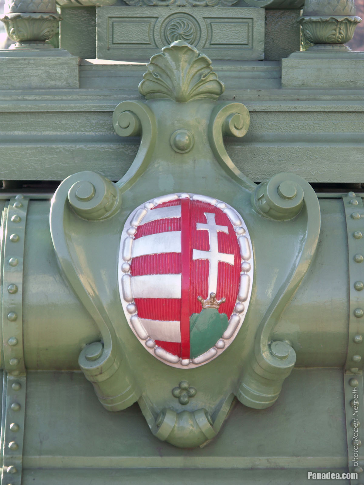
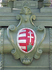
Simplified coat of arms of Hungary on the Liberty Bridge ("Szabadság híd")
Дата фотозйомки: 20132013
Створено: Роберт Немет
Модель камери: Konica Minolta Dimage A200
Будапешт, Угорщина
Simplified coat of arms of Hungary on the Liberty Bridge ("Szabadság híd") - Будапешт, Угорщина -
The Liberty Bridge ("Szabadság híd") to the direction of Buda
Дата фотозйомки: 20132013
Створено: Роберт Немет
Модель камери: Konica Minolta Dimage A200
Будапешт, Угорщина
The Liberty Bridge ("Szabadság híd") to the direction of Buda - Будапешт, Угорщина -
Detail of the Liberty Bridge
Дата фотозйомки: 20132013
Створено: Роберт Немет
Модель камери: Konica Minolta Dimage A200
Будапешт, Угорщина
Detail of the Liberty Bridge - Будапешт, Угорщина -
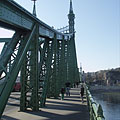
The green-painted Liberty Bridge ("Szabadság híd")
Дата фотозйомки: 20132013
Створено: Роберт Немет
Модель камери: Konica Minolta Dimage A200
Будапешт, Угорщина
The green-painted Liberty Bridge ("Szabadság híd") - Будапешт, Угорщина -
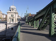
The Pest-side pylon of the Libery Bridge ("Szabadság híd")
Дата фотозйомки: 20132013
Створено: Роберт Немет
Модель камери: Konica Minolta Dimage A200
Будапешт, Угорщина
The Pest-side pylon of the Libery Bridge ("Szabadság híd") - Будапешт, Угорщина -
The surroundings of the Liberty Bridge on the Pest side of the river (embankment, Danube, bridge, etc.)
Дата фотозйомки: 20132013
Створено: Роберт Немет
Модель камери: Konica Minolta Dimage A200
Будапешт, Угорщина
The surroundings of the Liberty Bridge on the Pest side of the river (embankment, Danube, bridge, etc.) - Будапешт, Угорщина -
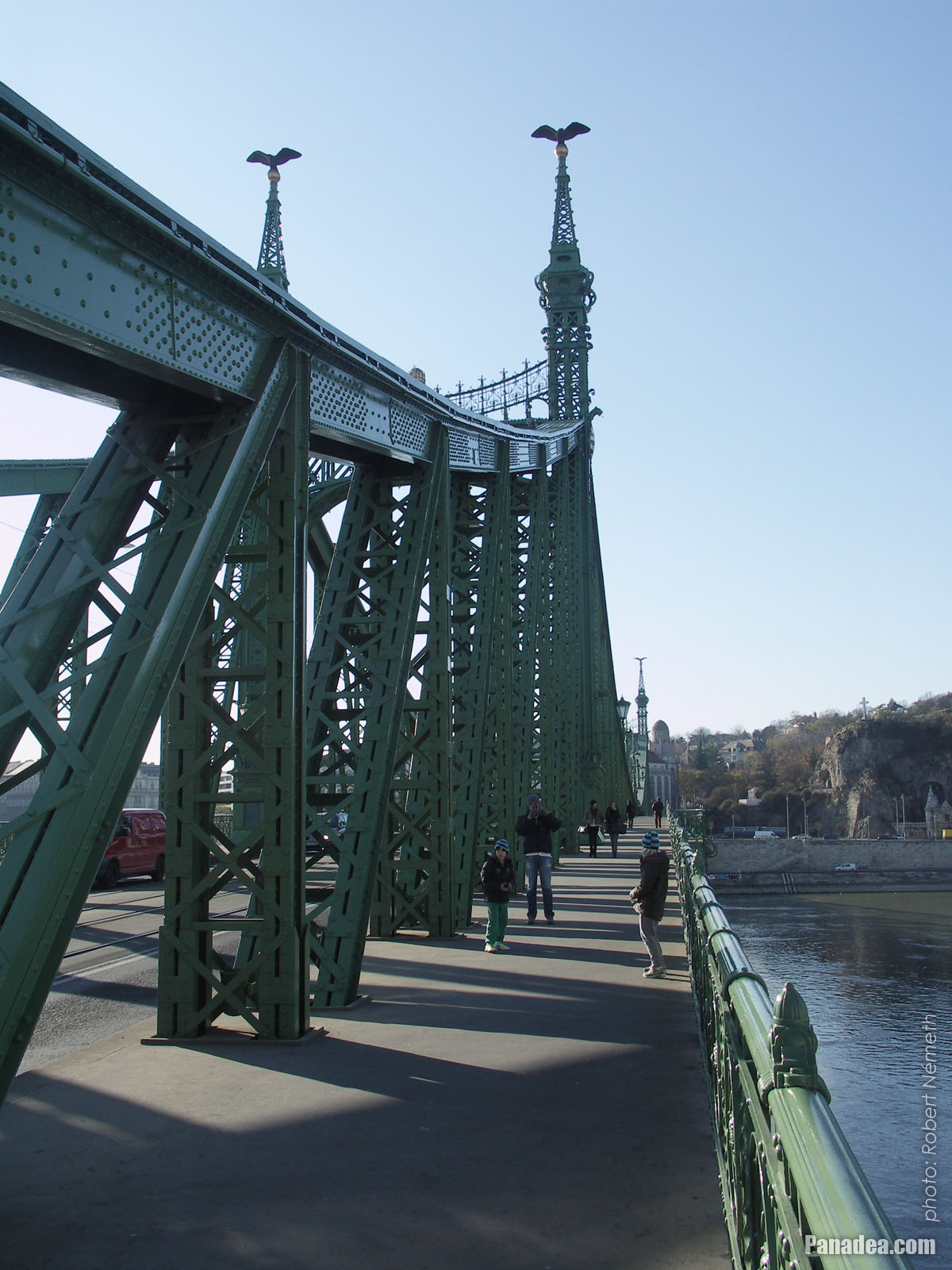
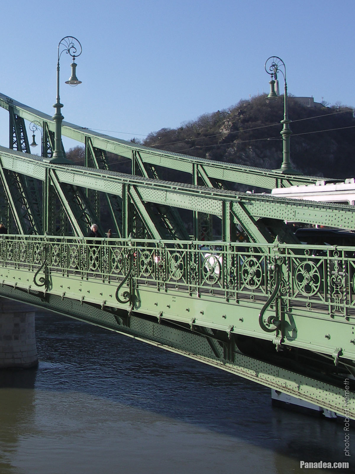
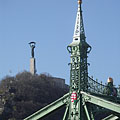
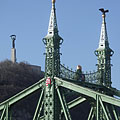
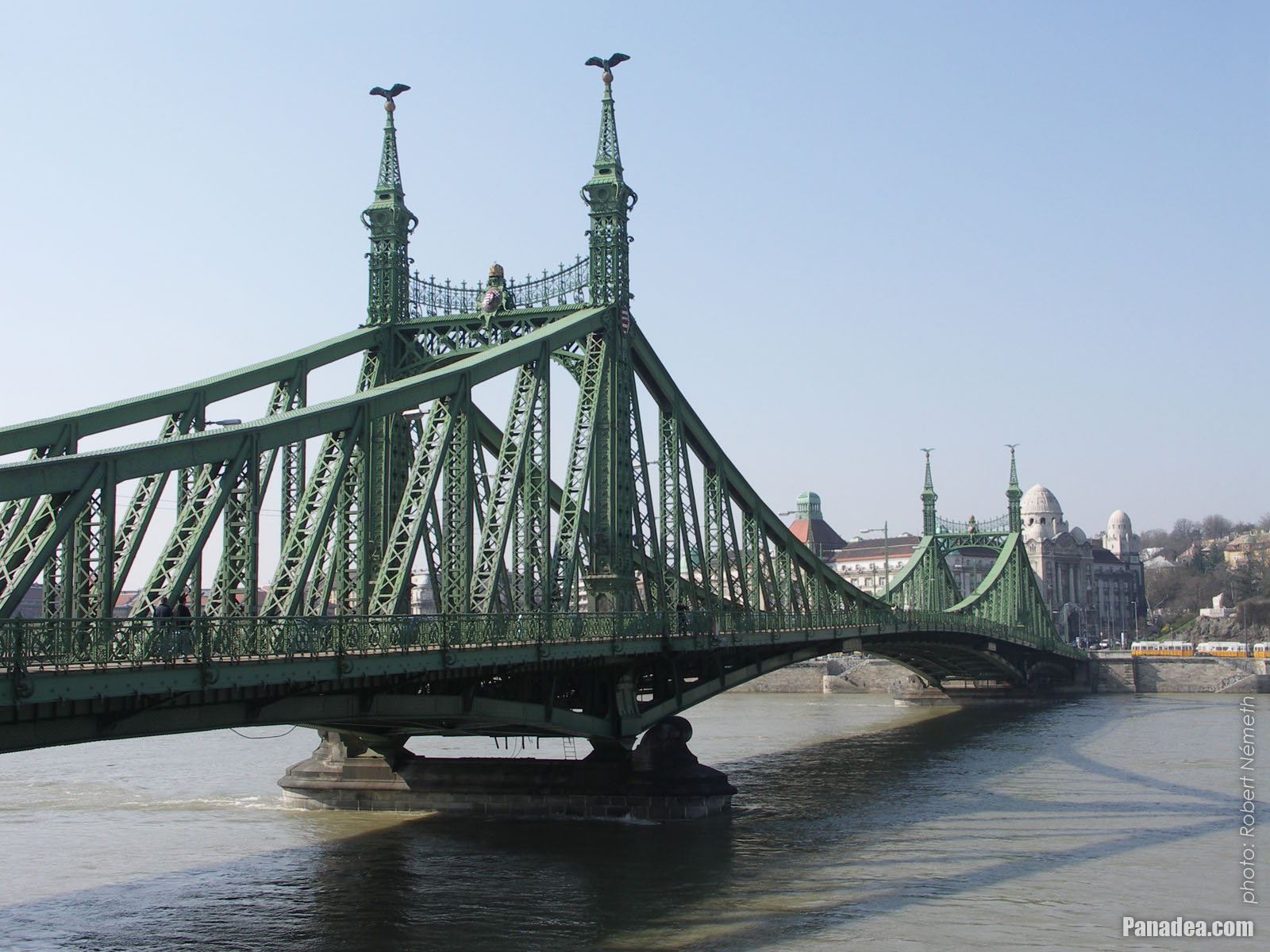
A tower (pylon) of the Liberty Bridge ("Szabadság híd") with the bronze sculpture of a falcon-like turul bird, as well as the Libery Statue on the Gellért Hill (in the distance)
Дата фотозйомки: 20132013
Створено: Роберт Немет
Модель камери: Konica Minolta Dimage A200
Будапешт, Угорщина
A tower (pylon) of the Liberty Bridge ("Szabadság híd") with the bronze sculpture of a falcon-like turul bird, as well as the Libery Statue on the Gellért Hill (in the distance) - Будапешт, Угорщина -
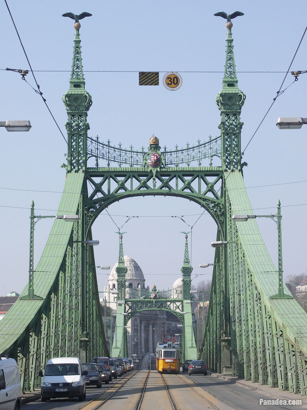
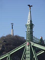
One of the towers (pylons) of the Liberty Bridge ("Szabadság híd") with two turul bird sculptures on its top, and the Liberty Statue on the Gellért Hill in the background
Дата фотозйомки: 20132013
Створено: Роберт Немет
Модель камери: Konica Minolta Dimage A200
Будапешт, Угорщина
One of the towers (pylons) of the Liberty Bridge ("Szabadság híd") with two turul bird sculptures on its top, and the Liberty Statue on the Gellért Hill in the background - Будапешт, Угорщина -
The Pest-side lower embankment, as well as the Liberty Bridge ("Szabadság híd") over River Danube
Дата фотозйомки: 20132013
Створено: Роберт Немет
Модель камери: Konica Minolta Dimage A200
Будапешт, Угорщина
The Pest-side lower embankment, as well as the Liberty Bridge ("Szabadság híd") over River Danube - Будапешт, Угорщина -
The Liberty Bridge ("Szabadság híd") over the river
Дата фотозйомки: 20132013
Створено: Роберт Немет
Модель камери: Konica Minolta Dimage A200
Будапешт, Угорщина
The Liberty Bridge ("Szabadság híd") over the river - Будапешт, Угорщина -
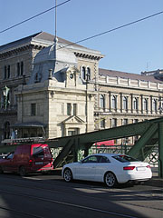
Liberty Bridge ("Szabadság híd", formerly "Ferencz József híd", "Fővám téri híd") over River Danube
Дата фотозйомки: 20062006
Створено: Роберт Немет
Модель камери: Konica Minolta Dimage A200
Будапешт, Угорщина
Liberty Bridge ("Szabadság híd", formerly "Ferencz József híd", "Fővám téri híd") over River Danube - Будапешт, Угорщина -
Liberty Bridge (in Hungarian "Szabadság híd"), as well as the Gellért Hotel and Gellért Bath in the distance
Дата фотозйомки: 20062006
Створено: Роберт Немет
Модель камери: Konica Minolta Dimage A200
Будапешт, Угорщина
Liberty Bridge (in Hungarian "Szabadság híd"), as well as the Gellért Hotel and Gellért Bath in the distance - Будапешт, Угорщина -
Liberty Bridge ("Szabadság híd") over the flooded Danube, viewed from Gellért Hill
Дата фотозйомки: 20062006
Створено: Роберт Немет
Модель камери: Konica Minolta Dimage A200
Будапешт, Угорщина
Liberty Bridge ("Szabadság híd") over the flooded Danube, viewed from Gellért Hill - Будапешт, Угорщина -
The Liberty Bridge ("Szabadság híd") and the flooding River Danube from Gellért Hill
Дата фотозйомки: 20062006
Створено: Роберт Немет
Модель камери: Konica Minolta Dimage A200
Будапешт, Угорщина
The Liberty Bridge ("Szabadság híd") and the flooding River Danube from Gellért Hill - Будапешт, Угорщина -
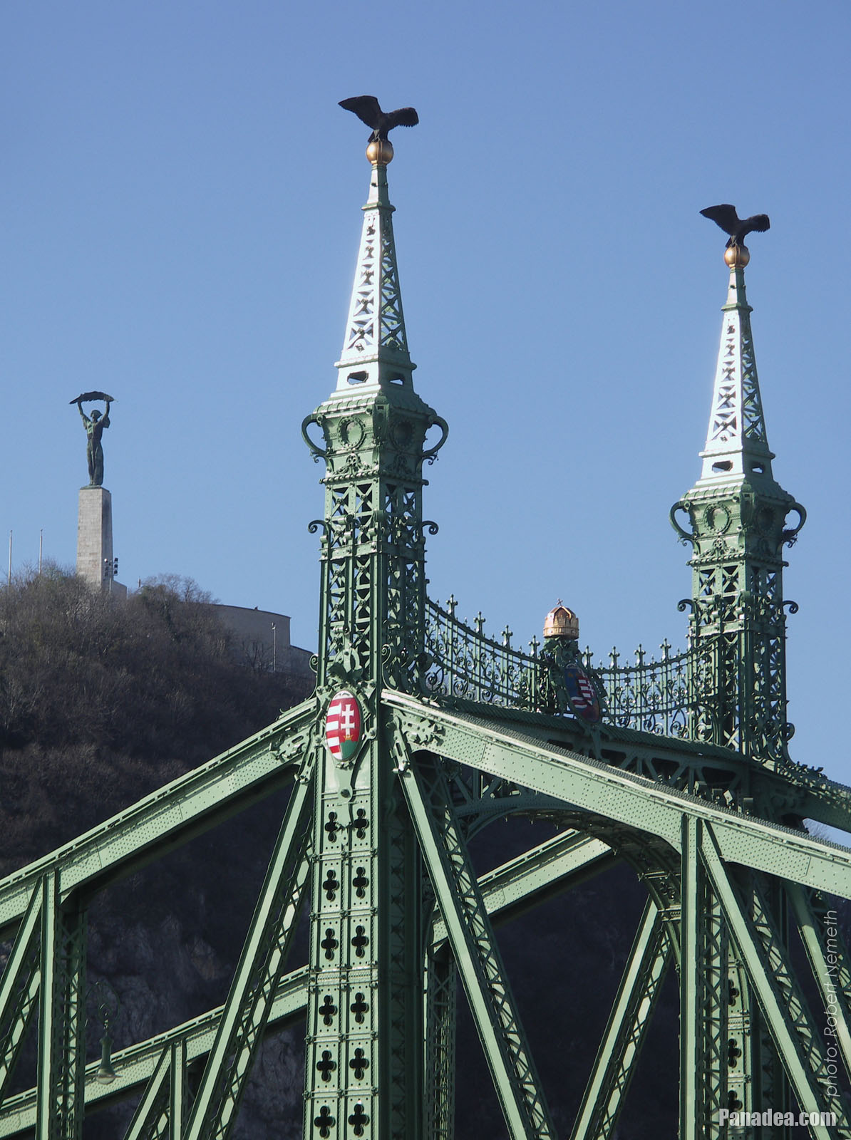
Coat of arms of Hungary and sculptures of turul birds on the pylon (tower) of the Liberty Bridge or "Szabadság híd"
Дата фотозйомки: 20062006
Створено: Роберт Немет
Модель камери: Konica Minolta Dimage A200
Будапешт, Угорщина
Coat of arms of Hungary and sculptures of turul birds on the pylon (tower) of the Liberty Bridge or "Szabadság híd" - Будапешт, Угорщина -
The view of the Buda-side embankment and the Hotel Gellért from the Liberty Bridge in the evening
Дата фотозйомки: 20042004
Створено: Роберт Немет
Модель камери: Canon PowerShot A85
Будапешт, Угорщина
The view of the Buda-side embankment and the Hotel Gellért from the Liberty Bridge in the evening - Будапешт, Угорщина


Натисніть на зображеннями!
Характеристики, особливості, властивості
Місцеположення:
GPS координати: Широти 47°29'8", Довготи 19°3'17" (N47 29.13 - E19 3.28)
Інформація, короткі історії, цікавинки
 Liberty Bridge ("Szabadság híd", formerly "Ferencz József híd", "Fővám téri híd") over River Danube
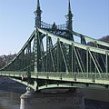
The Liberty Bridge or Freedom Bridge (also known as Freedom Bridge, in Hungarian "Szabadság híd") or as it was called initially the Franz Joseph Bridge ("Ferencz József híd") was designed by János Feketeházy, it was opened in the year of the Hungarian Millenium in 1896. This was the third permanent road crossing over the Danube in Budapest. Even then the bridge already had tram tracks, as well as electric and gas lighting.
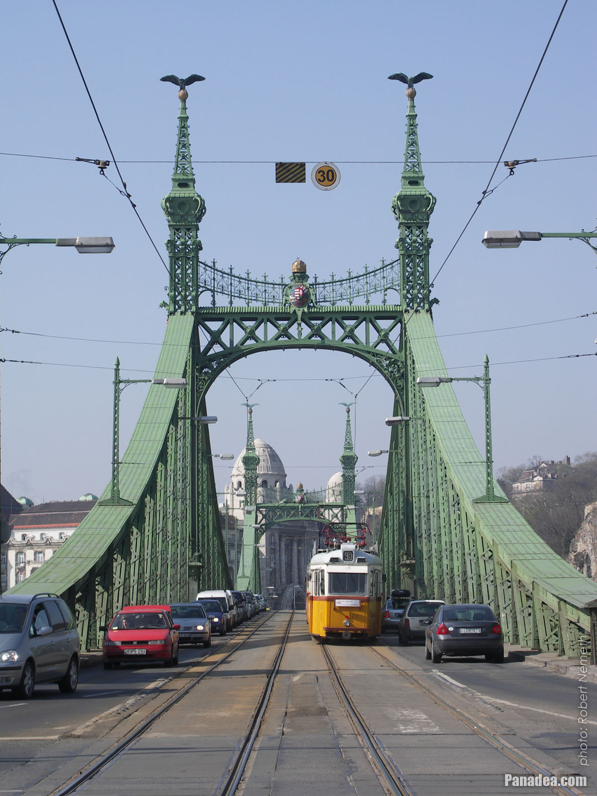
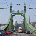
The first tram went throught the Liberty Bridge ("Szabadság híd") in 1898. At that time the tham tracks were on the sides of the bridge deck, and the tram used a conduit current collection system (the electric wires were on the ground) to get the power. The tram line was converted to overhead wire system in 1923, and from 1928 also the bus traffic was started on the bridge. Then in 1938 the rails were moved to the middle of the road, as it can be seen today.
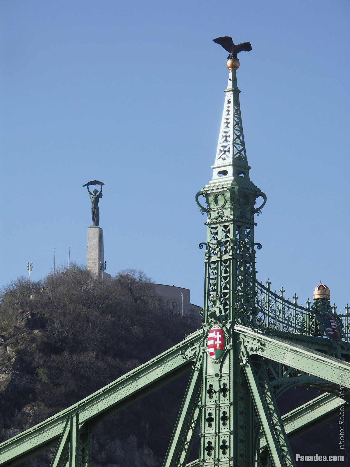
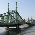
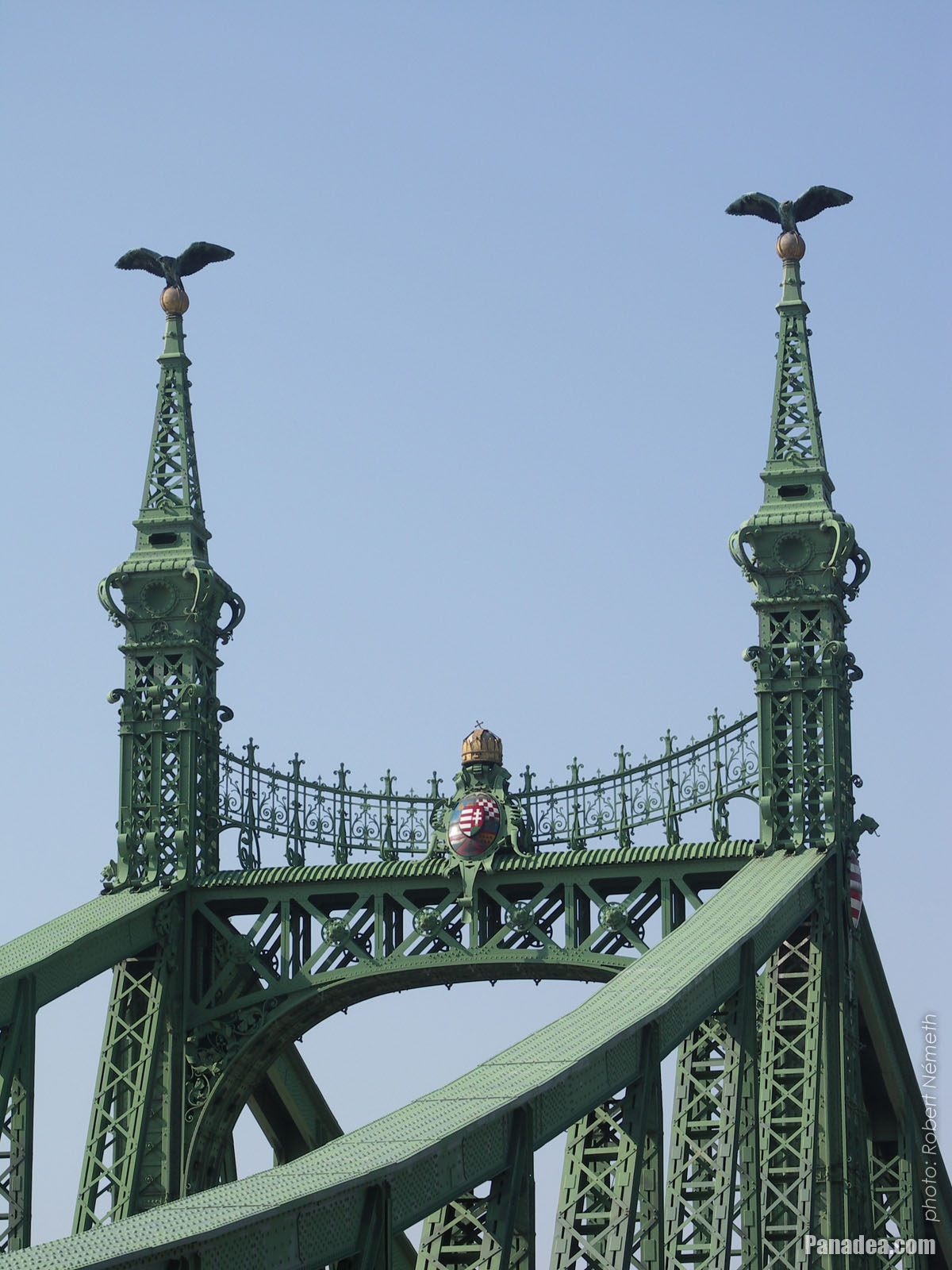
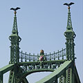
Another characteristics of the Szabadság Bridge or Liberty Bridge are the statues of turul birds with outstretched wings on the top of the pylon gates that were designed by Virgil Nagy, as well as the historical Hungarian coat of arms on the gateways (all of them were made in 1896).
 Liberty Bridge ("Szabadság híd") over the flooded Danube, viewed from Gellért Hill
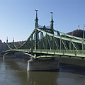
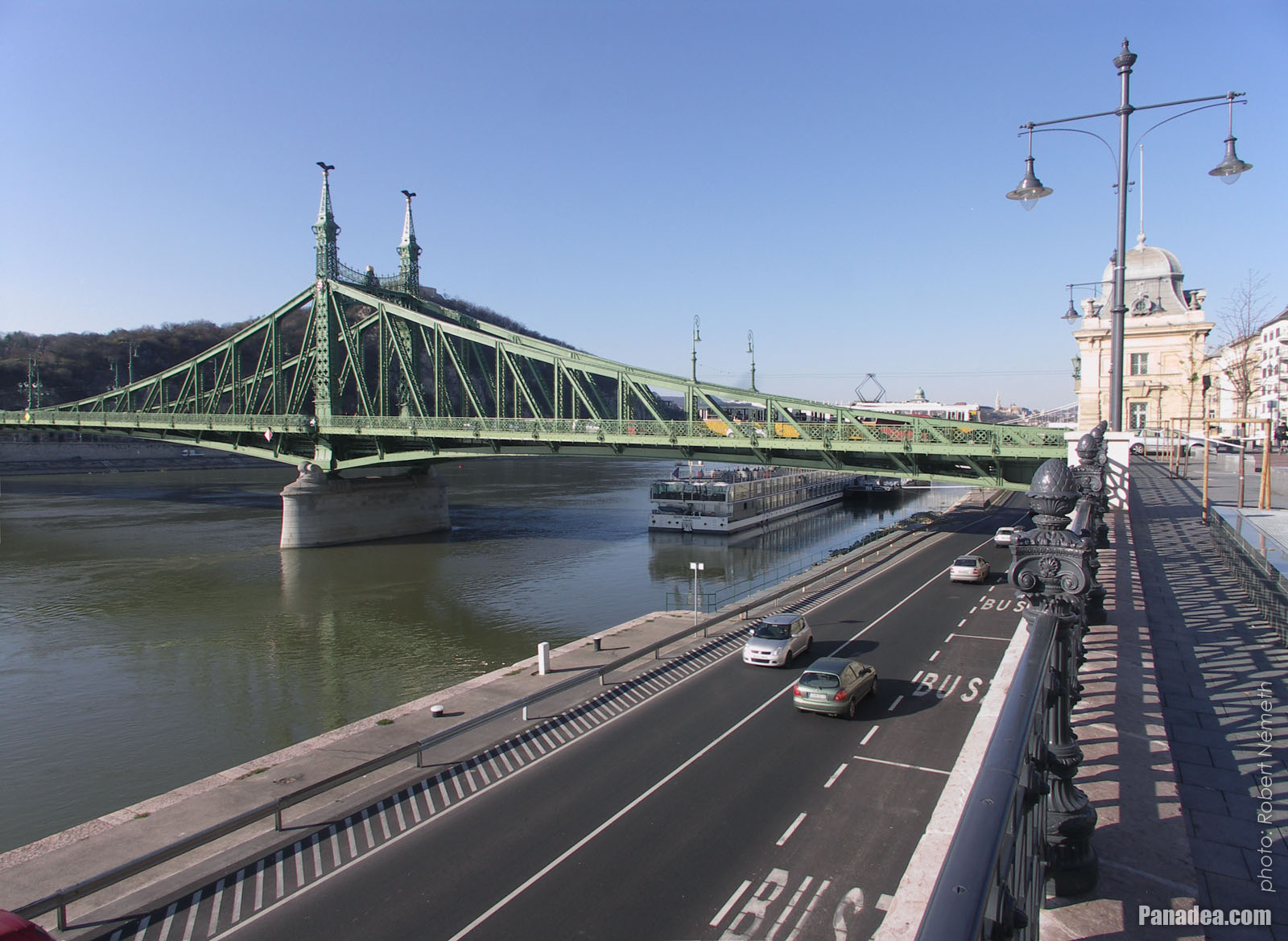
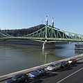
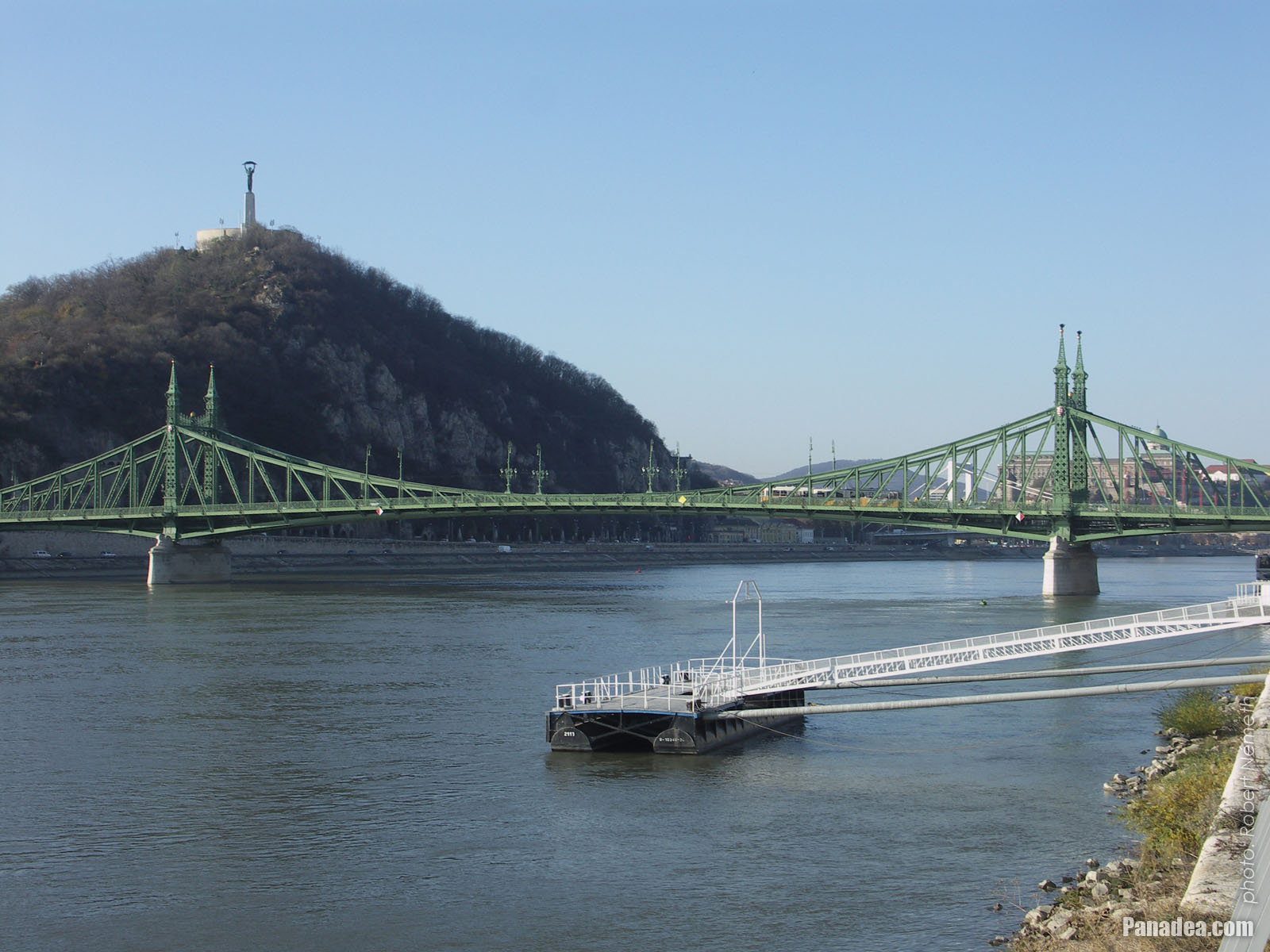
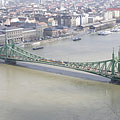
The Liberty Bridge (or Freedom Bridge, in Hungarian "Szabadság híd") is the shortest among the Danube bridges of Budapest. Before the World War II it was called Franz Joseph Bridge or Fővám Square Bridge ("Ferenc József híd" or "Fővám téri híd").
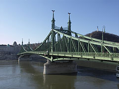
At the end of the World War II the bridge was blown up by the retreating German troops, like every other Danube bridge of Budapest. But the piers (more precisely the pylons) were remained intact and also the reparation of the middle section could be done relatively quickly. The reconstruction was done soon by the plans of Pál Sávoly architect, in 1946 it was already opened for service and then got its new name: "Szabadság híd" (in English "Liberty Bridge" or "Freedom Bridge").
Будапешт - Більше фото галереї:
Ви також можете бути зацікавлені в (Пов'язані сторінки):
Напрямки в путівнику:
Будапешт (8 468 фотографії + 21 панорамне зображеннями)
Buda Hills (Budai-hegység) (8 632 фотографії + 21 панорамне зображеннями)
Пешт медьє (15 122 фотографії + 50 панорамне зображеннями)
Будапешт і його околиці (Центральна Угорщина) (15 989 фотографії + 52 панорамне зображеннями)
Угорщина (27 287 фотографії + 163 панорамне зображеннями)
і додатково:
(в тут: Buda Hills)
Budakeszi (88 фотографії)
Pilisszentiván (76 фотографії)
Всі панорамні фото тут:
Будапешт (21 фотографії)
Пешт медьє (50 фотографії)
Будапешт і його околиці (Центральна Угорщина) (52 фотографії)
Угорщина (163 фотографії)
Європа (165 фотографії)
Всі нормально фото тут:
Будапешт (8 468 фотографії / 122 галереї)
Buda Hills (Budai-hegység) (8 632 фотографії / 124 галереї)
Пешт медьє (15 122 фотографії / 221 галереї)
Будапешт і його околиці (Центральна Угорщина) (15 989 фотографії / 234 галереї)
Угорщина (27 287 фотографії / 462 галереї)
Європа (30 494 фотографії / 523 галереї)
https://www.panadea.com/uk/guidebook/budapesht/photos/gal-014

Додати в Обране Додати в Закладки
Поділіться з вашими друзями!
і т.д.


Наш путівник містить:
Велика кількість фотографій і панорамних зображень, з великою кількістю інформації і цікавих фактів.
- 214 туристичні напрямки
- 165 панорамне зображеннями
- 30 494 інші фотографії
Велика колекція вибраних фотографій: чудова якість, висока роздільна здатність і природні кольори
Про нас - Правова інформація -
Всі права захищені
- ©2010-2022
Neuronit Creative Studio - Mogyoród / Будапешт / Угорщина