
(Otimizado para dispositivos de tela pequena)
Lakeshore of the Balaton - Balatonalmádi, Hungria
Quando você clica em:
Clique nas imagens!
-
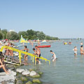
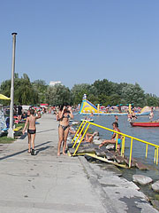
Wesselényi beach
Data de fotografia: 24/09/20102010
Criado por: Robert Németh
Modelo da câmara: Konica Minolta Dimage A200
Balatonalmádi, Hungria
-
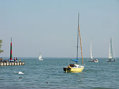
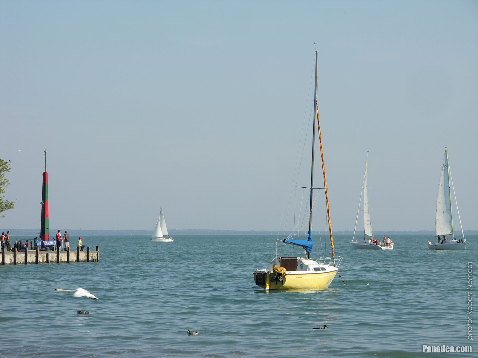
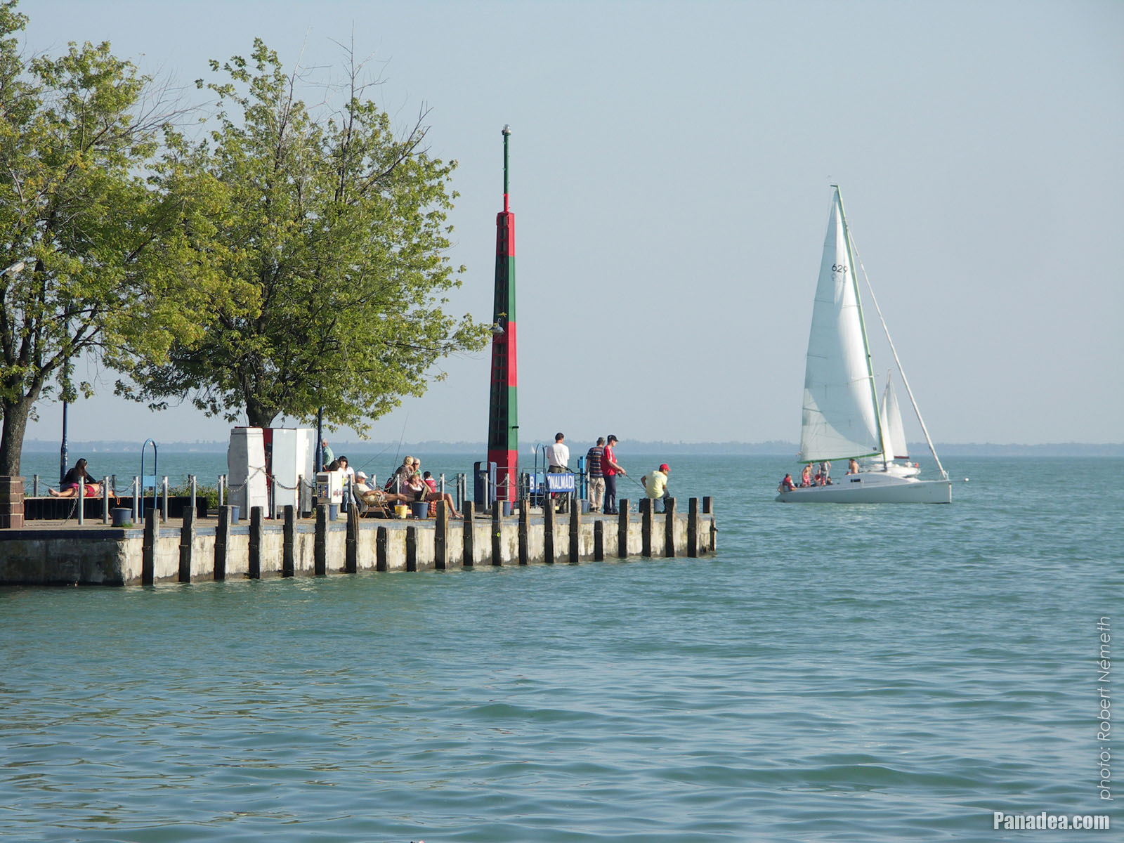
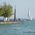
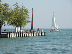
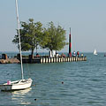
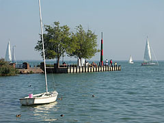
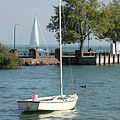
Sailboats on the lake at the boat station of Balatonalmádi
Data de fotografia: 24/09/20102010
Criado por: Robert Németh
Modelo da câmara: Konica Minolta Dimage A200
Balatonalmádi, Hungria
-
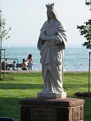
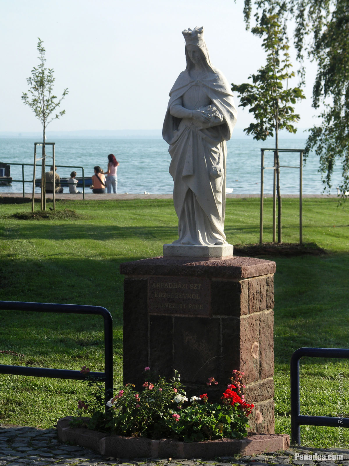
Statue of St. Elizabeth of Hungary
Data de fotografia: 24/09/20102010
Criado por: Robert Németh
Modelo da câmara: Konica Minolta Dimage A200
Balatonalmádi, Hungria
-

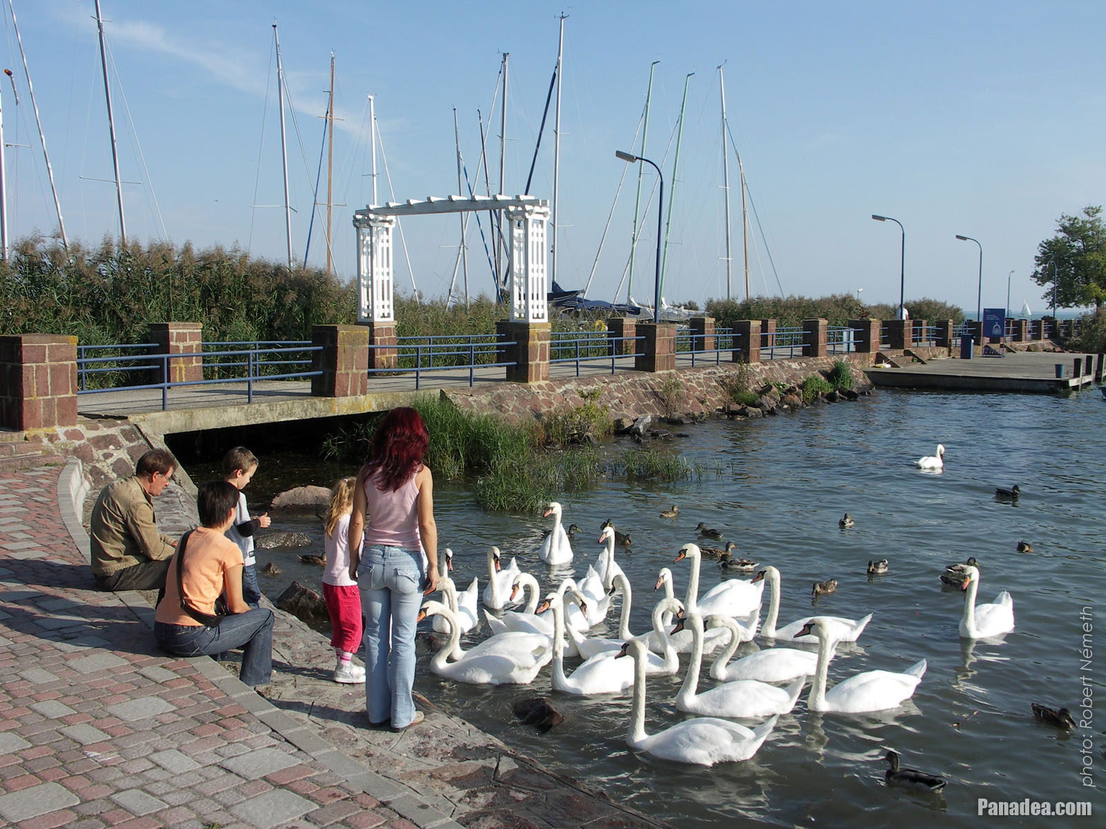
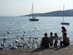
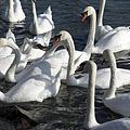
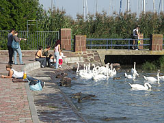
In exchange for some food these swans are very enthusiastic
Data de fotografia: 24/09/20102010
Criado por: Robert Németh
Modelo da câmara: Konica Minolta Dimage A200
Balatonalmádi, Hungria
-
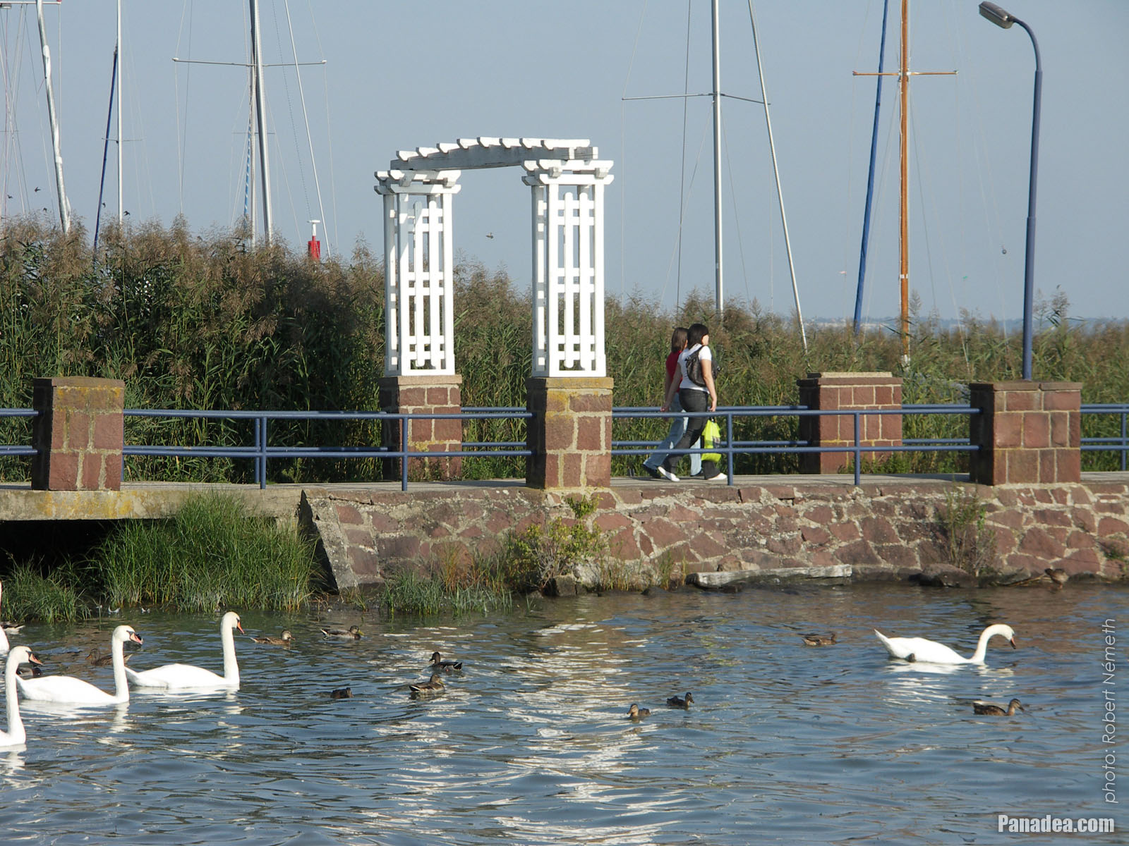
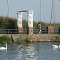
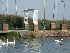
The red sandstone gate of Wesselényi beach
Data de fotografia: 24/09/20102010
Criado por: Robert Németh
Modelo da câmara: Konica Minolta Dimage A200
Balatonalmádi, Hungria
-

The distinctive gate of the Wesselényi beach
Data de fotografia: 17/08/20062006
Criado por: Robert Németh
Modelo da câmara: Konica Minolta Dimage A200
Balatonalmádi, Hungria
-
The characteristic gate of the Wesselényi beach
Data de fotografia: 17/08/20062006
Criado por: Robert Németh
Modelo da câmara: Konica Minolta Dimage A200
Balatonalmádi, Hungria
-
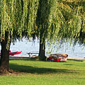
Grassy shore with willow trees on the Wesselényi beach
Data de fotografia: 17/08/20062006
Criado por: Robert Németh
Modelo da câmara: Konica Minolta Dimage A200
Balatonalmádi, Hungria
-
Wesselényi beach
Data de fotografia: 17/08/20062006
Criado por: Robert Németh
Modelo da câmara: Konica Minolta Dimage A200
Balatonalmádi, Hungria
-
The Wesselényi beach in Balatonalmádi, looking westwards (towards Balatonfüred)
Data de fotografia: 17/08/20062006
Criado por: Robert Németh
Modelo da câmara: Konica Minolta Dimage A200
Balatonalmádi, Hungria
-
The Wesselényi beach on the lakeshore of the Balaton
Data de fotografia: 17/08/20062006
Criado por: Robert Németh
Modelo da câmara: Konica Minolta Dimage A200
Balatonalmádi, Hungria
The Wesselényi beach on the lakeshore of the Balaton - Balatonalmádi, Hungria -
The lakeshore at the Wesselényi beach
Data de fotografia: 17/08/20062006
Criado por: Robert Németh
Modelo da câmara: Konica Minolta Dimage A200
Balatonalmádi, Hungria
The lakeshore at the Wesselényi beach - Balatonalmádi, Hungria -
Lake Balaton is shallow and the water is pleasantly warm in summer at the Wesselényi beach
Data de fotografia: 17/08/20062006
Criado por: Robert Németh
Modelo da câmara: Konica Minolta Dimage A200
Balatonalmádi, Hungria
Lake Balaton is shallow and the water is pleasantly warm in summer at the Wesselényi beach - Balatonalmádi, Hungria -
The view of Lake Balaton at the Wesselényi beach
Data de fotografia: 17/08/20062006
Criado por: Robert Németh
Modelo da câmara: Konica Minolta Dimage A200
Balatonalmádi, Hungria
The view of Lake Balaton at the Wesselényi beach - Balatonalmádi, Hungria -
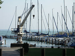
A boat-lifter crane at the marina (sailboat harbor)
Data de fotografia: 24/09/20102010
Criado por: Robert Németh
Modelo da câmara: Konica Minolta Dimage A200
Balatonalmádi, Hungria
A boat-lifter crane at the marina (sailboat harbor) - Balatonalmádi, Hungria -
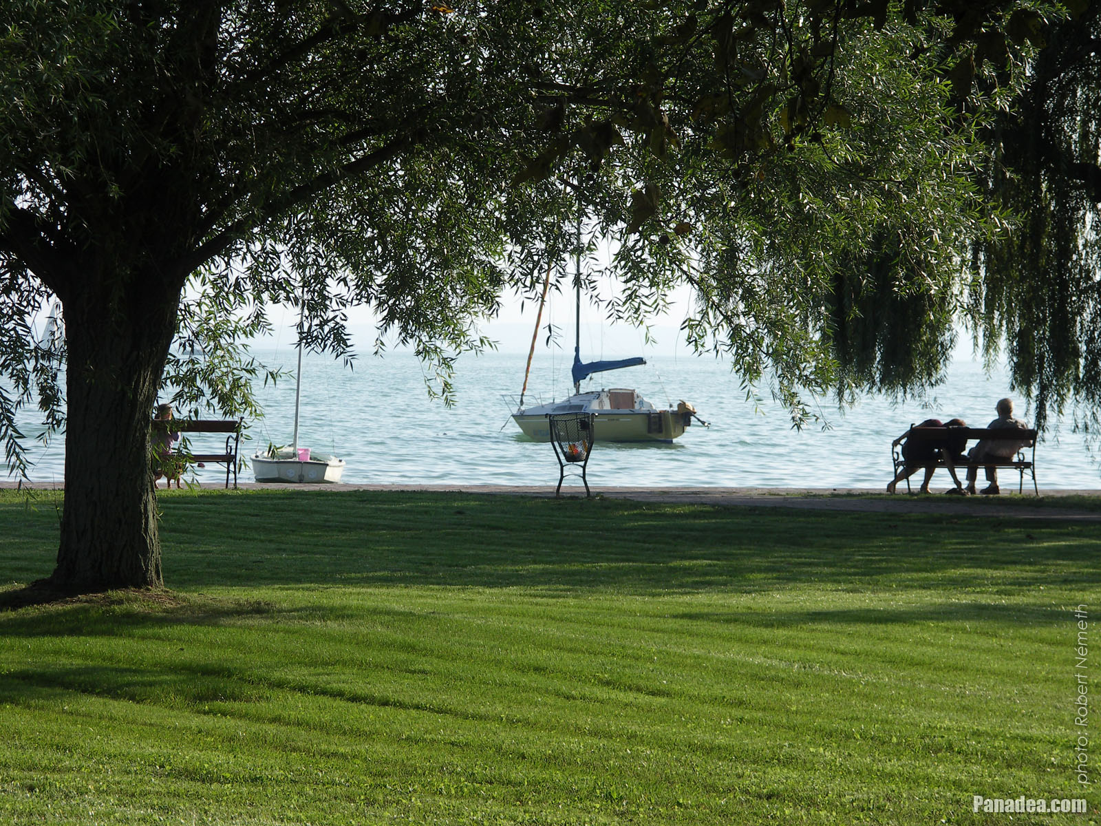
Fresh lawn and a willow tree in the park on the waterfront
Data de fotografia: 24/09/20102010
Criado por: Robert Németh
Modelo da câmara: Konica Minolta Dimage A200
Balatonalmádi, Hungria
Fresh lawn and a willow tree in the park on the waterfront - Balatonalmádi, Hungria -
Statue of St. Elizabeth of Hungary
Data de fotografia: 24/09/20102010
Criado por: Robert Németh
Modelo da câmara: Konica Minolta Dimage A200
Balatonalmádi, Hungria
Statue of St. Elizabeth of Hungary - Balatonalmádi, Hungria -
Pier of the boat station
Data de fotografia: 24/09/20102010
Criado por: Robert Németh
Modelo da câmara: Konica Minolta Dimage A200
Balatonalmádi, Hungria
Pier of the boat station - Balatonalmádi, Hungria -
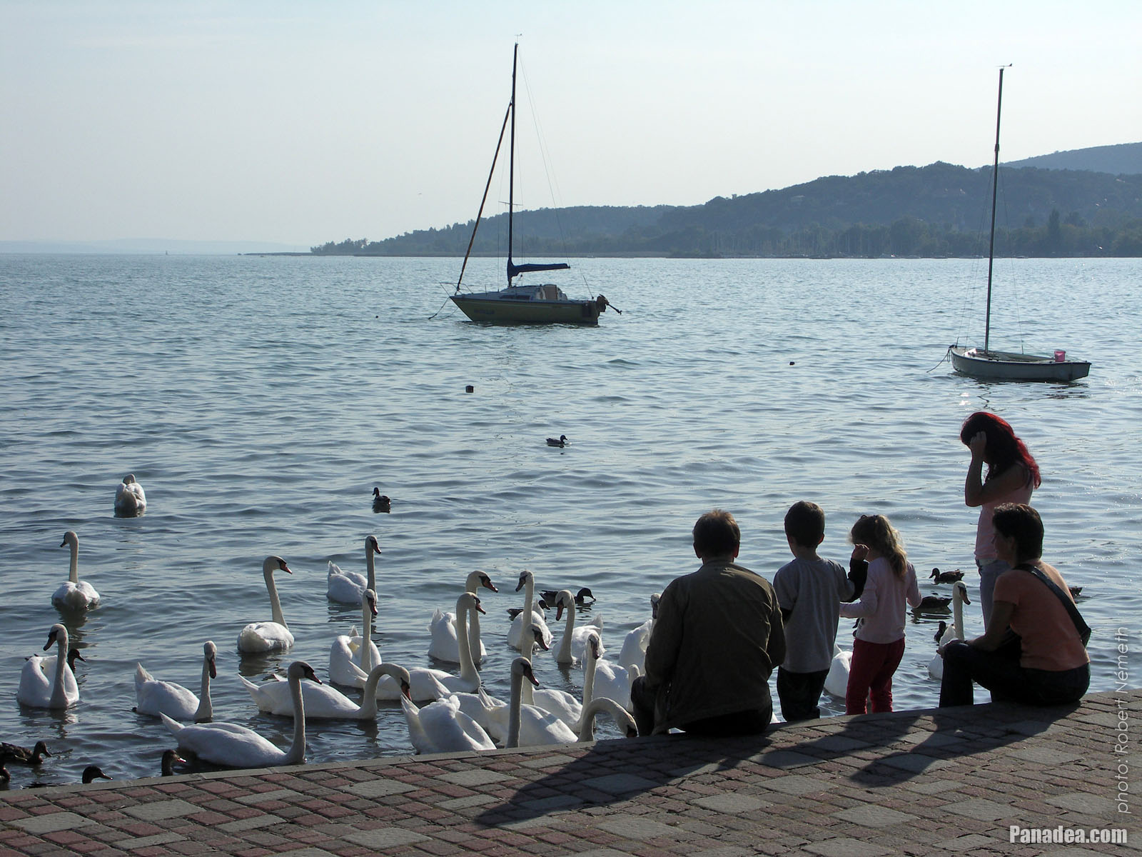
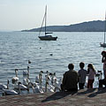
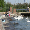
Swan feeding at the lakeshore of Balaton
Data de fotografia: 24/09/20102010
Criado por: Robert Németh
Modelo da câmara: Konica Minolta Dimage A200
Balatonalmádi, Hungria
Swan feeding at the lakeshore of Balaton - Balatonalmádi, Hungria -
The pier leads the the boat station
Data de fotografia: 24/09/20102010
Criado por: Robert Németh
Modelo da câmara: Konica Minolta Dimage A200
Balatonalmádi, Hungria
The pier leads the the boat station - Balatonalmádi, Hungria -
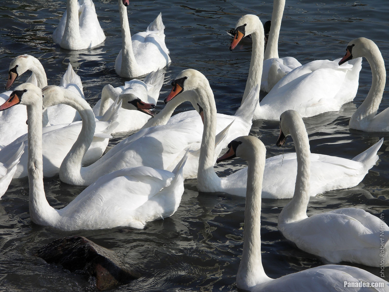
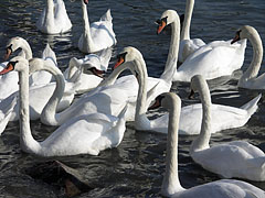
Mass of mute swans (Cygnus olor)
Data de fotografia: 24/09/20102010
Criado por: Robert Németh
Modelo da câmara: Konica Minolta Dimage A200
Balatonalmádi, Hungria
Mass of mute swans (Cygnus olor) - Balatonalmádi, Hungria -
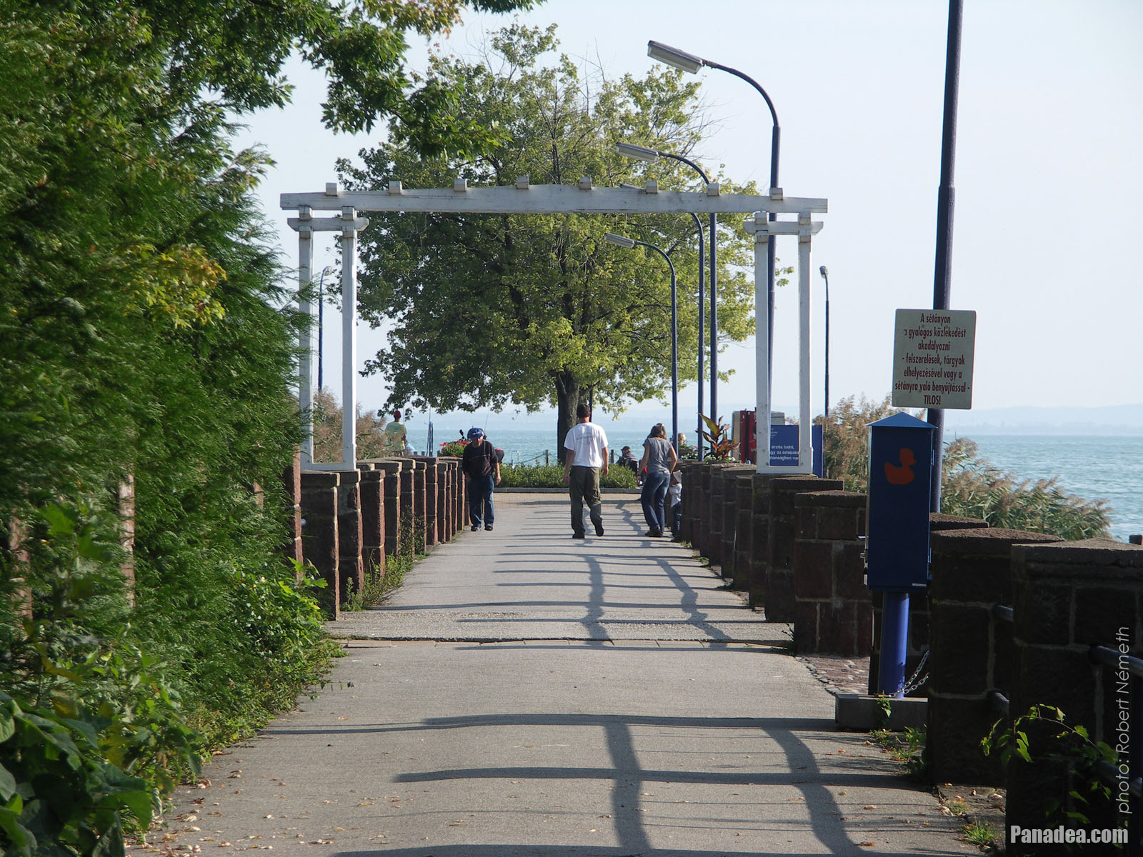
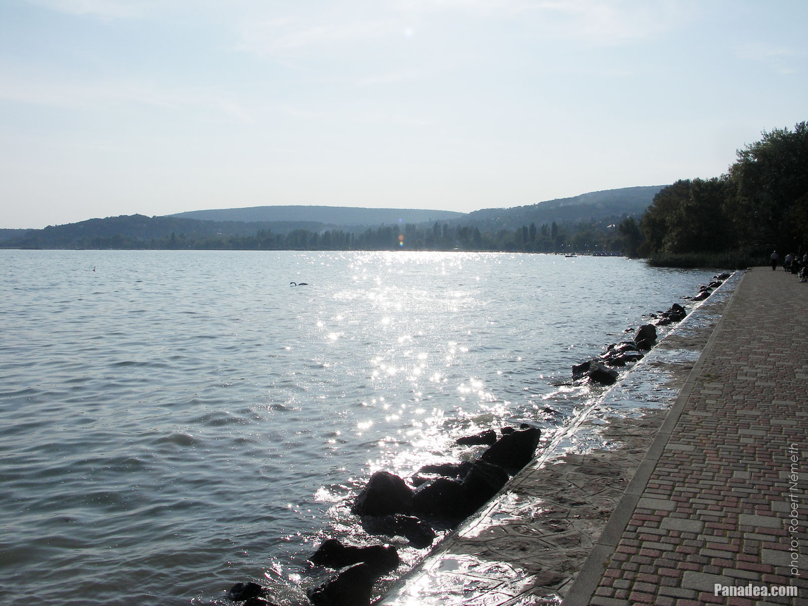
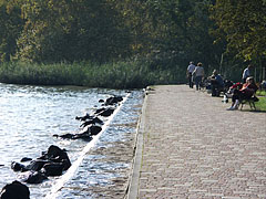
Lakeside promenade in the autumn sunshine
Data de fotografia: 24/09/20102010
Criado por: Robert Németh
Modelo da câmara: Konica Minolta Dimage A200
Balatonalmádi, Hungria
Lakeside promenade in the autumn sunshine - Balatonalmádi, Hungria -
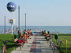
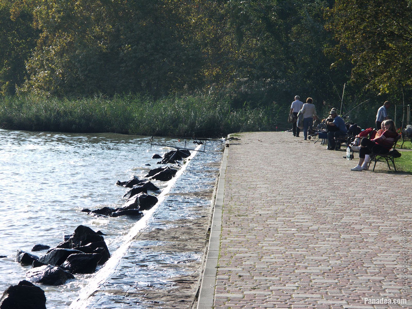
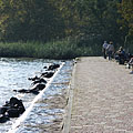
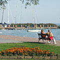
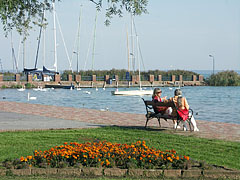
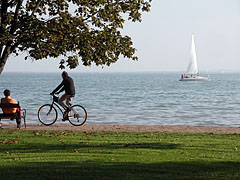
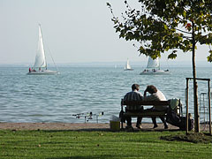
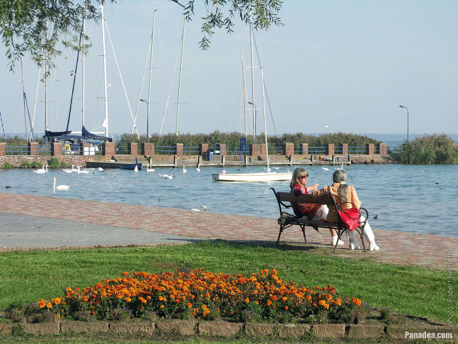
Lakeside walkway with relaxing people and some anglers
Data de fotografia: 24/09/20102010
Criado por: Robert Németh
Modelo da câmara: Konica Minolta Dimage A200
Balatonalmádi, Hungria
Lakeside walkway with relaxing people and some anglers - Balatonalmádi, Hungria -
Lakeside of Balaton at the Balatonalmádi boat station
Data de fotografia: 24/09/20102010
Criado por: Robert Németh
Modelo da câmara: Konica Minolta Dimage A200
Balatonalmádi, Hungria
Lakeside of Balaton at the Balatonalmádi boat station - Balatonalmádi, Hungria -
Pier
Data de fotografia: 24/09/20102010
Criado por: Robert Németh
Modelo da câmara: Konica Minolta Dimage A200
Balatonalmádi, Hungria
Pier - Balatonalmádi, Hungria -
Boat (ship) station of Balatonalmádi
Data de fotografia: 24/09/20102010
Criado por: Robert Németh
Modelo da câmara: Konica Minolta Dimage A200
Balatonalmádi, Hungria
Boat (ship) station of Balatonalmádi - Balatonalmádi, Hungria -
Boat station on the pier, and sailboats everywhere
Data de fotografia: 24/09/20102010
Criado por: Robert Németh
Modelo da câmara: Konica Minolta Dimage A200
Balatonalmádi, Hungria
Boat station on the pier, and sailboats everywhere - Balatonalmádi, Hungria -
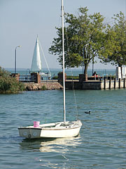
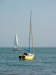
Moored tiny sailing boat is rocking on the water, and the boat station is behind
Data de fotografia: 24/09/20102010
Criado por: Robert Németh
Modelo da câmara: Konica Minolta Dimage A200
Balatonalmádi, Hungria
Moored tiny sailing boat is rocking on the water, and the boat station is behind - Balatonalmádi, Hungria -
Colors of late September by the lake shore, in the St. Elizabeth grove
Data de fotografia: 24/09/20102010
Criado por: Robert Németh
Modelo da câmara: Konica Minolta Dimage A200
Balatonalmádi, Hungria
Colors of late September by the lake shore, in the St. Elizabeth grove - Balatonalmádi, Hungria -
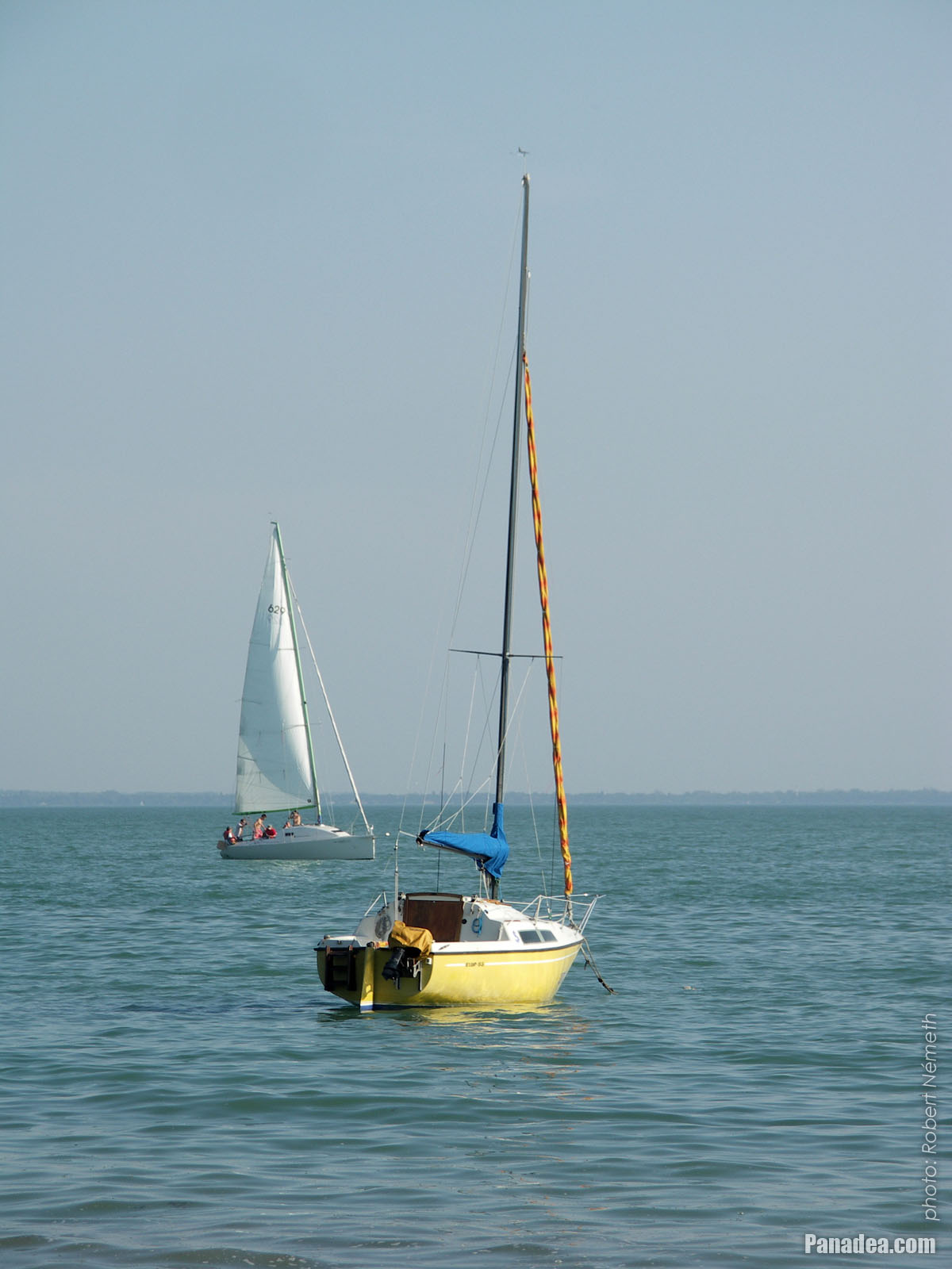
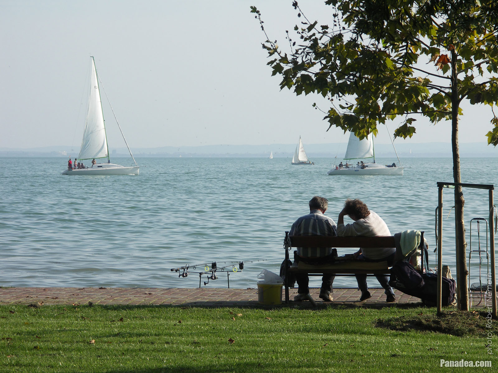
Sailboats on Lake Balaton
Data de fotografia: 24/09/20102010
Criado por: Robert Németh
Modelo da câmara: Konica Minolta Dimage A200
Balatonalmádi, Hungria
Sailboats on Lake Balaton - Balatonalmádi, Hungria -
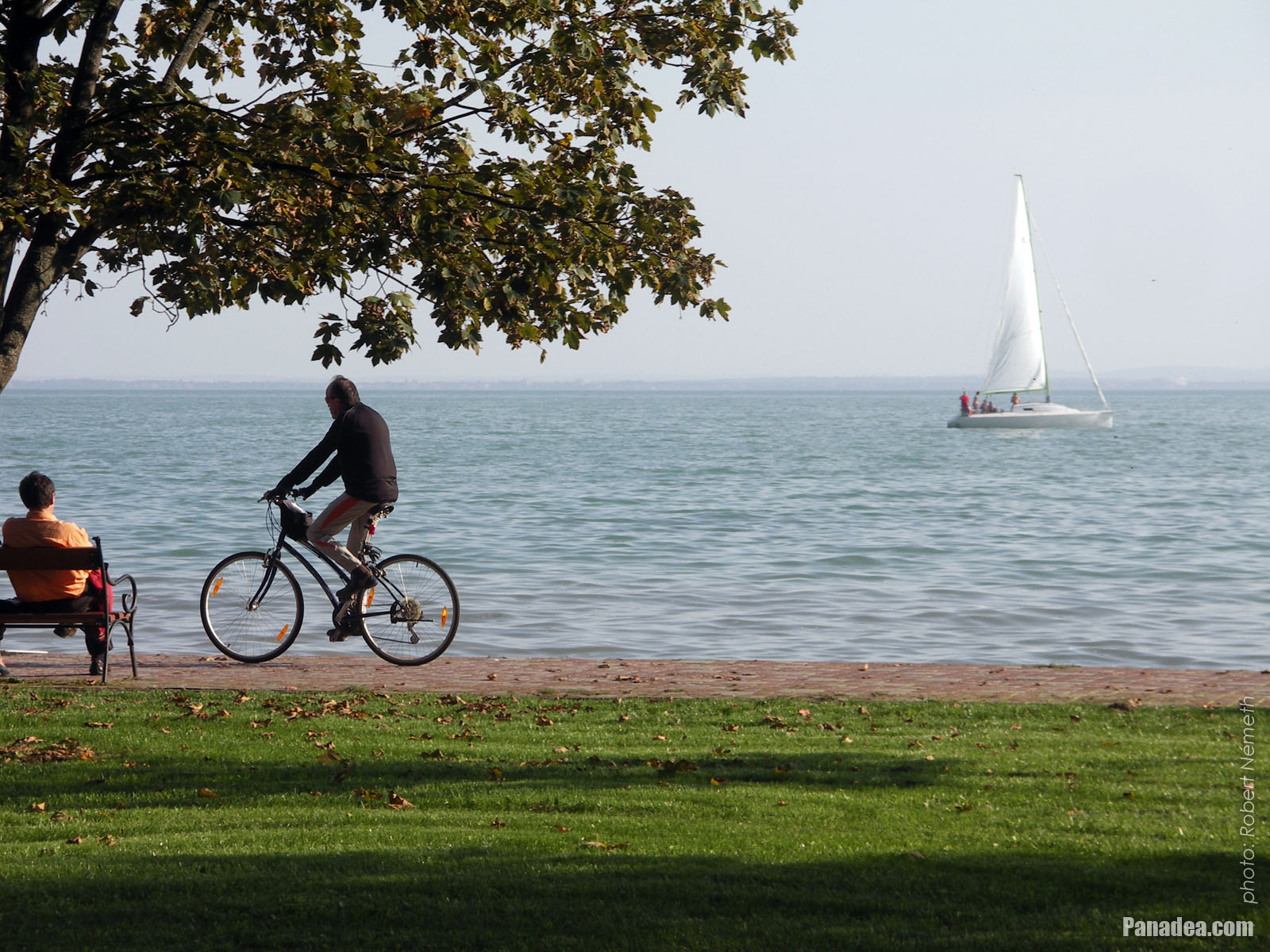
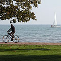
Lakeside promenade with some bikers
Data de fotografia: 24/09/20102010
Criado por: Robert Németh
Modelo da câmara: Konica Minolta Dimage A200
Balatonalmádi, Hungria
Lakeside promenade with some bikers - Balatonalmádi, Hungria -
Lakeside promenade
Data de fotografia: 24/09/20102010
Criado por: Robert Németh
Modelo da câmara: Konica Minolta Dimage A200
Balatonalmádi, Hungria
Lakeside promenade - Balatonalmádi, Hungria -
Authentic bandstand (music pavilion) in the "Old Park"
The park was established in 1902, today its entire area is a natural reserve.
Data de fotografia: 24/09/20102010
Criado por: Robert Németh
Modelo da câmara: Konica Minolta Dimage A200
Balatonalmádi, Hungria
Authentic bandstand (music pavilion) in the "Old Park" - Balatonalmádi, Hungria -
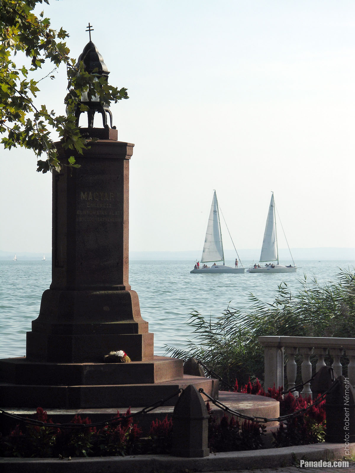
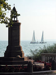
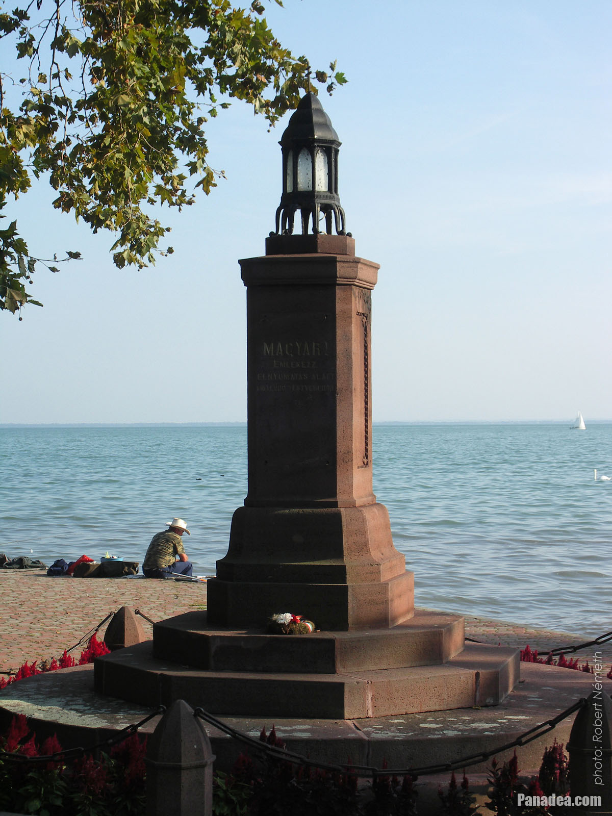
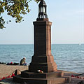
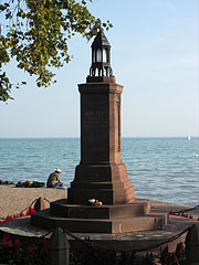
"Irredentist" eternal lamp (however some people think it's just a Trianon memorial)
Data de fotografia: 24/09/20102010
Criado por: Robert Németh
Modelo da câmara: Konica Minolta Dimage A200
Balatonalmádi, Hungria
"Irredentist" eternal lamp (however some people think it's just a Trianon memorial) - Balatonalmádi, Hungria -
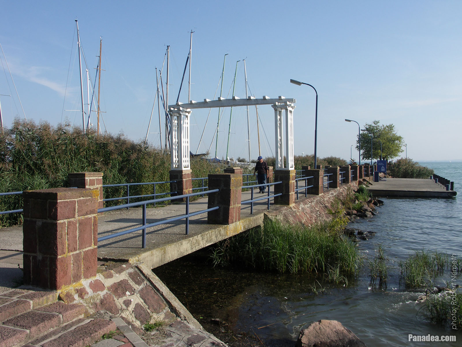
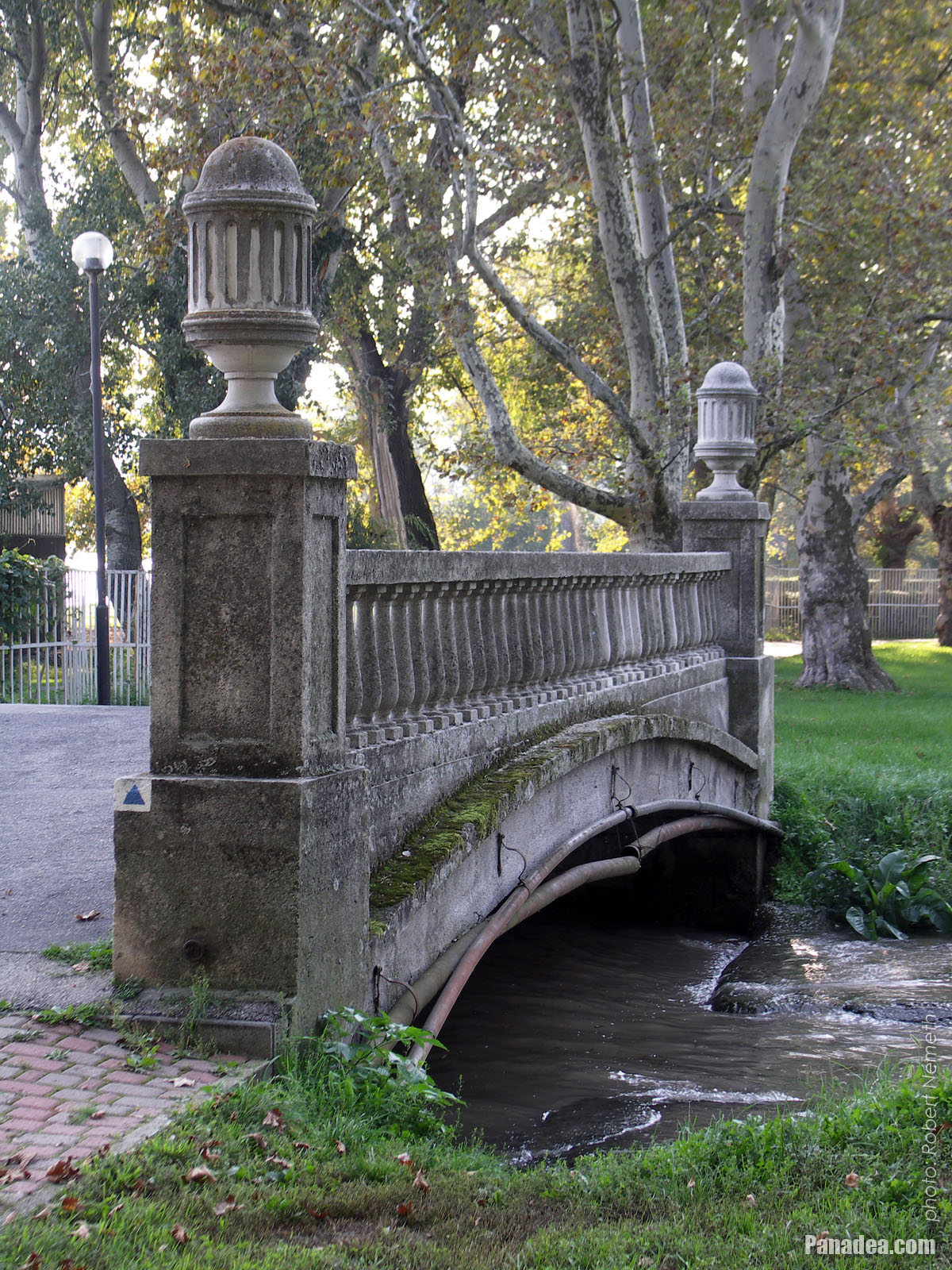
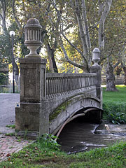
"Bridge of Sighs" in Balatonalmádi
Data de fotografia: 24/09/20102010
Criado por: Robert Németh
Modelo da câmara: Konica Minolta Dimage A200
Balatonalmádi, Hungria
"Bridge of Sighs" in Balatonalmádi - Balatonalmádi, Hungria -
"Irredentistic" eternal lamp
Created by architect László Lovas in 1928, for every Hungarian people abroad who became a minority in a violent way.
Data de fotografia: 24/09/20102010
Criado por: Robert Németh
Modelo da câmara: Konica Minolta Dimage A200
Balatonalmádi, Hungria
"Irredentistic" eternal lamp - Balatonalmádi, Hungria -
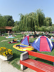
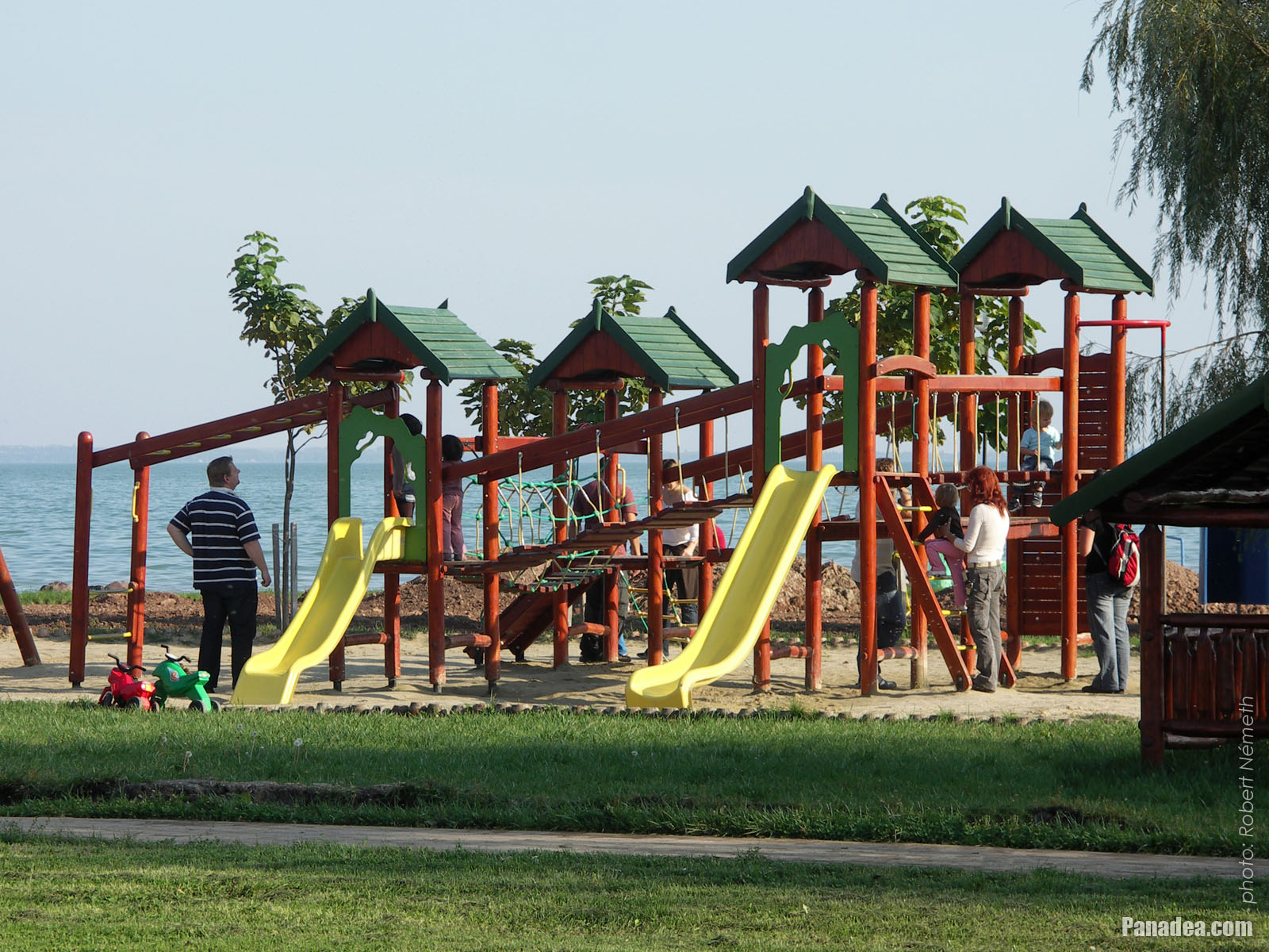
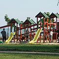
Playground by the lake
Data de fotografia: 24/09/20102010
Criado por: Robert Németh
Modelo da câmara: Konica Minolta Dimage A200
Balatonalmádi, Hungria
Playground by the lake - Balatonalmádi, Hungria -
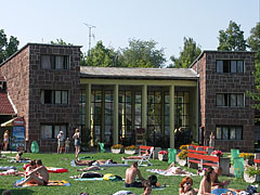
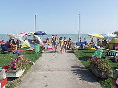
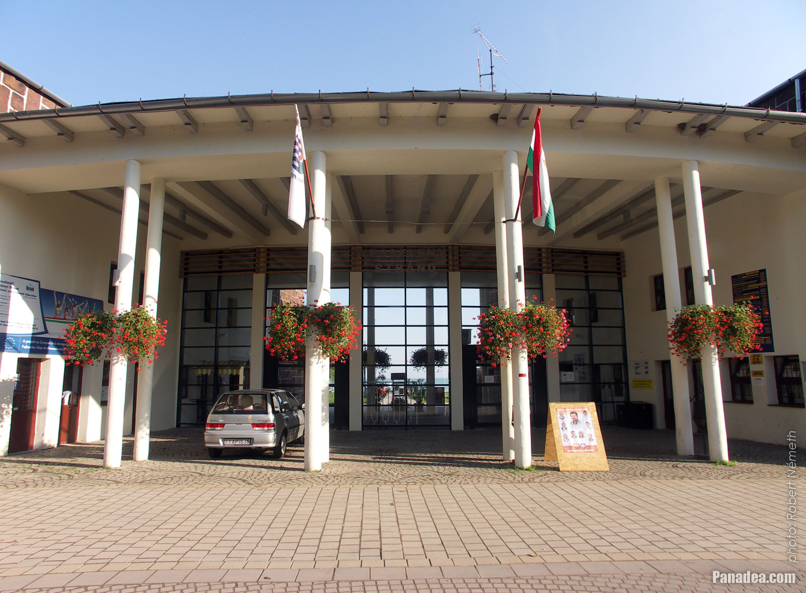
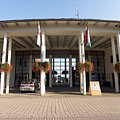
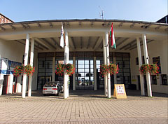
Main entrance of the Wesselényi beach
Data de fotografia: 24/09/20102010
Criado por: Robert Németh
Modelo da câmara: Konica Minolta Dimage A200
Balatonalmádi, Hungria
Main entrance of the Wesselényi beach - Balatonalmádi, Hungria -
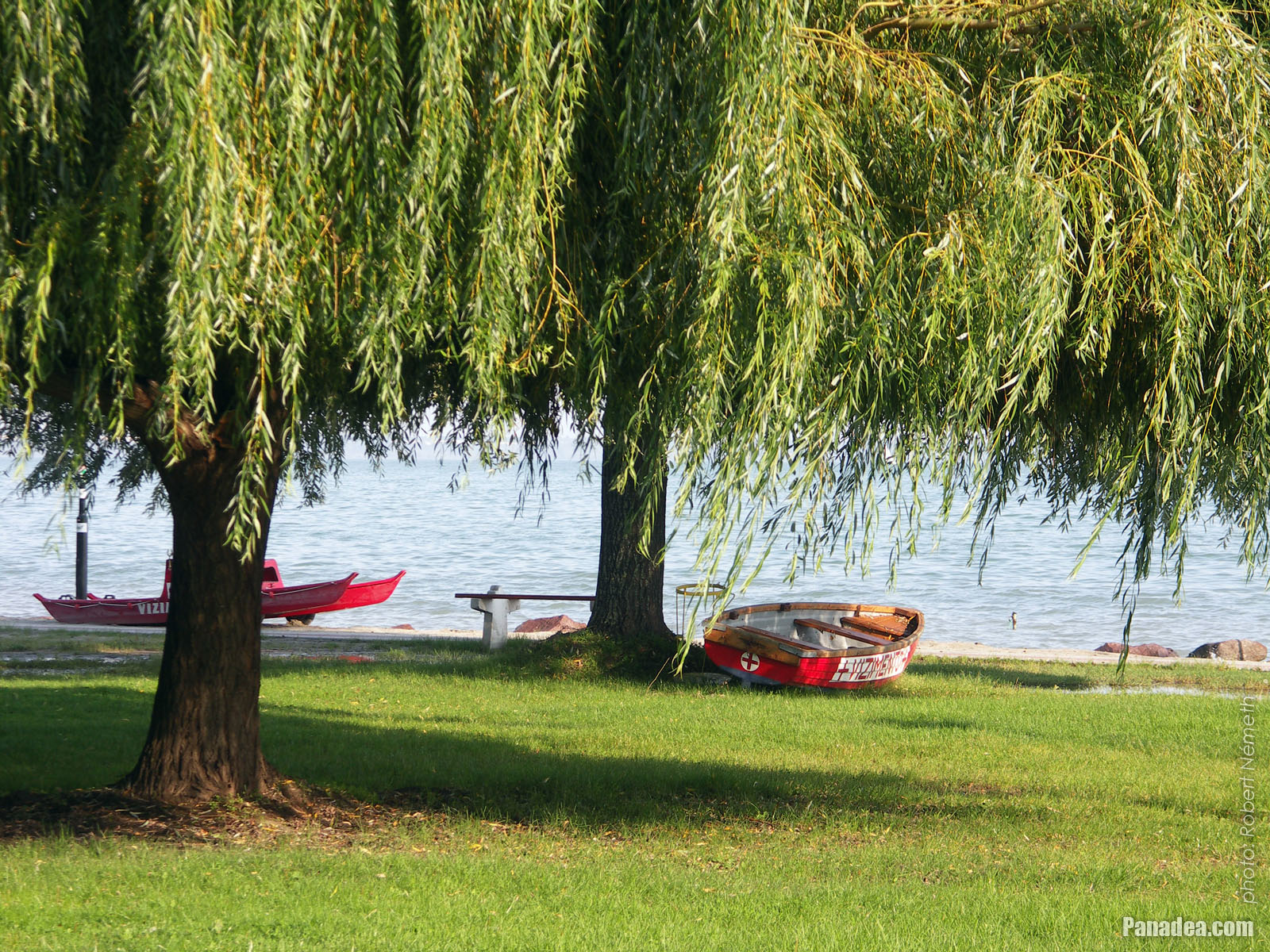
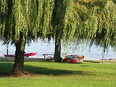
European weeping willow trees (Salix sepulcralis), and lifeguard boats on the beach
Data de fotografia: 24/09/20102010
Criado por: Robert Németh
Modelo da câmara: Konica Minolta Dimage A200
Balatonalmádi, Hungria
European weeping willow trees (Salix sepulcralis), and lifeguard boats on the beach - Balatonalmádi, Hungria


Clique nas imagens!
Características, propriedades
Localização:
Coordenadas GPS: Latitude 47°1'36", Longitude 18°0'55" (N47 1.6 - E18 0.92)
Informações, histórias curtas, fatos interessantes
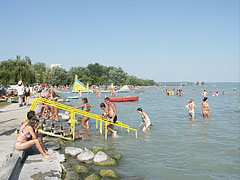
 The Wesselényi beach on the lakeshore of the Balaton
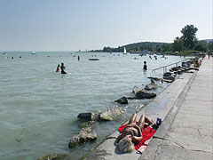
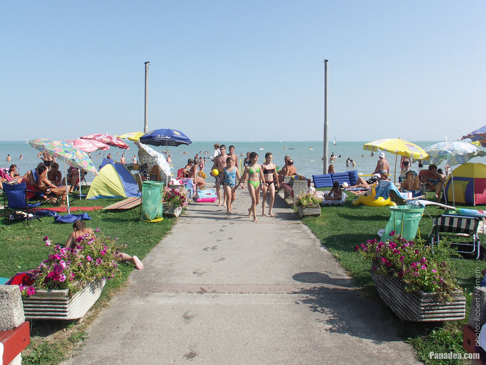
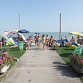
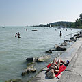
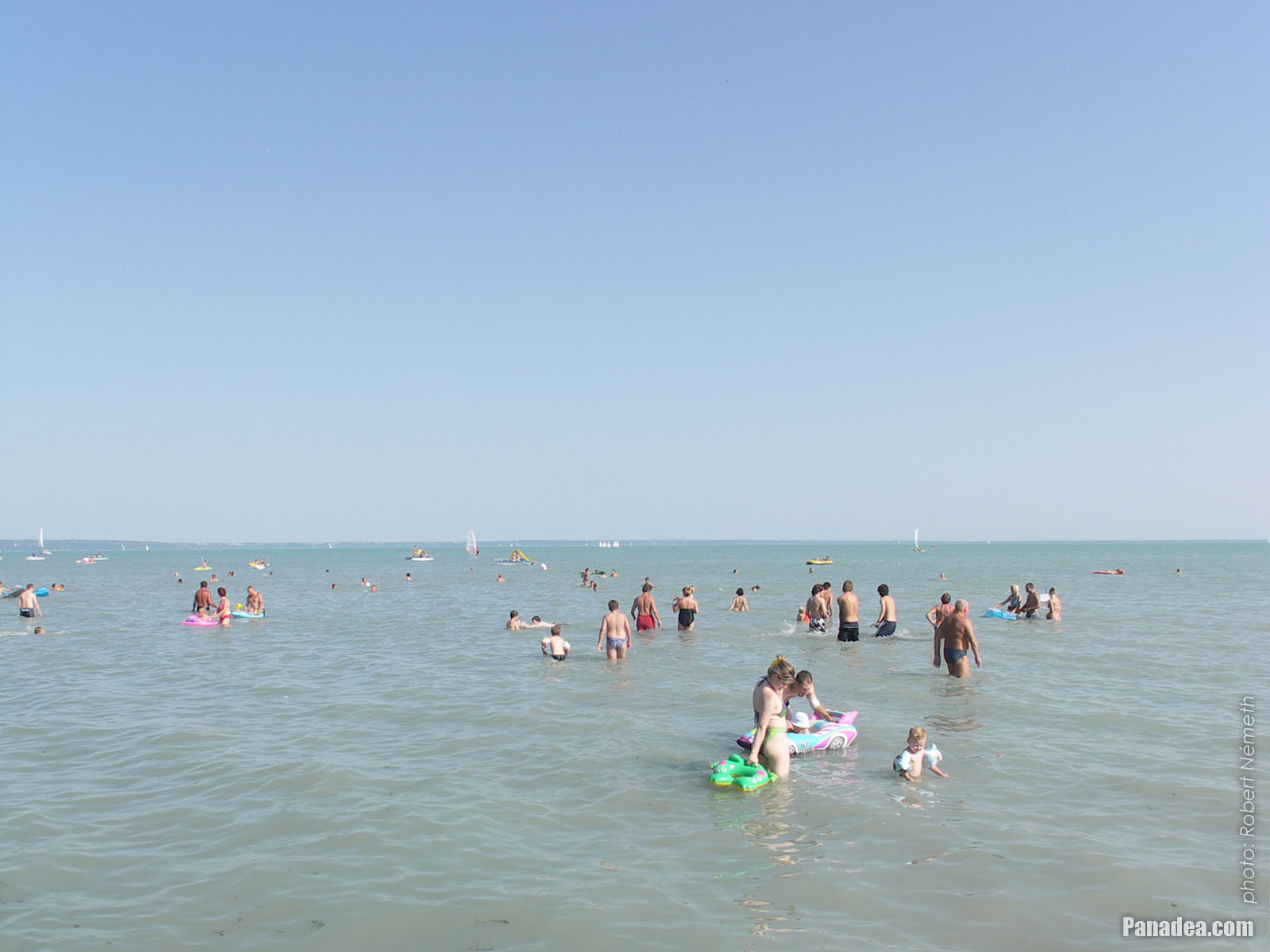
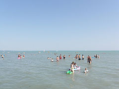
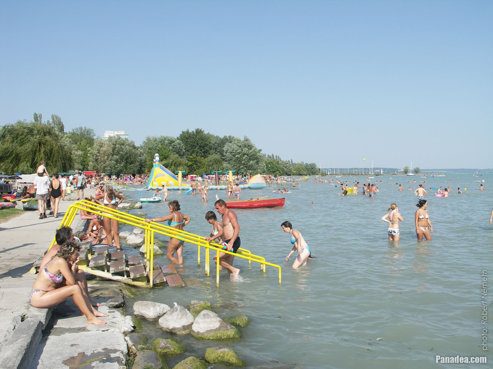
The position of Balatonalmádi is special, it is surrounded by hills and its like an amphitheater a little bit. Thanks to this the climate of the settlement is almost mediterranean. Although the town is situated on the north shore of Lake Balaton (where the water usually deepens more quickly than on the southern shore), the beach of Balatonalmádi is shallow even far from the shore and the water can warm up quickly to a pleasant temperature, so that's why it is highly recommended for families even with small children.
 Colors of late September by the lake shore, in the St. Elizabeth grove
The Öreg Park (literally "Old Park") or Szent Erzsébet Park ("St. Elizabeth's Park") is located in the town center of Balatonalmádi, between the railway tracks and the shore of Lake Balaton, near the Wesselényi Beach. The development of the park was begun at the end of the 1880s, initiated by Dezső Véghely natural scientist. It is situated on an area of 10 hectares and today the entire park is protected (nature reserve). There are special trees and valuable sculptures insite the park, as well as the so-called "Bridge of Sighs". By the way, the park is the last stop or station on the "Vörös Homokkő" (literally "Red sandstone") educational nature trail.
 Wesselényi beach
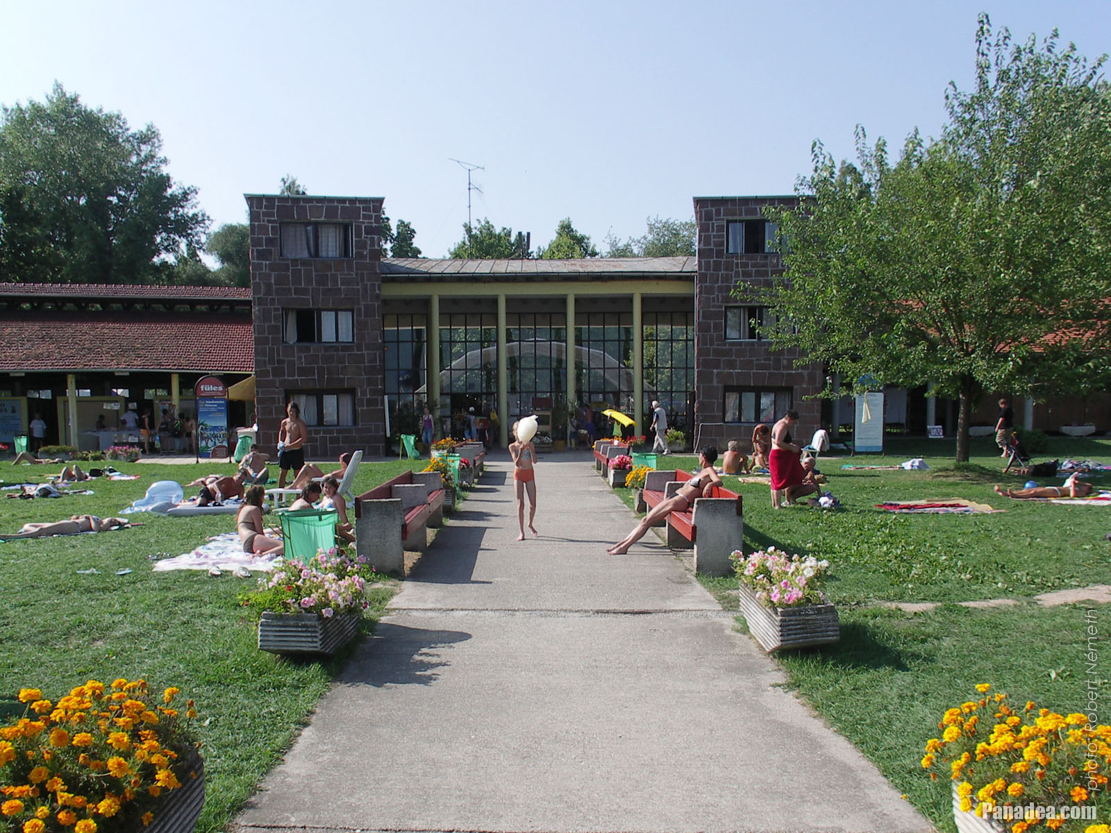
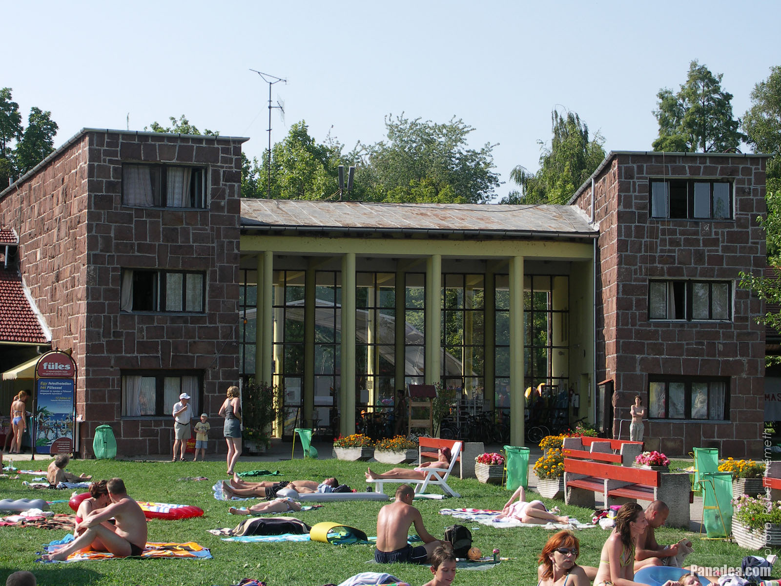
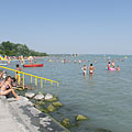
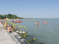
The Wesselényi Beach is the largest, most extensive beach on the northern shore of Lake Balaton. Even 10,000 people can relax and have fun comfortably at the same time on its half square kilometer of land. The area is landscaped, the willow and other trees provide shade for the guests who want to sleep or relax before or after bathing. The entrance building of the Wesselényi Beach is constructed from the typical building material of the region, the red sandstone from the Permian period (which was 299-252 million years ago).
Balatonalmádi - Mais galerias de fotos:
Você também pode estar interessado (Páginas relacionadas):
Destinos em o guia de viagem:
Balatonalmádi (61 fotos + 2 imagens panorâmicas)
Veszprém megye (county) (983 fotos + 16 imagens panorâmicas)
Balaton (1 597 fotos + 35 imagens panorâmicas)
Hungria (27 287 fotos + 163 imagens panorâmicas)
e adicionalmente:
(dentro aqui: Balaton e Veszprém megye)
Balaton Uplands National Park (Balaton-felvidék) (440 fotos + 15 imagens panorâmicas)
Balaton Uplands (Balaton-felvidék) (123 fotos + 5 imagens panorâmicas)
Révfülöp (12 fotos + 1 imagens panorâmicas)
Révfülöp (12 fotos + 1 imagens panorâmicas)
Balatonfüred (252 fotos + 2 imagens panorâmicas)
Balatonboglár
Balatonlelle (13 fotos)
Zalakaros (43 fotos + 3 imagens panorâmicas)
Balatonföldvár (11 fotos)
Fonyód (290 fotos)
Siófok (388 fotos + 11 imagens panorâmicas)
Tapolca (37 fotos + 3 imagens panorâmicas)
Balatonfüred (252 fotos + 2 imagens panorâmicas)
Ajka (82 fotos)
Sümeg (39 fotos)
Várpalota (16 fotos + 2 imagens panorâmicas)
Zirc (46 fotos)
Zamárdi (16 fotos + 1 imagens panorâmicas)
Badacsonytomaj (4 fotos)
Balatonvilágos (26 fotos)
Nagyvázsony (45 fotos)
Szigliget (25 fotos + 2 imagens panorâmicas)
Balatonszőlős
Tihany (106 fotos + 1 imagens panorâmicas)
Szentbékkálla (10 fotos)
Nagyvázsony (45 fotos)
Csesznek (40 fotos)
Eplény (25 fotos)
Tés (15 fotos)
Veszprém (168 fotos + 3 imagens panorâmicas)
Cada foto panorama aqui:
Balatonalmádi (2 fotos)
Veszprém megye (county) (16 fotos)
Balaton (35 fotos)
Hungria (163 fotos)
Europa (165 fotos)
Cada fotos normais aqui:
Balatonalmádi (61 fotos / 2 galerias)
Veszprém megye (county) (983 fotos / 27 galerias)
Balaton (1 597 fotos / 35 galerias)
Hungria (27 287 fotos / 462 galerias)
Europa (30 494 fotos / 523 galerias)
https://www.panadea.com/pt/guidebook/balatonalmadi/photos/gal-001

Adicionar aos Favoritos Adicionar aos Favoritos
Compartilhe com seus amigos!
etc.


O nosso guia de viagem contém:
Inúmeras fotos e imagens panorâmicas, com muitas informações e fatos interessantes.
- 214 destinos de viagem
- 165 imagens panorâmicas
- 30 494 outras fotos
Grande coleção de fotos selecionados: excelente qualidade, alta resolução e cores naturais
Sobre nós - Advertência jurídica -
Todos os direitos reservados
- ©2010-2022
Neuronit Creative Studio - Mogyoród / Budapeste / Hungria