
(작은 화면 장치에 최적화)
Lake Öreg and the Tata Castle - Tata, 헝가리
클릭 한 후:
그림을 클릭
-
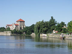
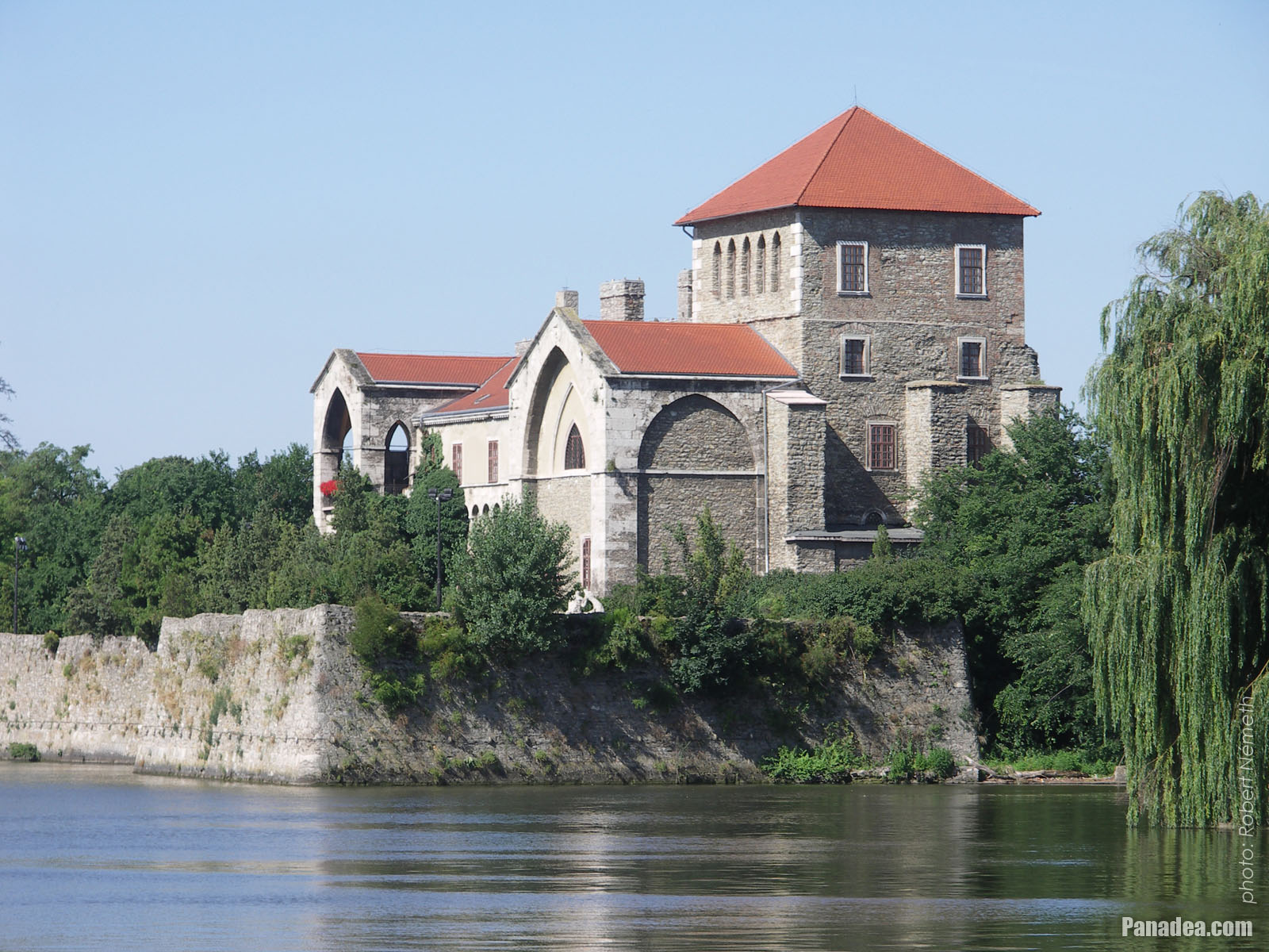
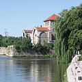
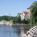
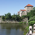
The Öreg Lake (Old Lake) and the Castle of Tata, which can be categorized as a water castle
날짜를 촬영: 2006년 07월 15일2006
에 의해 만들어: Robert Németh
카메라 모델: Konica Minolta Dimage A200
Tata, 헝가리
-

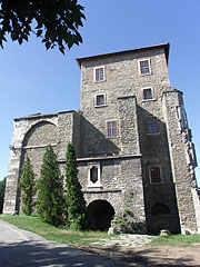
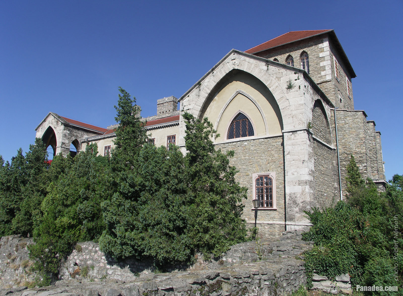
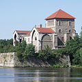
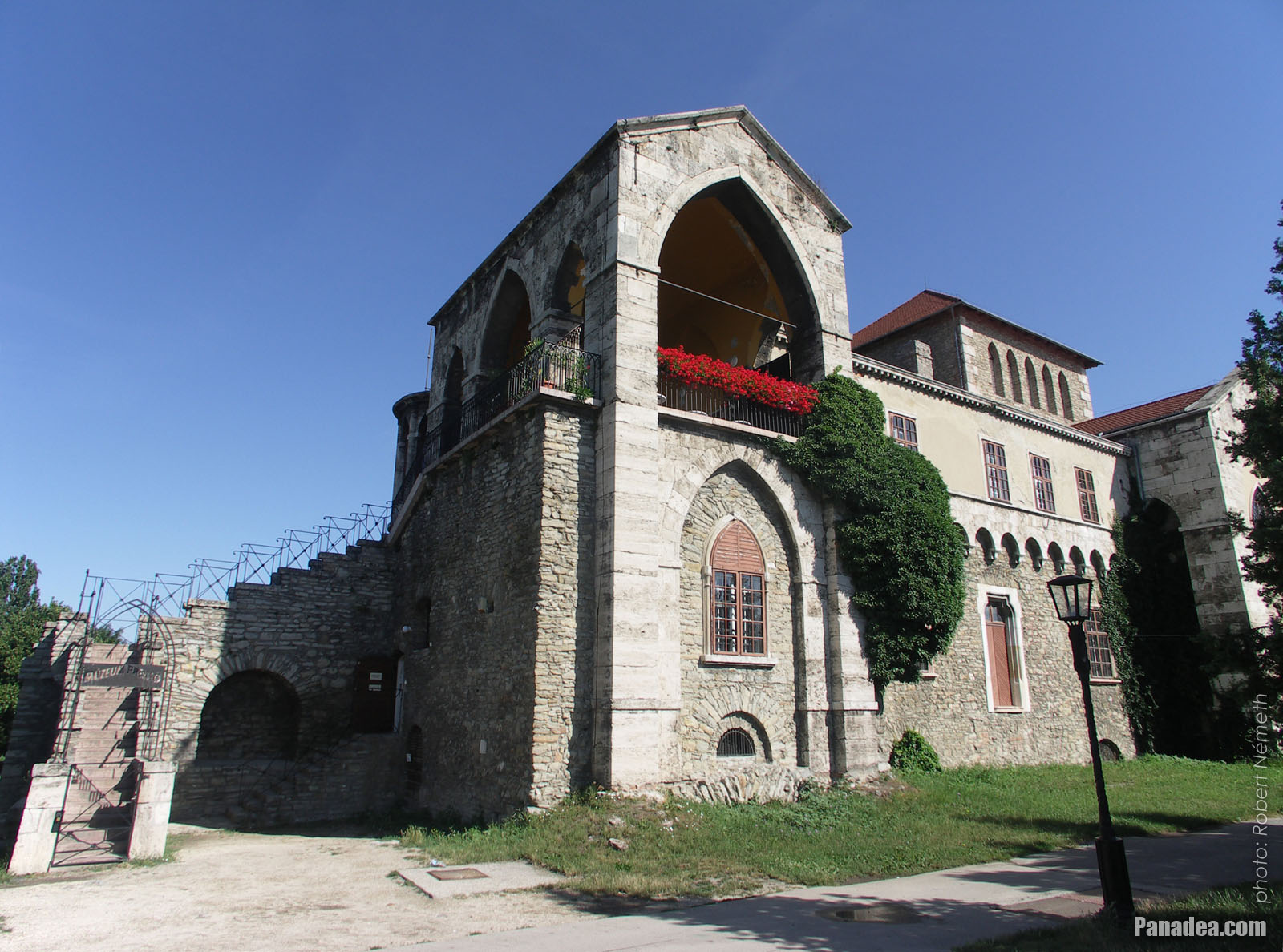
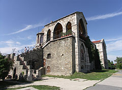
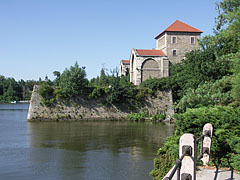
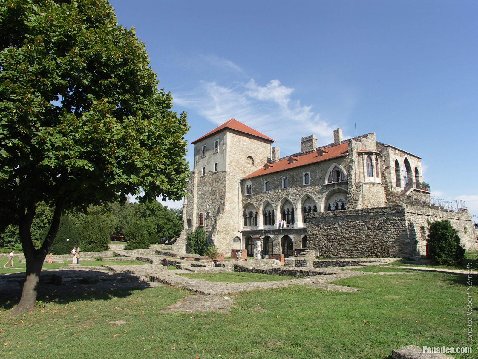
The sunny southern side of the Tata Castle
날짜를 촬영: 2006년 09월 02일2006
에 의해 만들어: Robert Németh
카메라 모델: Konica Minolta Dimage A200
Tata, 헝가리
-

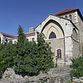
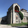
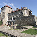
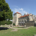
Tower of the Tata Castle (in reality it is the inner castle itself), including the Kuny Domokos County Museum
날짜를 촬영: 2006년 09월 02일2006
에 의해 만들어: Robert Németh
카메라 모델: Konica Minolta Dimage A200
Tata, 헝가리
-

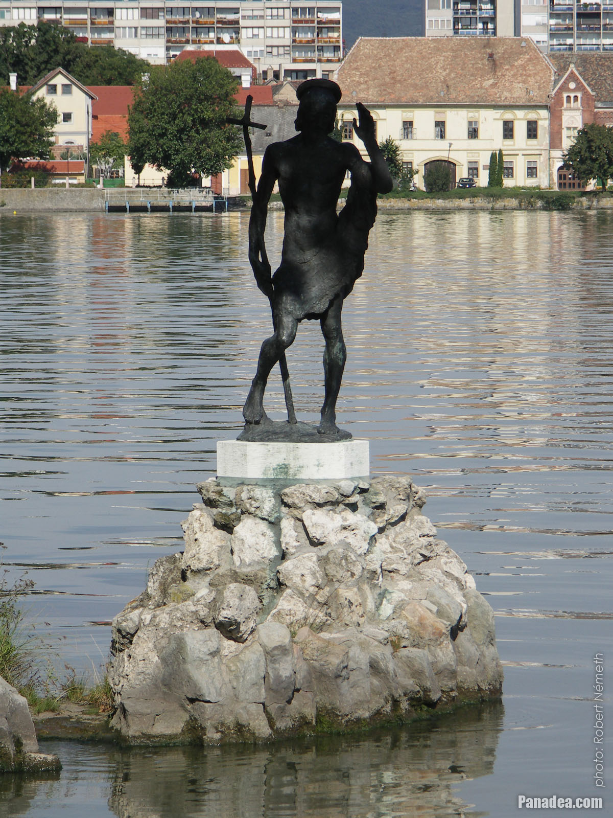
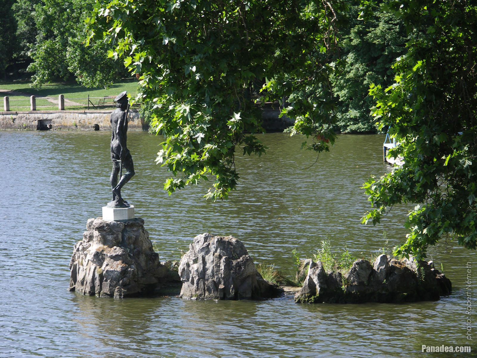
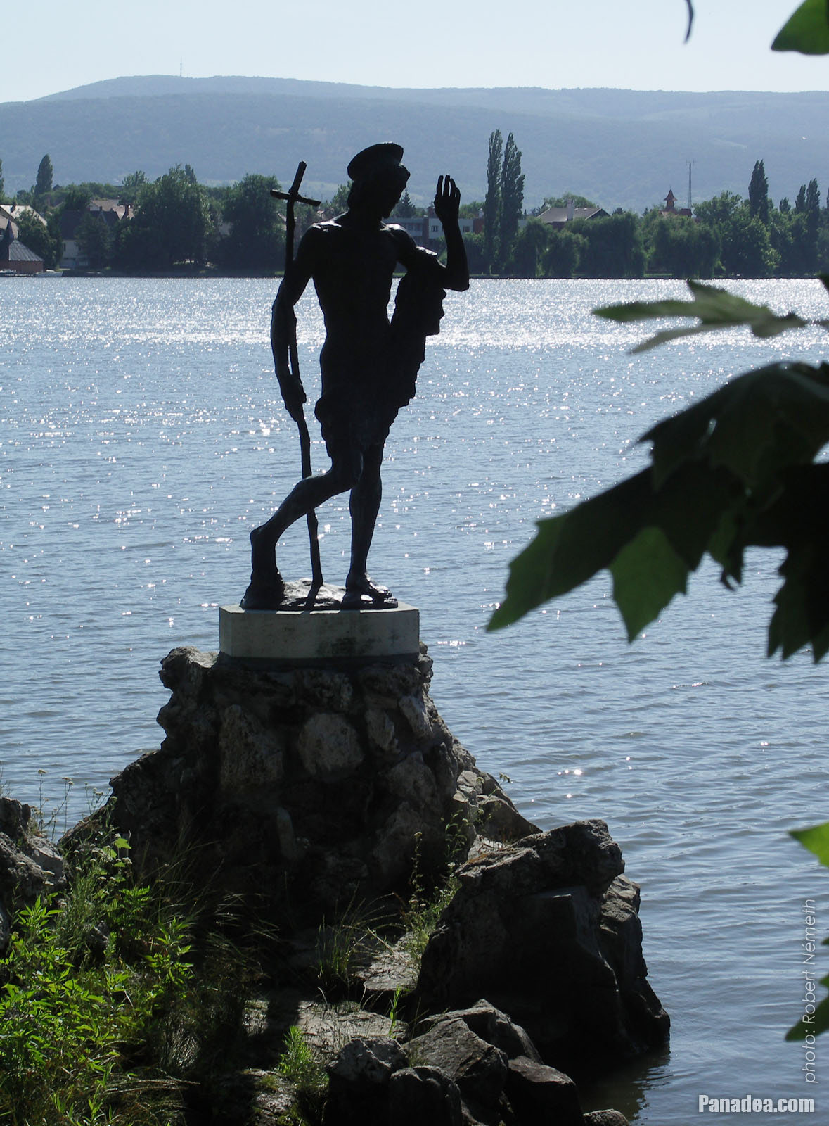
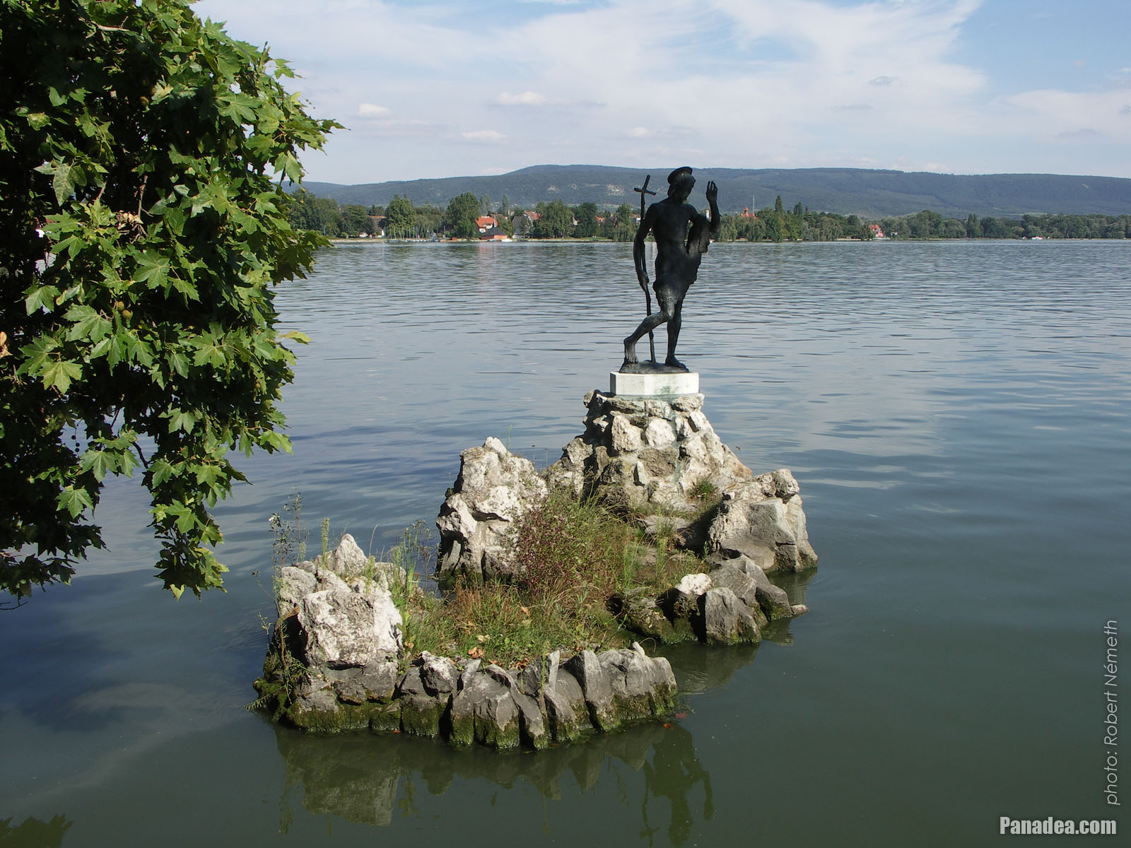
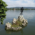
Statue of Saint John the Baptist in lake on a rock, behind the sculpture on the lakeshore the Hamary House can be seen
날짜를 촬영: 2006년 09월 02일2006
에 의해 만들어: Robert Németh
카메라 모델: Konica Minolta Dimage A200
Tata, 헝가리
-
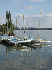
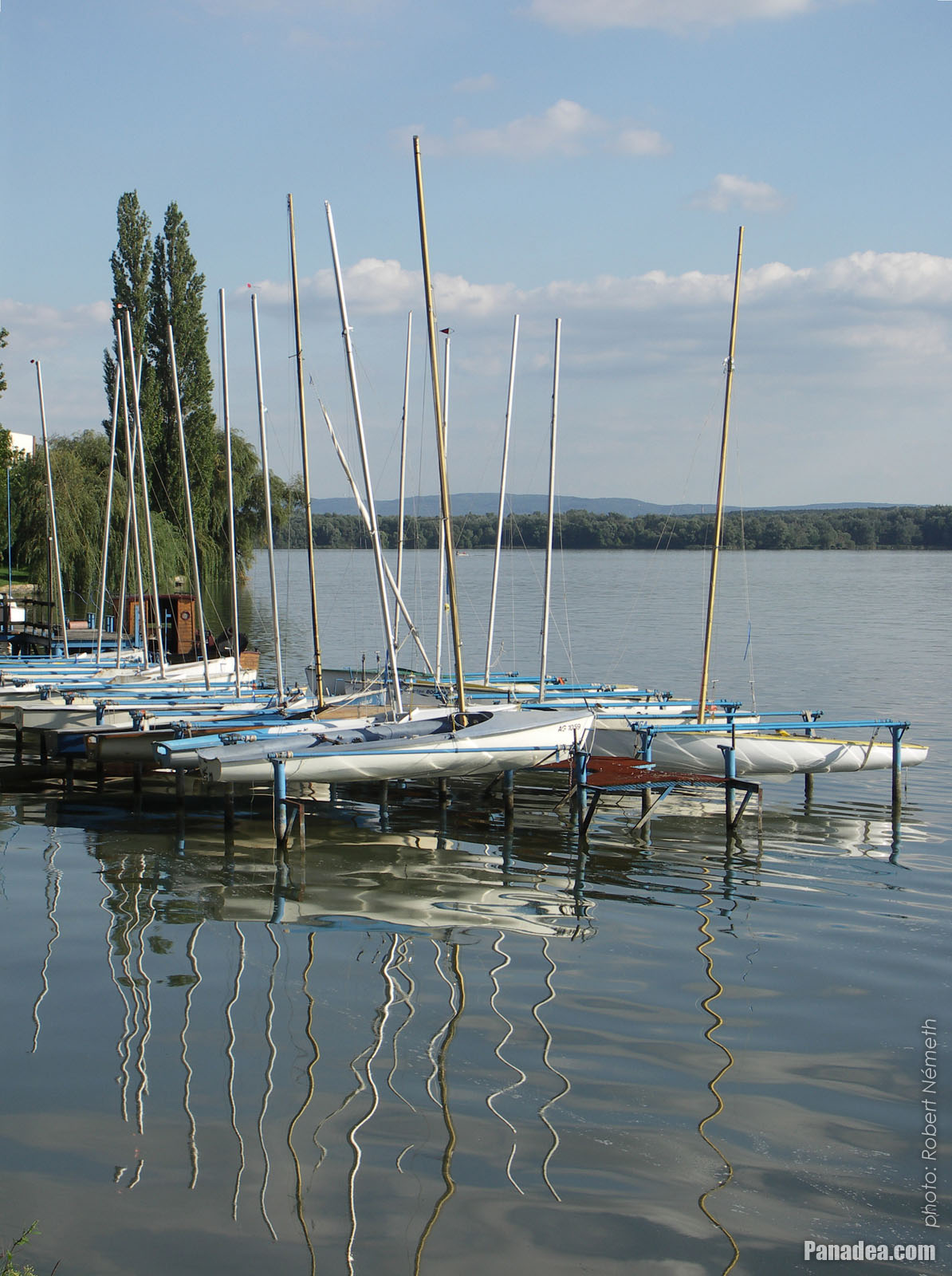
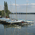
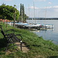
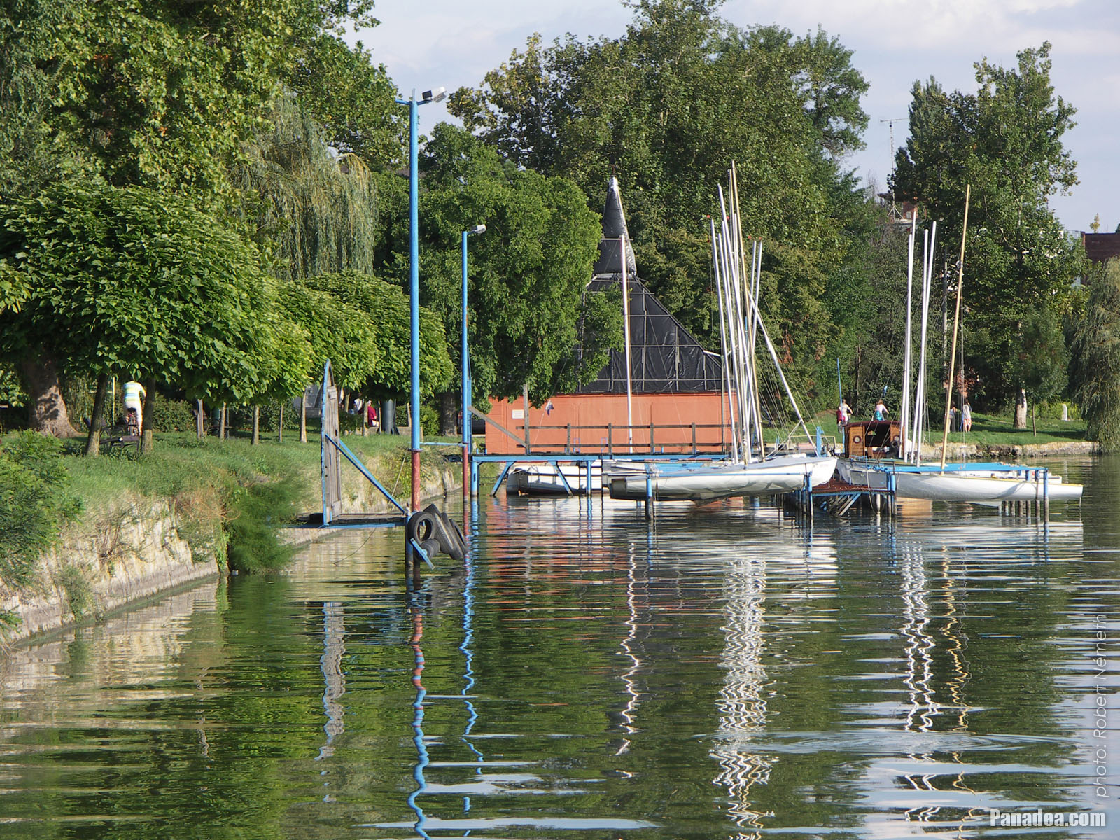
Small sailboat harbour
날짜를 촬영: 2006년 09월 02일2006
에 의해 만들어: Robert Németh
카메라 모델: Konica Minolta Dimage A200
Tata, 헝가리
-
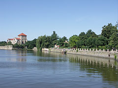
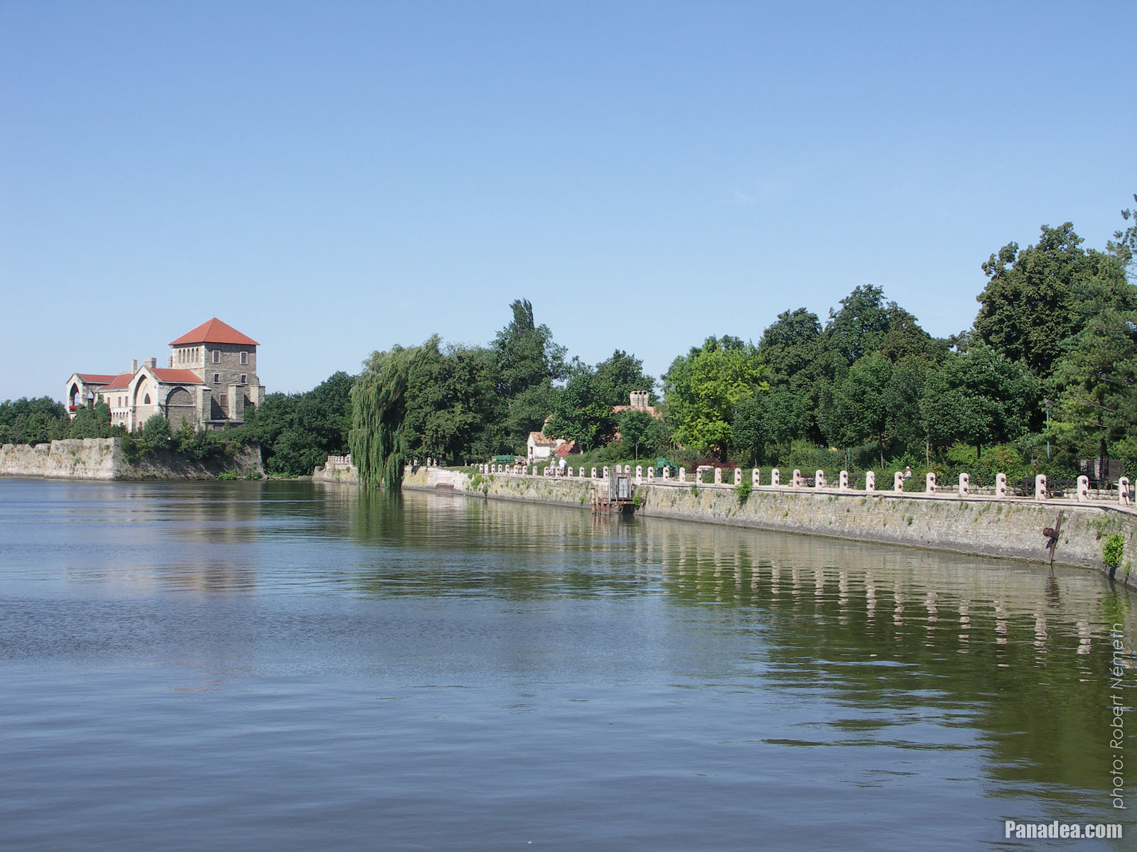
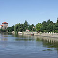
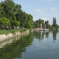
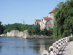
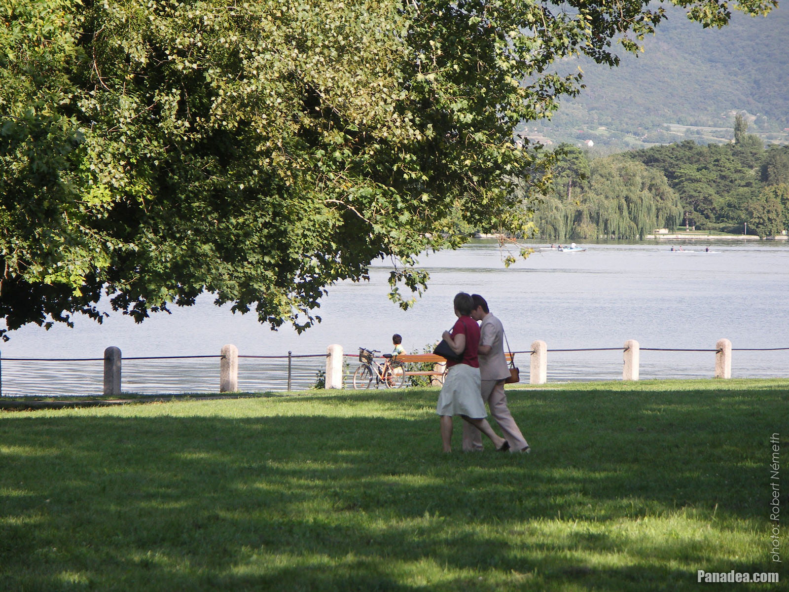
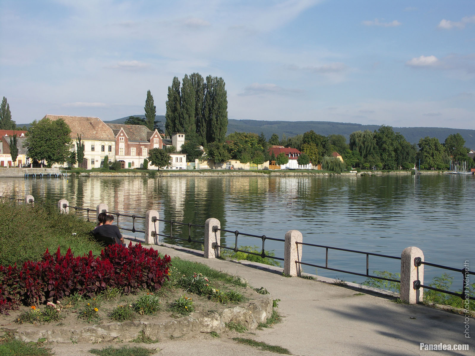
View of Lake Öreg (Old Lake) in the morning: blue plain water, waterfront promenade and some distance away the Castle of Tata
날짜를 촬영: 2006년 07월 15일2006
에 의해 만들어: Robert Németh
카메라 모델: Konica Minolta Dimage A200
Tata, 헝가리
-

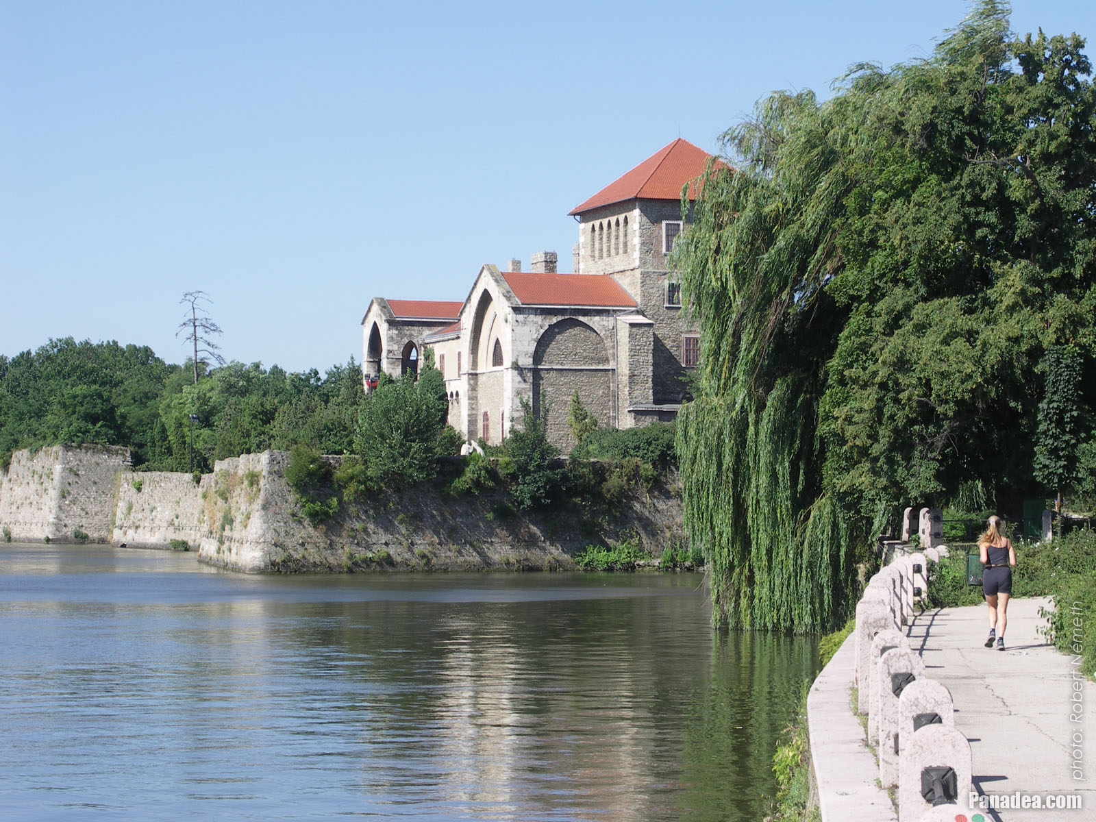
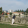
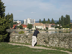
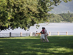
Jogging in the morning by the Lake Öreg on the promenade beside the Tata Castle
날짜를 촬영: 2006년 07월 15일2006
에 의해 만들어: Robert Németh
카메라 모델: Konica Minolta Dimage A200
Tata, 헝가리
-

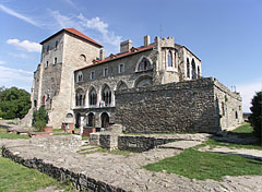
The Tata Castle on the shore of Lake Öreg (or Old Lake, in Hungarian "Öreg-tó")
날짜를 촬영: 2006년 07월 15일2006
에 의해 만들어: Robert Németh
카메라 모델: Konica Minolta Dimage A200
Tata, 헝가리
-

The current tower of the Tata Castle
It was developed from the remains of the inner castle in 1815.
날짜를 촬영: 2006년 07월 15일2006
에 의해 만들어: Robert Németh
카메라 모델: Konica Minolta Dimage A200
Tata, 헝가리
-
Castle of Tata
날짜를 촬영: 2006년 07월 15일2006
에 의해 만들어: Robert Németh
카메라 모델: Konica Minolta Dimage A200
Tata, 헝가리
-
Tower of the Tata Castle (the so-called "Old Tower")
날짜를 촬영: 2006년 07월 15일2006
에 의해 만들어: Robert Németh
카메라 모델: Konica Minolta Dimage A200
Tata, 헝가리
Tower of the Tata Castle (the so-called "Old Tower") - Tata, 헝가리 -
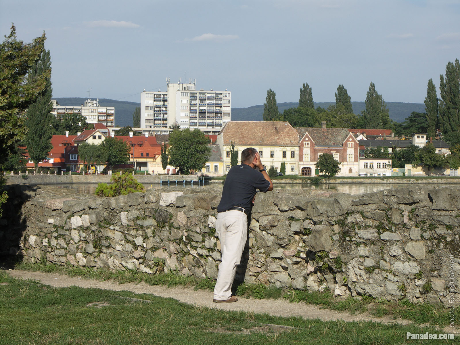
View to the town and the Old Lake (in Hungarian "Öreg-tó") from the castle wall
날짜를 촬영: 2006년 09월 02일2006
에 의해 만들어: Robert Németh
카메라 모델: Konica Minolta Dimage A200
Tata, 헝가리
View to the town and the Old Lake (in Hungarian "Öreg-tó") from the castle wall - Tata, 헝가리 -
Statue of Saint John the Baptist in the Tata Lake (also known as Öreg Lake or Old Lake)
날짜를 촬영: 2006년 07월 15일2006
에 의해 만들어: Robert Németh
카메라 모델: Konica Minolta Dimage A200
Tata, 헝가리
Statue of Saint John the Baptist in the Tata Lake (also known as Öreg Lake or Old Lake) - Tata, 헝가리 -
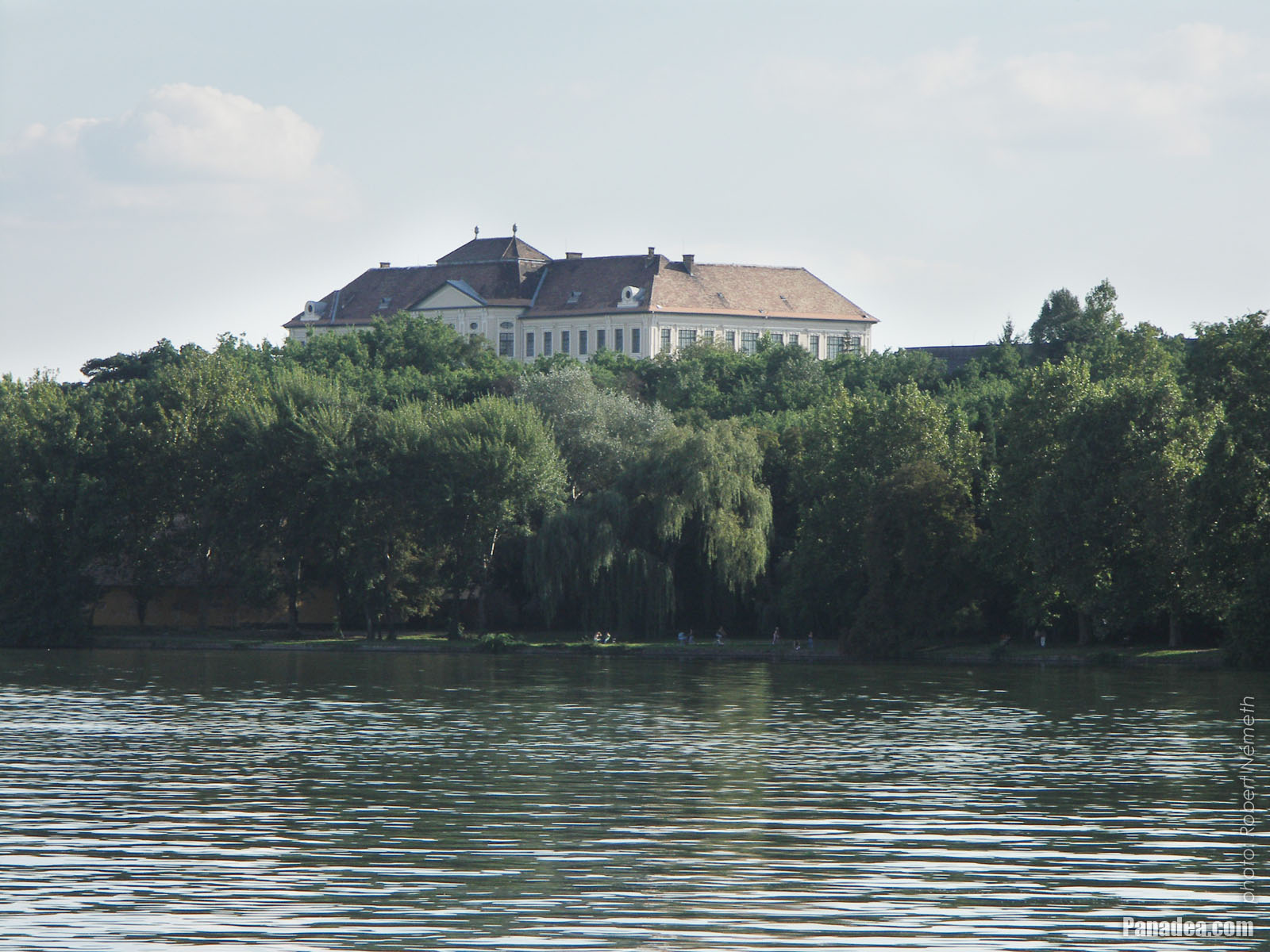
Eötvös József High School, the former Piarist secondary school
The school building was built in 1912.
날짜를 촬영: 2006년 07월 15일2006
에 의해 만들어: Robert Németh
카메라 모델: Konica Minolta Dimage A200
Tata, 헝가리
Eötvös József High School, the former Piarist secondary school - Tata, 헝가리 -
Stairs up to the small Múzeum Presso restaurant on the storey of the castle tower
날짜를 촬영: 2006년 09월 02일2006
에 의해 만들어: Robert Németh
카메라 모델: Konica Minolta Dimage A200
Tata, 헝가리
Stairs up to the small Múzeum Presso restaurant on the storey of the castle tower - Tata, 헝가리 -
The restored part ("tower") and the wall remains of the Tata Castle
The castle built between 1397-1409
날짜를 촬영: 2006년 09월 02일2006
에 의해 만들어: Robert Németh
카메라 모델: Konica Minolta Dimage A200
Tata, 헝가리
The restored part ("tower") and the wall remains of the Tata Castle - Tata, 헝가리 -
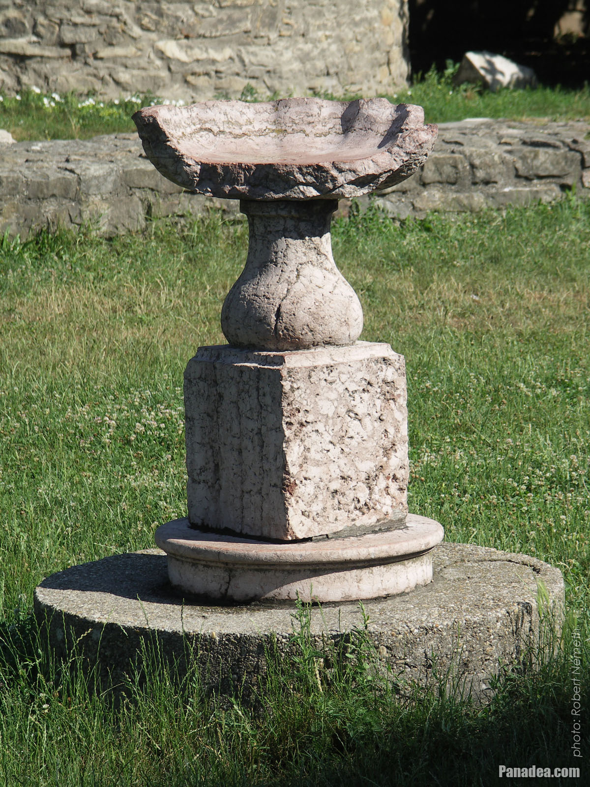
A broken stone bowl of vase in the castle garden
날짜를 촬영: 2006년 07월 15일2006
에 의해 만들어: Robert Németh
카메라 모델: Konica Minolta Dimage A200
Tata, 헝가리
A broken stone bowl of vase in the castle garden - Tata, 헝가리 -
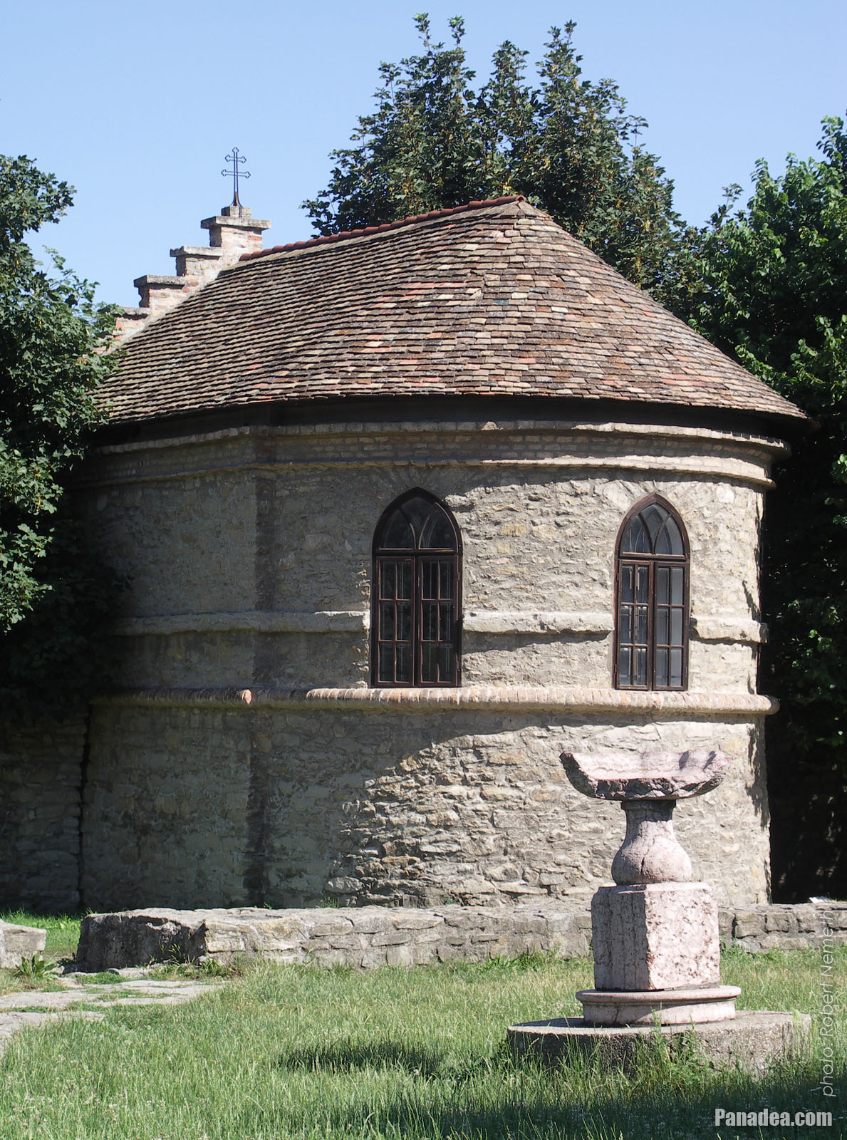
Prison chapel of the so-called seneschal's house (senechal = officer of the noble), built into the castle wall
Built in 1755, designed by Jakab Fellner
날짜를 촬영: 2006년 07월 15일2006
에 의해 만들어: Robert Németh
카메라 모델: Konica Minolta Dimage A200
Tata, 헝가리
Prison chapel of the so-called seneschal's house (senechal = officer of the noble), built into the castle wall - Tata, 헝가리 -
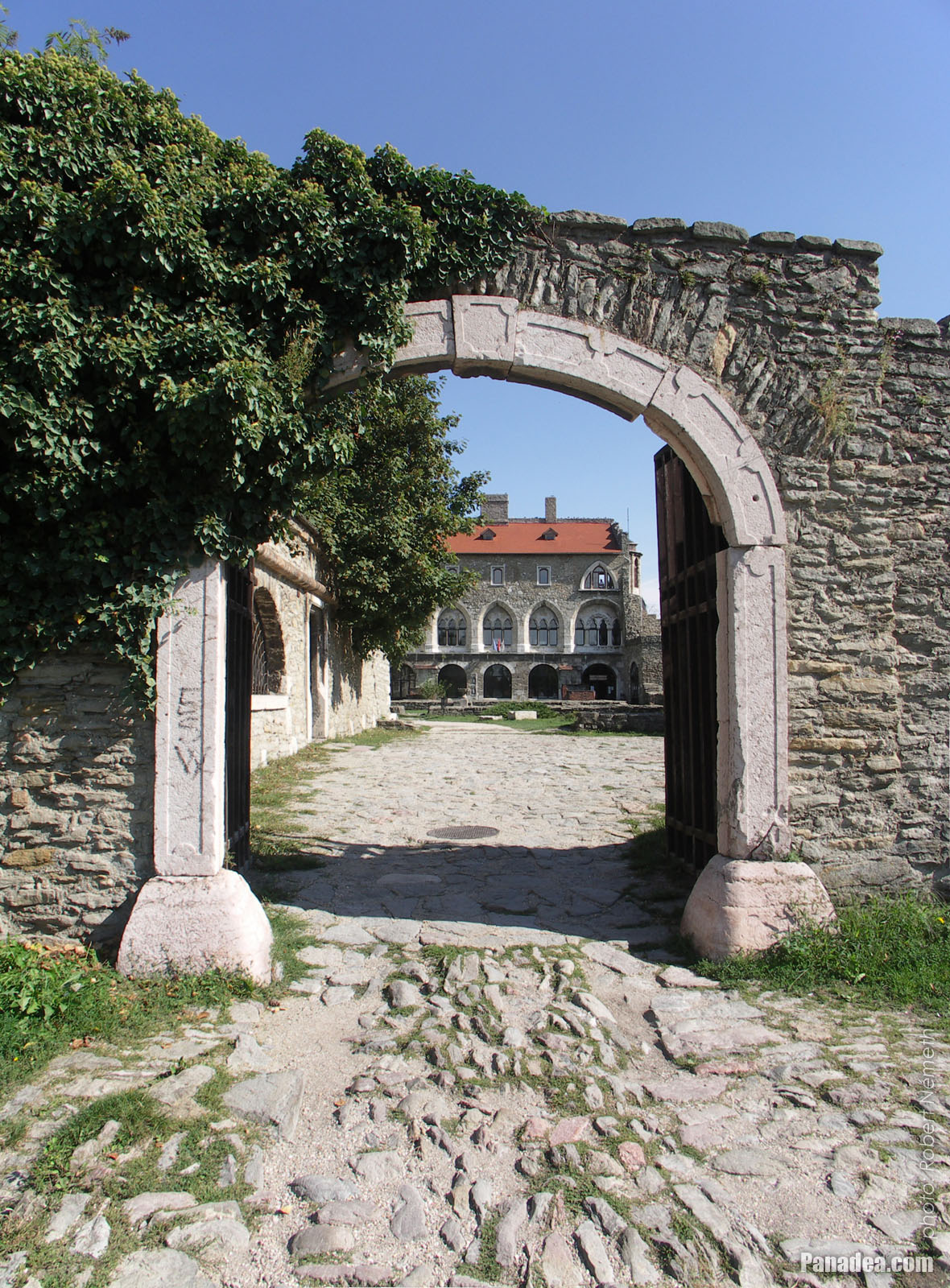
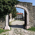
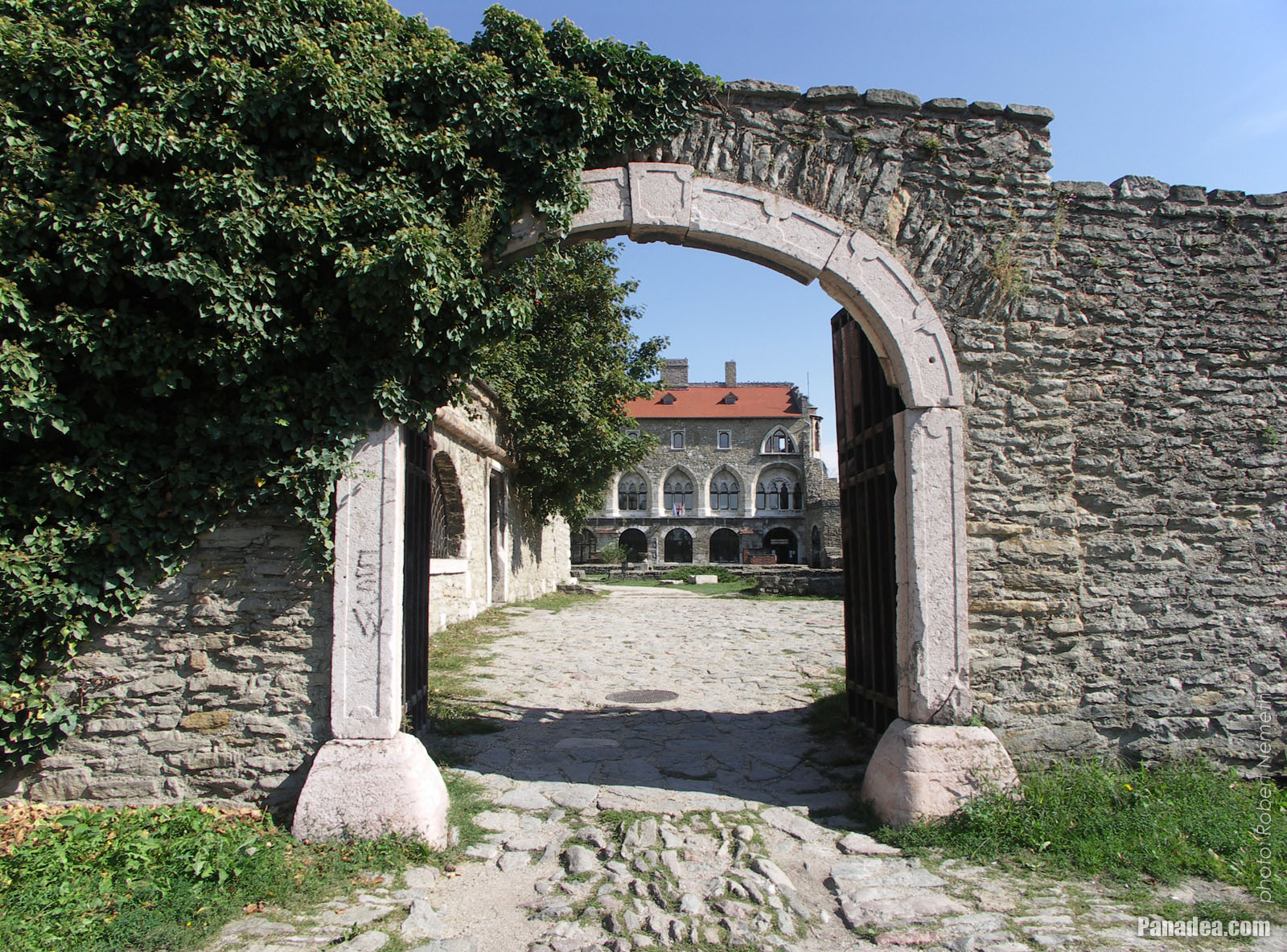
Castle of Tata, the vaulted stone gate with red marble frame on the north-westernd castle wall
Designed by Jakab Fellner, built in 1755
날짜를 촬영: 2006년 09월 02일2006
에 의해 만들어: Robert Németh
카메라 모델: Konica Minolta Dimage A200
Tata, 헝가리
Castle of Tata, the vaulted stone gate with red marble frame on the north-westernd castle wall - Tata, 헝가리 -
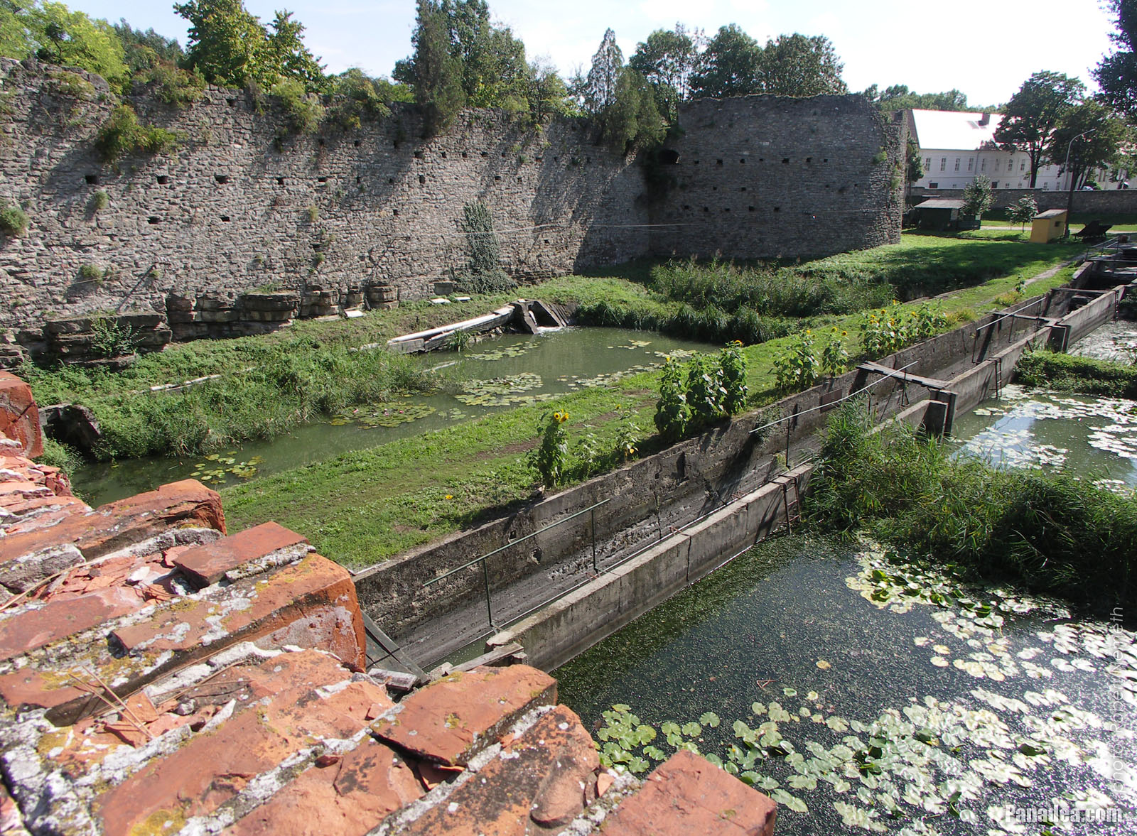
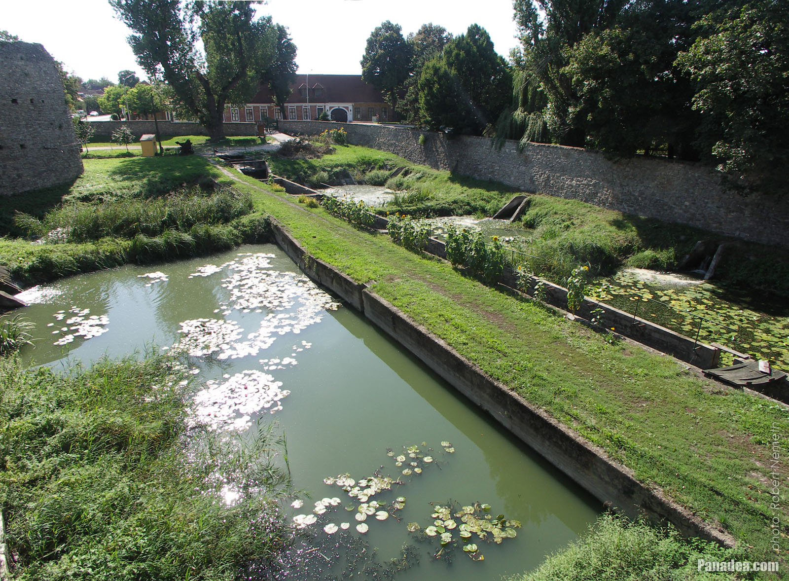
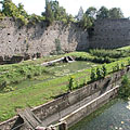
The north-western wall of Tata Castle, the western circular bastion (rondella) and the moat ("water ditch"), viewed from the castle bridge
The four-span bridge and the castle gate was built by Jakab Fellner in 1755.
날짜를 촬영: 2006년 09월 02일2006
에 의해 만들어: Robert Németh
카메라 모델: Konica Minolta Dimage A200
Tata, 헝가리
The north-western wall of Tata Castle, the western circular bastion (rondella) and the moat ("water ditch"), viewed from the castle bridge - Tata, 헝가리 -
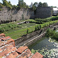
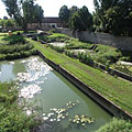
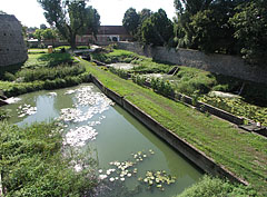
The former moat (broad defence ditch, filled with water) along the castle wall
날짜를 촬영: 2006년 09월 02일2006
에 의해 만들어: Robert Németh
카메라 모델: Konica Minolta Dimage A200
Tata, 헝가리
The former moat (broad defence ditch, filled with water) along the castle wall - Tata, 헝가리 -
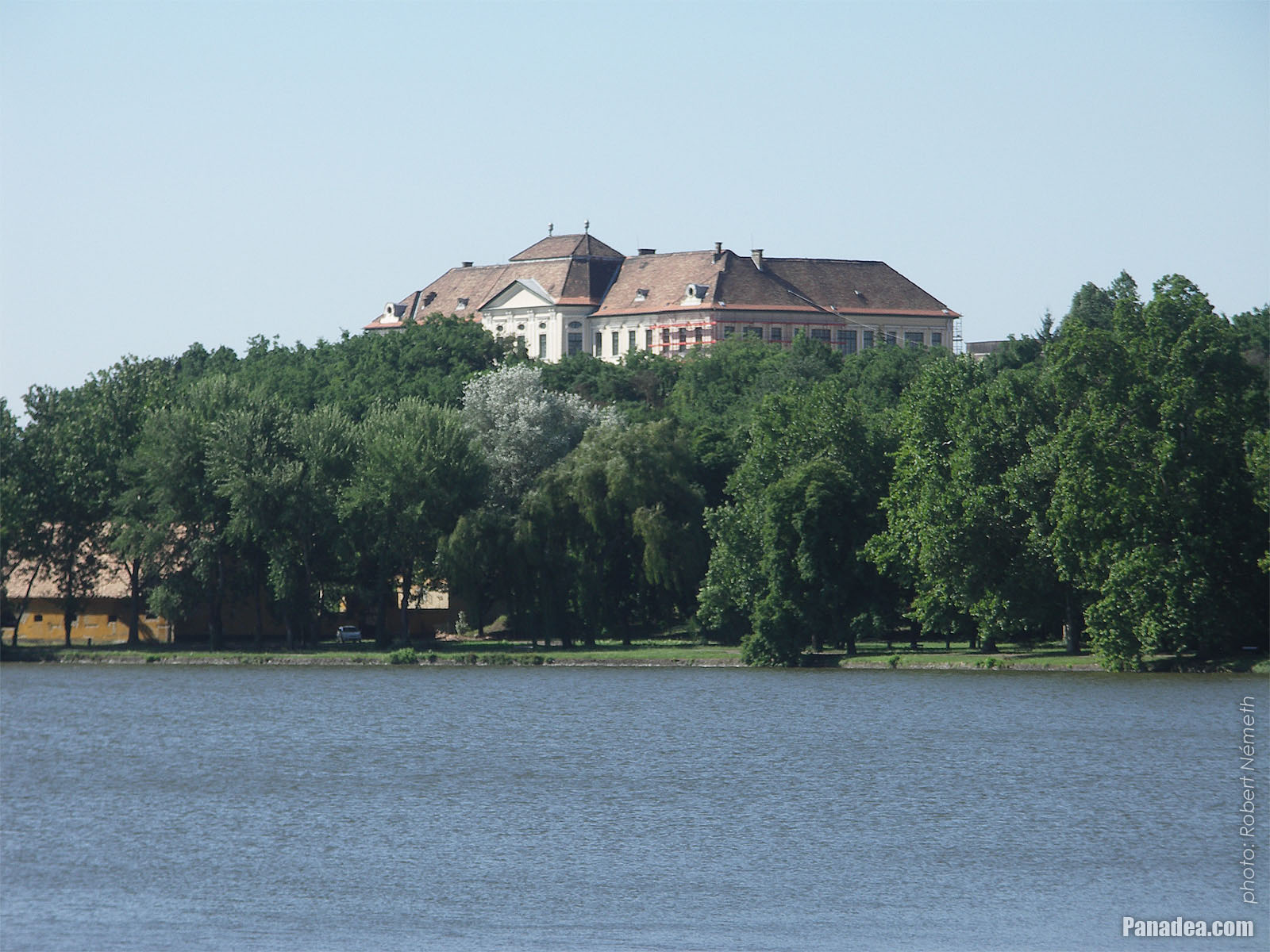
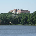
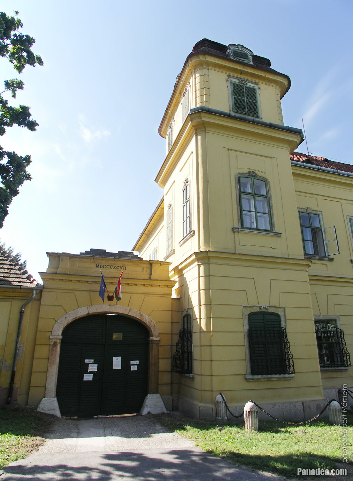
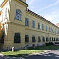
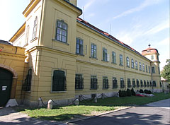
The yellow-painted Esterházy Palace (or Esterházy Mansion)
날짜를 촬영: 2006년 09월 02일2006
에 의해 만들어: Robert Németh
카메라 모델: Konica Minolta Dimage A200
Tata, 헝가리
The yellow-painted Esterházy Palace (or Esterházy Mansion) - Tata, 헝가리 -
Esterházy Palace
Built between 1760 and 1776, designed by Jakab Fellner
날짜를 촬영: 2006년 09월 02일2006
에 의해 만들어: Robert Németh
카메라 모델: Konica Minolta Dimage A200
Tata, 헝가리
Esterházy Palace - Tata, 헝가리 -
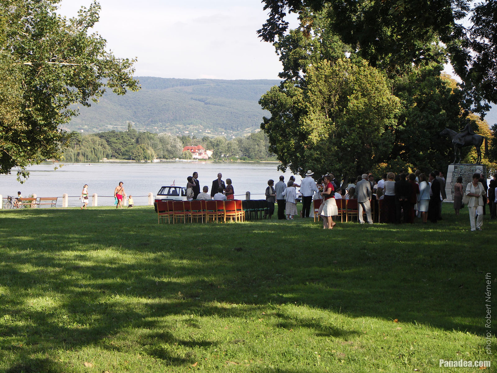
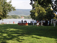
Preparing for a wedding ceremony by the Lake Öreg, on the grassy meadow beside the Esterházy Mansion
날짜를 촬영: 2006년 09월 02일2006
에 의해 만들어: Robert Németh
카메라 모델: Konica Minolta Dimage A200
Tata, 헝가리
Preparing for a wedding ceremony by the Lake Öreg, on the grassy meadow beside the Esterházy Mansion - Tata, 헝가리 -
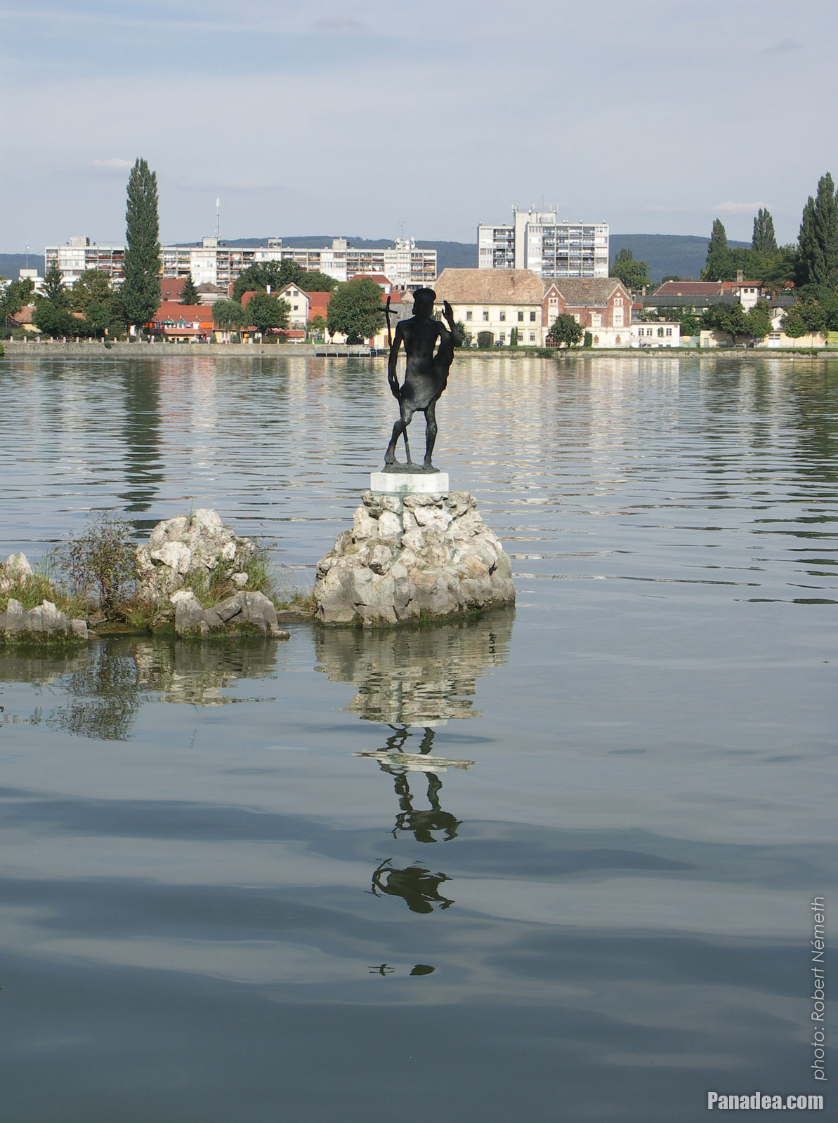
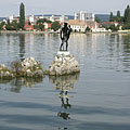
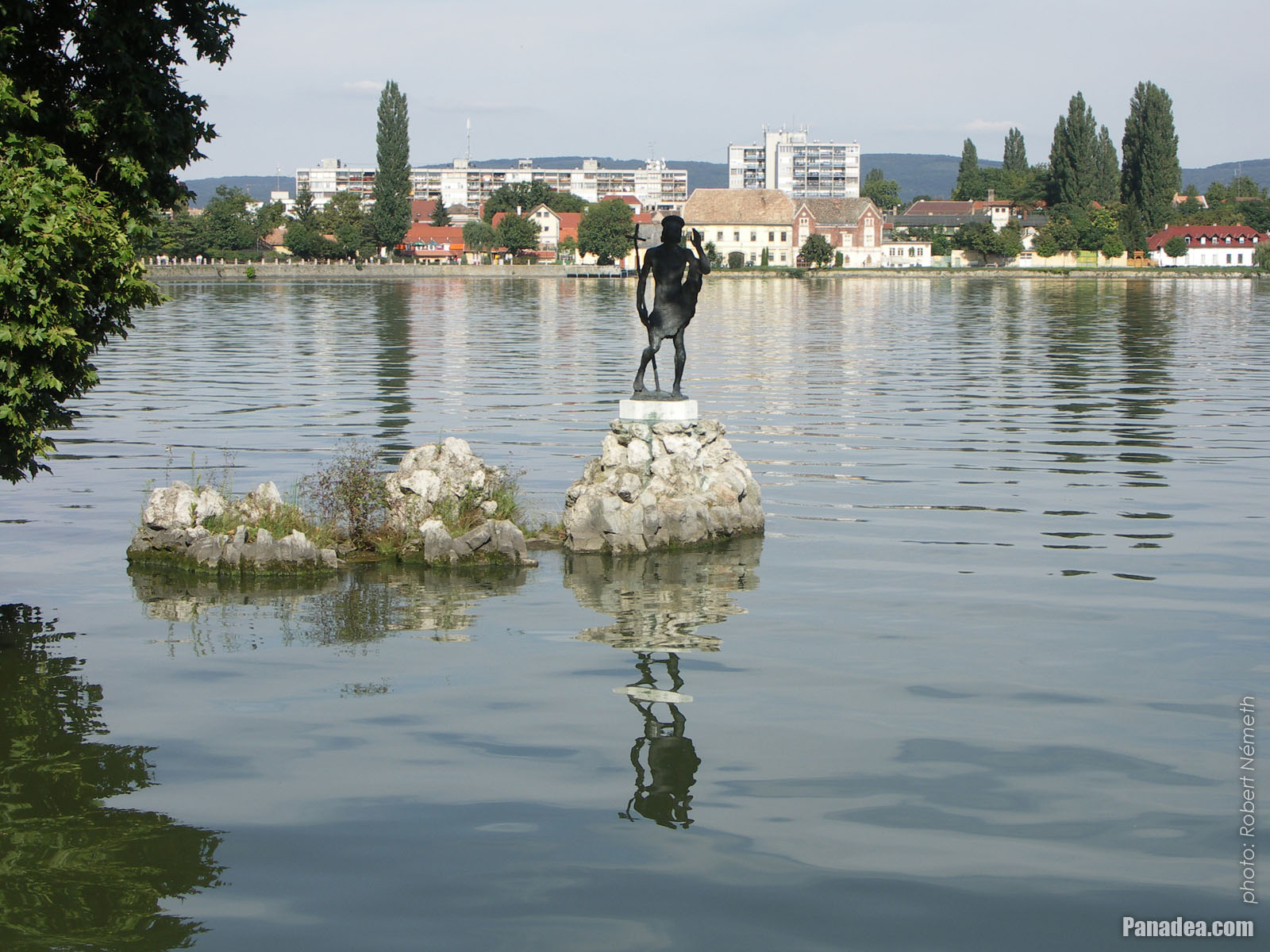
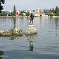
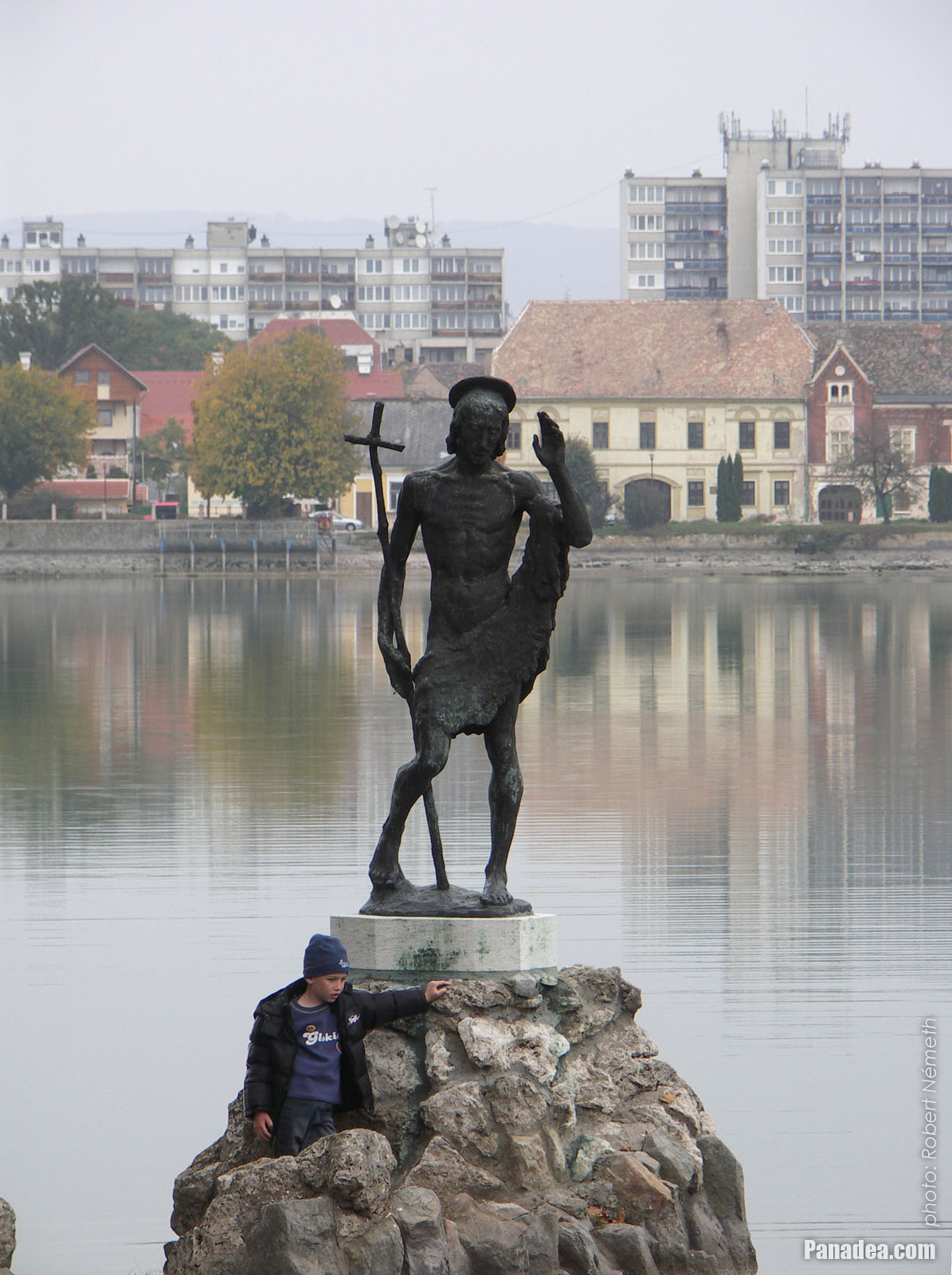
Statue of St. John the Baptist in the middle of Lake Öreg or Old Lake, on a rock
Created by Mária N. Kovács in 1943, stands on its present location since 1989.
날짜를 촬영: 2006년 09월 02일2006
에 의해 만들어: Robert Németh
카메라 모델: Konica Minolta Dimage A200
Tata, 헝가리
Statue of St. John the Baptist in the middle of Lake Öreg or Old Lake, on a rock - Tata, 헝가리 -
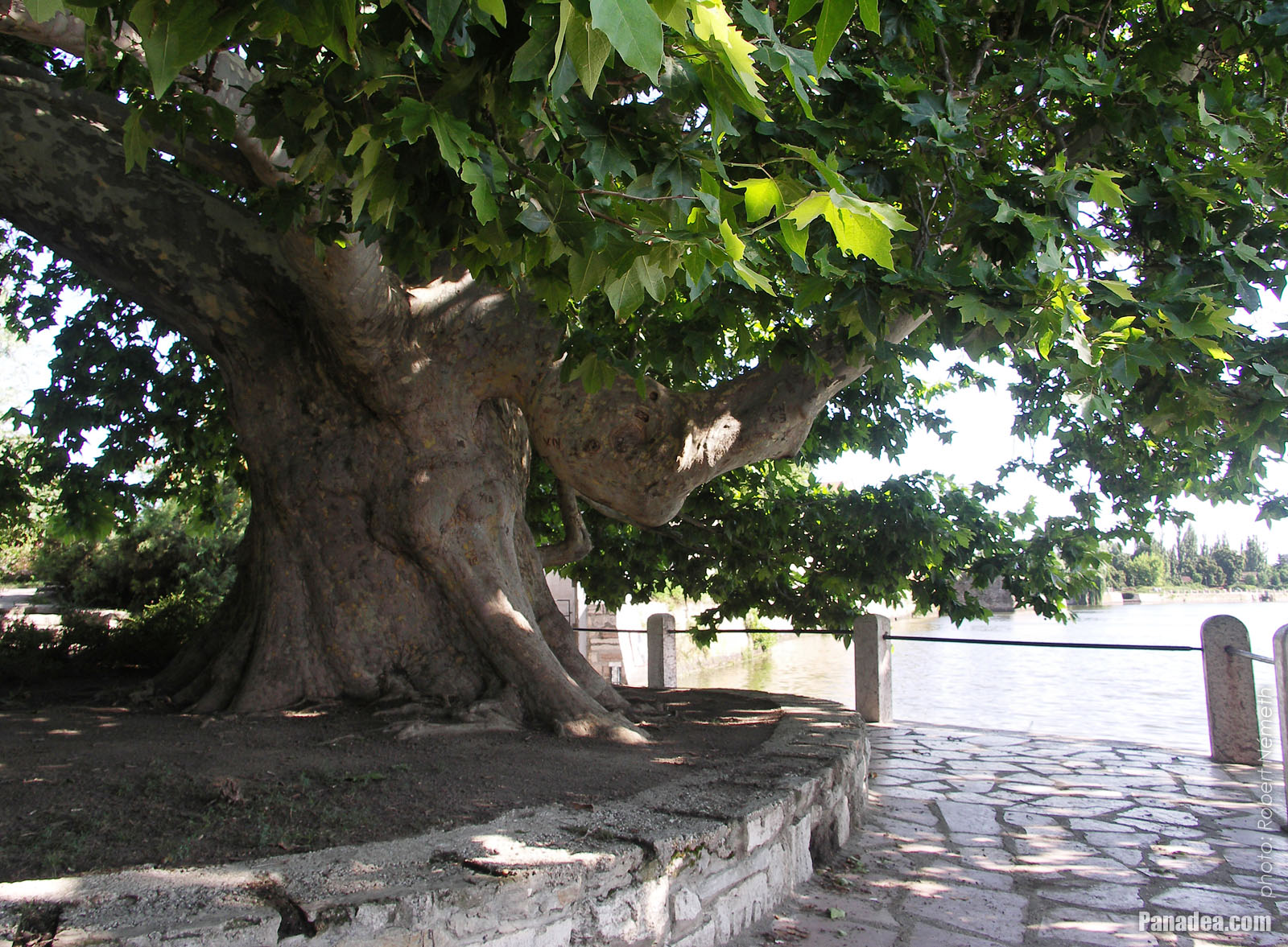
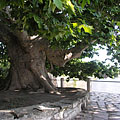
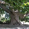
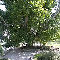
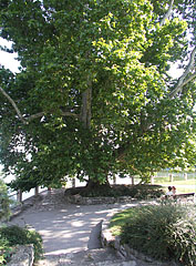
An incredibly thick-trunked old plane tree (sycamore tree or platan) which is considerably more than 300 years old, surprisingly on the shore of the Old Lake (Lake Öreg)
날짜를 촬영: 2006년 07월 15일2006
에 의해 만들어: Robert Németh
카메라 모델: Konica Minolta Dimage A200
Tata, 헝가리
An incredibly thick-trunked old plane tree (sycamore tree or platan) which is considerably more than 300 years old, surprisingly on the shore of the Old Lake (Lake Öreg) - Tata, 헝가리 -
Statue of St. John the Baptist in the lake
날짜를 촬영: 2006년 07월 15일2006
에 의해 만들어: Robert Németh
카메라 모델: Konica Minolta Dimage A200
Tata, 헝가리
Statue of St. John the Baptist in the lake - Tata, 헝가리 -
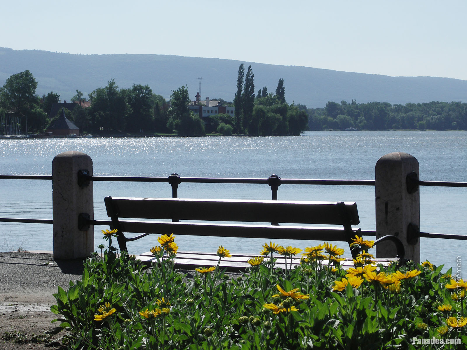
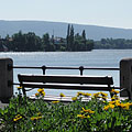
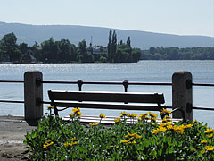
Lakeside tranquility, a bench, flowers and the shining water
날짜를 촬영: 2006년 07월 15일2006
에 의해 만들어: Robert Németh
카메라 모델: Konica Minolta Dimage A200
Tata, 헝가리
Lakeside tranquility, a bench, flowers and the shining water - Tata, 헝가리 -
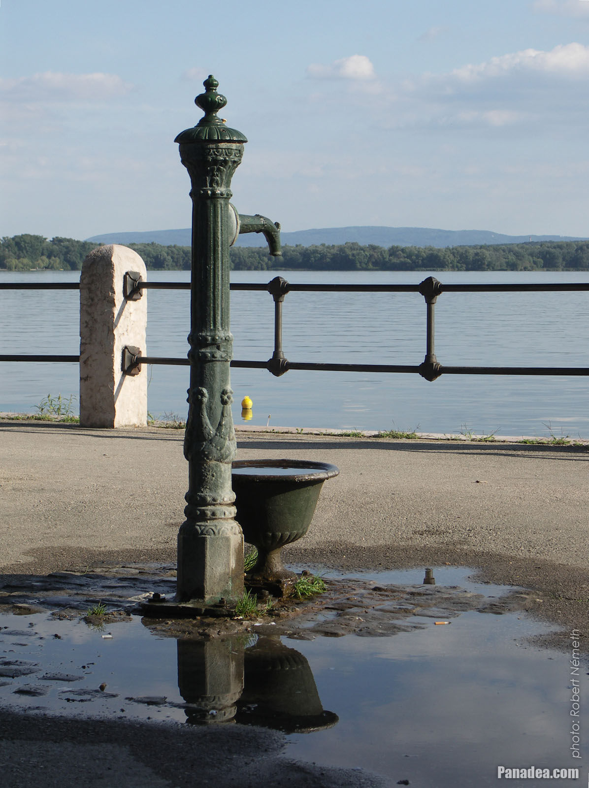
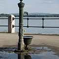
Cast iron water well at the Öreg Lake or Old Lake
It was placed here maybe together with the nearby "Csurgó" water well in 1999 (the latter is standing on the place of a former fountain).
날짜를 촬영: 2006년 09월 02일2006
에 의해 만들어: Robert Németh
카메라 모델: Konica Minolta Dimage A200
Tata, 헝가리
Cast iron water well at the Öreg Lake or Old Lake - Tata, 헝가리 -
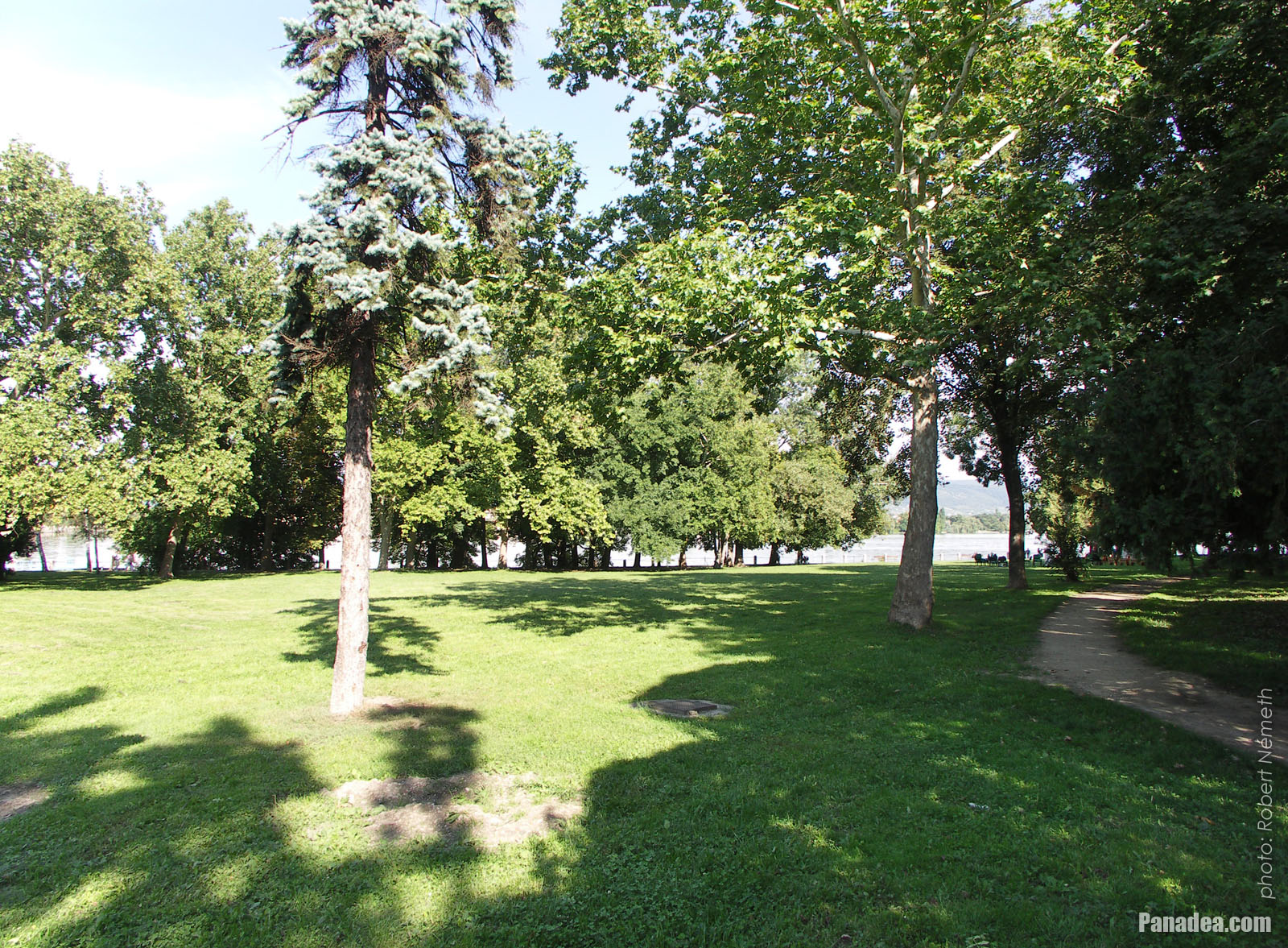
Lakeside promenade and park
날짜를 촬영: 2006년 09월 02일2006
에 의해 만들어: Robert Németh
카메라 모델: Konica Minolta Dimage A200
Tata, 헝가리
Lakeside promenade and park - Tata, 헝가리 -
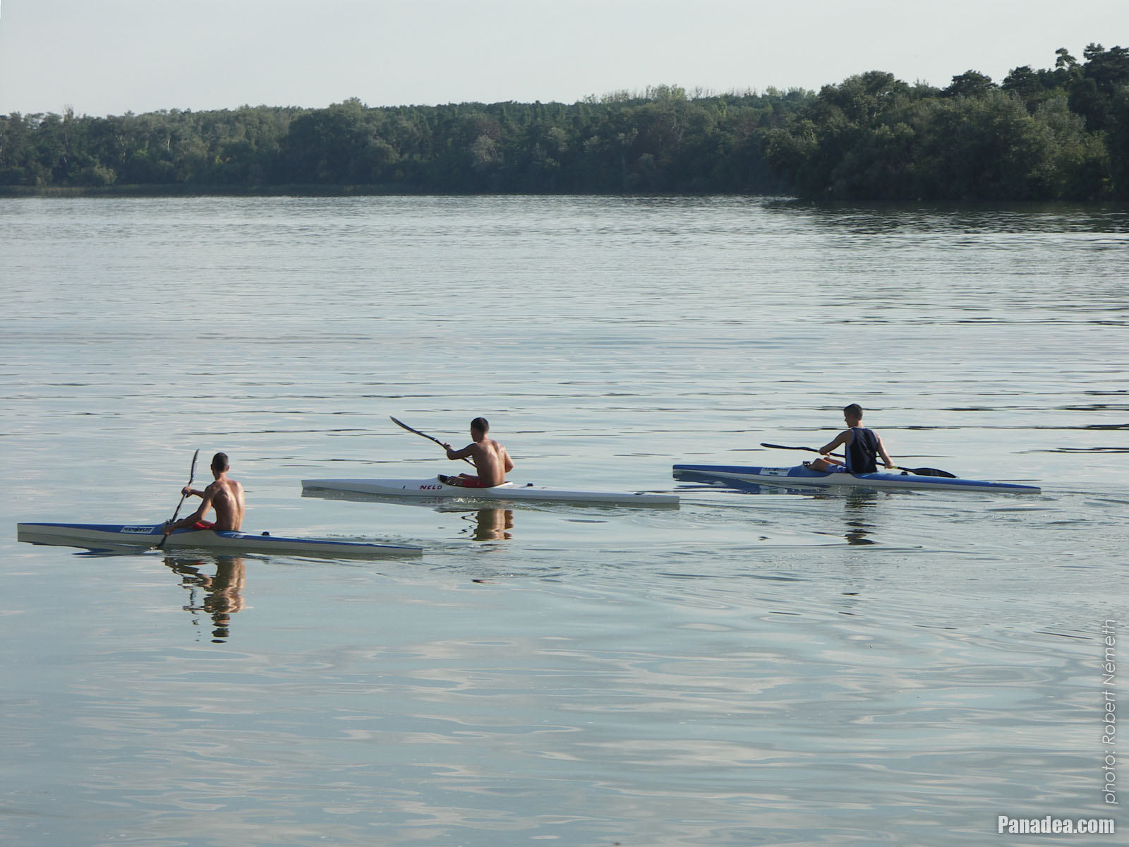
Kayakers on the lake
날짜를 촬영: 2006년 09월 02일2006
에 의해 만들어: Robert Németh
카메라 모델: Konica Minolta Dimage A200
Tata, 헝가리
Kayakers on the lake - Tata, 헝가리 -
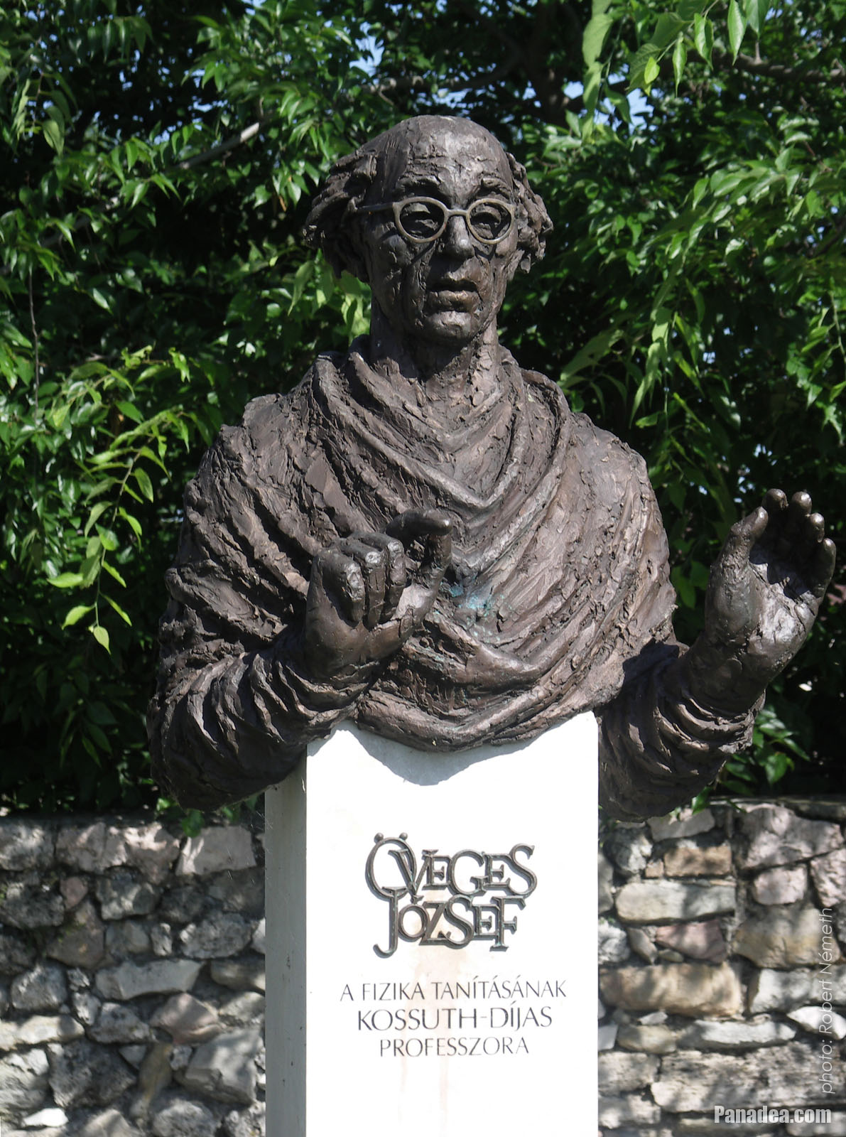
Bust sculpture of the Kossuth Prize awarded József Öveges professor of physics
Created by Béla Tóth in 2002
날짜를 촬영: 2006년 07월 15일2006
에 의해 만들어: Robert Németh
카메라 모델: Konica Minolta Dimage A200
Tata, 헝가리
Bust sculpture of the Kossuth Prize awarded József Öveges professor of physics - Tata, 헝가리 -
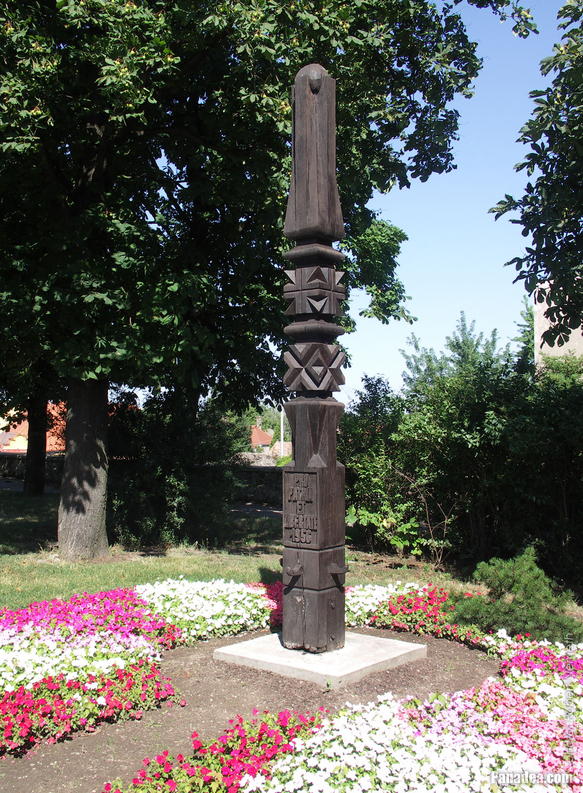
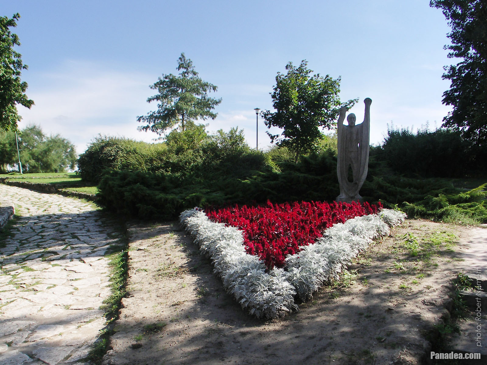
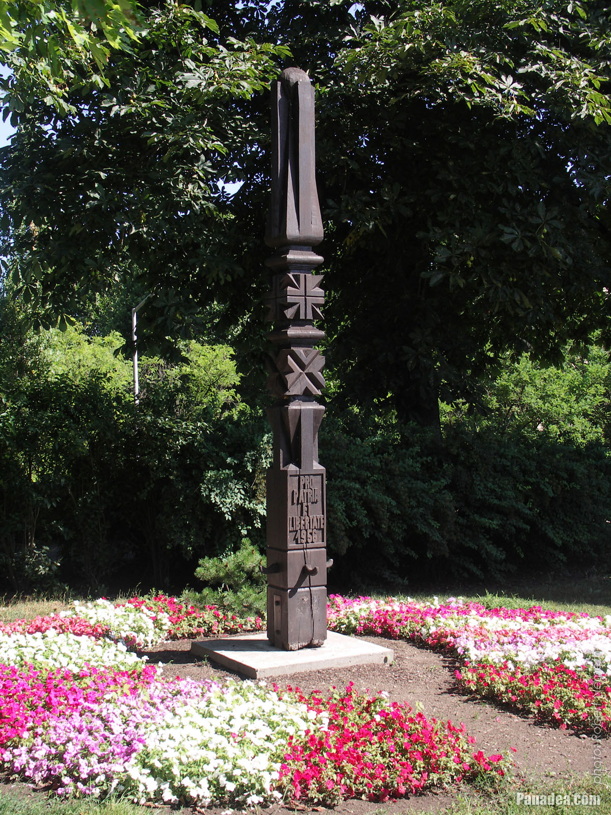
Wooden memorial column in the park between flowers (memorial of the Hungarian Uprising and Revolution of 1956)
날짜를 촬영: 2006년 07월 15일2006
에 의해 만들어: Robert Németh
카메라 모델: Konica Minolta Dimage A200
Tata, 헝가리
Wooden memorial column in the park between flowers (memorial of the Hungarian Uprising and Revolution of 1956) - Tata, 헝가리 -
Old fisherman holds his net, a stone statue in the park
Created by Tibor Borbás in 1974
날짜를 촬영: 2006년 09월 02일2006
에 의해 만들어: Robert Németh
카메라 모델: Konica Minolta Dimage A200
Tata, 헝가리
Old fisherman holds his net, a stone statue in the park - Tata, 헝가리 -
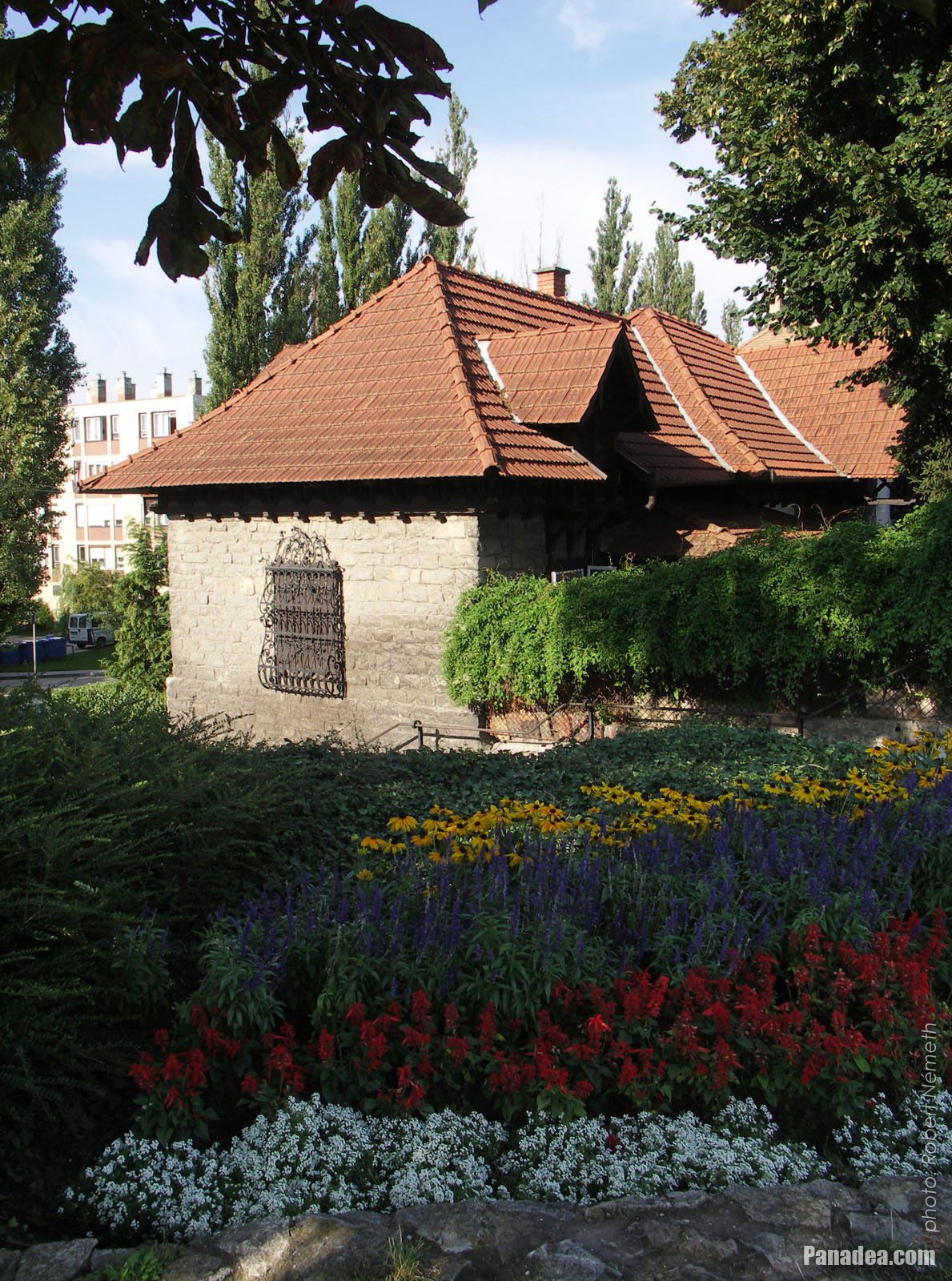
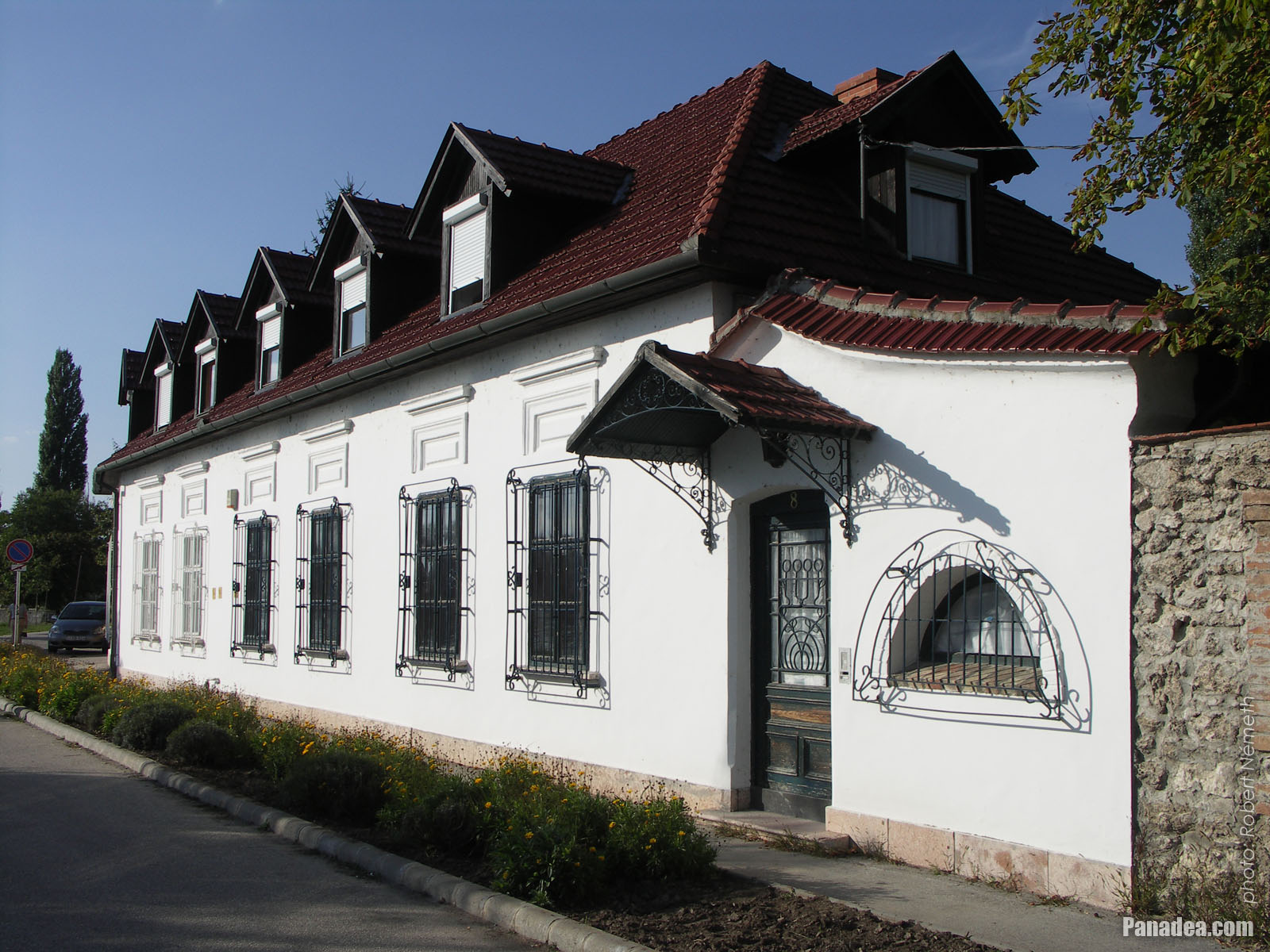
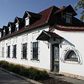
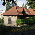
Flowered park and a cozy stone-walled dwelling house
날짜를 촬영: 2006년 09월 02일2006
에 의해 만들어: Robert Németh
카메라 모델: Konica Minolta Dimage A200
Tata, 헝가리
Flowered park and a cozy stone-walled dwelling house - Tata, 헝가리 -
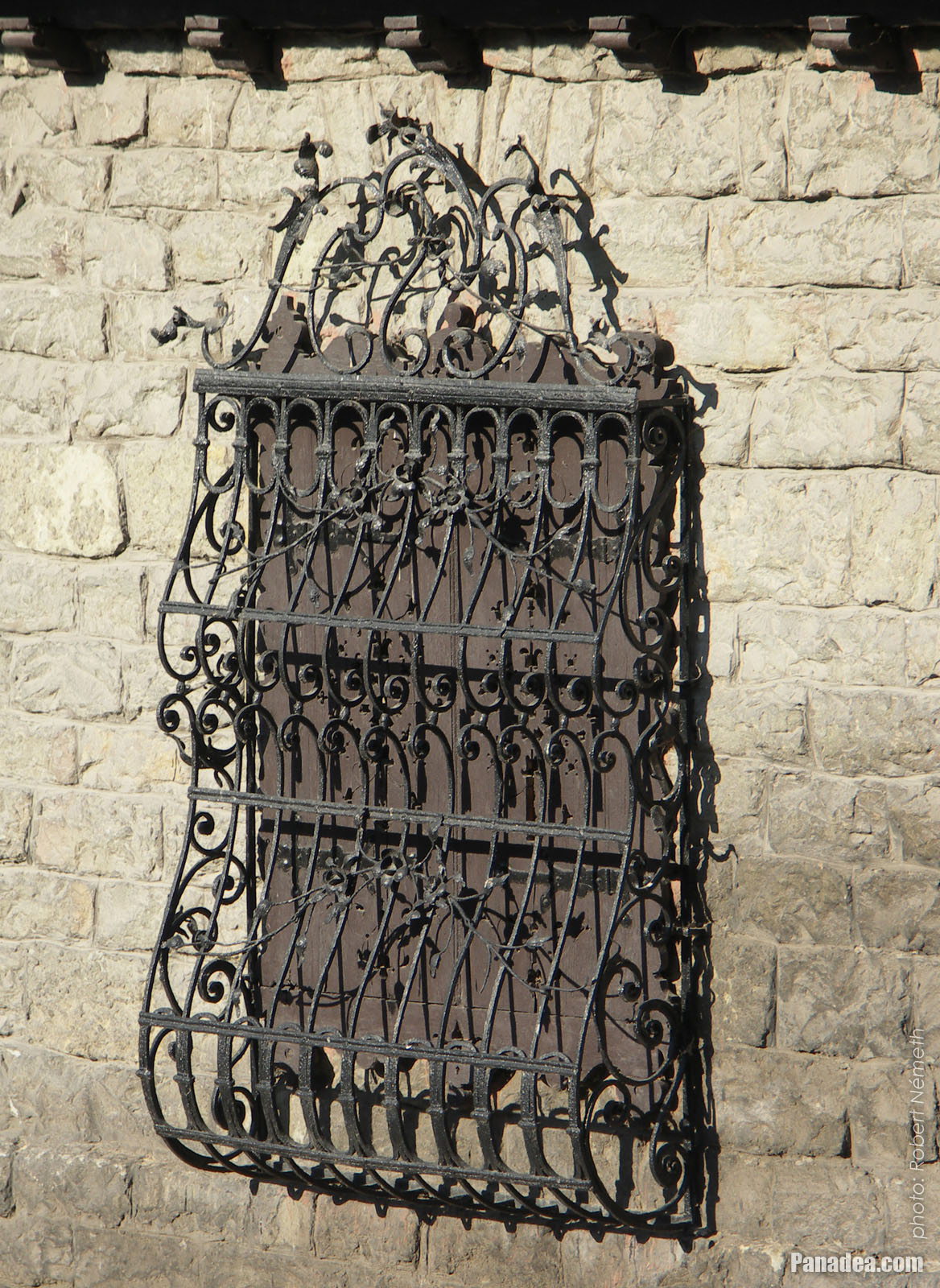
Ornate wrought iron grille on the window of a dwelling house
날짜를 촬영: 2006년 09월 02일2006
에 의해 만들어: Robert Németh
카메라 모델: Konica Minolta Dimage A200
Tata, 헝가리
Ornate wrought iron grille on the window of a dwelling house - Tata, 헝가리 -
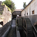
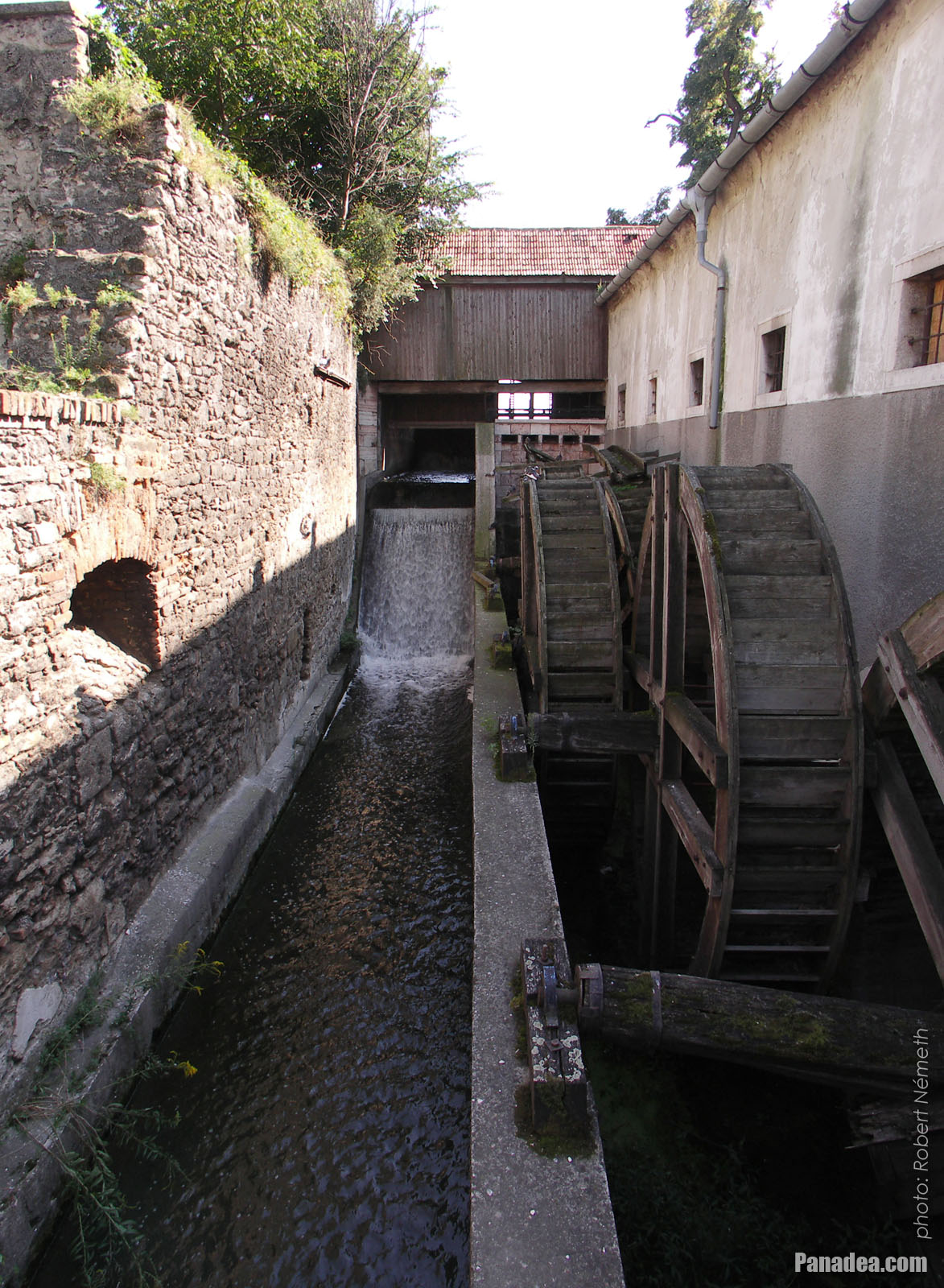
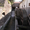
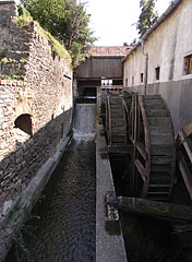
The water wheel system of the old Cifra water mill
날짜를 촬영: 2006년 09월 02일2006
에 의해 만들어: Robert Németh
카메라 모델: Konica Minolta Dimage A200
Tata, 헝가리
The water wheel system of the old Cifra water mill - Tata, 헝가리 -
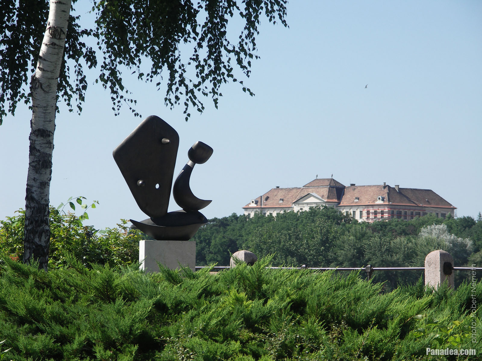
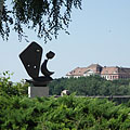
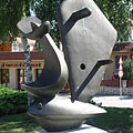
The contemporary sculpture called "Sailboat" in the park, and the Eötvös József High School (former Piarist High School) on the other side of the lake, on a hill
날짜를 촬영: 2006년 07월 15일2006
에 의해 만들어: Robert Németh
카메라 모델: Konica Minolta Dimage A200
Tata, 헝가리
The contemporary sculpture called "Sailboat" in the park, and the Eötvös József High School (former Piarist High School) on the other side of the lake, on a hill - Tata, 헝가리 -
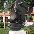
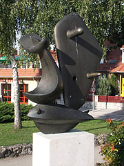
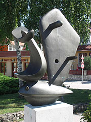
Bronze statue of a sailboat by the lake, represents a fishing boat and a fish in one
Created by Ferenc Friedrich in 1996, based on the work of Ferenc Martyn and in memory of the Breton fishermen.
날짜를 촬영: 2006년 09월 02일2006
에 의해 만들어: Robert Németh
카메라 모델: Konica Minolta Dimage A200
Tata, 헝가리
Bronze statue of a sailboat by the lake, represents a fishing boat and a fish in one - Tata, 헝가리 -
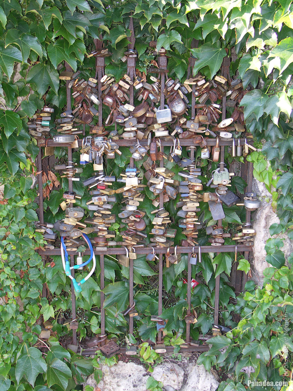
Love padlocks on the waterfront stone fence of a dwelling house in Alkotmány Street
날짜를 촬영: 2006년 09월 02일2006
에 의해 만들어: Robert Németh
카메라 모델: Konica Minolta Dimage A200
Tata, 헝가리
Love padlocks on the waterfront stone fence of a dwelling house in Alkotmány Street - Tata, 헝가리 -
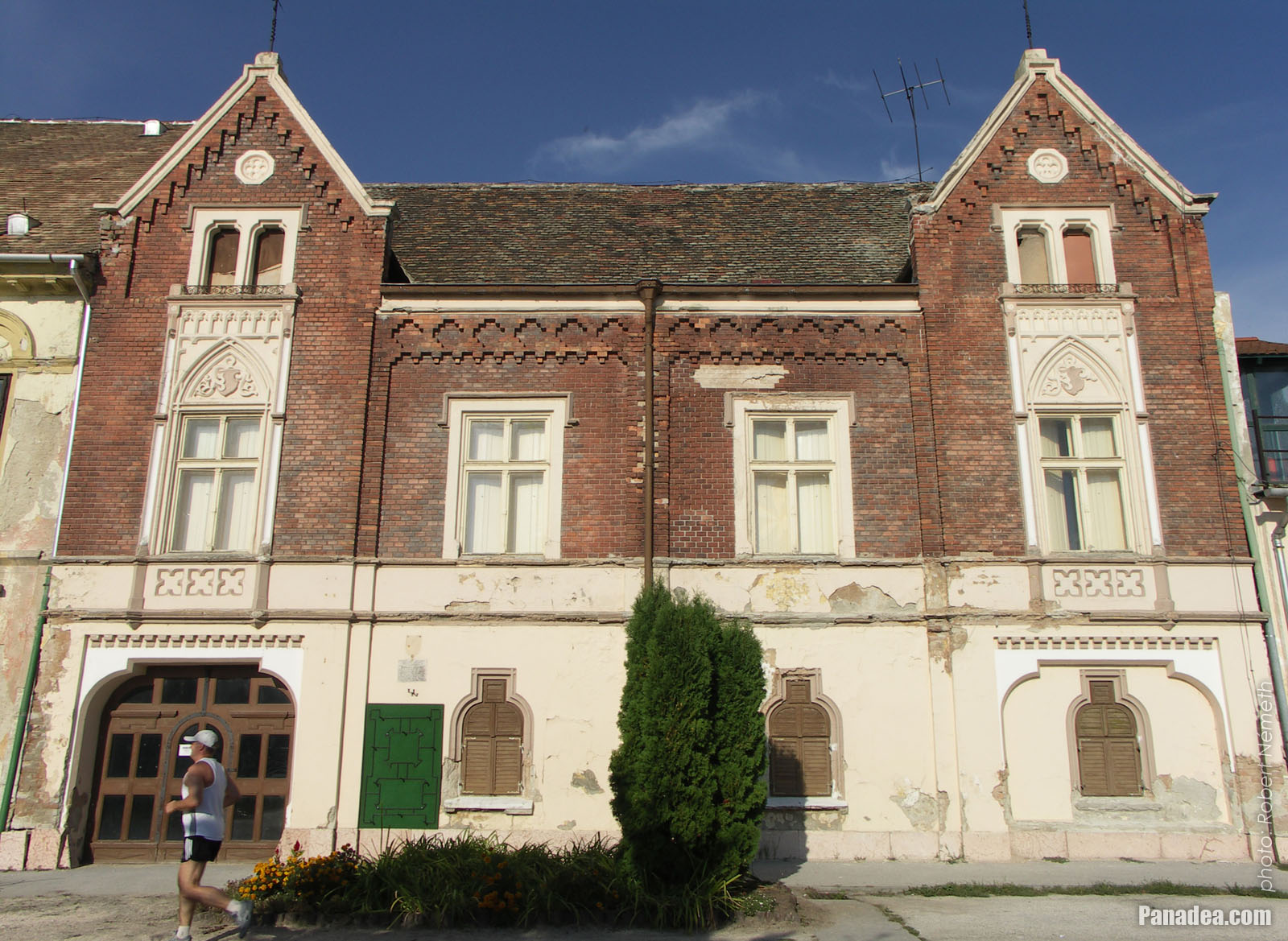
Facade of the historicist neo-gothic style Hamary House
This former tannery or leather factory was built around 1770, and it was extended with the red brick upper floor in the late 19th century.
날짜를 촬영: 2006년 09월 02일2006
에 의해 만들어: Robert Németh
카메라 모델: Konica Minolta Dimage A200
Tata, 헝가리
Facade of the historicist neo-gothic style Hamary House - Tata, 헝가리 -
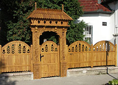
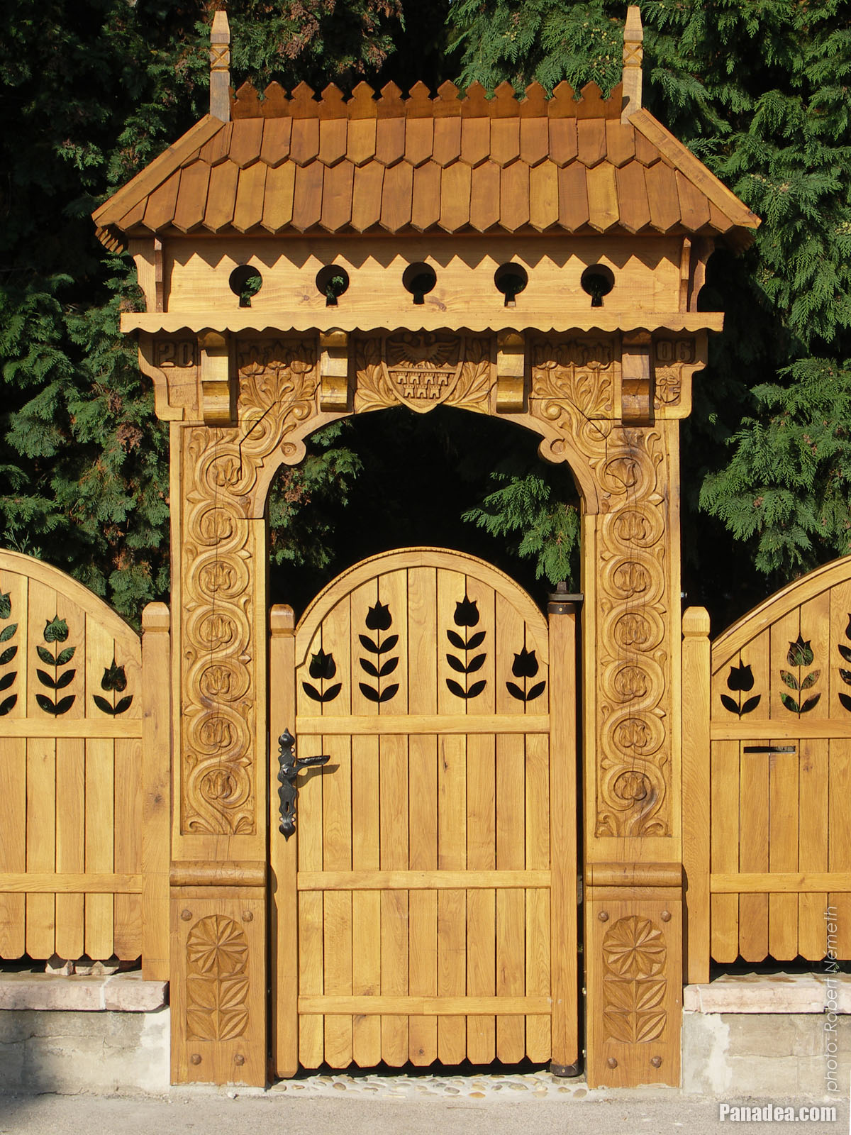
The wooden carved Székely gate and fence of a Lakeside dwelling house
날짜를 촬영: 2006년 09월 02일2006
에 의해 만들어: Robert Németh
카메라 모델: Konica Minolta Dimage A200
Tata, 헝가리
The wooden carved Székely gate and fence of a Lakeside dwelling house - Tata, 헝가리 -
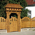
The wood-carved gateway looks like a Szekey gate
Carved by Ernő Cs. Kiss in 2005
날짜를 촬영: 2006년 09월 02일2006
에 의해 만들어: Robert Németh
카메라 모델: Konica Minolta Dimage A200
Tata, 헝가리
The wood-carved gateway looks like a Szekey gate - Tata, 헝가리 -
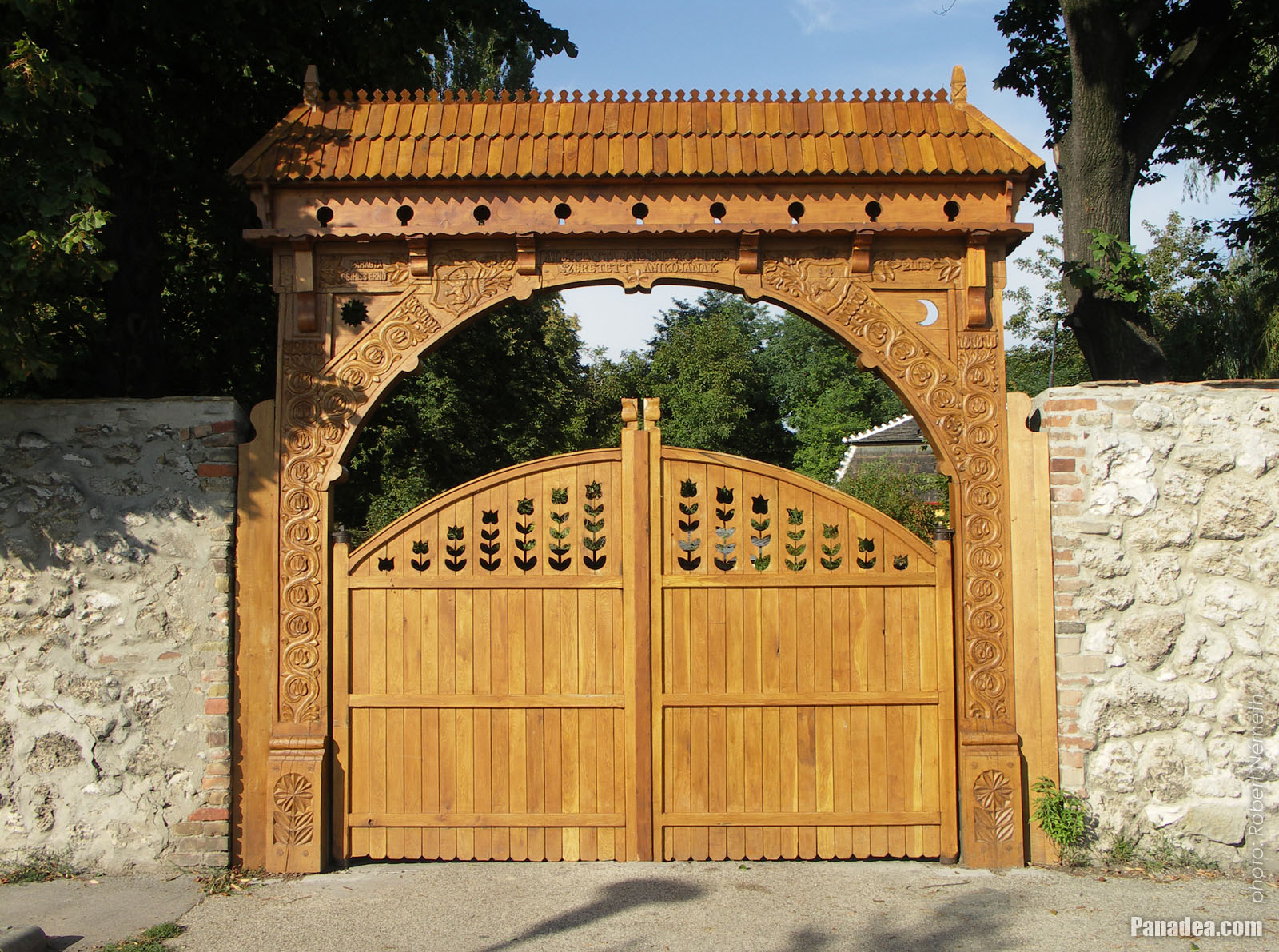
Wide wood-carved Székely gate
According to an inscription on the gate it was created by Hungarian wood carver folk artist Ernő Cs. Kiss from Tata in 2005.
날짜를 촬영: 2006년 09월 02일2006
에 의해 만들어: Robert Németh
카메라 모델: Konica Minolta Dimage A200
Tata, 헝가리
Wide wood-carved Székely gate - Tata, 헝가리 -
Ornate window grille of a nice white dwelling house
날짜를 촬영: 2006년 09월 02일2006
에 의해 만들어: Robert Németh
카메라 모델: Konica Minolta Dimage A200
Tata, 헝가리
Ornate window grille of a nice white dwelling house - Tata, 헝가리 -
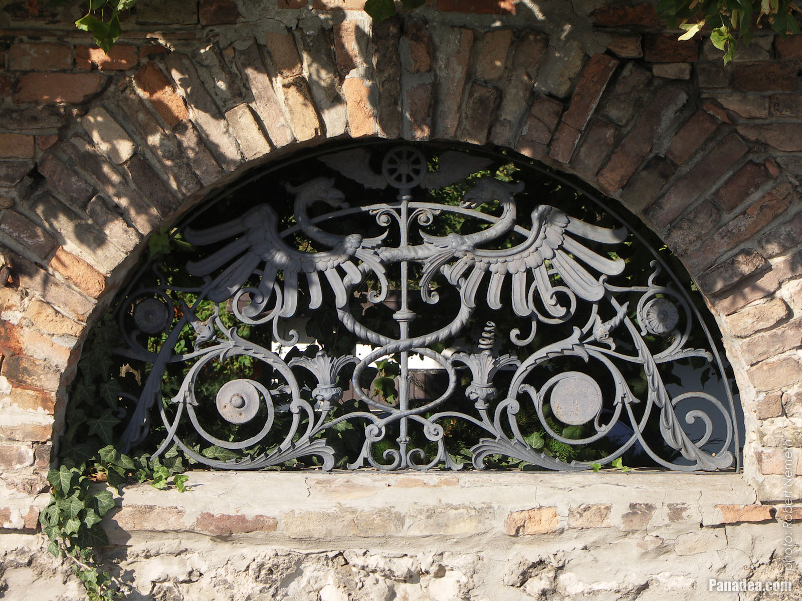
Wrought iron dragons and other motifs in an arched opening of a brick-wall fence
날짜를 촬영: 2006년 09월 02일2006
에 의해 만들어: Robert Németh
카메라 모델: Konica Minolta Dimage A200
Tata, 헝가리
Wrought iron dragons and other motifs in an arched opening of a brick-wall fence - Tata, 헝가리 -
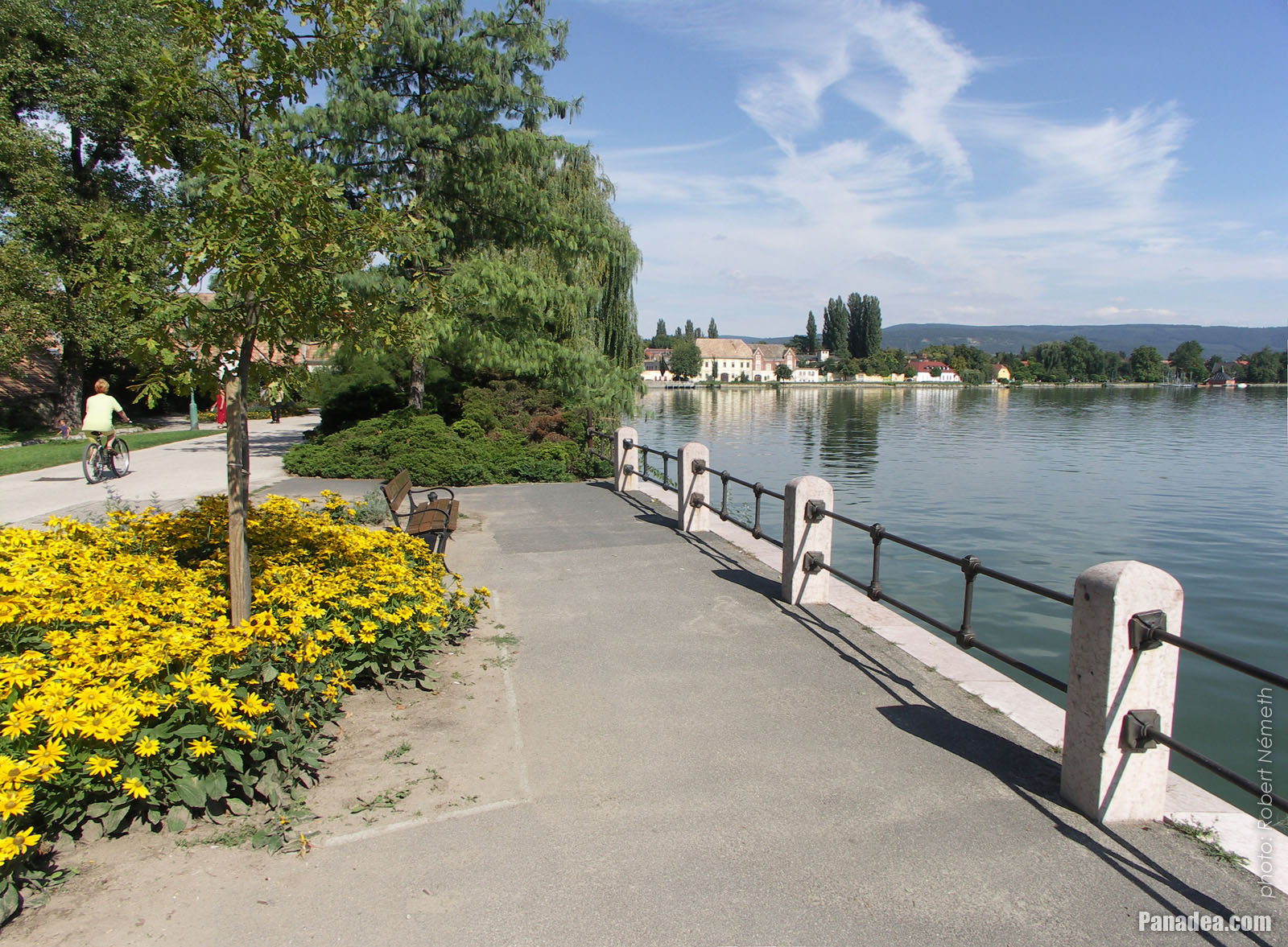
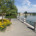
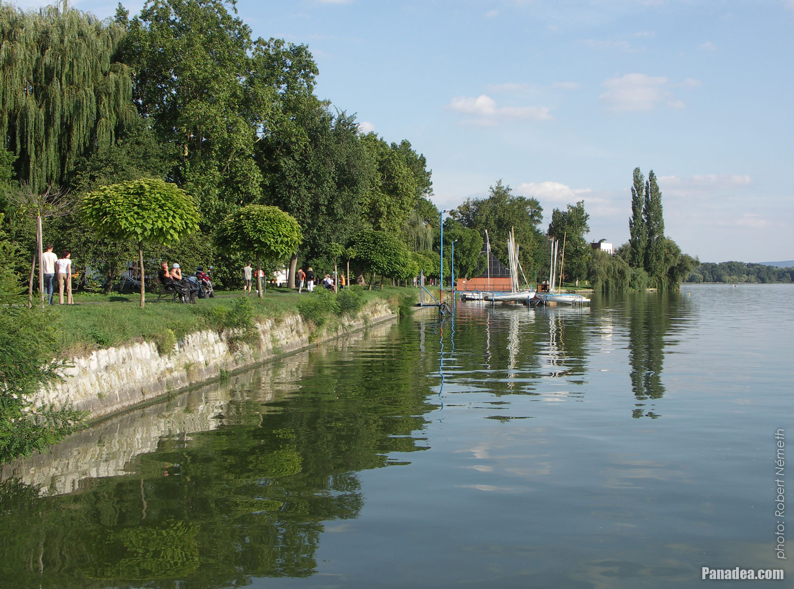
Lake Öreg (or Old Lake), with landscaped walkway on the shore and a small sailboat harbour ahead
날짜를 촬영: 2006년 09월 02일2006
에 의해 만들어: Robert Németh
카메라 모델: Konica Minolta Dimage A200
Tata, 헝가리
Lake Öreg (or Old Lake), with landscaped walkway on the shore and a small sailboat harbour ahead - Tata, 헝가리 -
The baroque style yellow-painted Pötörke Mill watermill
It was built in the late 18th century by Jakab Fellner architect, now it is the creative house of the Hungarian National Monuments Office.
날짜를 촬영: 2006년 09월 02일2006
에 의해 만들어: Robert Németh
카메라 모델: Konica Minolta Dimage A200
Tata, 헝가리
The baroque style yellow-painted Pötörke Mill watermill - Tata, 헝가리 -
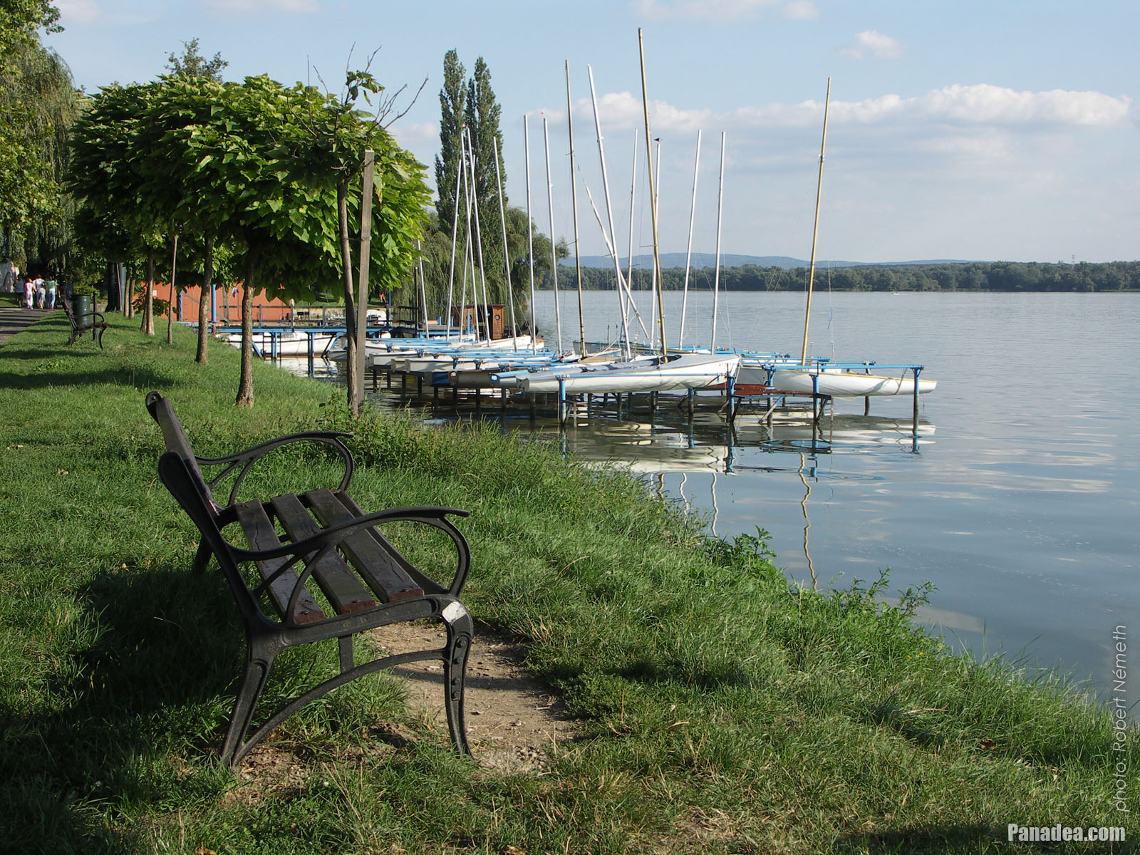
Bench and sailboat harbour by the lake
날짜를 촬영: 2006년 09월 02일2006
에 의해 만들어: Robert Németh
카메라 모델: Konica Minolta Dimage A200
Tata, 헝가리
Bench and sailboat harbour by the lake - Tata, 헝가리 -
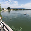
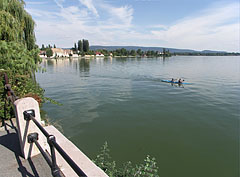
Three kayakers on the Old Lake (or Öreg Lake)
날짜를 촬영: 2006년 09월 02일2006
에 의해 만들어: Robert Németh
카메라 모델: Konica Minolta Dimage A200
Tata, 헝가리
Three kayakers on the Old Lake (or Öreg Lake) - Tata, 헝가리 -
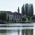
Lake Öreg and the Castle of Tata
날짜를 촬영: 2006년 07월 15일2006
에 의해 만들어: Robert Németh
카메라 모델: Konica Minolta Dimage A200
Tata, 헝가리
Lake Öreg and the Castle of Tata - Tata, 헝가리 -
The Axmann House (built in 1833) and the Hamary House on the shore of Lake Öreg
날짜를 촬영: 2006년 07월 15일2006
에 의해 만들어: Robert Németh
카메라 모델: Konica Minolta Dimage A200
Tata, 헝가리
The Axmann House (built in 1833) and the Hamary House on the shore of Lake Öreg - Tata, 헝가리 -
Castle of Tata by the lake
날짜를 촬영: 2006년 07월 15일2006
에 의해 만들어: Robert Németh
카메라 모델: Konica Minolta Dimage A200
Tata, 헝가리
Castle of Tata by the lake - Tata, 헝가리 -
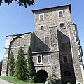
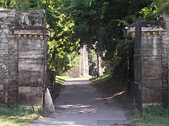
The western gate of Tata Castle
날짜를 촬영: 2006년 07월 15일2006
에 의해 만들어: Robert Németh
카메라 모델: Konica Minolta Dimage A200
Tata, 헝가리
The western gate of Tata Castle - Tata, 헝가리 -
An old plane tree by the lake near the castle
날짜를 촬영: 2006년 07월 15일2006
에 의해 만들어: Robert Németh
카메라 모델: Konica Minolta Dimage A200
Tata, 헝가리
An old plane tree by the lake near the castle - Tata, 헝가리 -
The survived central tower of the Tata Castle, these days it is the home of the Kuny Domokos County Museum
날짜를 촬영: 2006년 07월 15일2006
에 의해 만들어: Robert Németh
카메라 모델: Konica Minolta Dimage A200
Tata, 헝가리
The survived central tower of the Tata Castle, these days it is the home of the Kuny Domokos County Museum - Tata, 헝가리 -
A headboard, carved wooden column in the park, memorial of the Hungarian revolution and independece war of 1956
날짜를 촬영: 2006년 07월 15일2006
에 의해 만들어: Robert Németh
카메라 모델: Konica Minolta Dimage A200
Tata, 헝가리
A headboard, carved wooden column in the park, memorial of the Hungarian revolution and independece war of 1956 - Tata, 헝가리 -
"Sailboat", an abstract modern style bronze sculpture on the lakeside promenade
Created by Ferenc Friedrich in 1996
날짜를 촬영: 2006년 07월 15일2006
에 의해 만들어: Robert Németh
카메라 모델: Konica Minolta Dimage A200
Tata, 헝가리
"Sailboat", an abstract modern style bronze sculpture on the lakeside promenade - Tata, 헝가리 -
Water wheels of the Cifra Mill
날짜를 촬영: 2006년 09월 02일2006
에 의해 만들어: Robert Németh
카메라 모델: Konica Minolta Dimage A200
Tata, 헝가리
Water wheels of the Cifra Mill - Tata, 헝가리 -
The wall remains around the survived tower of the Tata Castle are now part of the park
날짜를 촬영: 2006년 09월 02일2006
에 의해 만들어: Robert Németh
카메라 모델: Konica Minolta Dimage A200
Tata, 헝가리
The wall remains around the survived tower of the Tata Castle are now part of the park - Tata, 헝가리 -
The north-western wall of the Castle of Tata with a circular bastion (roundel) at the water-filled moat
날짜를 촬영: 2006년 09월 02일2006
에 의해 만들어: Robert Németh
카메라 모델: Konica Minolta Dimage A200
Tata, 헝가리
The north-western wall of the Castle of Tata with a circular bastion (roundel) at the water-filled moat - Tata, 헝가리 -
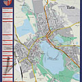
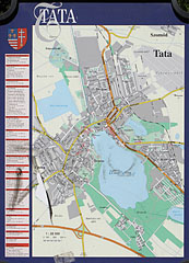
Map of Tata town
날짜를 촬영: 2006년 09월 02일2006
에 의해 만들어: Robert Németh
카메라 모델: Konica Minolta Dimage A200
Tata, 헝가리
Map of Tata town - Tata, 헝가리 -
The arched stone gate of the Tata Castle, on the north-western wall
날짜를 촬영: 2006년 09월 02일2006
에 의해 만들어: Robert Németh
카메라 모델: Konica Minolta Dimage A200
Tata, 헝가리
The arched stone gate of the Tata Castle, on the north-western wall - Tata, 헝가리 -
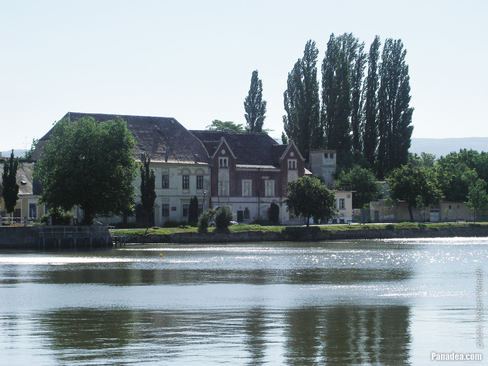
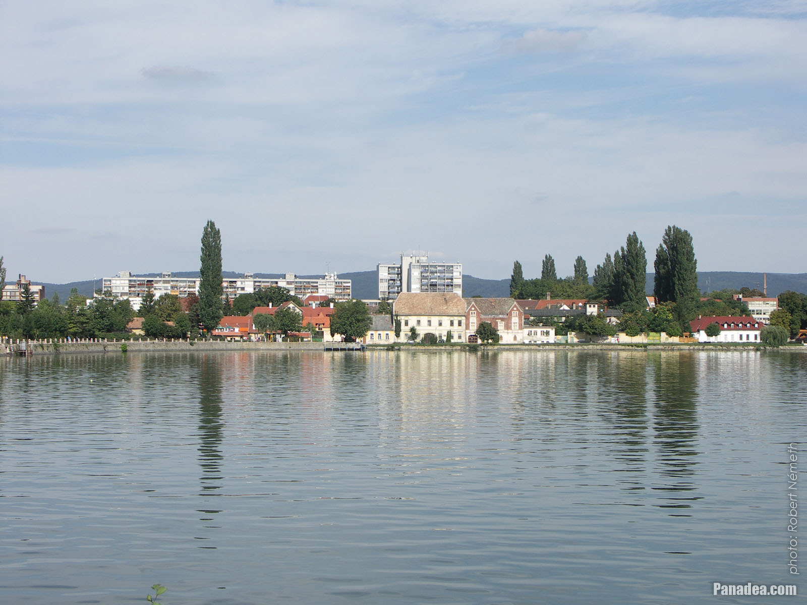
Residental buildings on the northern shore of Lake Tata
날짜를 촬영: 2006년 09월 02일2006
에 의해 만들어: Robert Németh
카메라 모델: Konica Minolta Dimage A200
Tata, 헝가리
Residental buildings on the northern shore of Lake Tata - Tata, 헝가리 -
The famous old plane tree on the lakeside
날짜를 촬영: 2006년 09월 02일2006
에 의해 만들어: Robert Németh
카메라 모델: Konica Minolta Dimage A200
Tata, 헝가리
The famous old plane tree on the lakeside - Tata, 헝가리 -
Statue of St. John the Baptist on a rock in the lake
날짜를 촬영: 2006년 09월 02일2006
에 의해 만들어: Robert Németh
카메라 모델: Konica Minolta Dimage A200
Tata, 헝가리
Statue of St. John the Baptist on a rock in the lake - Tata, 헝가리 -
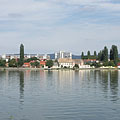
Tatai Lake (also known as Öreg Lake, literally "Old Lake")
날짜를 촬영: 2006년 09월 02일2006
에 의해 만들어: Robert Németh
카메라 모델: Konica Minolta Dimage A200
Tata, 헝가리
Tatai Lake (also known as Öreg Lake, literally "Old Lake") - Tata, 헝가리 -
Park on the lakeside
날짜를 촬영: 2006년 09월 02일2006
에 의해 만들어: Robert Németh
카메라 모델: Konica Minolta Dimage A200
Tata, 헝가리
Park on the lakeside - Tata, 헝가리 -
Lakeside grassy park
날짜를 촬영: 2006년 09월 02일2006
에 의해 만들어: Robert Németh
카메라 모델: Konica Minolta Dimage A200
Tata, 헝가리
Lakeside grassy park - Tata, 헝가리 -
The Lake Öreg and the buildings of the the Tóváros quarter, viewed from the castle walls
날짜를 촬영: 2006년 09월 02일2006
에 의해 만들어: Robert Németh
카메라 모델: Konica Minolta Dimage A200
Tata, 헝가리
The Lake Öreg and the buildings of the the Tóváros quarter, viewed from the castle walls - Tata, 헝가리 -
Moody promenade by the lake
날짜를 촬영: 2006년 09월 02일2006
에 의해 만들어: Robert Németh
카메라 모델: Konica Minolta Dimage A200
Tata, 헝가리
Moody promenade by the lake - Tata, 헝가리 -
The Eötvös József High School (former Piarist Secondary School) on the other side of the lake on a hill
날짜를 촬영: 2006년 09월 02일2006
에 의해 만들어: Robert Németh
카메라 모델: Konica Minolta Dimage A200
Tata, 헝가리
The Eötvös József High School (former Piarist Secondary School) on the other side of the lake on a hill - Tata, 헝가리 -
Stone walled dwelling house at the edge of the park
날짜를 촬영: 2006년 09월 02일2006
에 의해 만들어: Robert Németh
카메라 모델: Konica Minolta Dimage A200
Tata, 헝가리
Stone walled dwelling house at the edge of the park - Tata, 헝가리 -
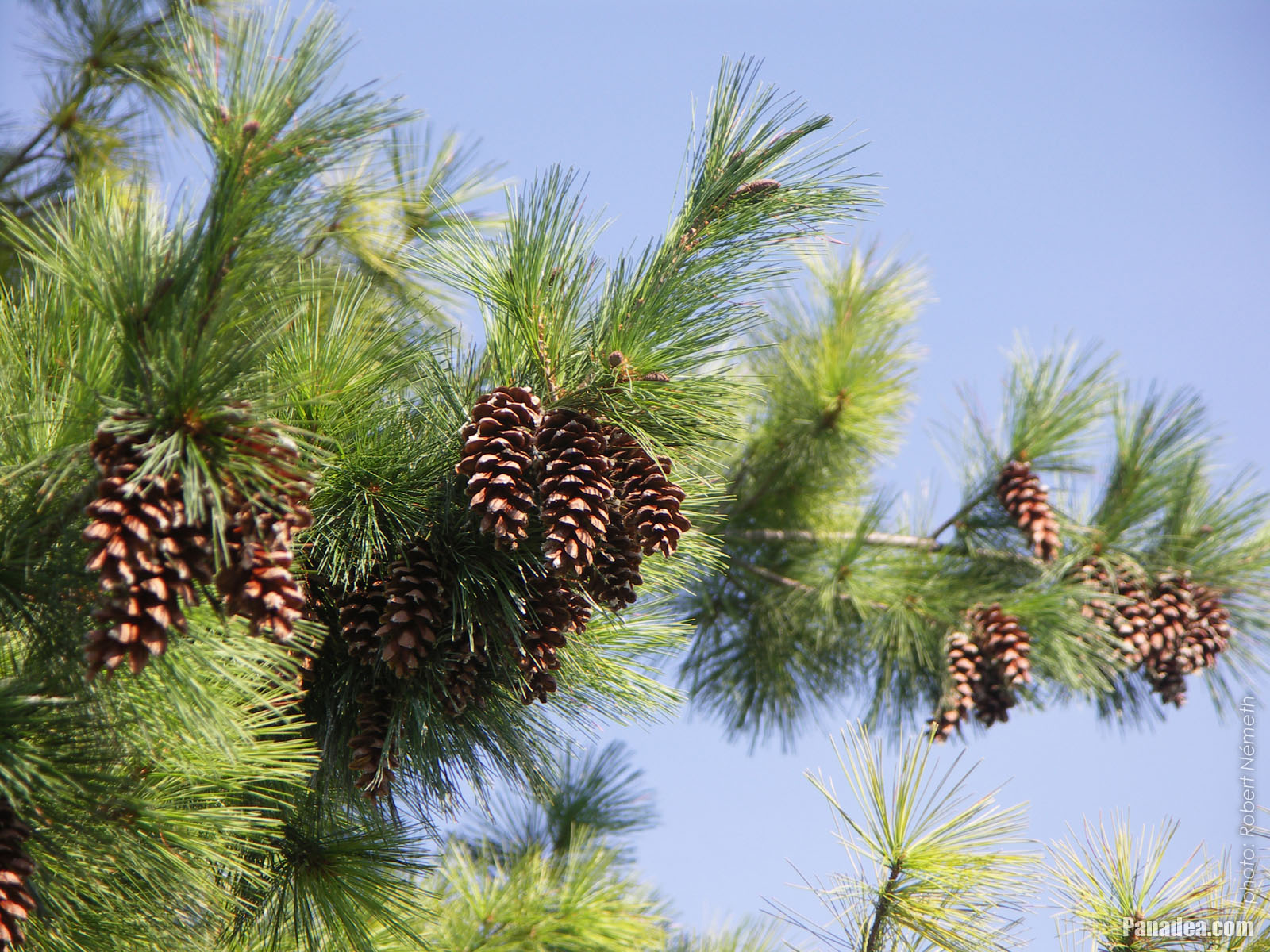
Cones on a lakeside pine tree
날짜를 촬영: 2006년 09월 02일2006
에 의해 만들어: Robert Németh
카메라 모델: Konica Minolta Dimage A200
Tata, 헝가리
Cones on a lakeside pine tree - Tata, 헝가리 -
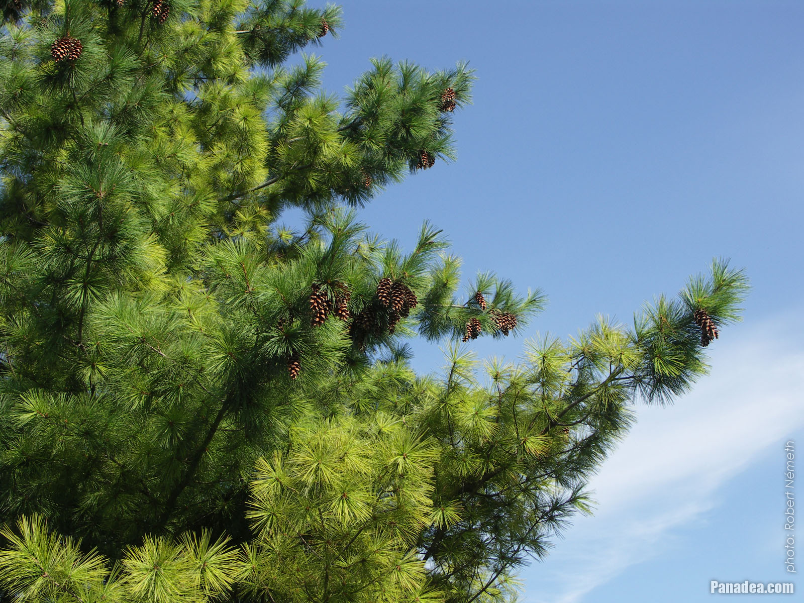
Verdant pine branches in the park
날짜를 촬영: 2006년 09월 02일2006
에 의해 만들어: Robert Németh
카메라 모델: Konica Minolta Dimage A200
Tata, 헝가리
Verdant pine branches in the park - Tata, 헝가리 -
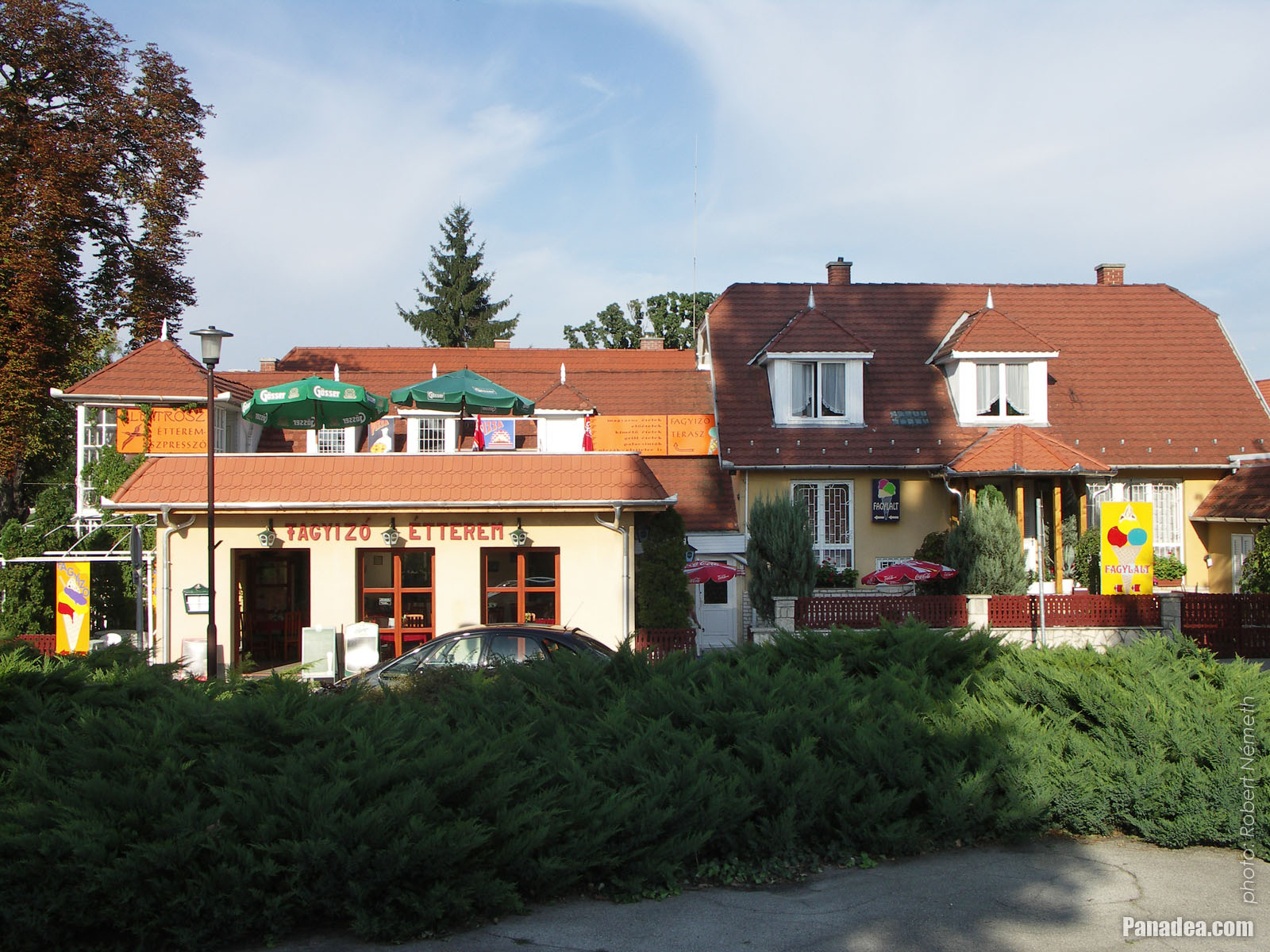
Albatrosz Restaurant and ice cream parlor near the lakeside promenade
날짜를 촬영: 2006년 09월 02일2006
에 의해 만들어: Robert Németh
카메라 모델: Konica Minolta Dimage A200
Tata, 헝가리
Albatrosz Restaurant and ice cream parlor near the lakeside promenade - Tata, 헝가리 -
Small sailboats in the harbour on the north shore of Lake Öreg
날짜를 촬영: 2006년 09월 02일2006
에 의해 만들어: Robert Németh
카메라 모델: Konica Minolta Dimage A200
Tata, 헝가리
Small sailboats in the harbour on the north shore of Lake Öreg - Tata, 헝가리 -
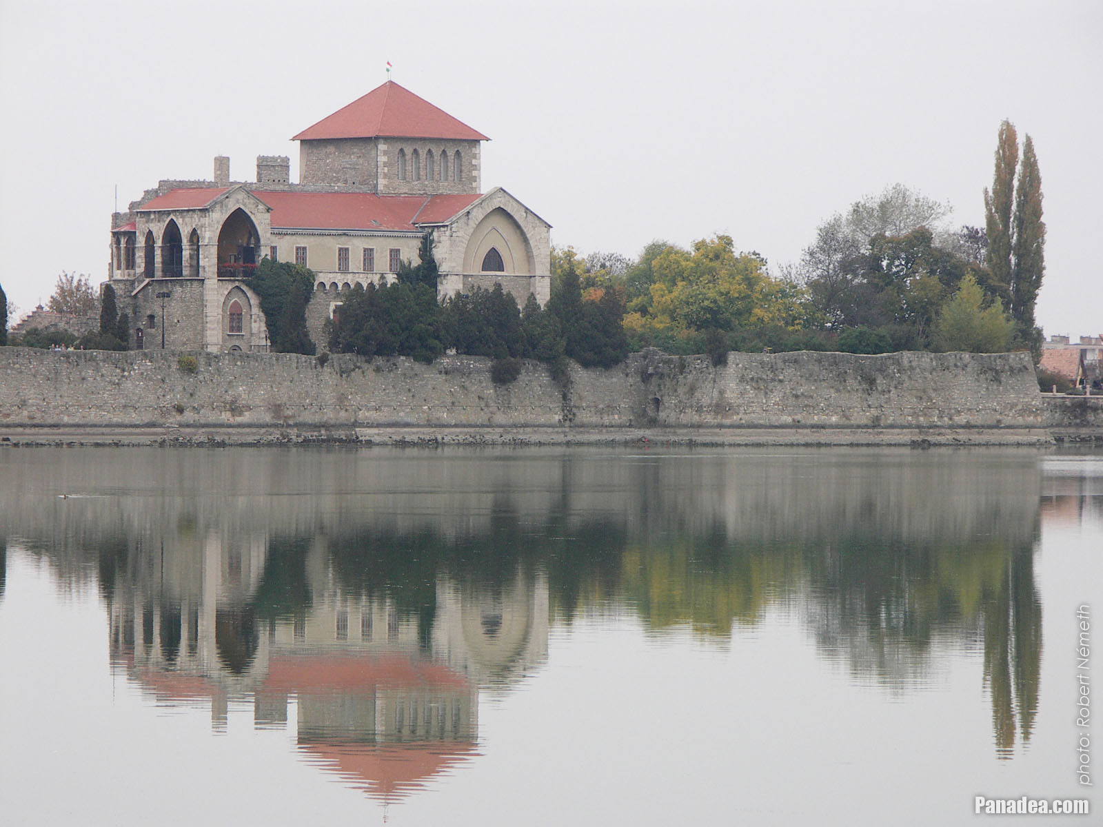
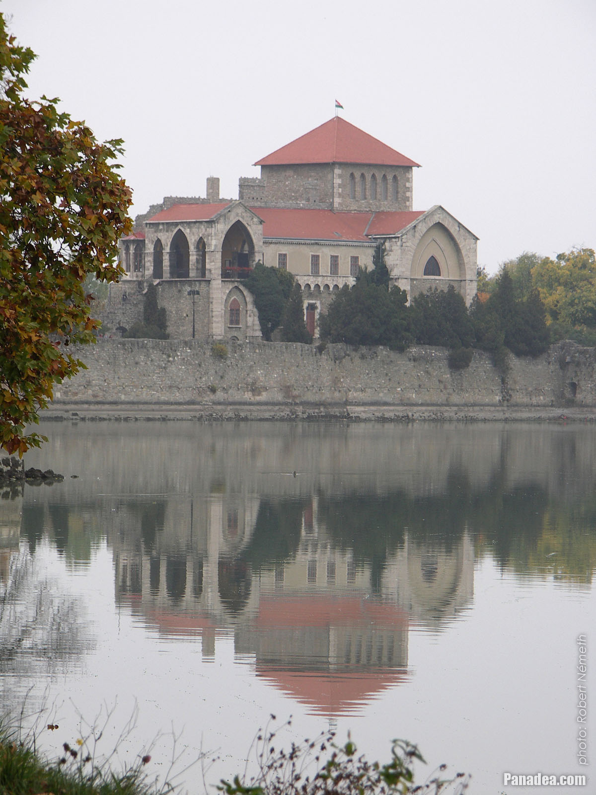
The Castle of Tata by the Öreg Lake (Old Lake) in autumn
날짜를 촬영: 2008년 10월 26일2008
에 의해 만들어: Robert Németh
카메라 모델: Konica Minolta Dimage A200
Tata, 헝가리
The Castle of Tata by the Öreg Lake (Old Lake) in autumn - Tata, 헝가리 -
Statue of St. John the Baptist
The statue is usually stands in the water, but sometimes in autumn and winter when the water level is lowered it can be accessed even on foot.
날짜를 촬영: 2008년 10월 26일2008
에 의해 만들어: Robert Németh
카메라 모델: Konica Minolta Dimage A200
Tata, 헝가리
Statue of St. John the Baptist - Tata, 헝가리 -
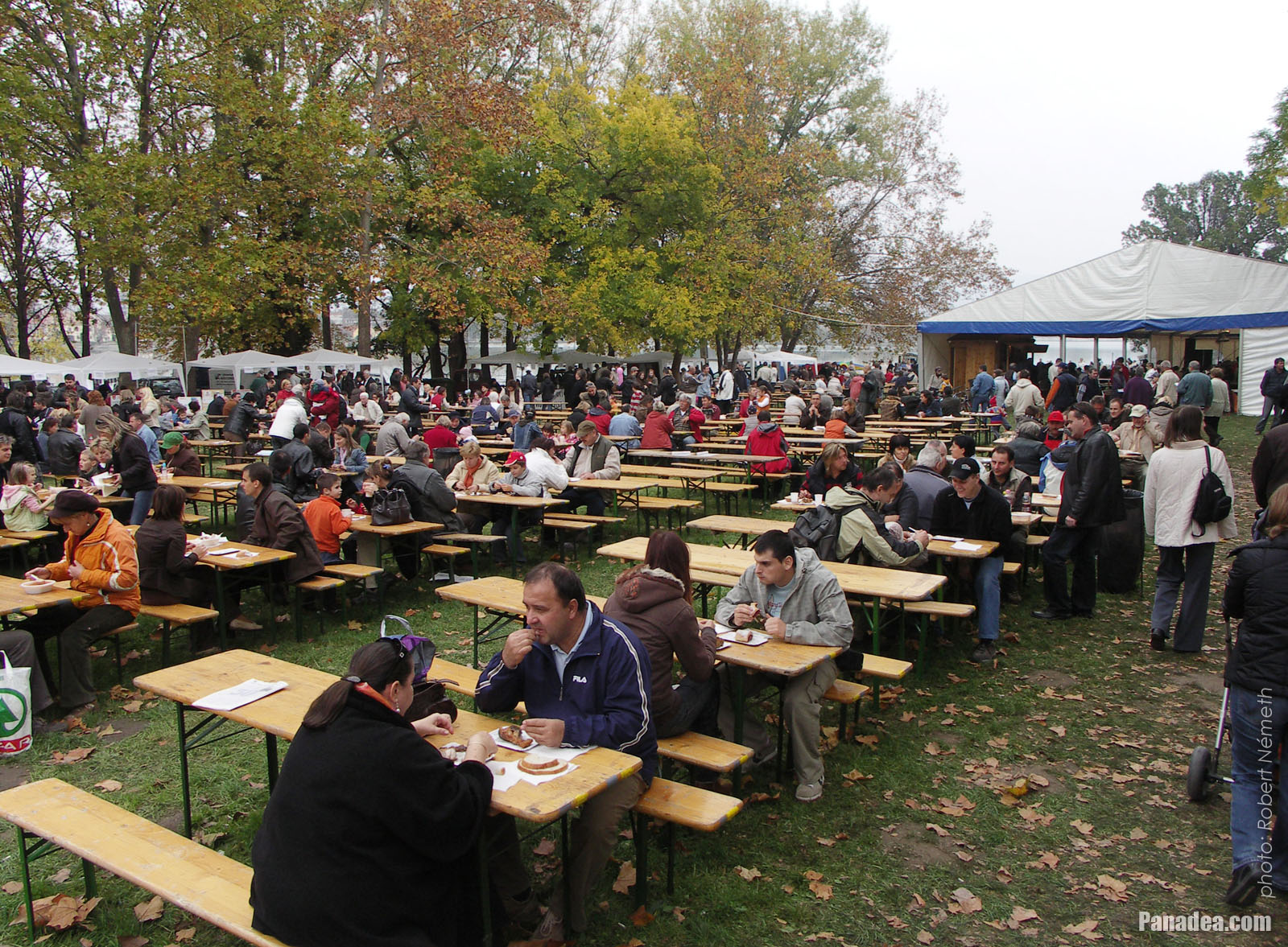
Canteen tables on the "Great Fishing on Lake Öreg" event, with among others fish food tasting
날짜를 촬영: 2008년 10월 26일2008
에 의해 만들어: Robert Németh
카메라 모델: Konica Minolta Dimage A200
Tata, 헝가리
Canteen tables on the "Great Fishing on Lake Öreg" event, with among others fish food tasting - Tata, 헝가리 -
The Castle of Tata at Lake Öreg
In autumn the lake is an important location of mass bird migrations.
날짜를 촬영: 2008년 10월 26일2008
에 의해 만들어: Robert Németh
카메라 모델: Konica Minolta Dimage A200
Tata, 헝가리
The Castle of Tata at Lake Öreg - Tata, 헝가리


그림을 클릭
특성, 특징
위치:
GPS 좌표: 위도 47°38'54", 경도 18°19'10" (N47 38.9 - E18 19.17)
정보, 짧은 이야기, 흥미로운 사실들
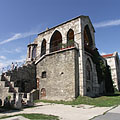
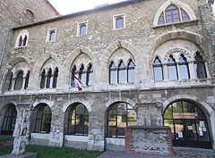
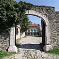
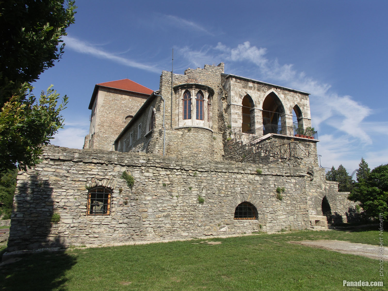 The sunny southern side of the Tata Castle
The structure in the central part of the Tata Castle is not a true keep or residental tower, but the modified southern wing of the original rectangular inner castle that had four corner towers. The castle was blown up by the Ottoman troops in 1683. Leopold I, Holy Roman Emperor and King of Hungary ordered to completely destroy this castle together with many other Hungarian fortresses, but this further destruction was avoided thanks to the outbreaking Rákóczi's War of Independence in 1702-1703.
Then the castle was acquired by the Esterházy family who ordered to do major changes to the building in 1755, but mostly the surroundings of the northwestern wall was affected by these modifications (the new gate with a stone bridge over the ditch, the "prison chapel", etc.). There was a fire in the castle in the early-19th century, then in 1815 the remaining parts of buildings were altered and extended in neo-gothic style (gothic revival or romantic style). The most of the upper level of the current "tower" (the "Old tower") was built at that time, including for example the covered terrace, the small rounded closed balcony and the neo-gothic style windows as well.
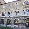
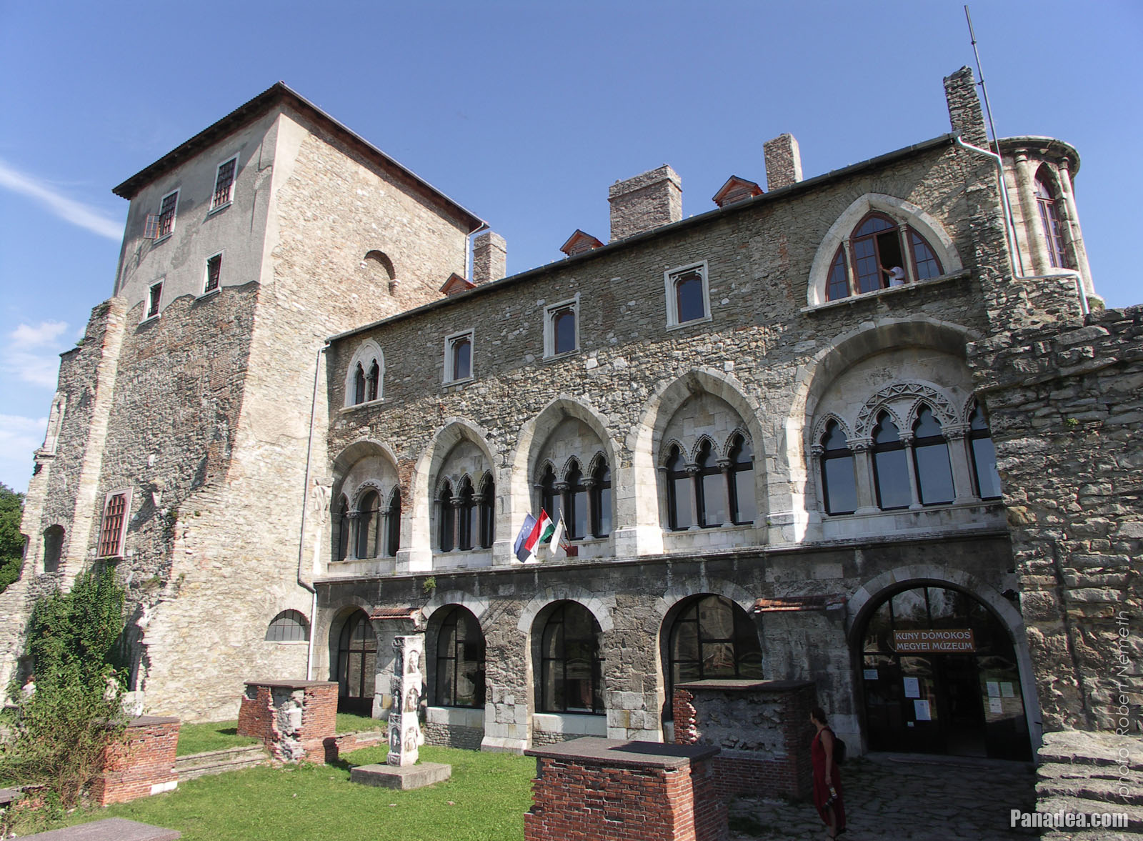 Tower of the Tata Castle (in reality it is the inner castle itself), including the Kuny Domokos County Museum
The remaining and rebuilt inner part of the Tata Castle received its current form at around the turn of the 1800s-1900s. At this time the windows were modified to the current style that reminds to the Italian gothic, as well as there were also some other minor modifications inside the building (e.g. stairs, vaulted ceiling, etc.). The castle remained in the possession of the Esterházy family until 1945, the end of the World War II. The Kuny Domokos Museum is operated in the castle since 1954, among others there is a historical and local history exhibition here, as well as a lapidary (stone collection) of the Roman Age and the Middle Ages. The major archaeological excavations of the castle were begun in 1964, and the monumental restoration works were finished in 1973 (however not fully completed, the exploration of some parts of the building, like for example the ditch, the casemates or the castle wells is yet to come).
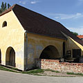
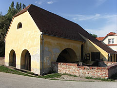
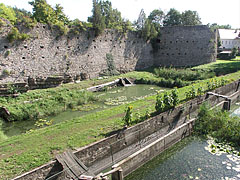
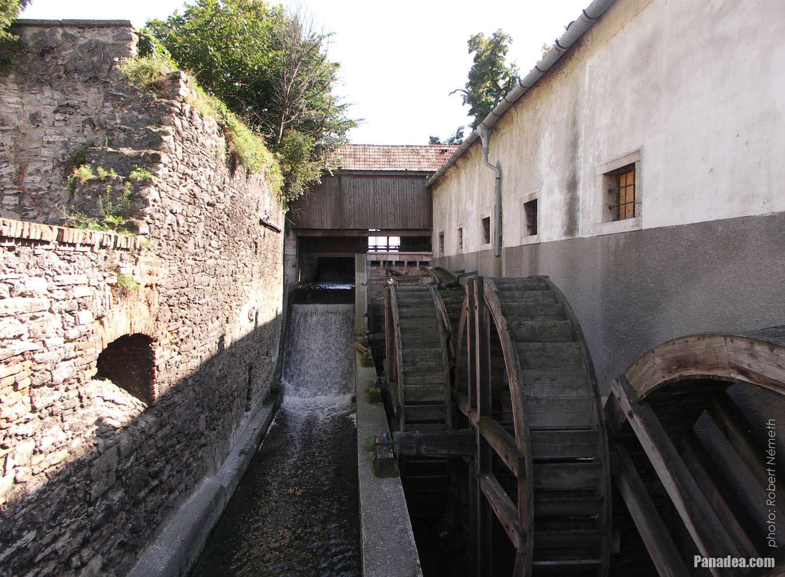 The water wheel system of the old Cifra water mill
The oldest water mill of Tata town is situated at one of the northern sluices of the Old Lake ("Öreg-tó"), over the stream called "Által-ér". The first written record of the Cifra Mill is from 1587, then it survived the times of the Turkish occupation of Hungary (1541-1699) and in 1753 it was rebuilt in baroque style. It was used normally for grinding until the end of the 1960s. Today (in 2014) the building stands empty and without function.
Until 1938 the border of the two separate villages, Tata and Tóváros (literally "Lake Town") was situated here at the Által-ér ("Által Stream"). At that time these villages were united and the modern Tata settlement was formed, which then received the rank of town in 1954. In 1985 Agostyán village was also annexed to Tata, and today the former villages live in the names of the quarters of the town.
Tata - 더 많은 사진 갤러리:
당신은 또한에 관심이있을 수 있습니다 (관련 페이지):
여행 가이드의 목적지:
Tata (120 사진 + 8 파노라마 이미지)
Komárom-Esztergom megye (county) (703 사진 + 10 파노라마 이미지)
Central Transdanubia (Közép-Dunántúl) (1,409 사진 + 20 파노라마 이미지)
헝가리 (27,287 사진 + 163 파노라마 이미지)
추가적으로:
(여기에 내부: Komárom-Esztergom megye)
Komárom (82 사진)
Esztergom (110 사진 + 1 파노라마 이미지)
Tatabánya (275 사진)
Dobogókő (116 사진 + 1 파노라마 이미지)
여기에 모든 파노라마 사진:
Tata (8 사진)
Komárom-Esztergom megye (county) (10 사진)
Central Transdanubia (Közép-Dunántúl) (20 사진)
헝가리 (163 사진)
유럽 (165 사진)
여기에 모든 일반 사진:
Tata (120 사진 / 2 갤러리)
Komárom-Esztergom megye (county) (703 사진 / 13 갤러리)
Central Transdanubia (Közép-Dunántúl) (1,409 사진 / 31 갤러리)
헝가리 (27,287 사진 / 462 갤러리)
유럽 (30,494 사진 / 523 갤러리)
https://www.panadea.com/ko/guidebook/tata/photos/gal-001

즐겨 찾기에 추가 북마크에 추가
친구들과 공유하세요!
기타


우리의 여행 가이드가 포함되어 있습니다:
많은 사진과 파노라마 이미지, 정보와 흥미로운 사실을 많이가 부속됩니다.
- 214 여행 목적지
- 165 파노라마 이미지
- 30,494 다른 사진
선택한 사진의 큰 컬렉션: 우수한 품질, 높은 해상도와 자연 색상
회사 소개 - 법적 고지 & 면책 조항 -
모든 권리 보유
- ©2010-2022
Neuronit Creative Studio - Mogyoród / 부다페스트 / 헝가리