
(Küçük ekranlı cihazlar için optimize)
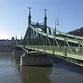
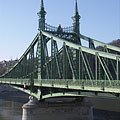
Liberty Bridge (aka Freedom Bridge, "Szabadság híd") - Budapeşte, Macaristan
Tıkladığınızda:
Resimlerin üzerine tıklayın!
-

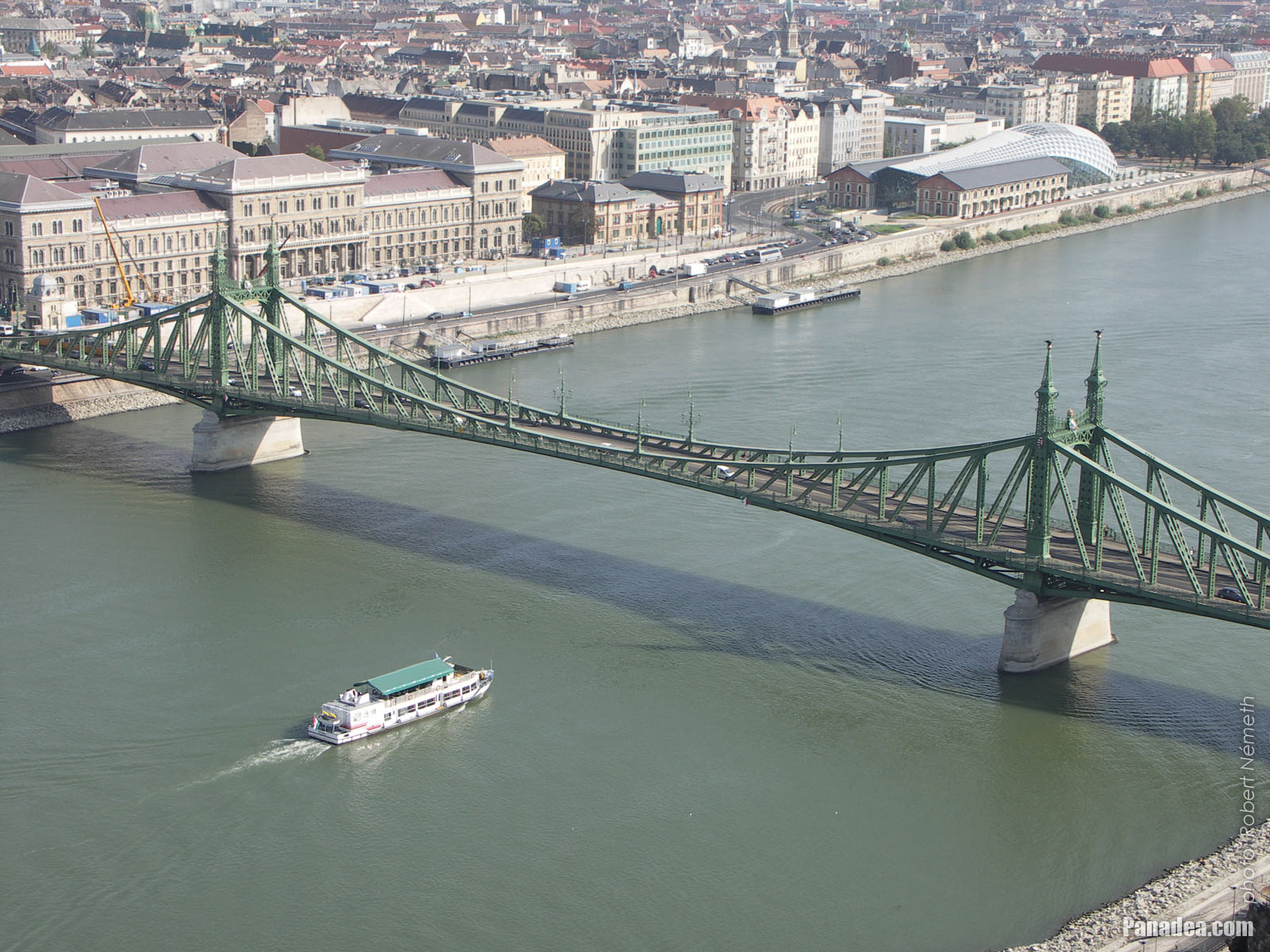
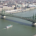
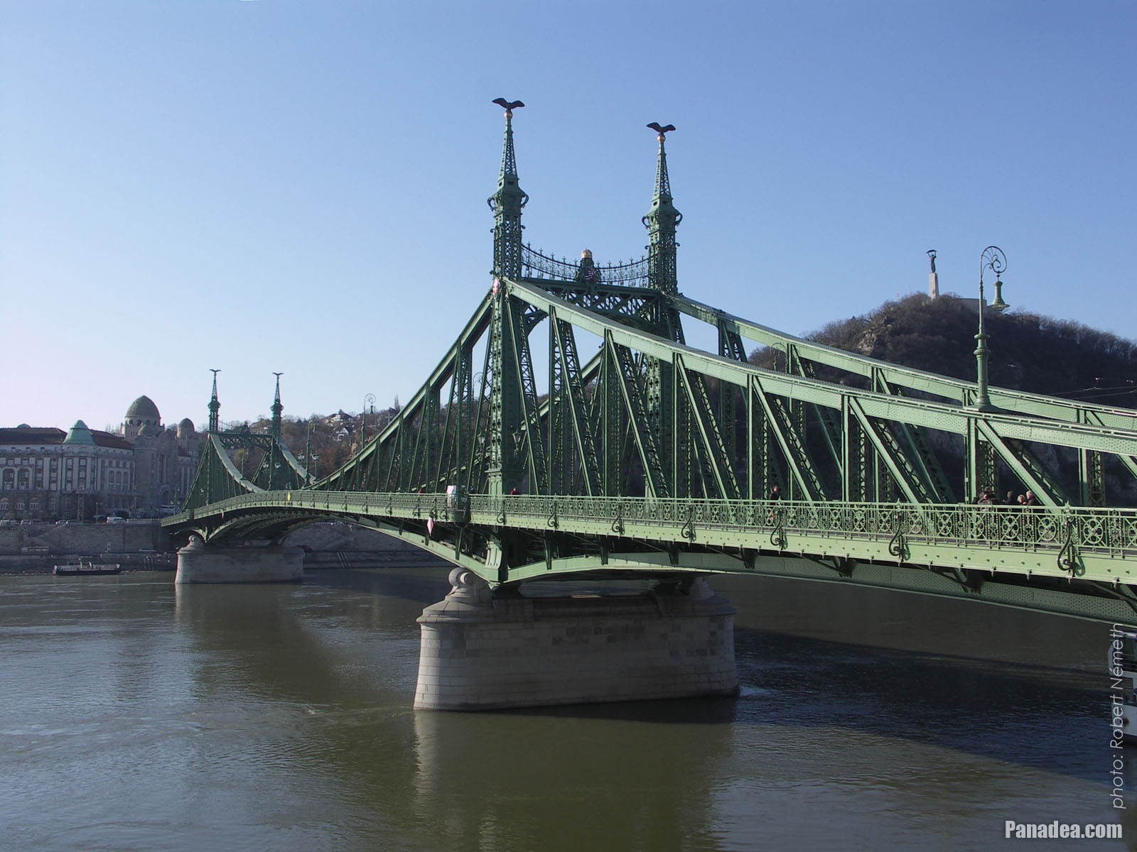
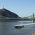
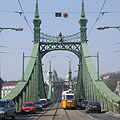
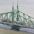
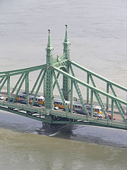
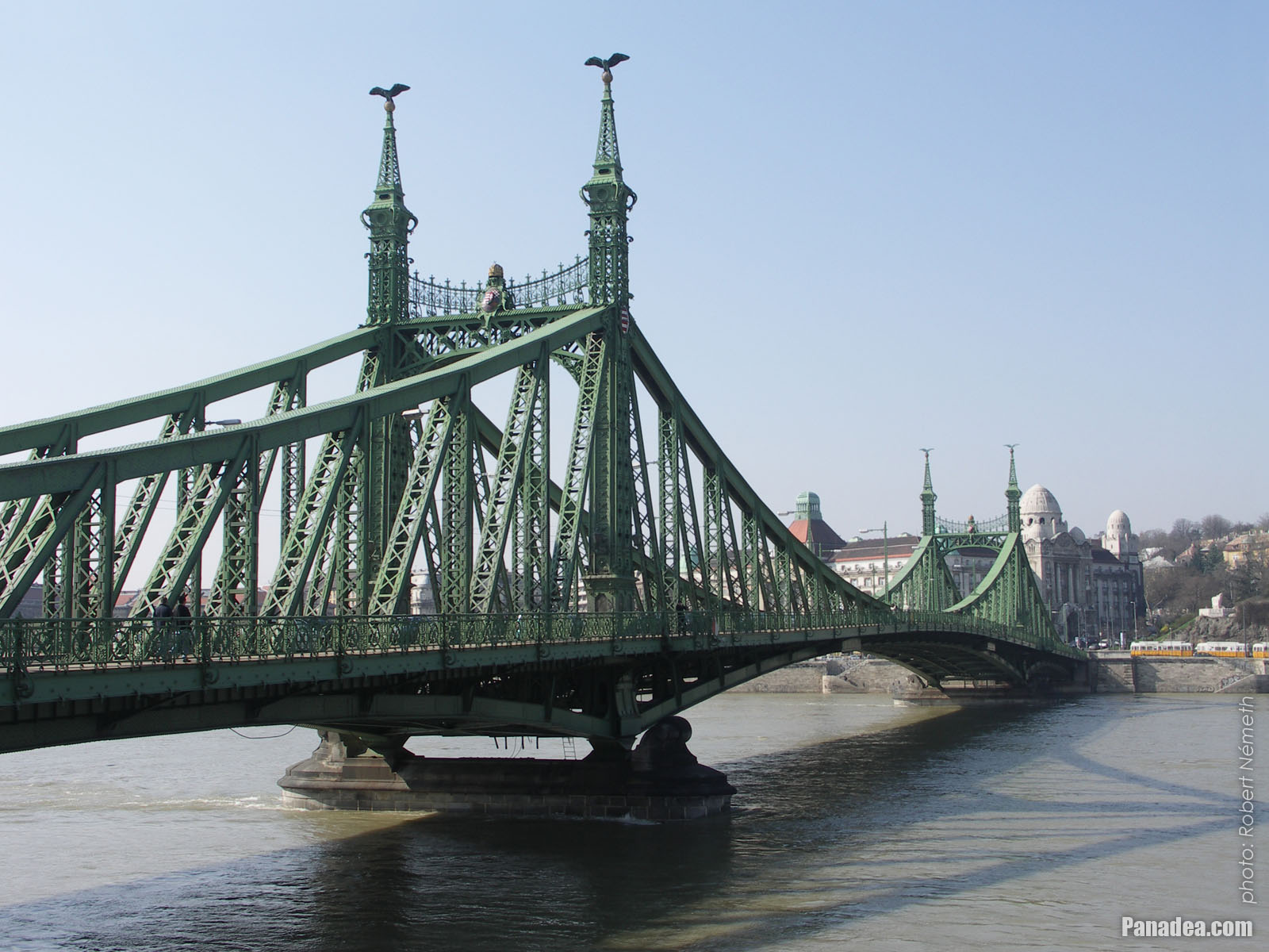
The Liberty Bridge of Budapest ("Szabadság híd") over the Danube River and in front of the Gellért Hill ("Gellért-hegy")
Fotoğrafçılığın tarihi: 20132013
Tarafından yaratılan: Robert Németh
Fotoğraf makinesi model: Konica Minolta Dimage A200
Budapeşte, Macaristan
-
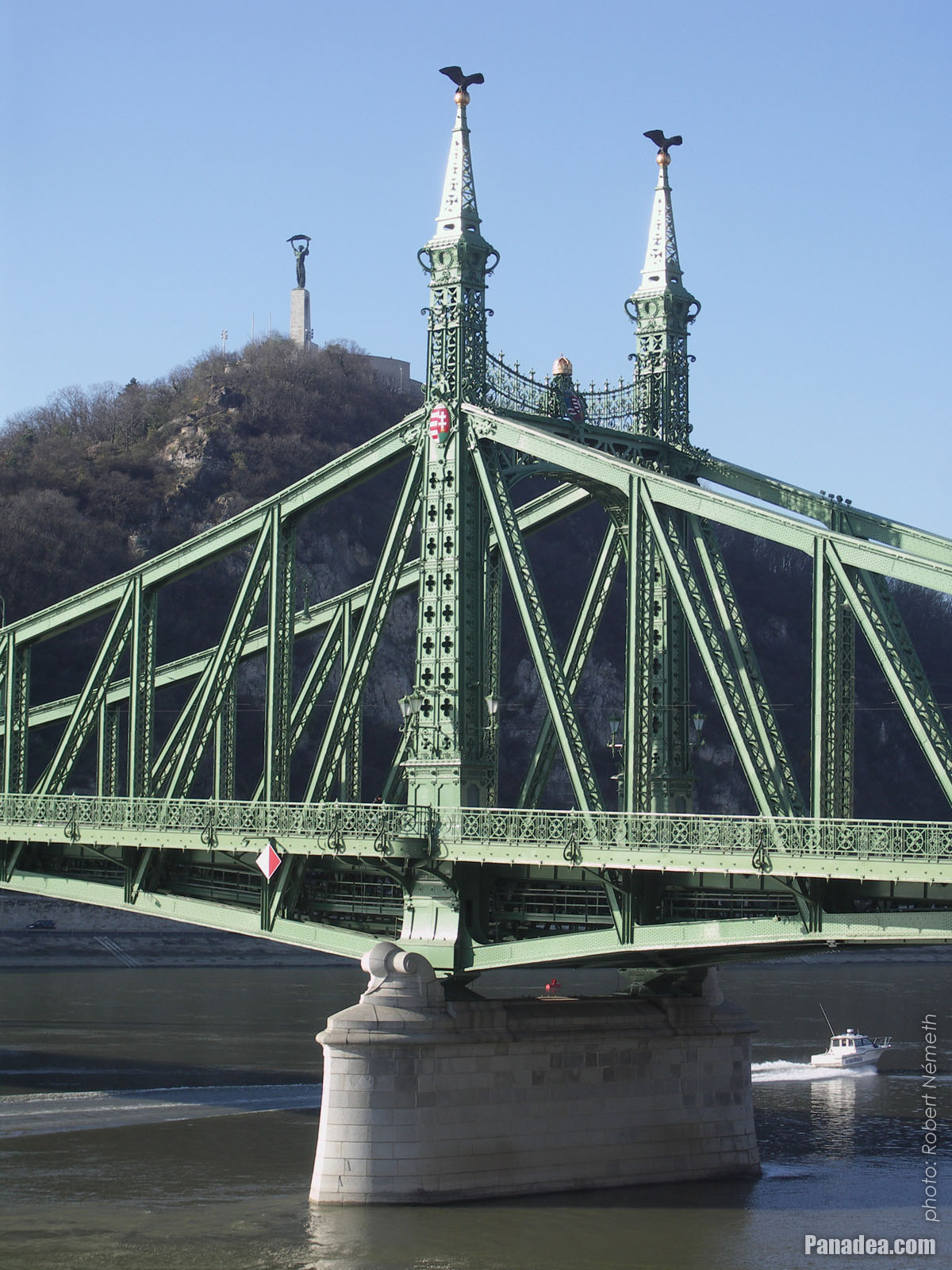
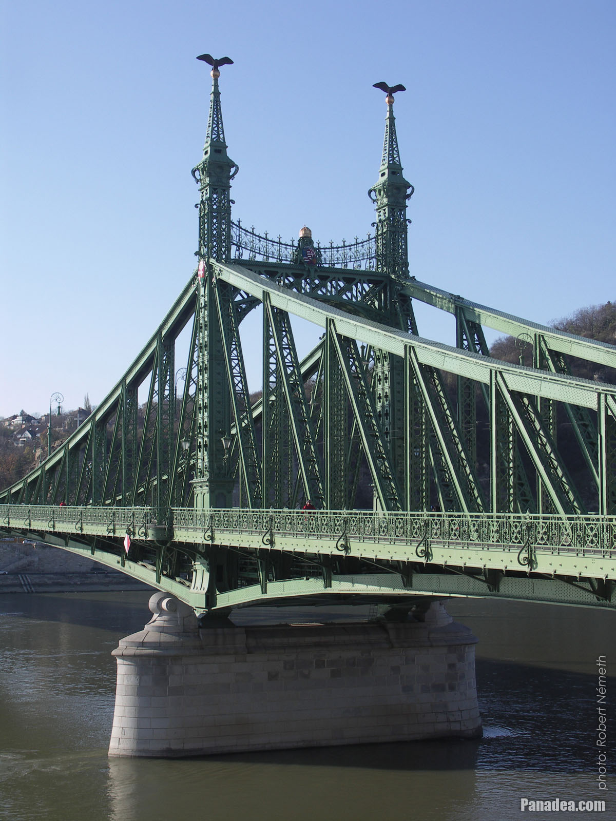
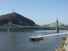
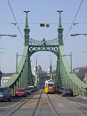
The Pest-side tower (pylon) of the Liberty Bridge ("Szabadság híd") in front of the Gellért Hill
Fotoğrafçılığın tarihi: 20132013
Tarafından yaratılan: Robert Németh
Fotoğraf makinesi model: Konica Minolta Dimage A200
Budapeşte, Macaristan
-
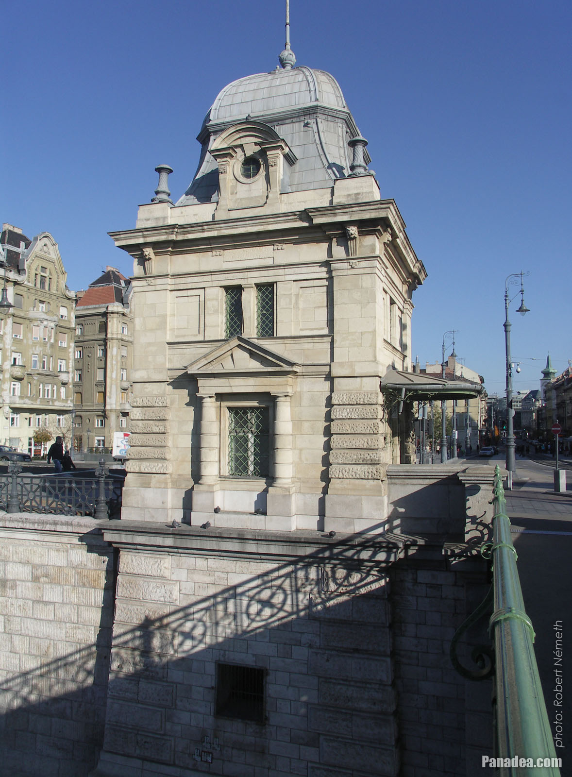
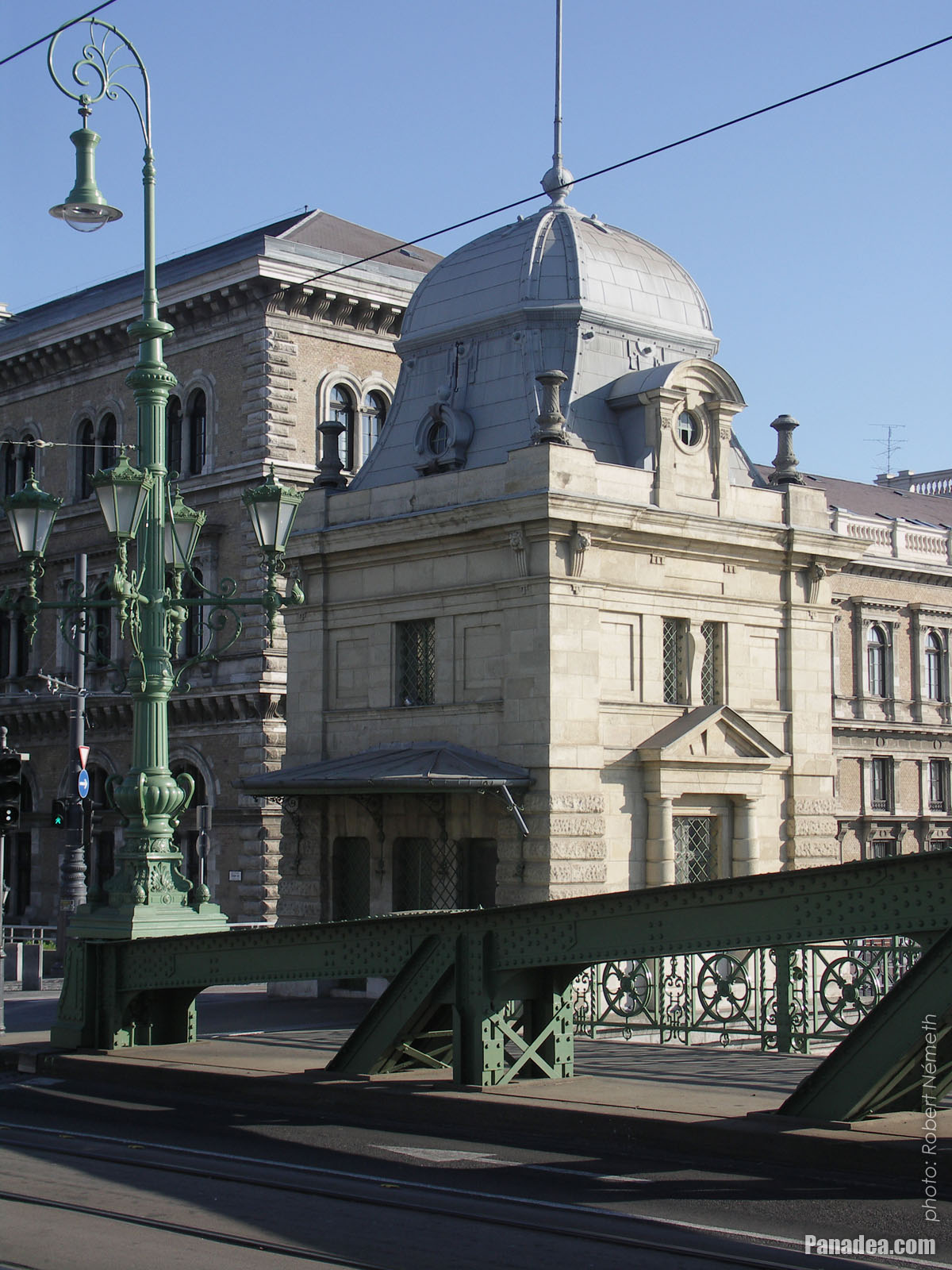
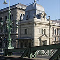
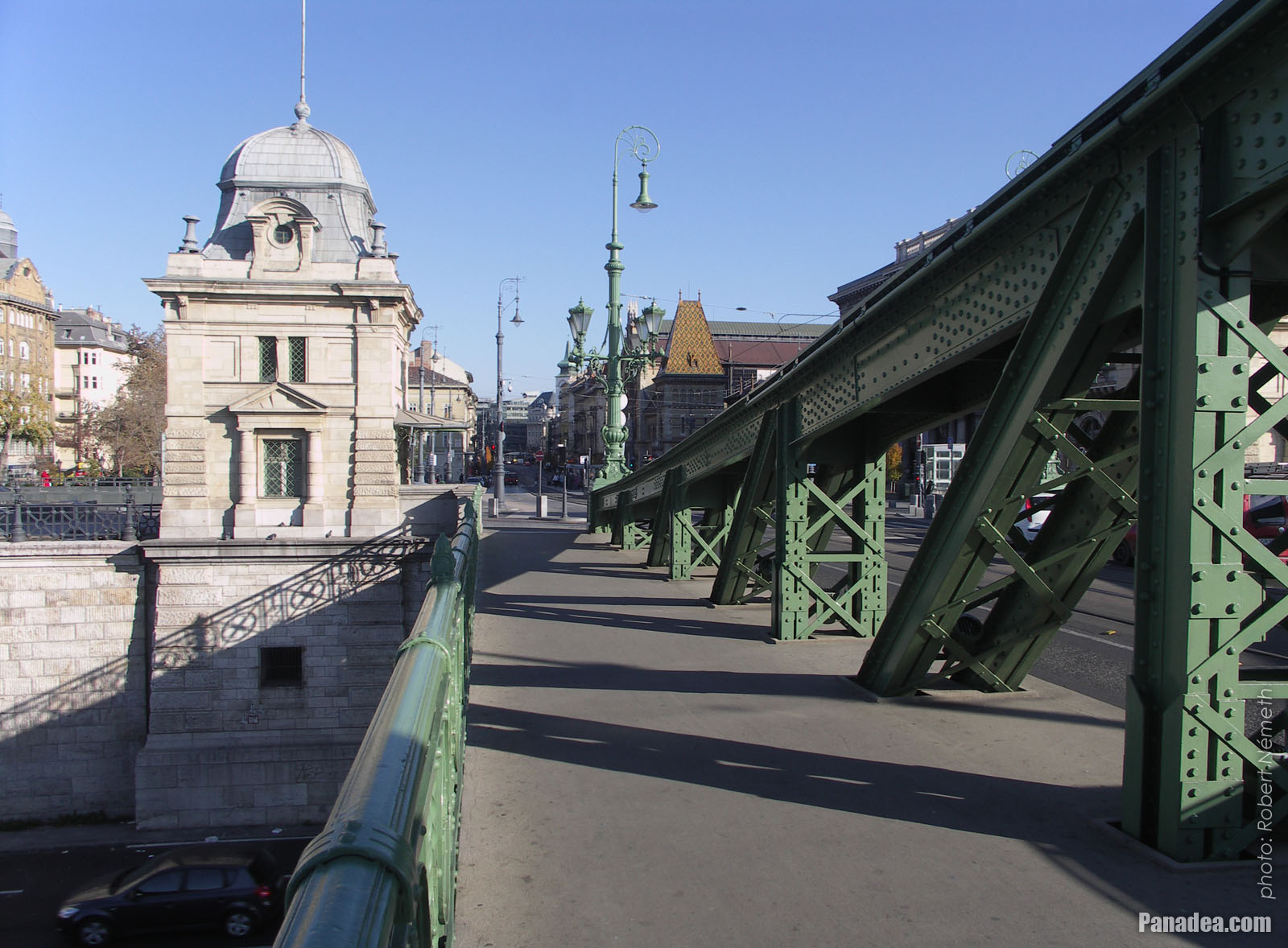
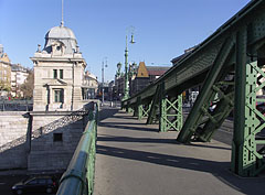
Former customs house at the Pest side of the Liberty Bridge ("Szabadság híd")
Fotoğrafçılığın tarihi: 20132013
Tarafından yaratılan: Robert Németh
Fotoğraf makinesi model: Konica Minolta Dimage A200
Budapeşte, Macaristan
-

The sight of the Liberty Bridge ("Szabadság híd") and the Buda Castle Quarter from the promenade on the Danube bank in Pest
Fotoğrafçılığın tarihi: 20132013
Tarafından yaratılan: Robert Németh
Fotoğraf makinesi model: Konica Minolta Dimage A200
Budapeşte, Macaristan
-
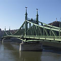
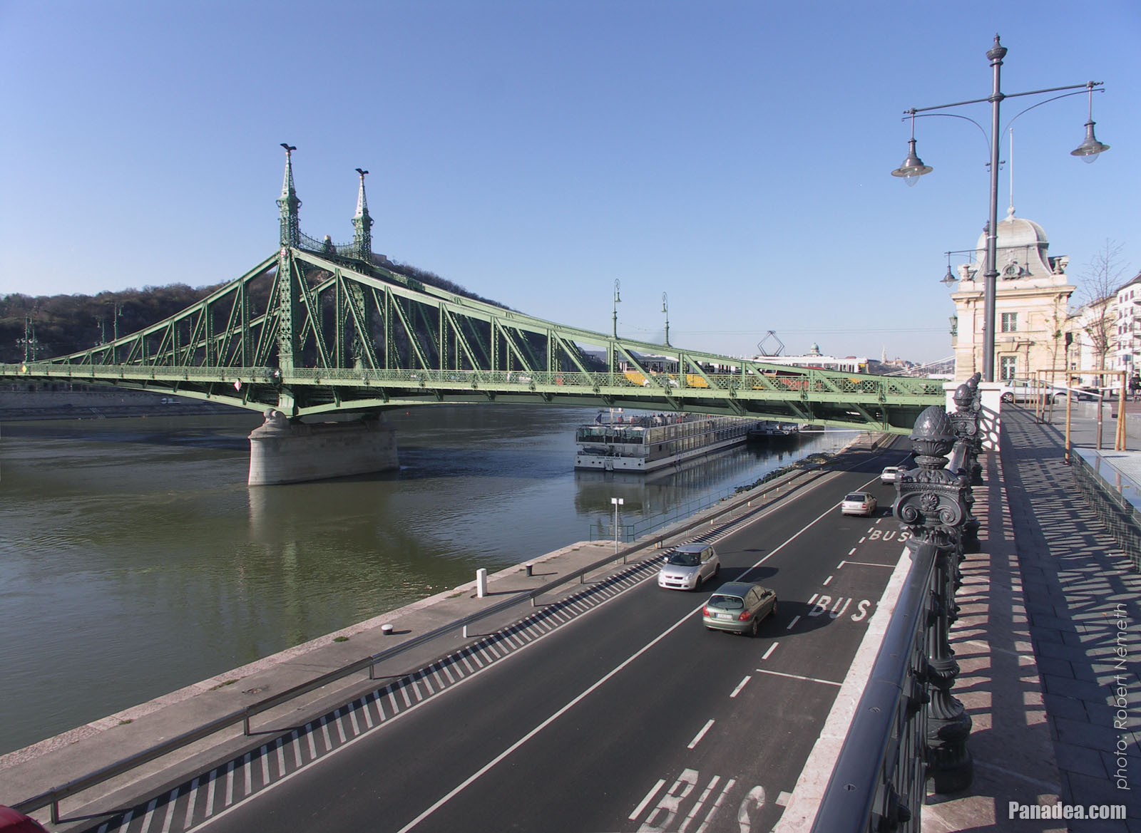
The view of the Liberty Bridge from the Pest bank of the Danube
Fotoğrafçılığın tarihi: 20062006
Tarafından yaratılan: Robert Németh
Fotoğraf makinesi model: Konica Minolta Dimage A200
Budapeşte, Macaristan
-

The Liberty Bridge ("Szabadság híd") over the Danube River, as seen from the Gellért Hill
Fotoğrafçılığın tarihi: 20112011
Tarafından yaratılan: Robert Németh
Fotoğraf makinesi model: Konica Minolta Dimage A200
Budapeşte, Macaristan
-
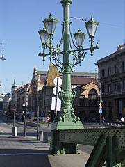
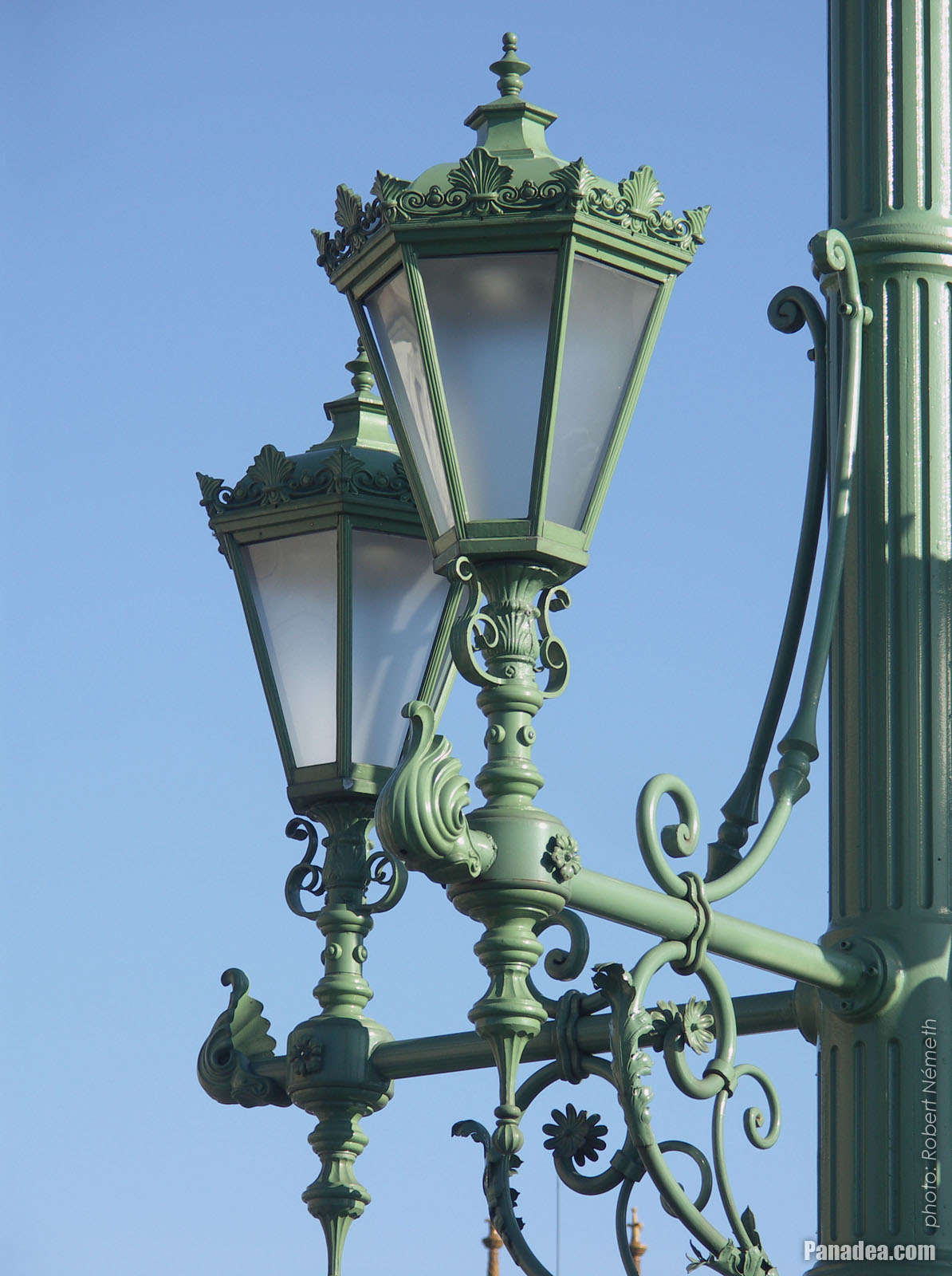
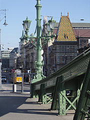
One of the ornate four-way lamp posts of the Liberty Bridge
In the background it is the Central Market Hall.
Fotoğrafçılığın tarihi: 20132013
Tarafından yaratılan: Robert Németh
Fotoğraf makinesi model: Konica Minolta Dimage A200
Budapeşte, Macaristan
-
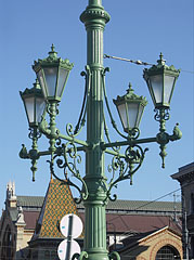
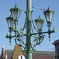
Ornate four-way lamp post on the Liberty Bridge ("Szabadság híd")
Fotoğrafçılığın tarihi: 20132013
Tarafından yaratılan: Robert Németh
Fotoğraf makinesi model: Konica Minolta Dimage A200
Budapeşte, Macaristan
-
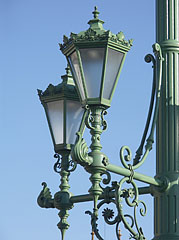
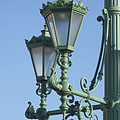
Some lamps of the Liberty Bridge
Fotoğrafçılığın tarihi: 20132013
Tarafından yaratılan: Robert Németh
Fotoğraf makinesi model: Konica Minolta Dimage A200
Budapeşte, Macaristan
-

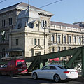
The other former customs house of the Liberty Bridge ("Szabadság híd"), in front of the main building of the Corvinus University
Fotoğrafçılığın tarihi: 20132013
Tarafından yaratılan: Robert Németh
Fotoğraf makinesi model: Konica Minolta Dimage A200
Budapeşte, Macaristan
-
The foot of the Gellért Hill viewed from the Liberty Bridge ("Szabadság híd")
Fotoğrafçılığın tarihi: 20132013
Tarafından yaratılan: Robert Németh
Fotoğraf makinesi model: Konica Minolta Dimage A200
Budapeşte, Macaristan
The foot of the Gellért Hill viewed from the Liberty Bridge ("Szabadság híd") - Budapeşte, Macaristan -
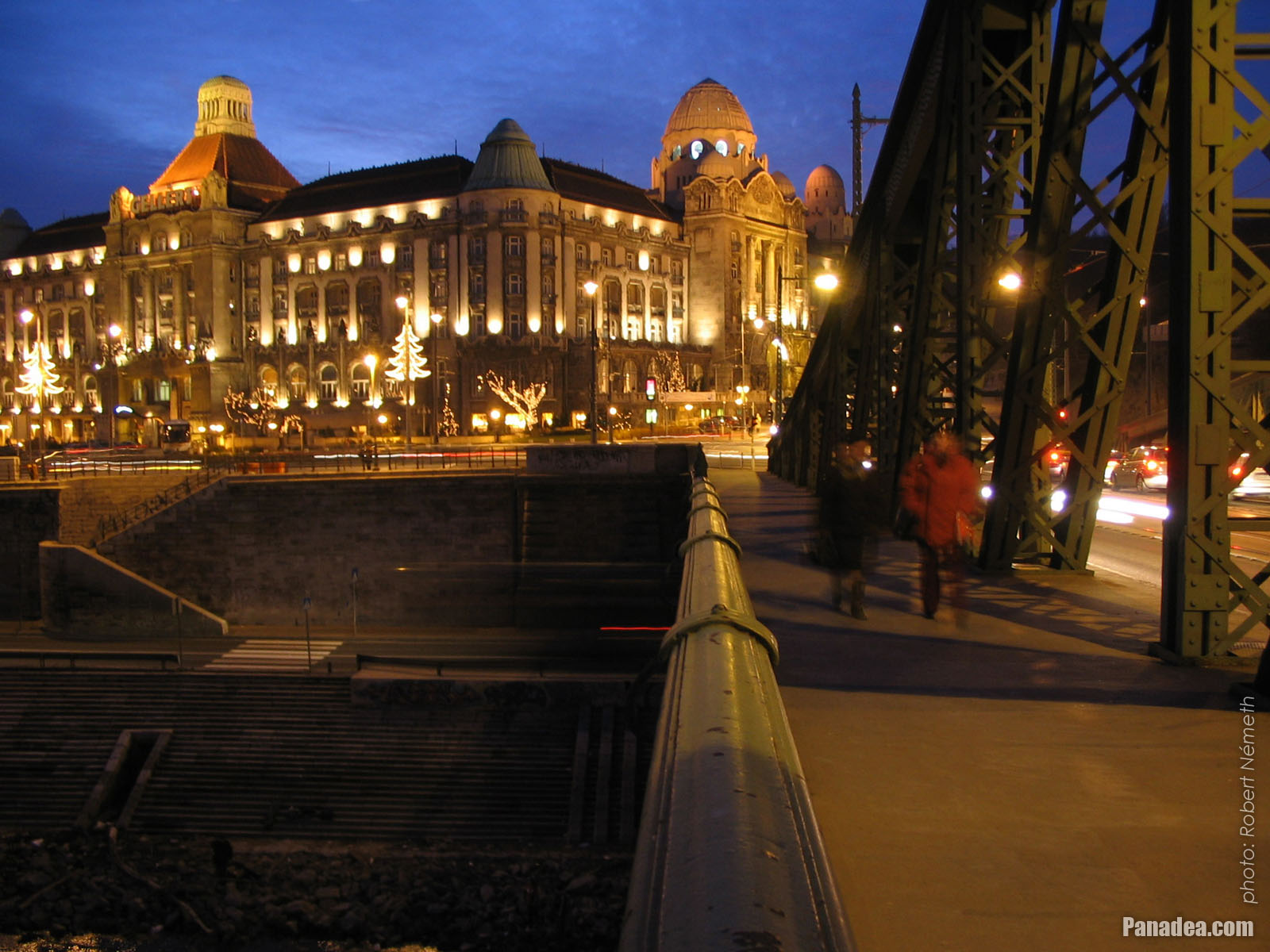
The end of the Liberty Bridge ("Szabadság híd") and the lower embankment on the Pest side of the river
Fotoğrafçılığın tarihi: 20132013
Tarafından yaratılan: Robert Németh
Fotoğraf makinesi model: Konica Minolta Dimage A200
Budapeşte, Macaristan
The end of the Liberty Bridge ("Szabadság híd") and the lower embankment on the Pest side of the river - Budapeşte, Macaristan -
The Pest-side end of the Liberty Bridge ("Szabadság híd")
Fotoğrafçılığın tarihi: 20132013
Tarafından yaratılan: Robert Németh
Fotoğraf makinesi model: Konica Minolta Dimage A200
Budapeşte, Macaristan
The Pest-side end of the Liberty Bridge ("Szabadság híd") - Budapeşte, Macaristan -
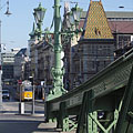
The view of the Liberty Bridge ("Szabadság híd") towards Buda
Fotoğrafçılığın tarihi: 20132013
Tarafından yaratılan: Robert Németh
Fotoğraf makinesi model: Konica Minolta Dimage A200
Budapeşte, Macaristan
The view of the Liberty Bridge ("Szabadság híd") towards Buda - Budapeşte, Macaristan -
The connection of the Liberty Bridge ("Szabadság híd") on the Pest riverside
Fotoğrafçılığın tarihi: 20132013
Tarafından yaratılan: Robert Németh
Fotoğraf makinesi model: Konica Minolta Dimage A200
Budapeşte, Macaristan
The connection of the Liberty Bridge ("Szabadság híd") on the Pest riverside - Budapeşte, Macaristan -
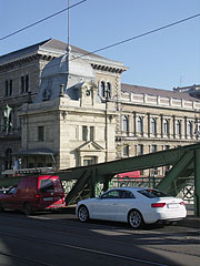
The Pest-side end of the Liberty Bridge ("Szabadság híd"), and the main building of the Corvinus University in the background
Fotoğrafçılığın tarihi: 20132013
Tarafından yaratılan: Robert Németh
Fotoğraf makinesi model: Konica Minolta Dimage A200
Budapeşte, Macaristan
The Pest-side end of the Liberty Bridge ("Szabadság híd"), and the main building of the Corvinus University in the background - Budapeşte, Macaristan -
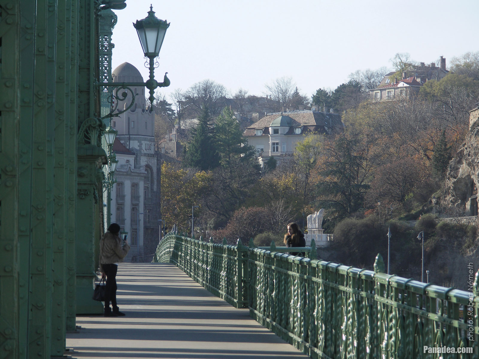
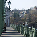
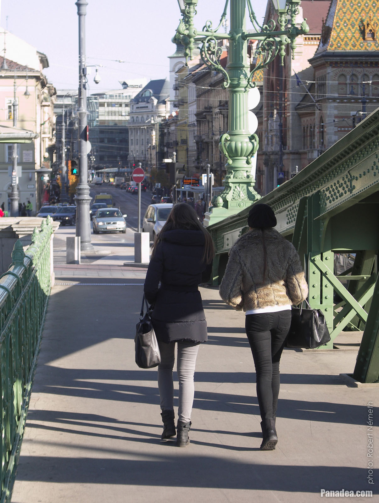
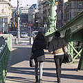
Passers-by on the Liberty Bridge ("Szabadság híd")
Fotoğrafçılığın tarihi: 20132013
Tarafından yaratılan: Robert Németh
Fotoğraf makinesi model: Konica Minolta Dimage A200
Budapeşte, Macaristan
Passers-by on the Liberty Bridge ("Szabadság híd") - Budapeşte, Macaristan -
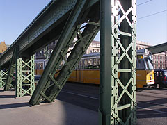
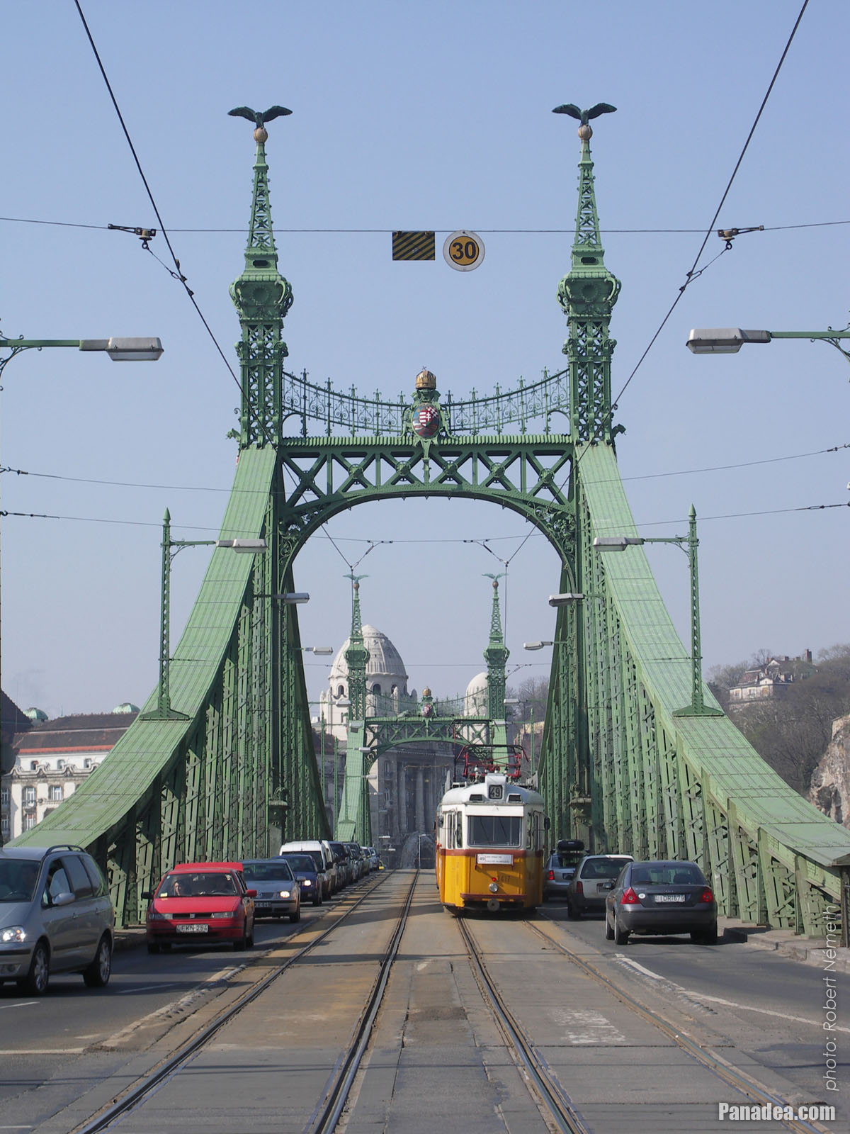
A tram on the Liberty Bridge
Fotoğrafçılığın tarihi: 20132013
Tarafından yaratılan: Robert Németh
Fotoğraf makinesi model: Konica Minolta Dimage A200
Budapeşte, Macaristan
A tram on the Liberty Bridge - Budapeşte, Macaristan -
The sight from the Libery Bridge northwards: the Danube River, the Gellért Hill, the Elisabeth Bridge and the Buda Castle
Fotoğrafçılığın tarihi: 20132013
Tarafından yaratılan: Robert Németh
Fotoğraf makinesi model: Konica Minolta Dimage A200
Budapeşte, Macaristan
The sight from the Libery Bridge northwards: the Danube River, the Gellért Hill, the Elisabeth Bridge and the Buda Castle - Budapeşte, Macaristan -
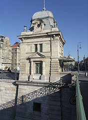
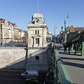
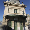
Old customs house, today museum with exhibition that presents the Danube bridges of Budapest
Fotoğrafçılığın tarihi: 20132013
Tarafından yaratılan: Robert Németh
Fotoğraf makinesi model: Konica Minolta Dimage A200
Budapeşte, Macaristan
Old customs house, today museum with exhibition that presents the Danube bridges of Budapest - Budapeşte, Macaristan -
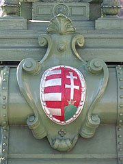
Simplified coat of arms of Hungary on the Liberty Bridge ("Szabadság híd")
Fotoğrafçılığın tarihi: 20132013
Tarafından yaratılan: Robert Németh
Fotoğraf makinesi model: Konica Minolta Dimage A200
Budapeşte, Macaristan
Simplified coat of arms of Hungary on the Liberty Bridge ("Szabadság híd") - Budapeşte, Macaristan -
The Liberty Bridge ("Szabadság híd") to the direction of Buda
Fotoğrafçılığın tarihi: 20132013
Tarafından yaratılan: Robert Németh
Fotoğraf makinesi model: Konica Minolta Dimage A200
Budapeşte, Macaristan
The Liberty Bridge ("Szabadság híd") to the direction of Buda - Budapeşte, Macaristan -
Detail of the Liberty Bridge
Fotoğrafçılığın tarihi: 20132013
Tarafından yaratılan: Robert Németh
Fotoğraf makinesi model: Konica Minolta Dimage A200
Budapeşte, Macaristan
Detail of the Liberty Bridge - Budapeşte, Macaristan -
The green-painted Liberty Bridge ("Szabadság híd")
Fotoğrafçılığın tarihi: 20132013
Tarafından yaratılan: Robert Németh
Fotoğraf makinesi model: Konica Minolta Dimage A200
Budapeşte, Macaristan
The green-painted Liberty Bridge ("Szabadság híd") - Budapeşte, Macaristan -
The Pest-side pylon of the Libery Bridge ("Szabadság híd")
Fotoğrafçılığın tarihi: 20132013
Tarafından yaratılan: Robert Németh
Fotoğraf makinesi model: Konica Minolta Dimage A200
Budapeşte, Macaristan
The Pest-side pylon of the Libery Bridge ("Szabadság híd") - Budapeşte, Macaristan -
The surroundings of the Liberty Bridge on the Pest side of the river (embankment, Danube, bridge, etc.)
Fotoğrafçılığın tarihi: 20132013
Tarafından yaratılan: Robert Németh
Fotoğraf makinesi model: Konica Minolta Dimage A200
Budapeşte, Macaristan
The surroundings of the Liberty Bridge on the Pest side of the river (embankment, Danube, bridge, etc.) - Budapeşte, Macaristan -
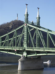
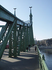
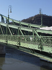
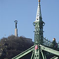
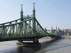
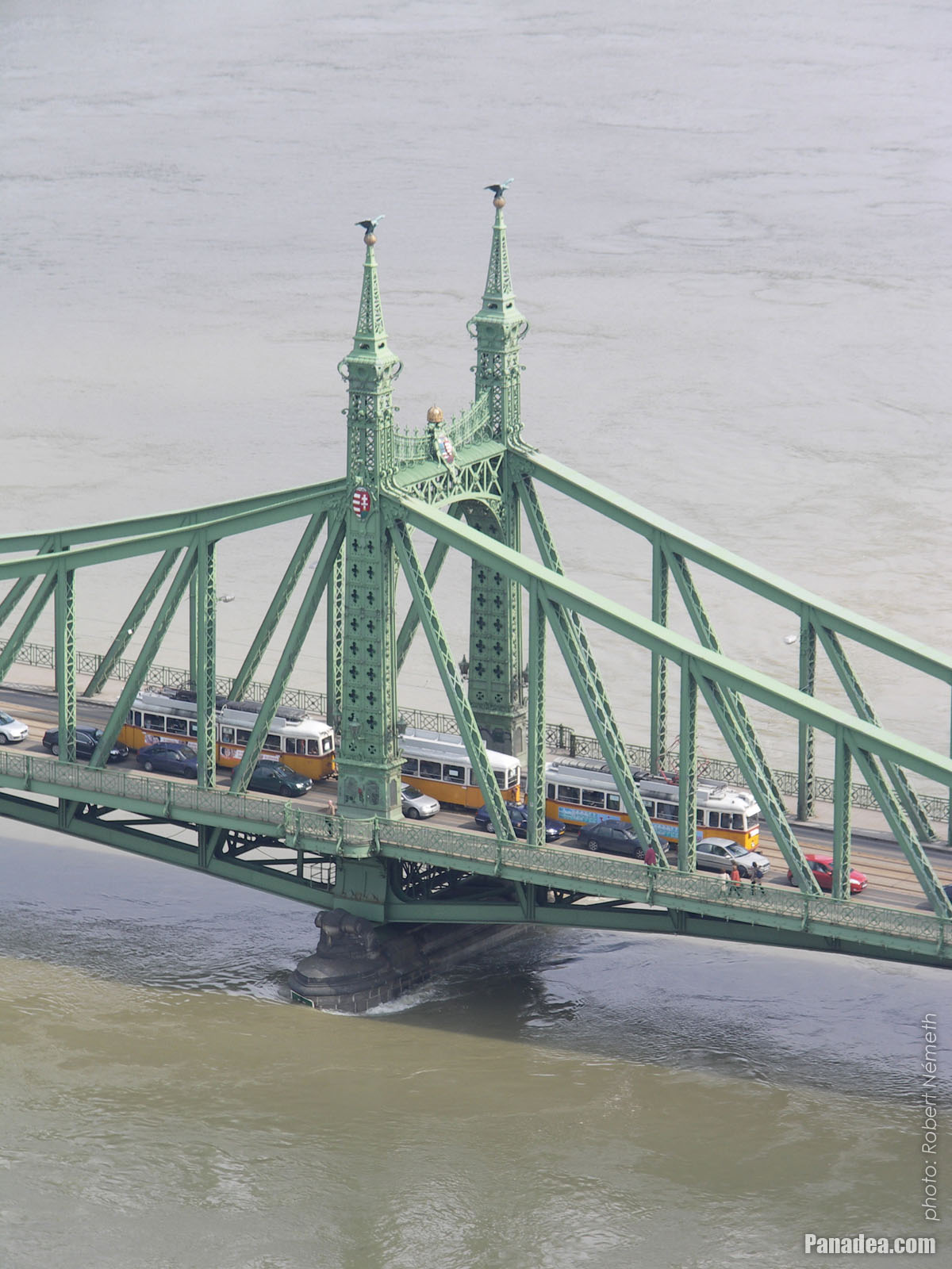
A tower (pylon) of the Liberty Bridge ("Szabadság híd") with the bronze sculpture of a falcon-like turul bird, as well as the Libery Statue on the Gellért Hill (in the distance)
Fotoğrafçılığın tarihi: 20132013
Tarafından yaratılan: Robert Németh
Fotoğraf makinesi model: Konica Minolta Dimage A200
Budapeşte, Macaristan
A tower (pylon) of the Liberty Bridge ("Szabadság híd") with the bronze sculpture of a falcon-like turul bird, as well as the Libery Statue on the Gellért Hill (in the distance) - Budapeşte, Macaristan -
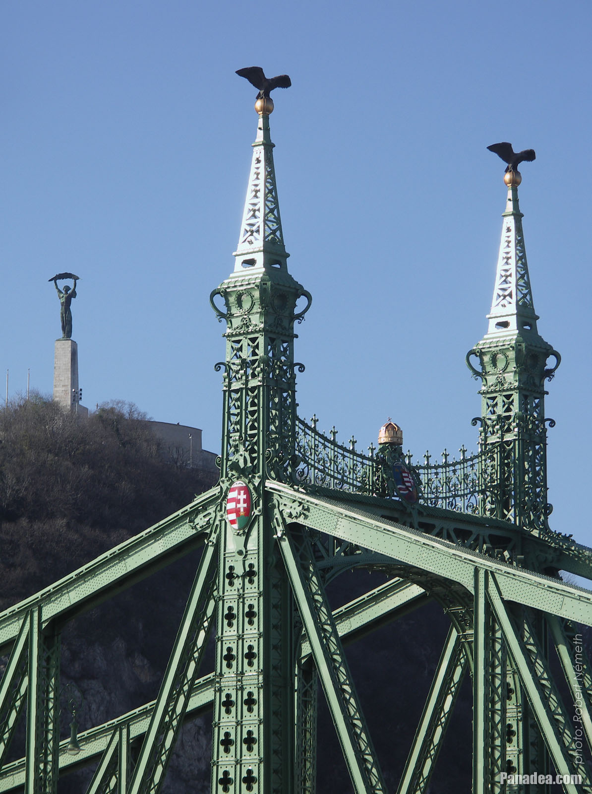
One of the towers (pylons) of the Liberty Bridge ("Szabadság híd") with two turul bird sculptures on its top, and the Liberty Statue on the Gellért Hill in the background
Fotoğrafçılığın tarihi: 20132013
Tarafından yaratılan: Robert Németh
Fotoğraf makinesi model: Konica Minolta Dimage A200
Budapeşte, Macaristan
One of the towers (pylons) of the Liberty Bridge ("Szabadság híd") with two turul bird sculptures on its top, and the Liberty Statue on the Gellért Hill in the background - Budapeşte, Macaristan -
The Pest-side lower embankment, as well as the Liberty Bridge ("Szabadság híd") over River Danube
Fotoğrafçılığın tarihi: 20132013
Tarafından yaratılan: Robert Németh
Fotoğraf makinesi model: Konica Minolta Dimage A200
Budapeşte, Macaristan
The Pest-side lower embankment, as well as the Liberty Bridge ("Szabadság híd") over River Danube - Budapeşte, Macaristan -
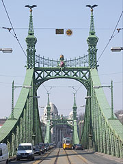
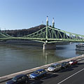
The Liberty Bridge ("Szabadság híd") over the river
Fotoğrafçılığın tarihi: 20132013
Tarafından yaratılan: Robert Németh
Fotoğraf makinesi model: Konica Minolta Dimage A200
Budapeşte, Macaristan
The Liberty Bridge ("Szabadság híd") over the river - Budapeşte, Macaristan -
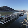
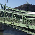
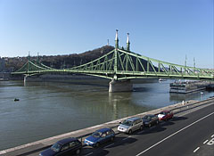
Liberty Bridge ("Szabadság híd", formerly "Ferencz József híd", "Fővám téri híd") over River Danube
Fotoğrafçılığın tarihi: 20062006
Tarafından yaratılan: Robert Németh
Fotoğraf makinesi model: Konica Minolta Dimage A200
Budapeşte, Macaristan
Liberty Bridge ("Szabadság híd", formerly "Ferencz József híd", "Fővám téri híd") over River Danube - Budapeşte, Macaristan -
Liberty Bridge (in Hungarian "Szabadság híd"), as well as the Gellért Hotel and Gellért Bath in the distance
Fotoğrafçılığın tarihi: 20062006
Tarafından yaratılan: Robert Németh
Fotoğraf makinesi model: Konica Minolta Dimage A200
Budapeşte, Macaristan
Liberty Bridge (in Hungarian "Szabadság híd"), as well as the Gellért Hotel and Gellért Bath in the distance - Budapeşte, Macaristan -
Liberty Bridge ("Szabadság híd") over the flooded Danube, viewed from Gellért Hill
Fotoğrafçılığın tarihi: 20062006
Tarafından yaratılan: Robert Németh
Fotoğraf makinesi model: Konica Minolta Dimage A200
Budapeşte, Macaristan
Liberty Bridge ("Szabadság híd") over the flooded Danube, viewed from Gellért Hill - Budapeşte, Macaristan -
The Liberty Bridge ("Szabadság híd") and the flooding River Danube from Gellért Hill
Fotoğrafçılığın tarihi: 20062006
Tarafından yaratılan: Robert Németh
Fotoğraf makinesi model: Konica Minolta Dimage A200
Budapeşte, Macaristan
The Liberty Bridge ("Szabadság híd") and the flooding River Danube from Gellért Hill - Budapeşte, Macaristan -
Coat of arms of Hungary and sculptures of turul birds on the pylon (tower) of the Liberty Bridge or "Szabadság híd"
Fotoğrafçılığın tarihi: 20062006
Tarafından yaratılan: Robert Németh
Fotoğraf makinesi model: Konica Minolta Dimage A200
Budapeşte, Macaristan
Coat of arms of Hungary and sculptures of turul birds on the pylon (tower) of the Liberty Bridge or "Szabadság híd" - Budapeşte, Macaristan -
The view of the Buda-side embankment and the Hotel Gellért from the Liberty Bridge in the evening
Fotoğrafçılığın tarihi: 20042004
Tarafından yaratılan: Robert Németh
Fotoğraf makinesi model: Canon PowerShot A85
Budapeşte, Macaristan
The view of the Buda-side embankment and the Hotel Gellért from the Liberty Bridge in the evening - Budapeşte, Macaristan


Resimlerin üzerine tıklayın!
Özellikleri, nitelikleri
Konum:
GPS koordinatları: Enlem 47°29'8", Boylam 19°3'17" (N47 29.13 - E19 3.28)
Bilgileri, kısa hikayeler, İlginç Gerçekler
 Liberty Bridge ("Szabadság híd", formerly "Ferencz József híd", "Fővám téri híd") over River Danube
The Liberty Bridge or Freedom Bridge (also known as Freedom Bridge, in Hungarian "Szabadság híd") or as it was called initially the Franz Joseph Bridge ("Ferencz József híd") was designed by János Feketeházy, it was opened in the year of the Hungarian Millenium in 1896. This was the third permanent road crossing over the Danube in Budapest. Even then the bridge already had tram tracks, as well as electric and gas lighting.
The first tram went throught the Liberty Bridge ("Szabadság híd") in 1898. At that time the tham tracks were on the sides of the bridge deck, and the tram used a conduit current collection system (the electric wires were on the ground) to get the power. The tram line was converted to overhead wire system in 1923, and from 1928 also the bus traffic was started on the bridge. Then in 1938 the rails were moved to the middle of the road, as it can be seen today.
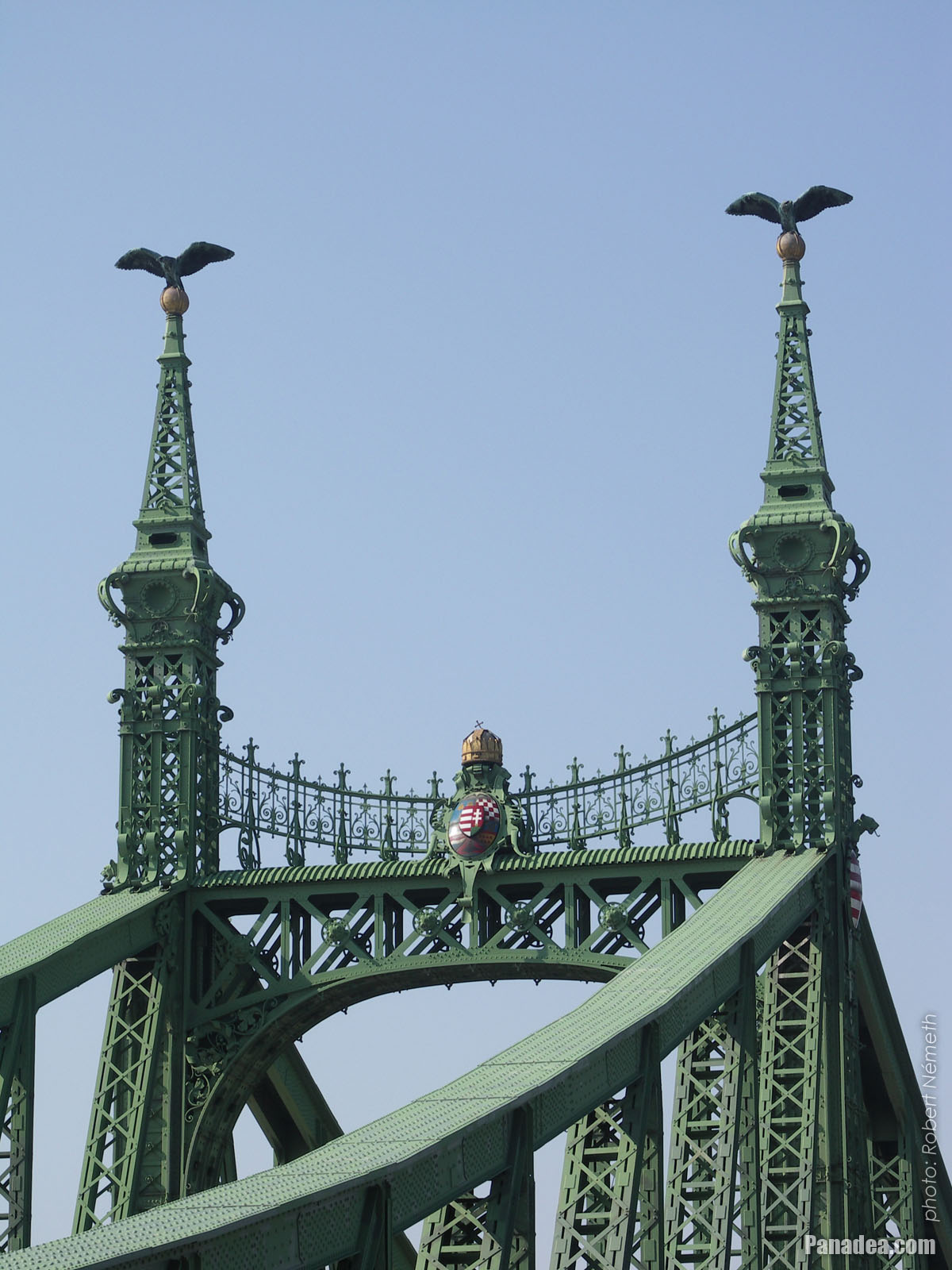
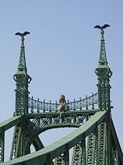
Another characteristics of the Szabadság Bridge or Liberty Bridge are the statues of turul birds with outstretched wings on the top of the pylon gates that were designed by Virgil Nagy, as well as the historical Hungarian coat of arms on the gateways (all of them were made in 1896).
 Liberty Bridge ("Szabadság híd") over the flooded Danube, viewed from Gellért Hill
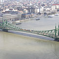
The Liberty Bridge (or Freedom Bridge, in Hungarian "Szabadság híd") is the shortest among the Danube bridges of Budapest. Before the World War II it was called Franz Joseph Bridge or Fővám Square Bridge ("Ferenc József híd" or "Fővám téri híd").
At the end of the World War II the bridge was blown up by the retreating German troops, like every other Danube bridge of Budapest. But the piers (more precisely the pylons) were remained intact and also the reparation of the middle section could be done relatively quickly. The reconstruction was done soon by the plans of Pál Sávoly architect, in 1946 it was already opened for service and then got its new name: "Szabadság híd" (in English "Liberty Bridge" or "Freedom Bridge").
Budapeşte - Daha fazla fotoğraf galerileri:
Şunlar da ilginizi çekebilir (İlgili sayfalar):
Seyahat rehberi noktaları:
Budapeşte (8 468 resim + 21 panoramik resim)
Buda Hills (Budai-hegység) (8 632 resim + 21 panoramik resim)
Pest megye (county) (15 122 resim + 50 panoramik resim)
Budapeşte ve çevresindeki (Orta Macaristan) (15 989 resim + 52 panoramik resim)
Macaristan (27 287 resim + 163 panoramik resim)
ve ek olarak:
(burada içinde: Buda Hills)
Budakeszi (88 resim)
Pilisszentiván (76 resim)
Her panorama fotoğraf burada:
Budapeşte (21 resim)
Pest megye (county) (50 resim)
Budapeşte ve çevresindeki (Orta Macaristan) (52 resim)
Macaristan (163 resim)
Avrupa (165 resim)
Her sıradan fotoğraf burada:
Budapeşte (8 468 resim / 122 galerileri)
Buda Hills (Budai-hegység) (8 632 resim / 124 galerileri)
Pest megye (county) (15 122 resim / 221 galerileri)
Budapeşte ve çevresindeki (Orta Macaristan) (15 989 resim / 234 galerileri)
Macaristan (27 287 resim / 462 galerileri)
Avrupa (30 494 resim / 523 galerileri)
https://www.panadea.com/tr/guidebook/budapeste/photos/gal-014

Favorilerime ekle Yer imlerine ekle
Arkadaşlarınla paylaş!
v.b.


Bizim seyahat rehberi içerir:
Çok sayıda bilgi ve ilginç gerçekler ile çok sayıda fotoğraflar ve panoramik görüntüler.
- 214 seyahat hedefleri
- 165 panoramik resim
- 30 494 diğer resim
Büyük fotoğraf koleksiyonları: mükemmel kalite, yüksek çözünürlüklü ve doğal renkler
Hakkımızda - Yasal Uyarı & Tekzip Hakkı -
Her hakkı saklıdır
- ©2010-2022
Neuronit Creative Studio - Mogyoród / Budapeşte / Macaristan