
(Оптимизирована для устройств с небольшим экраном)
Liberty Bridge (aka Freedom Bridge, "Szabadság híd") - Будапешт, Венгрия
При нажатии:
Нажмите на изображении!
-
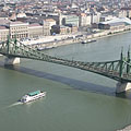
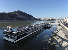
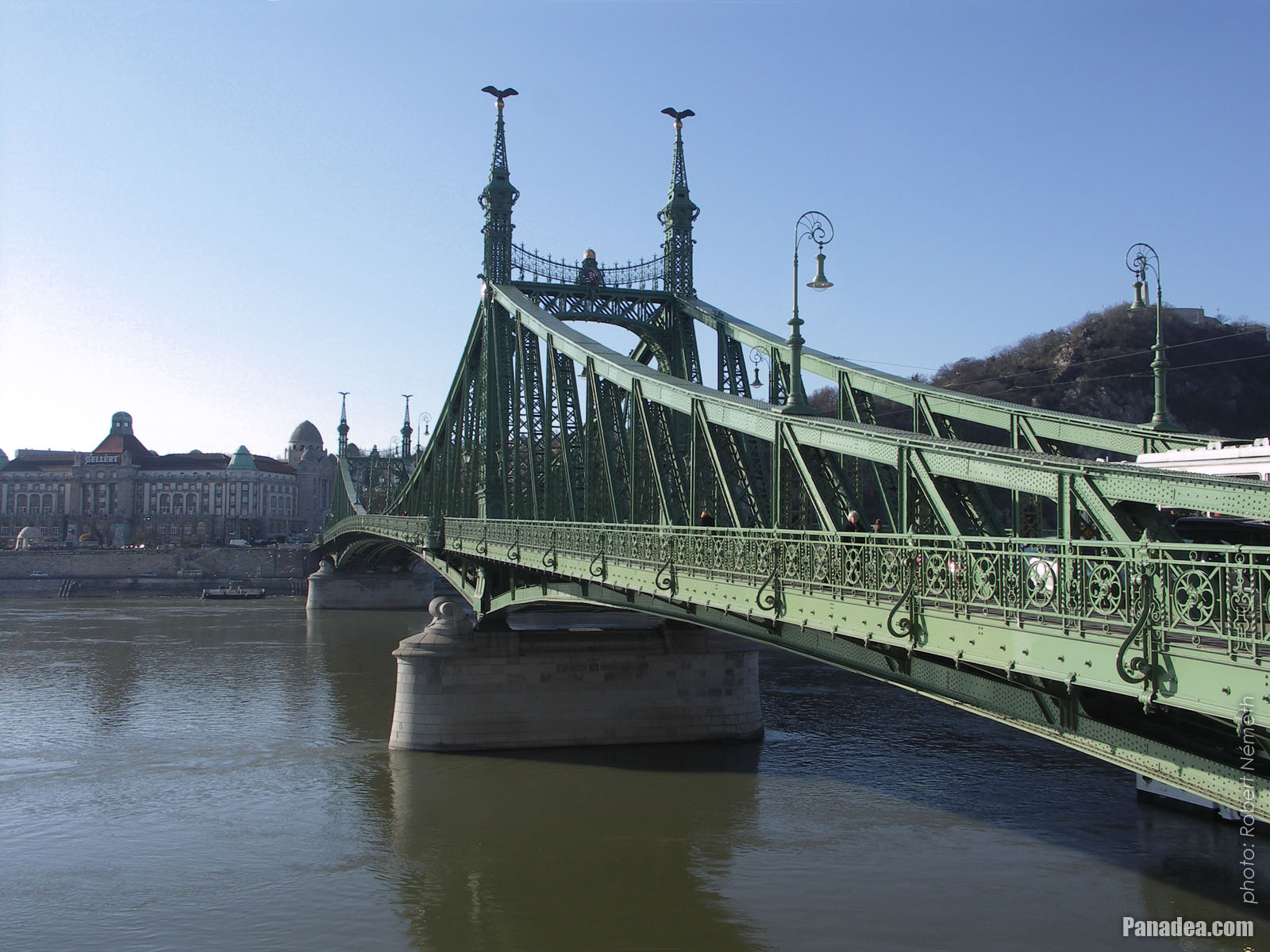
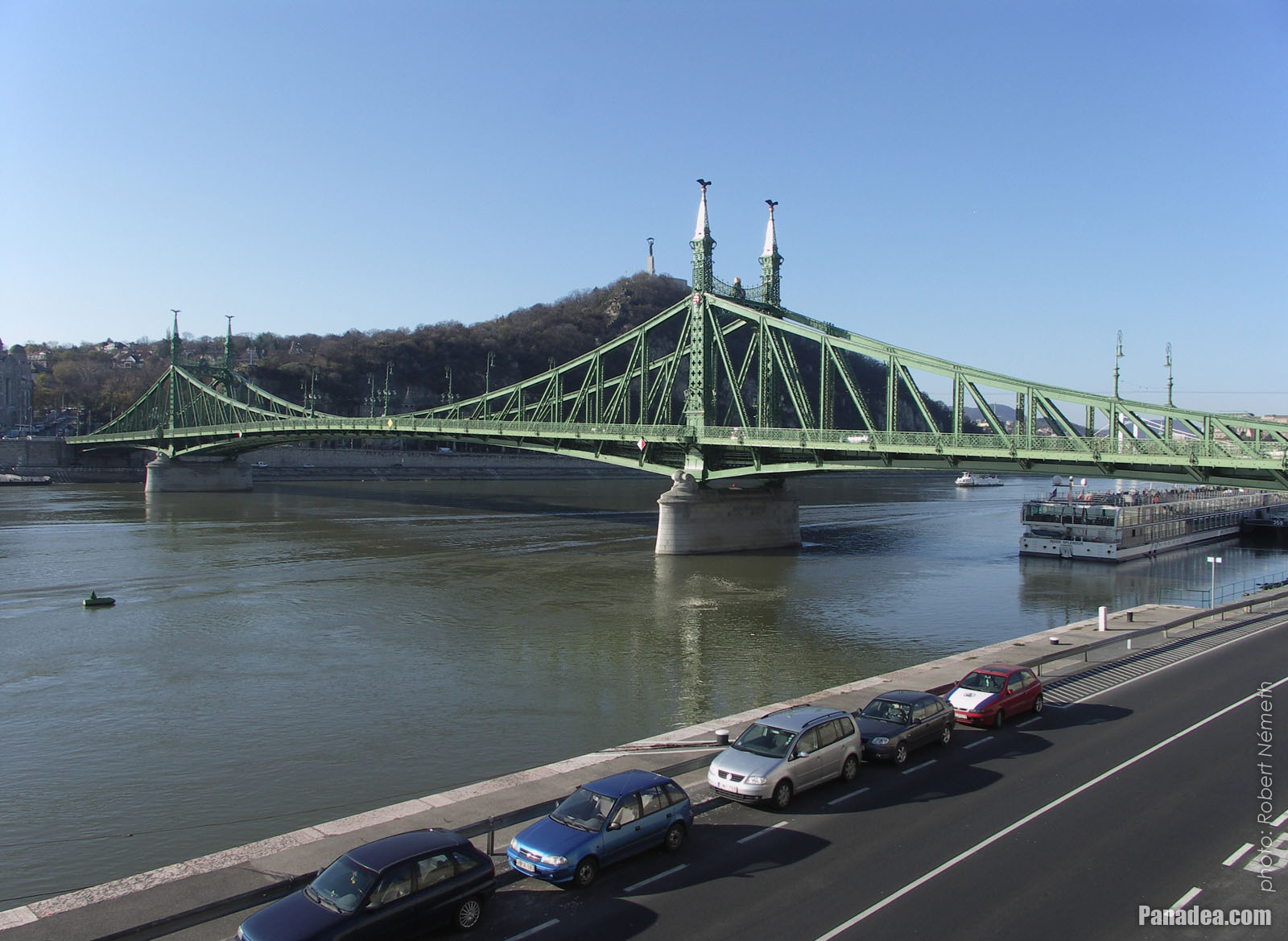
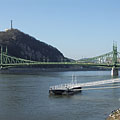
The Liberty Bridge of Budapest ("Szabadság híd") over the Danube River and in front of the Gellért Hill ("Gellért-hegy")
Дата фотографии: 20132013
Создано: Роберт Немет
Модель камеры: Konica Minolta Dimage A200
Будапешт, Венгрия
-

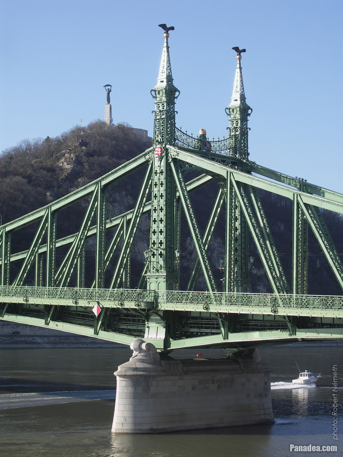
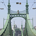
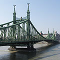
The Pest-side tower (pylon) of the Liberty Bridge ("Szabadság híd") in front of the Gellért Hill
Дата фотографии: 20132013
Создано: Роберт Немет
Модель камеры: Konica Minolta Dimage A200
Будапешт, Венгрия
-
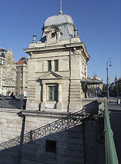
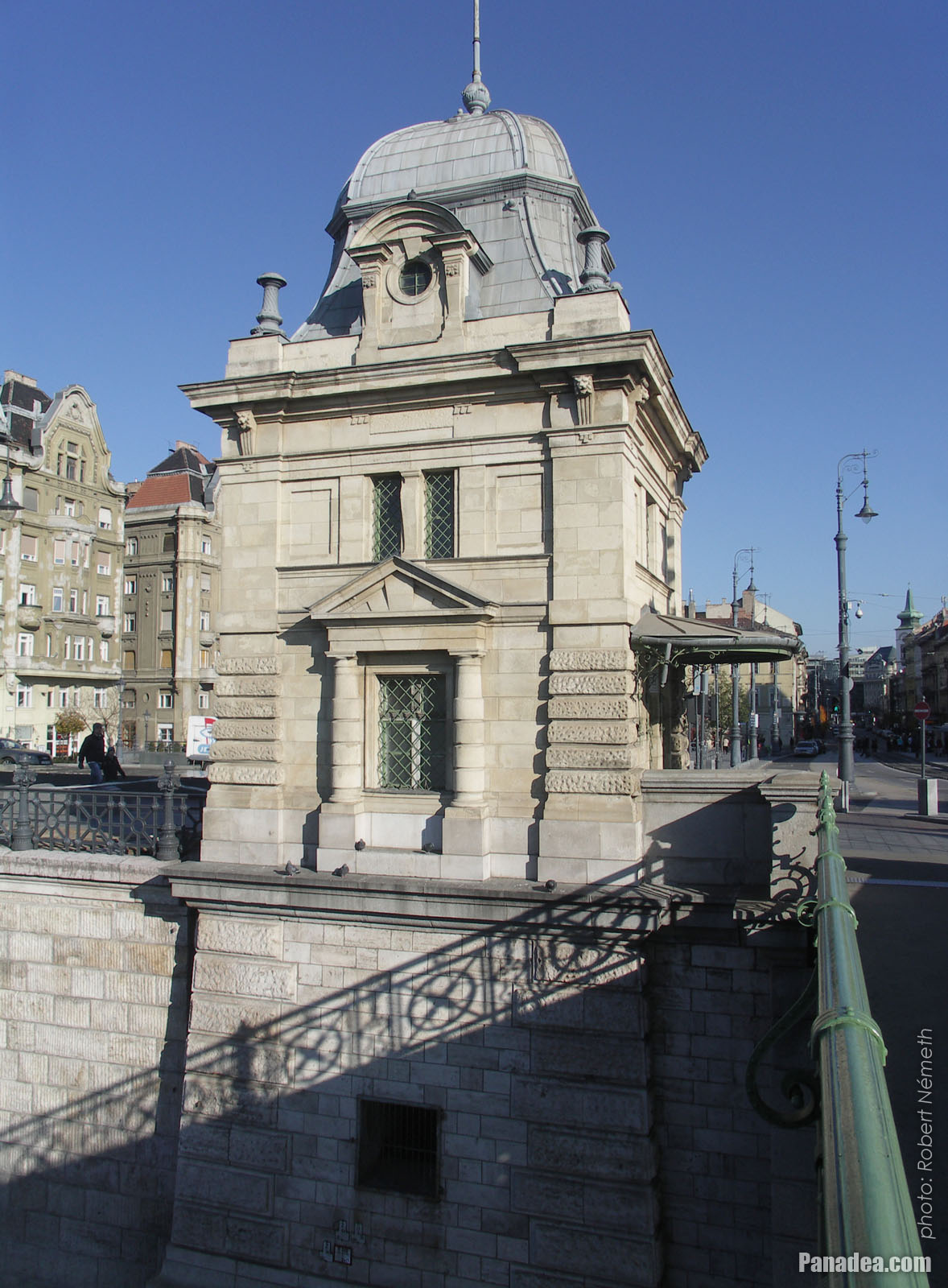
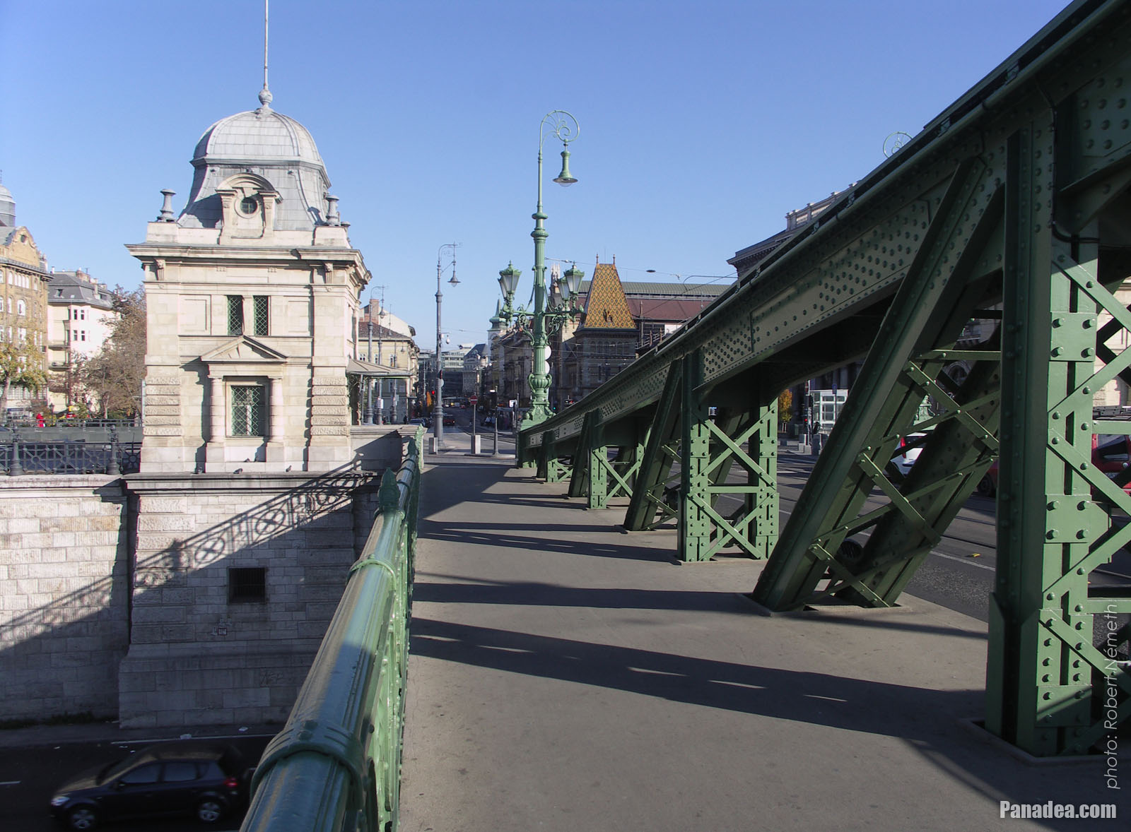
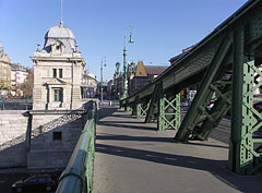
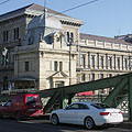
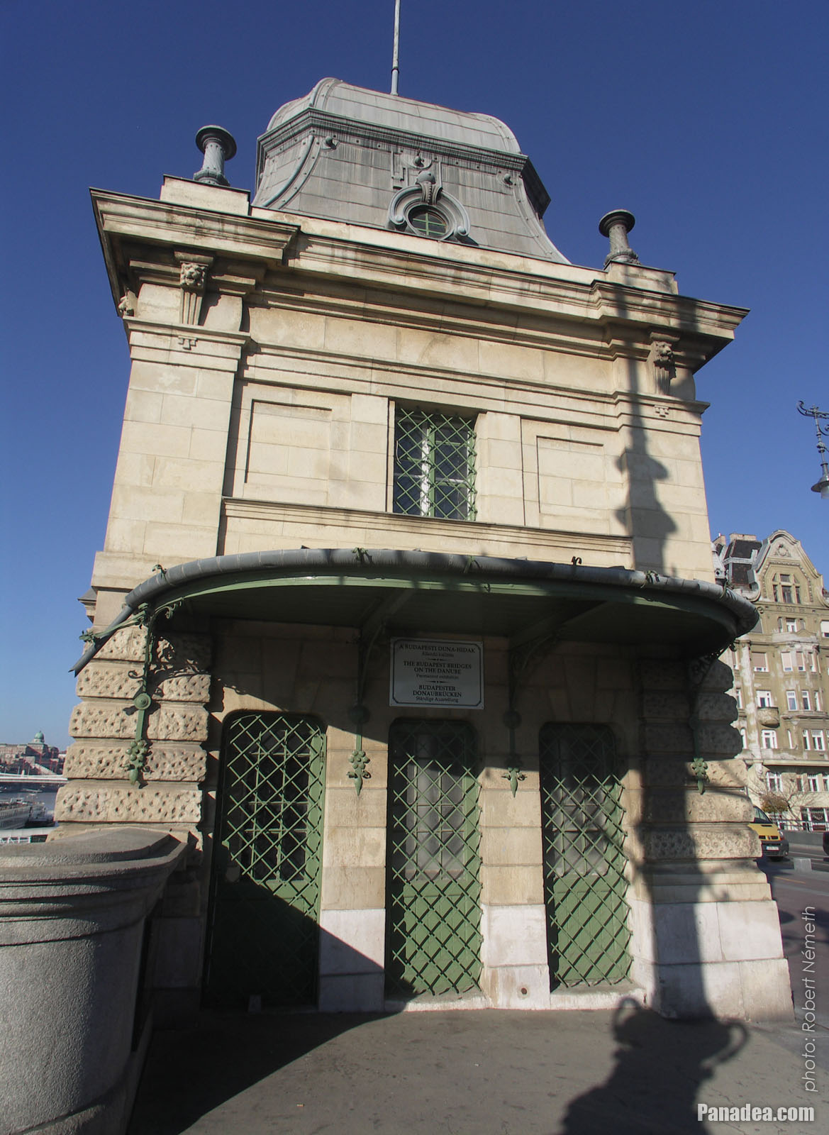
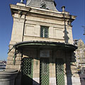
Former customs house at the Pest side of the Liberty Bridge ("Szabadság híd")
Дата фотографии: 20132013
Создано: Роберт Немет
Модель камеры: Konica Minolta Dimage A200
Будапешт, Венгрия
-

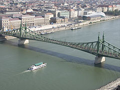
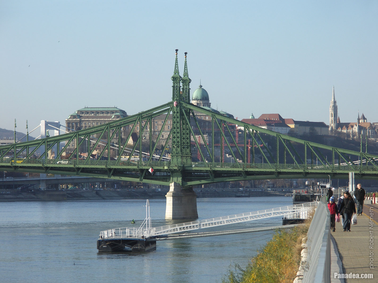
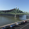
The sight of the Liberty Bridge ("Szabadság híd") and the Buda Castle Quarter from the promenade on the Danube bank in Pest
Дата фотографии: 20132013
Создано: Роберт Немет
Модель камеры: Konica Minolta Dimage A200
Будапешт, Венгрия
-

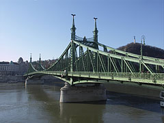
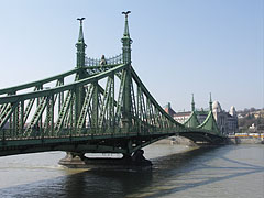
The view of the Liberty Bridge from the Pest bank of the Danube
Дата фотографии: 20062006
Создано: Роберт Немет
Модель камеры: Konica Minolta Dimage A200
Будапешт, Венгрия
-
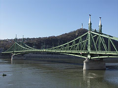
The Liberty Bridge ("Szabadság híd") over the Danube River, as seen from the Gellért Hill
Дата фотографии: 20112011
Создано: Роберт Немет
Модель камеры: Konica Minolta Dimage A200
Будапешт, Венгрия
-

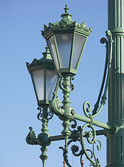
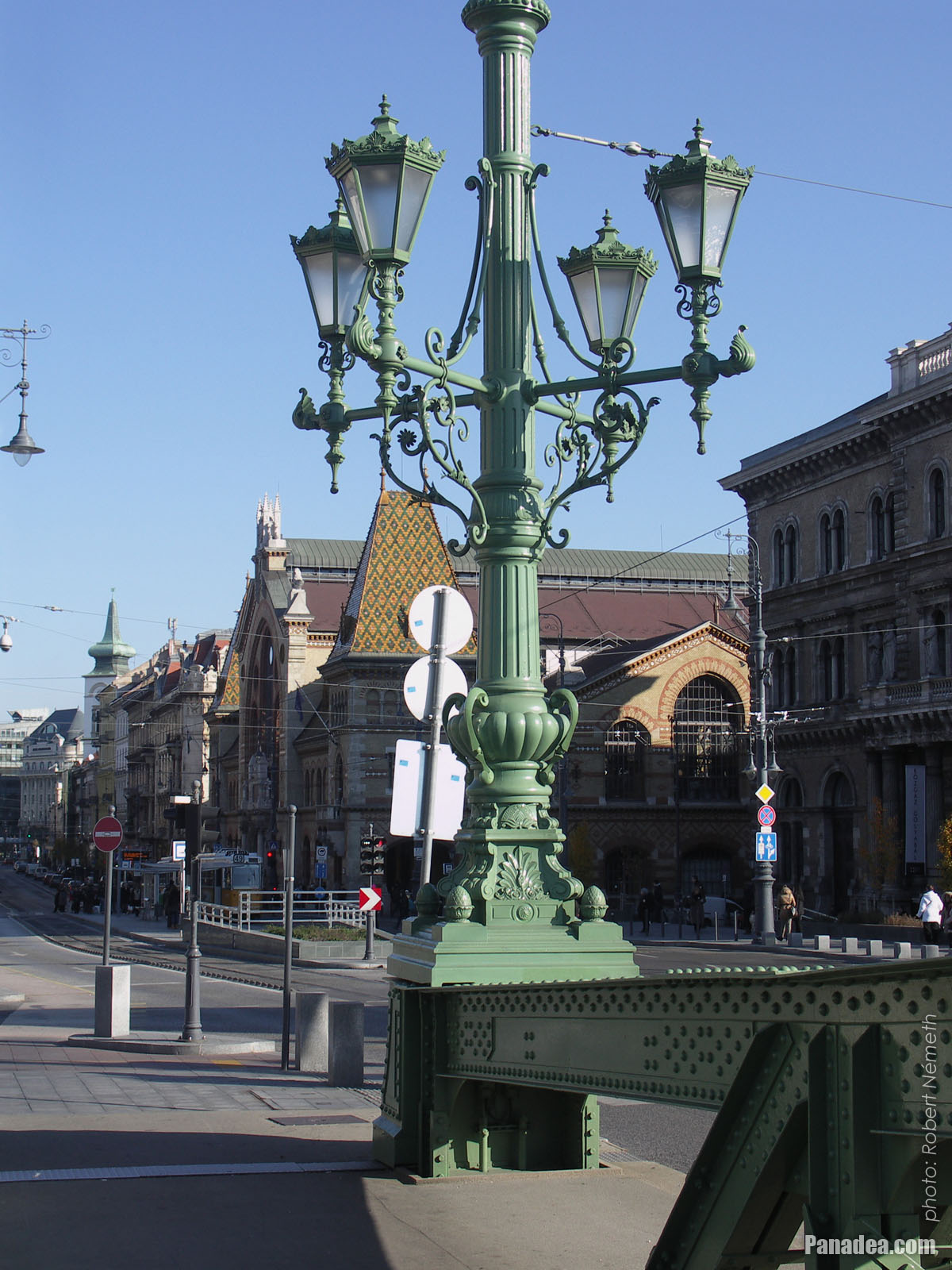
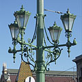
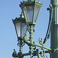
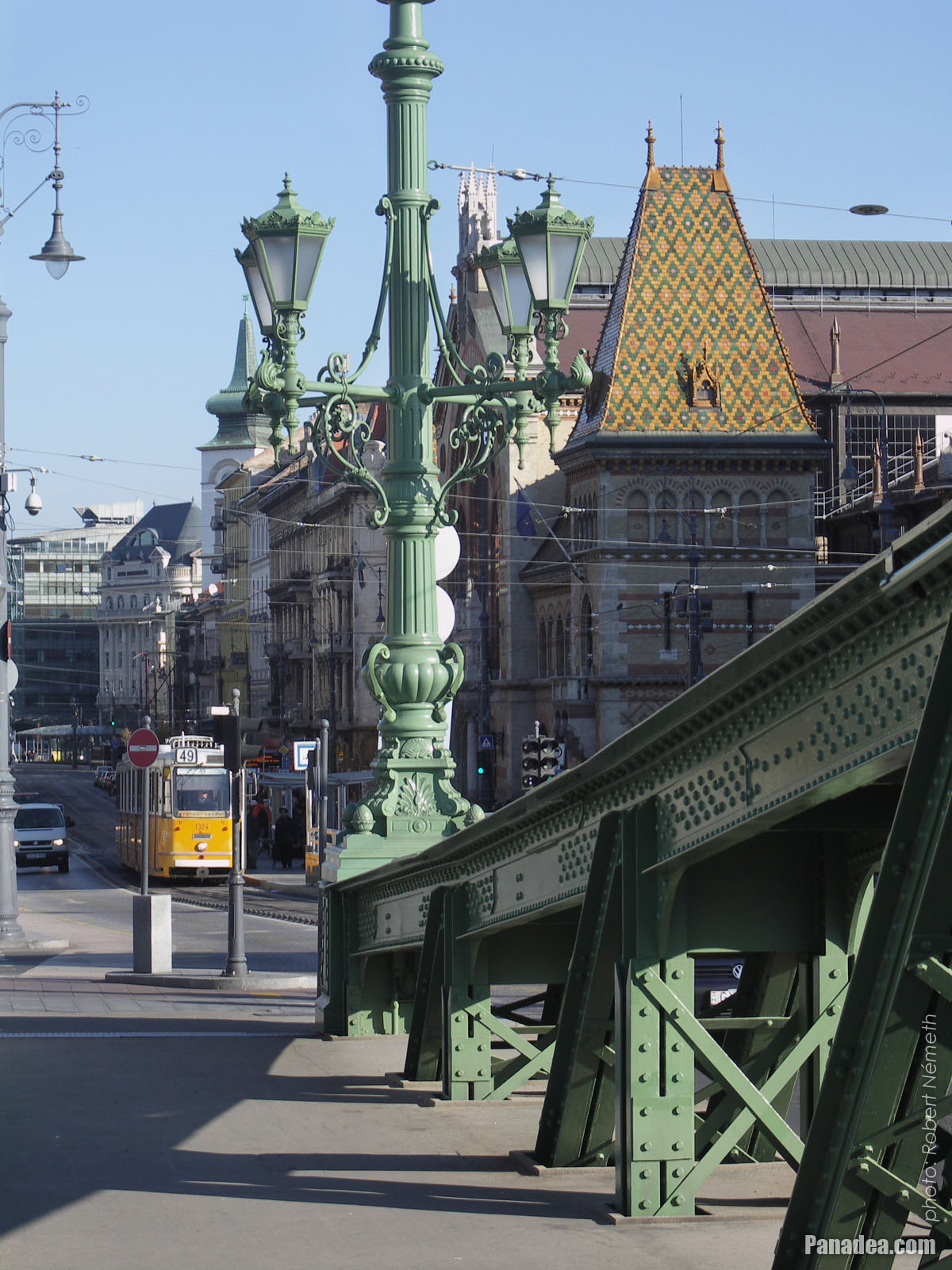
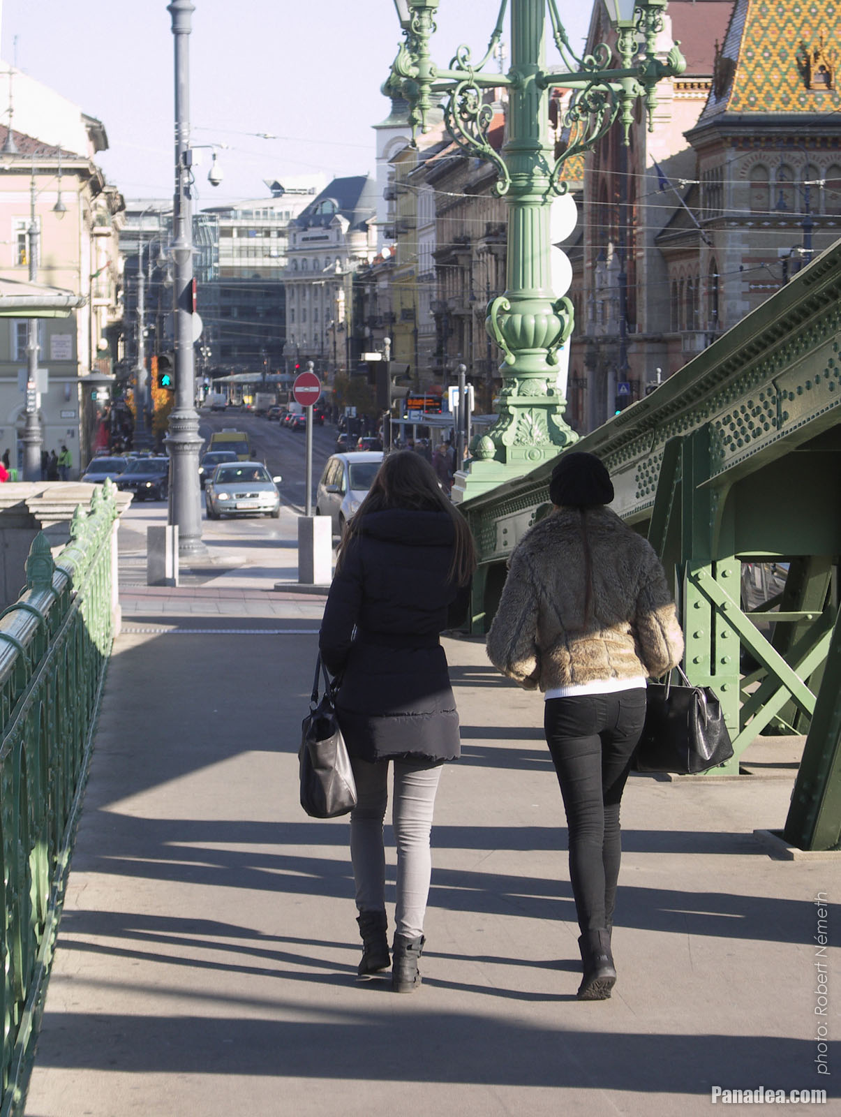
One of the ornate four-way lamp posts of the Liberty Bridge
In the background it is the Central Market Hall.
Дата фотографии: 20132013
Создано: Роберт Немет
Модель камеры: Konica Minolta Dimage A200
Будапешт, Венгрия
-

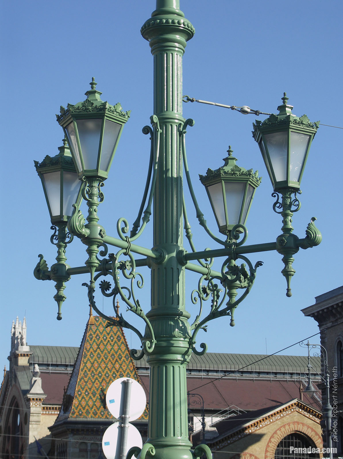
Ornate four-way lamp post on the Liberty Bridge ("Szabadság híd")
Дата фотографии: 20132013
Создано: Роберт Немет
Модель камеры: Konica Minolta Dimage A200
Будапешт, Венгрия
-
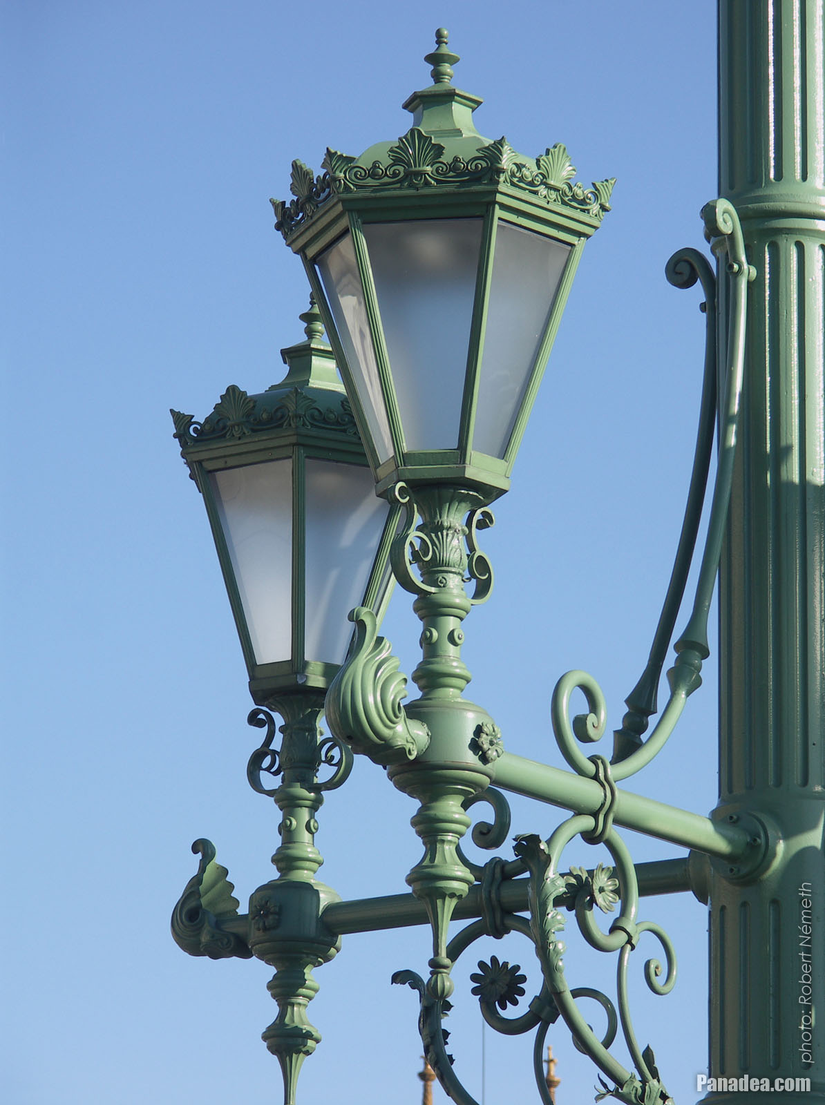
Some lamps of the Liberty Bridge
Дата фотографии: 20132013
Создано: Роберт Немет
Модель камеры: Konica Minolta Dimage A200
Будапешт, Венгрия
-
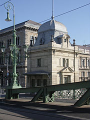
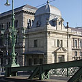
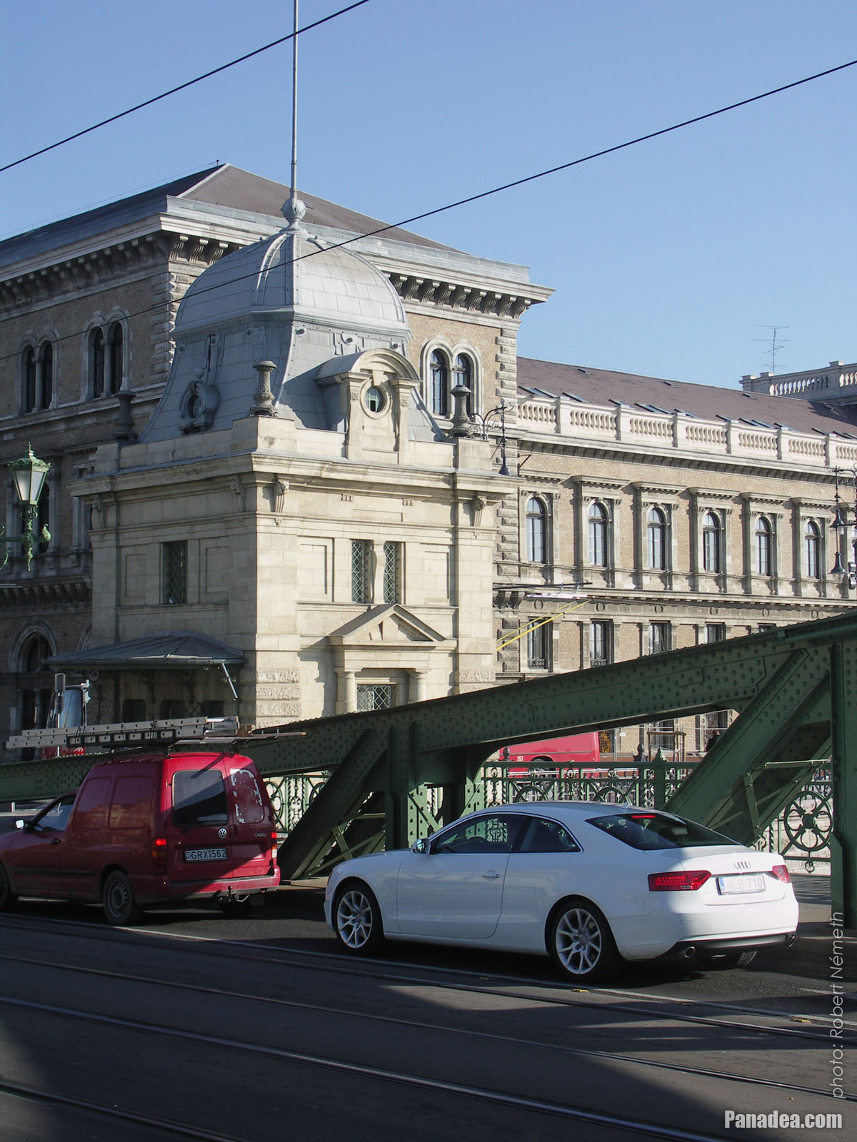
The other former customs house of the Liberty Bridge ("Szabadság híd"), in front of the main building of the Corvinus University
Дата фотографии: 20132013
Создано: Роберт Немет
Модель камеры: Konica Minolta Dimage A200
Будапешт, Венгрия
-
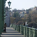
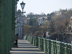
The foot of the Gellért Hill viewed from the Liberty Bridge ("Szabadság híd")
Дата фотографии: 20132013
Создано: Роберт Немет
Модель камеры: Konica Minolta Dimage A200
Будапешт, Венгрия
The foot of the Gellért Hill viewed from the Liberty Bridge ("Szabadság híd") - Будапешт, Венгрия -
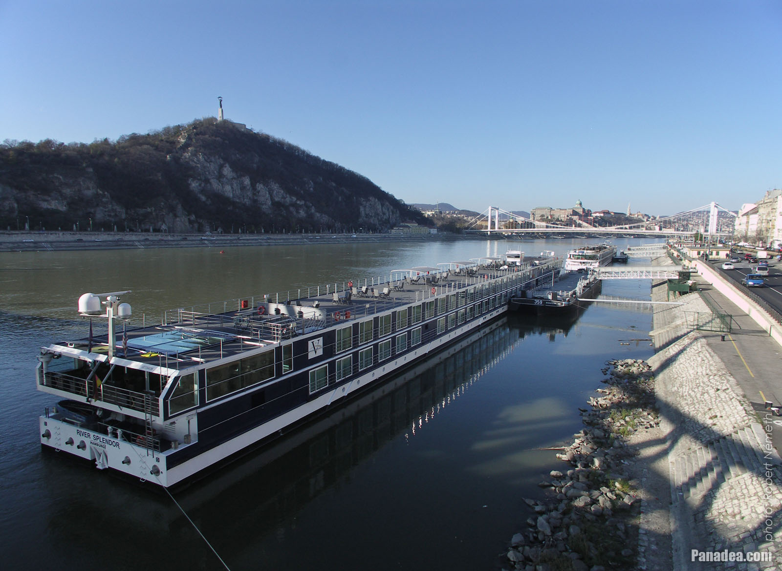
The end of the Liberty Bridge ("Szabadság híd") and the lower embankment on the Pest side of the river
Дата фотографии: 20132013
Создано: Роберт Немет
Модель камеры: Konica Minolta Dimage A200
Будапешт, Венгрия
The end of the Liberty Bridge ("Szabadság híd") and the lower embankment on the Pest side of the river - Будапешт, Венгрия -
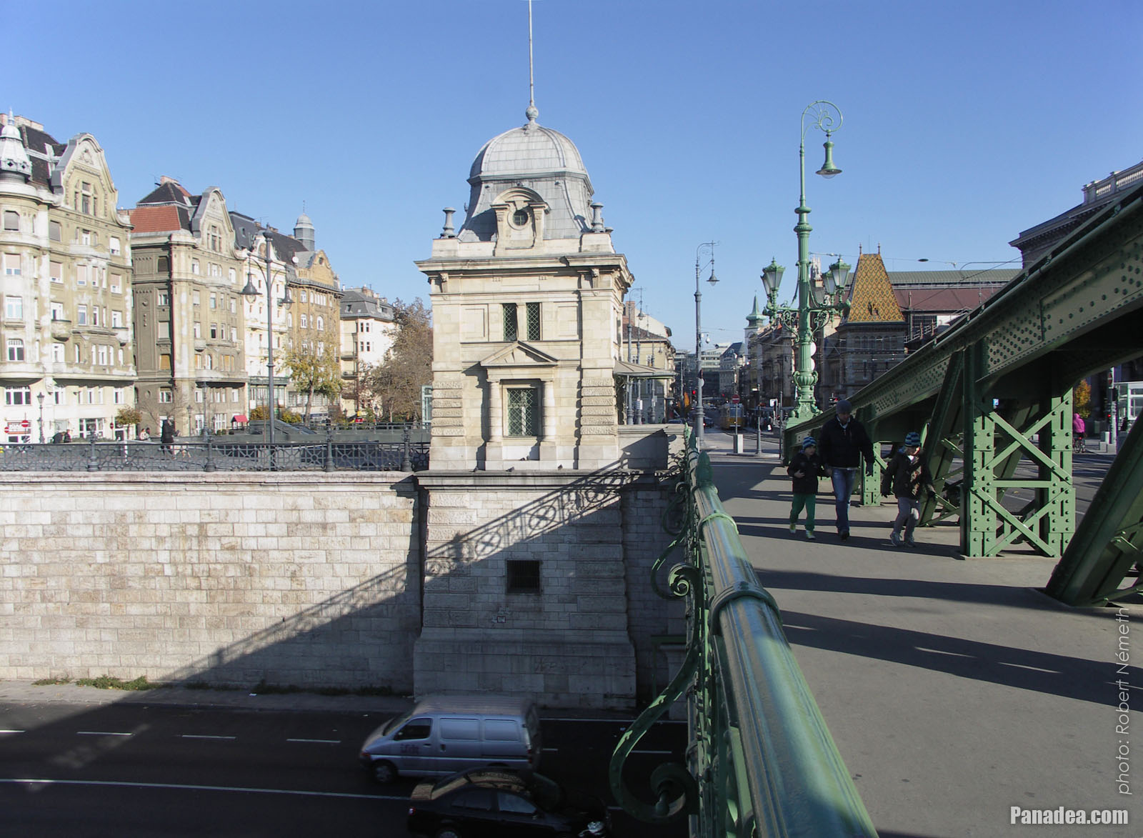
The Pest-side end of the Liberty Bridge ("Szabadság híd")
Дата фотографии: 20132013
Создано: Роберт Немет
Модель камеры: Konica Minolta Dimage A200
Будапешт, Венгрия
The Pest-side end of the Liberty Bridge ("Szabadság híd") - Будапешт, Венгрия -
The view of the Liberty Bridge ("Szabadság híd") towards Buda
Дата фотографии: 20132013
Создано: Роберт Немет
Модель камеры: Konica Minolta Dimage A200
Будапешт, Венгрия
The view of the Liberty Bridge ("Szabadság híd") towards Buda - Будапешт, Венгрия -
The connection of the Liberty Bridge ("Szabadság híd") on the Pest riverside
Дата фотографии: 20132013
Создано: Роберт Немет
Модель камеры: Konica Minolta Dimage A200
Будапешт, Венгрия
The connection of the Liberty Bridge ("Szabadság híd") on the Pest riverside - Будапешт, Венгрия -
The Pest-side end of the Liberty Bridge ("Szabadság híd"), and the main building of the Corvinus University in the background
Дата фотографии: 20132013
Создано: Роберт Немет
Модель камеры: Konica Minolta Dimage A200
Будапешт, Венгрия
The Pest-side end of the Liberty Bridge ("Szabadság híd"), and the main building of the Corvinus University in the background - Будапешт, Венгрия -
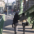
Passers-by on the Liberty Bridge ("Szabadság híd")
Дата фотографии: 20132013
Создано: Роберт Немет
Модель камеры: Konica Minolta Dimage A200
Будапешт, Венгрия
Passers-by on the Liberty Bridge ("Szabadság híd") - Будапешт, Венгрия -
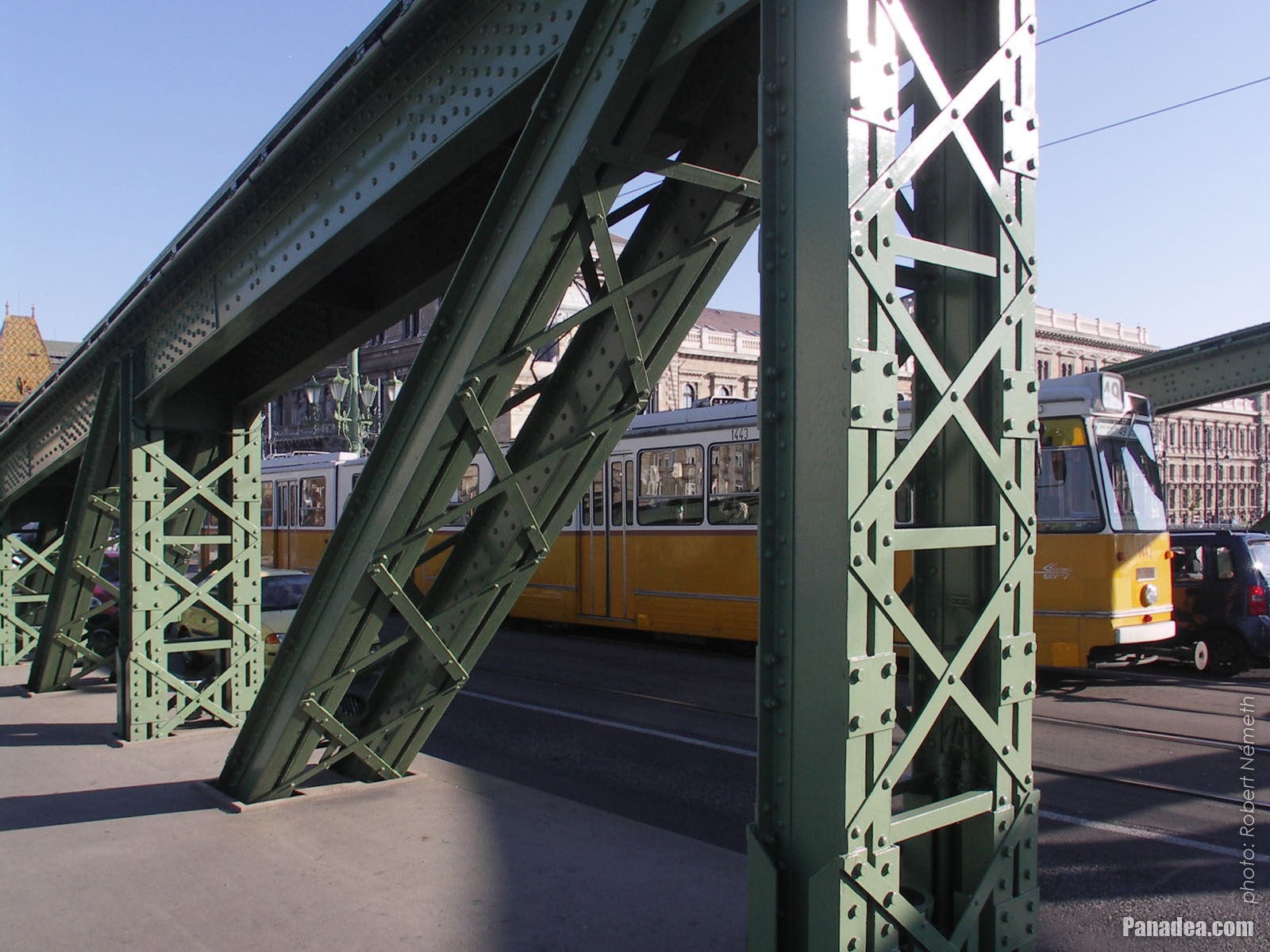
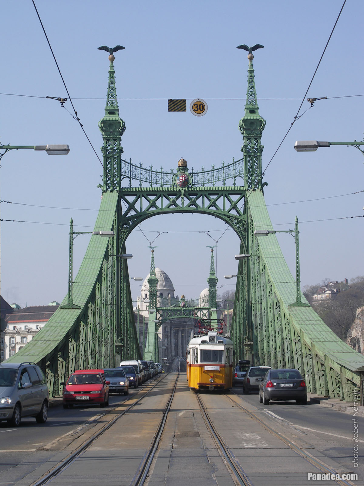
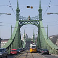
A tram on the Liberty Bridge
Дата фотографии: 20132013
Создано: Роберт Немет
Модель камеры: Konica Minolta Dimage A200
Будапешт, Венгрия
A tram on the Liberty Bridge - Будапешт, Венгрия -
The sight from the Libery Bridge northwards: the Danube River, the Gellért Hill, the Elisabeth Bridge and the Buda Castle
Дата фотографии: 20132013
Создано: Роберт Немет
Модель камеры: Konica Minolta Dimage A200
Будапешт, Венгрия
The sight from the Libery Bridge northwards: the Danube River, the Gellért Hill, the Elisabeth Bridge and the Buda Castle - Будапешт, Венгрия -
Old customs house, today museum with exhibition that presents the Danube bridges of Budapest
Дата фотографии: 20132013
Создано: Роберт Немет
Модель камеры: Konica Minolta Dimage A200
Будапешт, Венгрия
Old customs house, today museum with exhibition that presents the Danube bridges of Budapest - Будапешт, Венгрия -
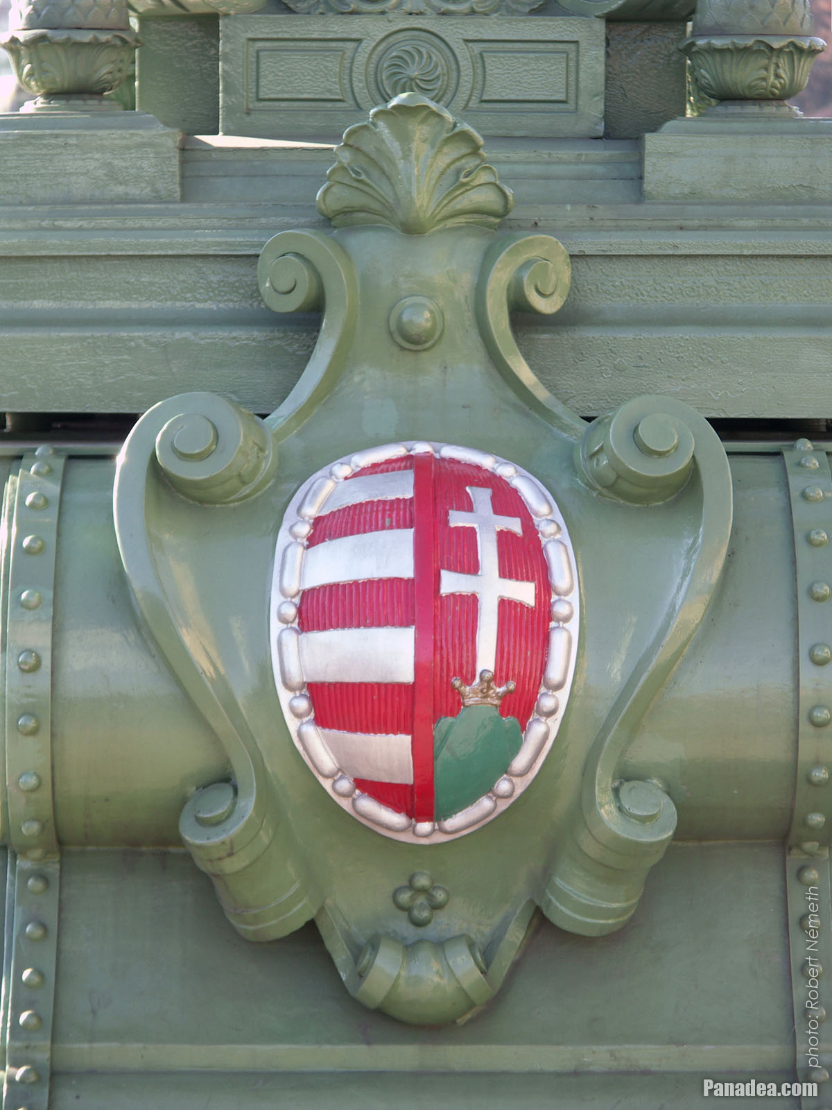
Simplified coat of arms of Hungary on the Liberty Bridge ("Szabadság híd")
Дата фотографии: 20132013
Создано: Роберт Немет
Модель камеры: Konica Minolta Dimage A200
Будапешт, Венгрия
Simplified coat of arms of Hungary on the Liberty Bridge ("Szabadság híd") - Будапешт, Венгрия -
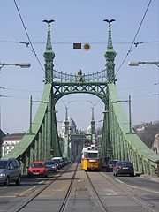
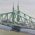
The Liberty Bridge ("Szabadság híd") to the direction of Buda
Дата фотографии: 20132013
Создано: Роберт Немет
Модель камеры: Konica Minolta Dimage A200
Будапешт, Венгрия
The Liberty Bridge ("Szabadság híd") to the direction of Buda - Будапешт, Венгрия -
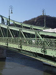
Detail of the Liberty Bridge
Дата фотографии: 20132013
Создано: Роберт Немет
Модель камеры: Konica Minolta Dimage A200
Будапешт, Венгрия
Detail of the Liberty Bridge - Будапешт, Венгрия -
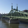
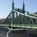
The green-painted Liberty Bridge ("Szabadság híd")
Дата фотографии: 20132013
Создано: Роберт Немет
Модель камеры: Konica Minolta Dimage A200
Будапешт, Венгрия
The green-painted Liberty Bridge ("Szabadság híd") - Будапешт, Венгрия -
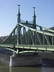
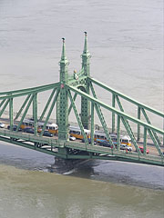
The Pest-side pylon of the Libery Bridge ("Szabadság híd")
Дата фотографии: 20132013
Создано: Роберт Немет
Модель камеры: Konica Minolta Dimage A200
Будапешт, Венгрия
The Pest-side pylon of the Libery Bridge ("Szabadság híd") - Будапешт, Венгрия -
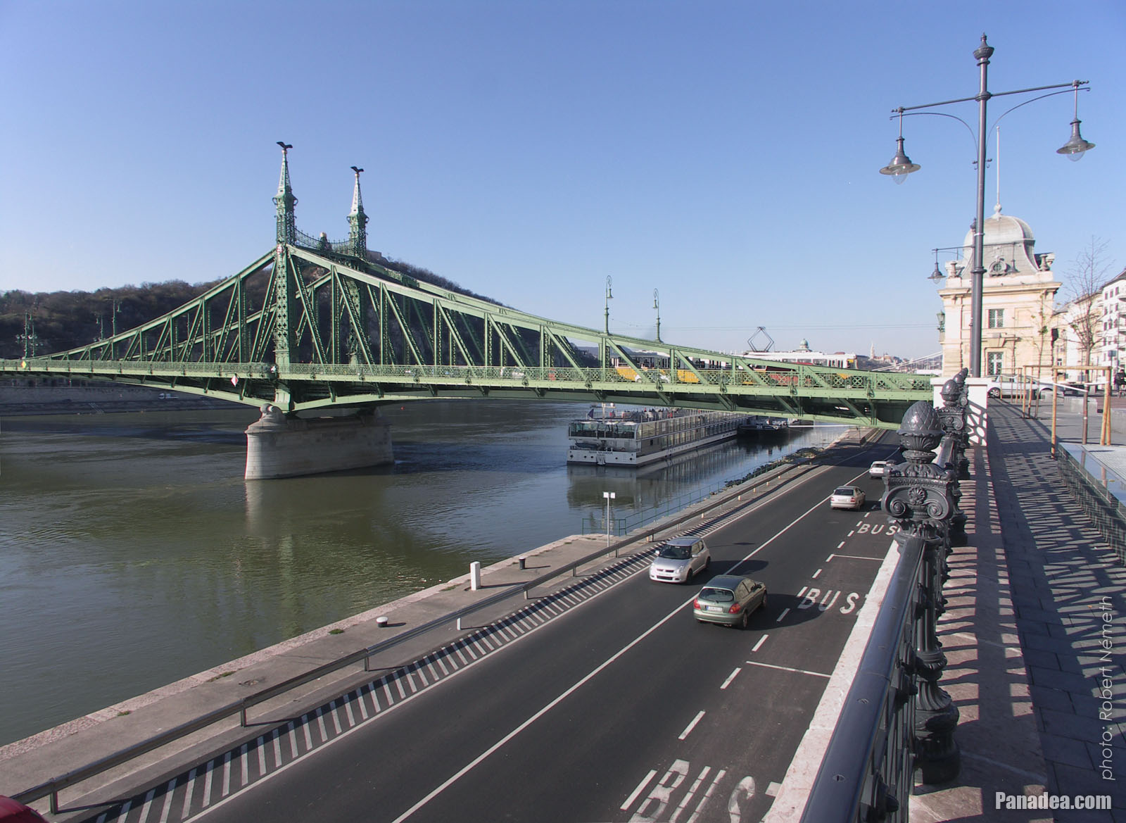
The surroundings of the Liberty Bridge on the Pest side of the river (embankment, Danube, bridge, etc.)
Дата фотографии: 20132013
Создано: Роберт Немет
Модель камеры: Konica Minolta Dimage A200
Будапешт, Венгрия
The surroundings of the Liberty Bridge on the Pest side of the river (embankment, Danube, bridge, etc.) - Будапешт, Венгрия -
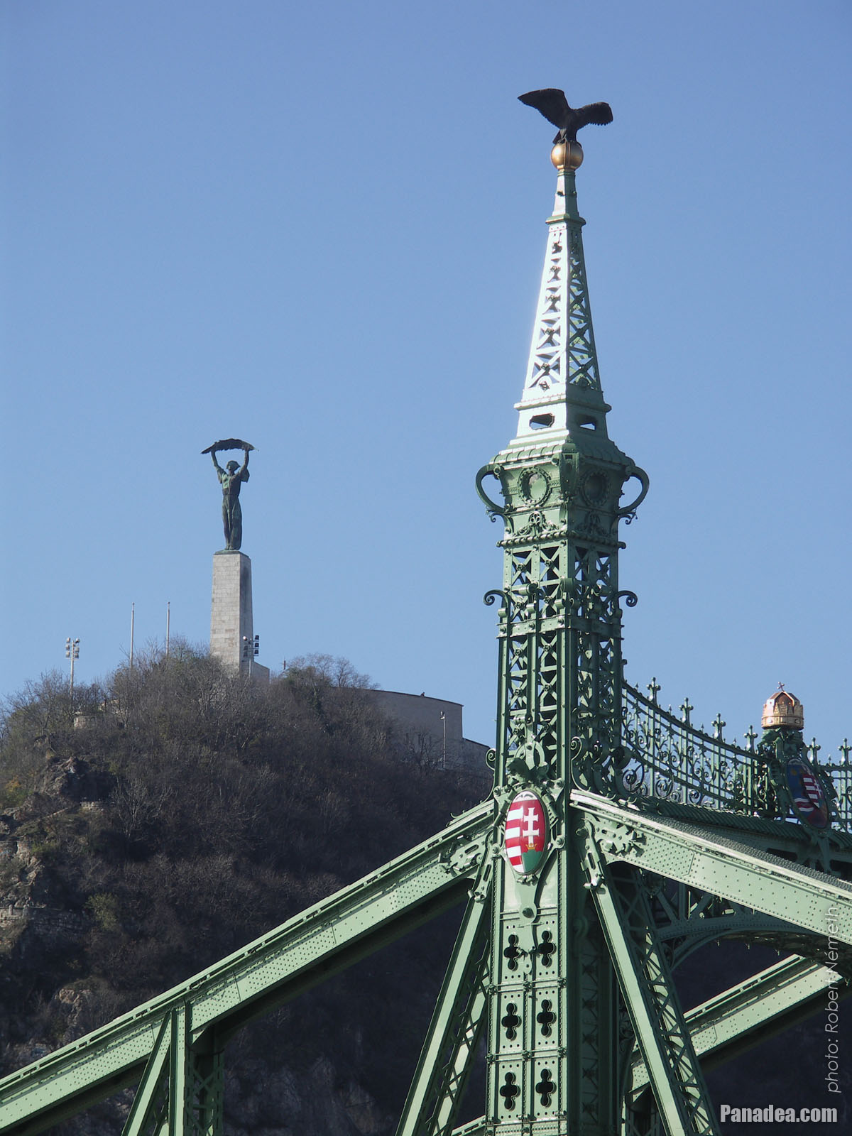
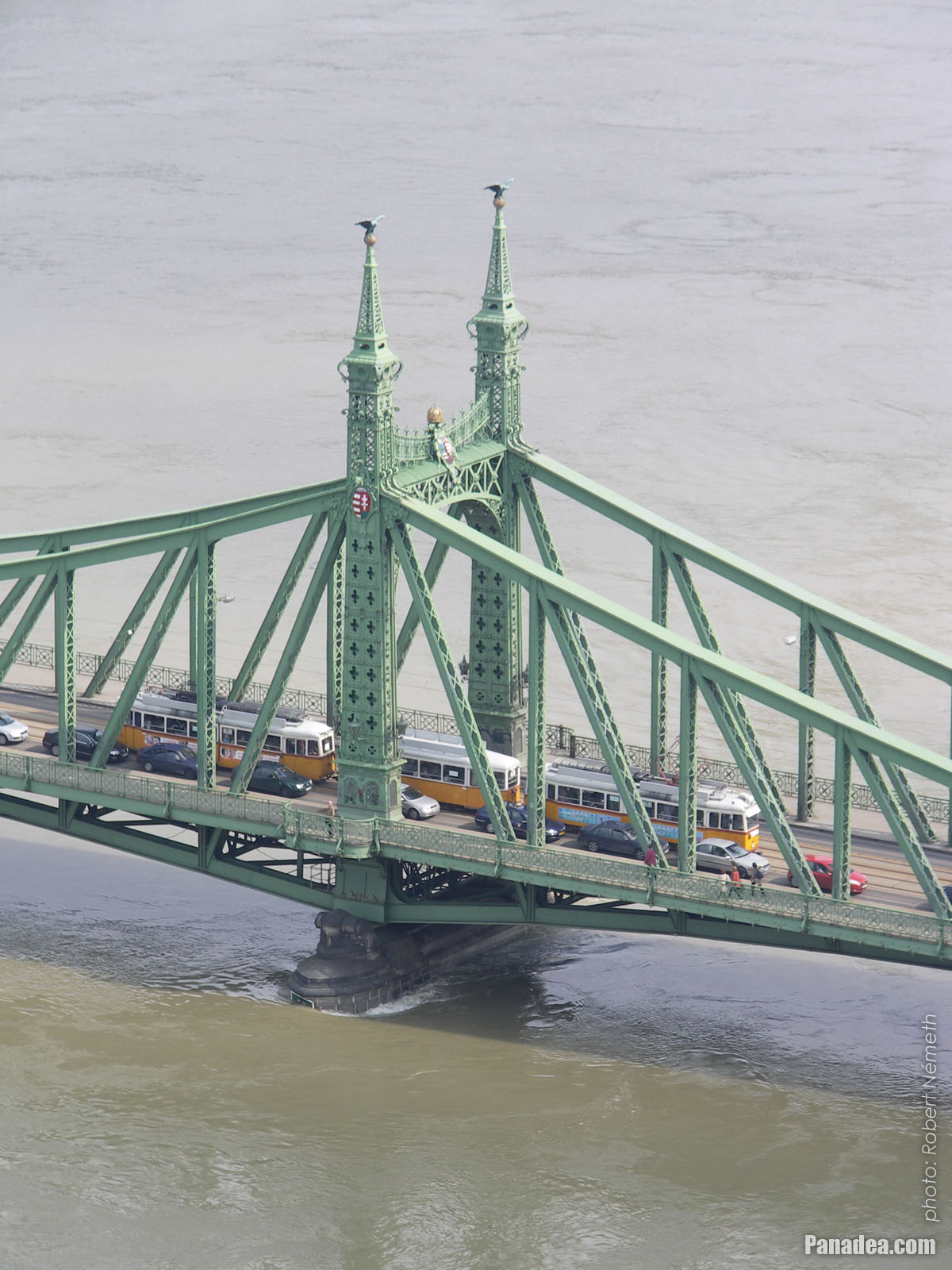
A tower (pylon) of the Liberty Bridge ("Szabadság híd") with the bronze sculpture of a falcon-like turul bird, as well as the Libery Statue on the Gellért Hill (in the distance)
Дата фотографии: 20132013
Создано: Роберт Немет
Модель камеры: Konica Minolta Dimage A200
Будапешт, Венгрия
A tower (pylon) of the Liberty Bridge ("Szabadság híd") with the bronze sculpture of a falcon-like turul bird, as well as the Libery Statue on the Gellért Hill (in the distance) - Будапешт, Венгрия -
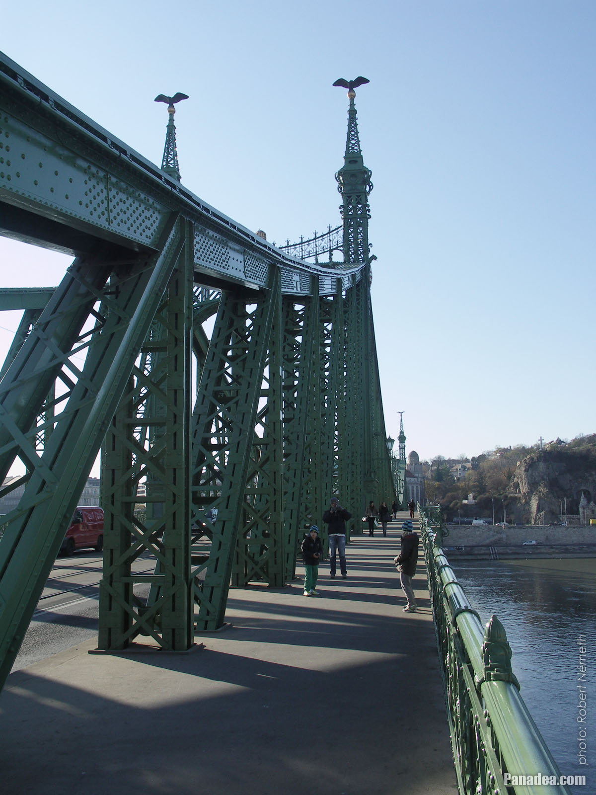
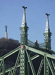
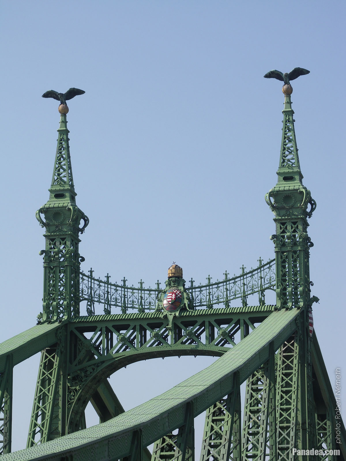
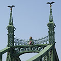
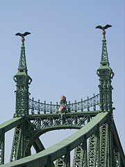
One of the towers (pylons) of the Liberty Bridge ("Szabadság híd") with two turul bird sculptures on its top, and the Liberty Statue on the Gellért Hill in the background
Дата фотографии: 20132013
Создано: Роберт Немет
Модель камеры: Konica Minolta Dimage A200
Будапешт, Венгрия
One of the towers (pylons) of the Liberty Bridge ("Szabadság híd") with two turul bird sculptures on its top, and the Liberty Statue on the Gellért Hill in the background - Будапешт, Венгрия -
The Pest-side lower embankment, as well as the Liberty Bridge ("Szabadság híd") over River Danube
Дата фотографии: 20132013
Создано: Роберт Немет
Модель камеры: Konica Minolta Dimage A200
Будапешт, Венгрия
The Pest-side lower embankment, as well as the Liberty Bridge ("Szabadság híd") over River Danube - Будапешт, Венгрия -
The Liberty Bridge ("Szabadság híd") over the river
Дата фотографии: 20132013
Создано: Роберт Немет
Модель камеры: Konica Minolta Dimage A200
Будапешт, Венгрия
The Liberty Bridge ("Szabadság híd") over the river - Будапешт, Венгрия -
Liberty Bridge ("Szabadság híd", formerly "Ferencz József híd", "Fővám téri híd") over River Danube
Дата фотографии: 20062006
Создано: Роберт Немет
Модель камеры: Konica Minolta Dimage A200
Будапешт, Венгрия
Liberty Bridge ("Szabadság híd", formerly "Ferencz József híd", "Fővám téri híd") over River Danube - Будапешт, Венгрия -
Liberty Bridge (in Hungarian "Szabadság híd"), as well as the Gellért Hotel and Gellért Bath in the distance
Дата фотографии: 20062006
Создано: Роберт Немет
Модель камеры: Konica Minolta Dimage A200
Будапешт, Венгрия
Liberty Bridge (in Hungarian "Szabadság híd"), as well as the Gellért Hotel and Gellért Bath in the distance - Будапешт, Венгрия -
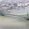
Liberty Bridge ("Szabadság híd") over the flooded Danube, viewed from Gellért Hill
Дата фотографии: 20062006
Создано: Роберт Немет
Модель камеры: Konica Minolta Dimage A200
Будапешт, Венгрия
Liberty Bridge ("Szabadság híd") over the flooded Danube, viewed from Gellért Hill - Будапешт, Венгрия -
The Liberty Bridge ("Szabadság híd") and the flooding River Danube from Gellért Hill
Дата фотографии: 20062006
Создано: Роберт Немет
Модель камеры: Konica Minolta Dimage A200
Будапешт, Венгрия
The Liberty Bridge ("Szabadság híd") and the flooding River Danube from Gellért Hill - Будапешт, Венгрия -
Coat of arms of Hungary and sculptures of turul birds on the pylon (tower) of the Liberty Bridge or "Szabadság híd"
Дата фотографии: 20062006
Создано: Роберт Немет
Модель камеры: Konica Minolta Dimage A200
Будапешт, Венгрия
Coat of arms of Hungary and sculptures of turul birds on the pylon (tower) of the Liberty Bridge or "Szabadság híd" - Будапешт, Венгрия -
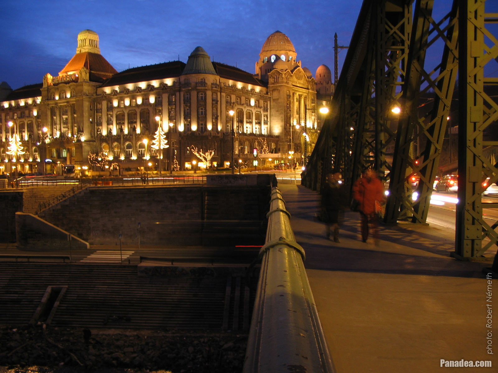
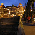
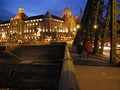
The view of the Buda-side embankment and the Hotel Gellért from the Liberty Bridge in the evening
Дата фотографии: 20042004
Создано: Роберт Немет
Модель камеры: Canon PowerShot A85
Будапешт, Венгрия
The view of the Buda-side embankment and the Hotel Gellért from the Liberty Bridge in the evening - Будапешт, Венгрия


Нажмите на изображении!
Характеристики, особенности
Расположение:
GPS координаты: Широта 47°29'8", Долгота 19°3'17" (N47 29.13 - E19 3.28)
Информация, короткие рассказы, интересности
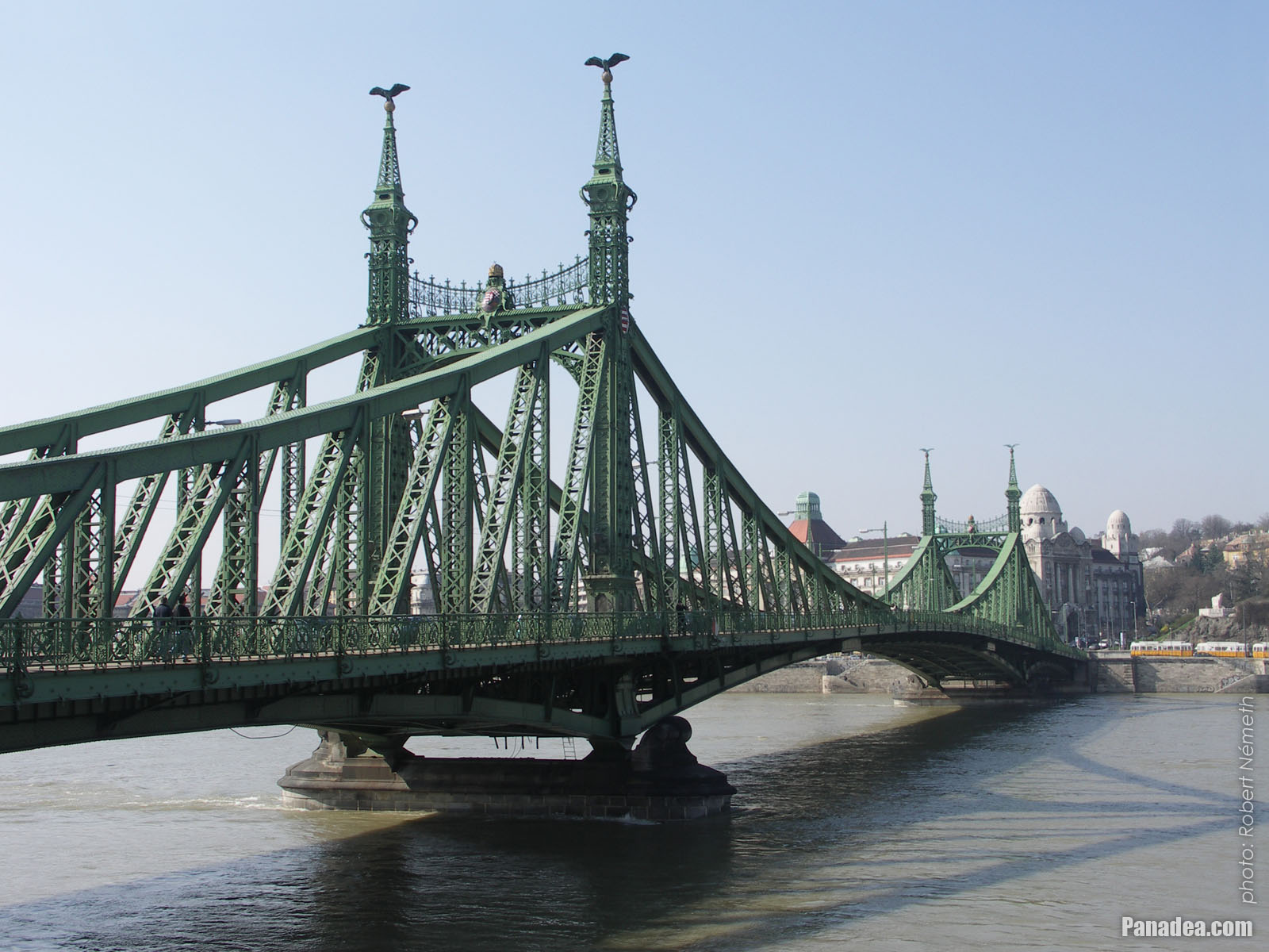 Liberty Bridge ("Szabadság híd", formerly "Ferencz József híd", "Fővám téri híd") over River Danube
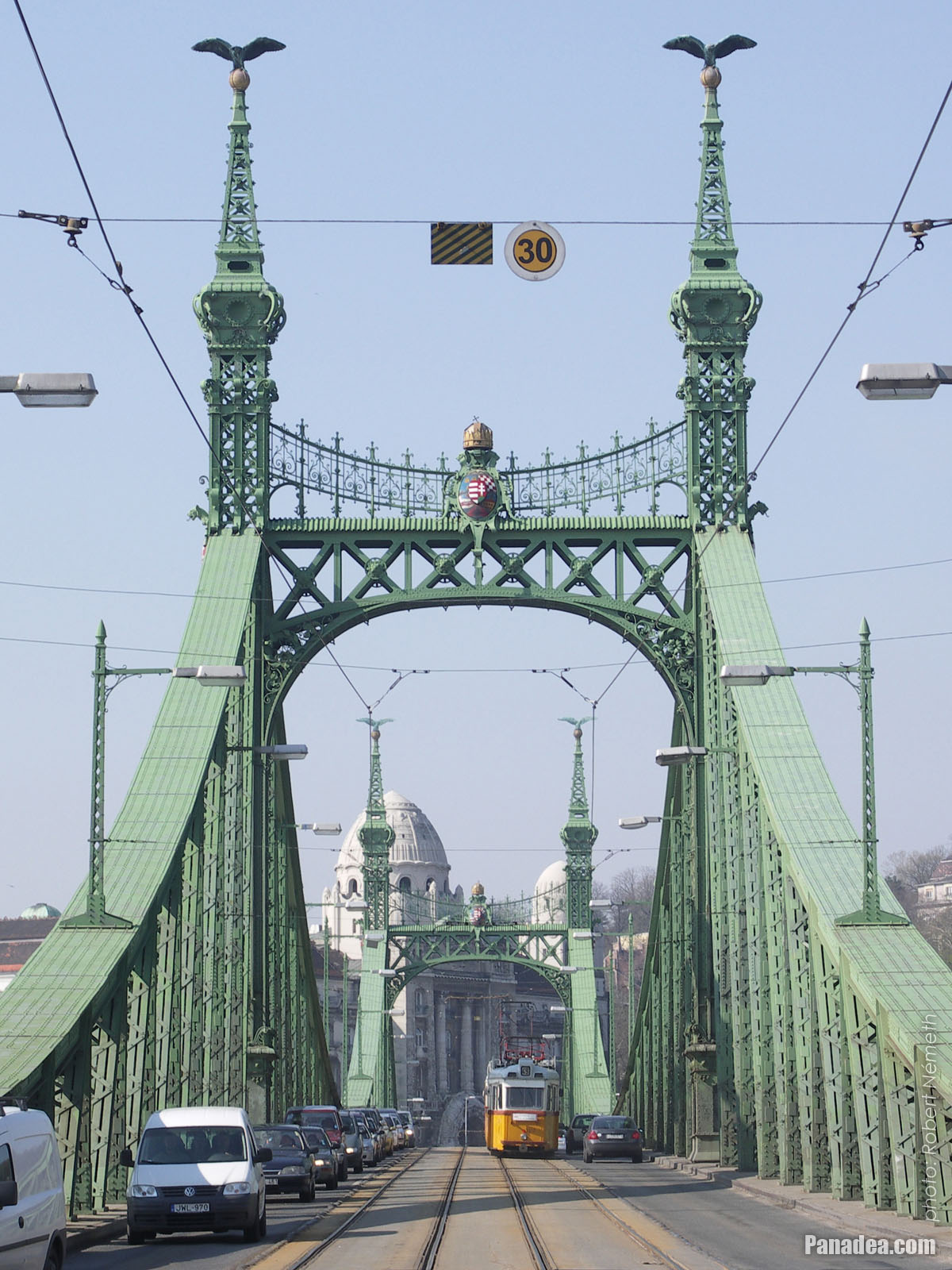
The Liberty Bridge or Freedom Bridge (also known as Freedom Bridge, in Hungarian "Szabadság híd") or as it was called initially the Franz Joseph Bridge ("Ferencz József híd") was designed by János Feketeházy, it was opened in the year of the Hungarian Millenium in 1896. This was the third permanent road crossing over the Danube in Budapest. Even then the bridge already had tram tracks, as well as electric and gas lighting.
The first tram went throught the Liberty Bridge ("Szabadság híd") in 1898. At that time the tham tracks were on the sides of the bridge deck, and the tram used a conduit current collection system (the electric wires were on the ground) to get the power. The tram line was converted to overhead wire system in 1923, and from 1928 also the bus traffic was started on the bridge. Then in 1938 the rails were moved to the middle of the road, as it can be seen today.
Another characteristics of the Szabadság Bridge or Liberty Bridge are the statues of turul birds with outstretched wings on the top of the pylon gates that were designed by Virgil Nagy, as well as the historical Hungarian coat of arms on the gateways (all of them were made in 1896).
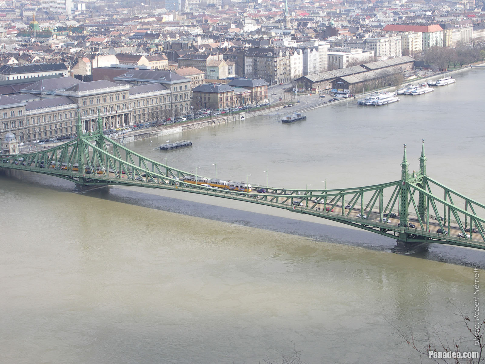 Liberty Bridge ("Szabadság híd") over the flooded Danube, viewed from Gellért Hill
The Liberty Bridge (or Freedom Bridge, in Hungarian "Szabadság híd") is the shortest among the Danube bridges of Budapest. Before the World War II it was called Franz Joseph Bridge or Fővám Square Bridge ("Ferenc József híd" or "Fővám téri híd").
At the end of the World War II the bridge was blown up by the retreating German troops, like every other Danube bridge of Budapest. But the piers (more precisely the pylons) were remained intact and also the reparation of the middle section could be done relatively quickly. The reconstruction was done soon by the plans of Pál Sávoly architect, in 1946 it was already opened for service and then got its new name: "Szabadság híd" (in English "Liberty Bridge" or "Freedom Bridge").
Будапешт - Другие галереи фото:
Вы также можете быть заинтересованы в (Связанные страницы):
Места назначения в путеводителе:
Будапешт (8 468 фотографии + 21 панорамные снимки)
Buda Hills (Budai-hegység) (8 632 фотографии + 21 панорамные снимки)
Пешт медье (15 122 фотографии + 50 панорамные снимки)
Будапешт и его окрестности (15 989 фотографии + 52 панорамные снимки)
Венгрия (27 287 фотографии + 163 панорамные снимки)
и кроме того:
(в здесь: Buda Hills)
Budakeszi (88 фотографии)
Pilisszentiván (76 фотографии)
Каждая панорама фото здесь:
Будапешт (21 фотографии)
Пешт медье (50 фотографии)
Будапешт и его окрестности (52 фотографии)
Венгрия (163 фотографии)
Европа (165 фотографии)
Все нормальные фотографии здесь:
Будапешт (8 468 фотографии / 122 галереи)
Buda Hills (Budai-hegység) (8 632 фотографии / 124 галереи)
Пешт медье (15 122 фотографии / 221 галереи)
Будапешт и его окрестности (15 989 фотографии / 234 галереи)
Венгрия (27 287 фотографии / 462 галереи)
Европа (30 494 фотографии / 523 галереи)
https://www.panadea.com/ru/guidebook/budapesht/photos/gal-014

Добавить в Избранное Добавь в Закладки
Поделитесь с вашими друзьями!
и т.д.


Наш путеводитель содержит:
Многочисленные фотографии и панорамные изображения, с большим количеством информации и интересных фактов.
- 214 места назначения
- 165 панорамные снимки
- 30 494 другие фотографии
Большая коллекция отобранных фотографий: превосходное качество, высокое разрешение и естественные цвета
О нас - Юридическая декларация -
Все права защищены
- ©2010-2022
Neuronit Creative Studio - Mogyoród / Будапешт / Венгрия