
(작은 화면 장치에 최적화)
Újpest, miscellaneous photos - 부다페스트, 헝가리
클릭 한 후:
그림을 클릭
-

Yellow tram 14 in front of the bilingual secondary school
날짜를 촬영: 2014년 04월 30일2014
에 의해 만들어: Robert Németh
카메라 모델: Konica Minolta Dimage A200
부다페스트, 헝가리
-

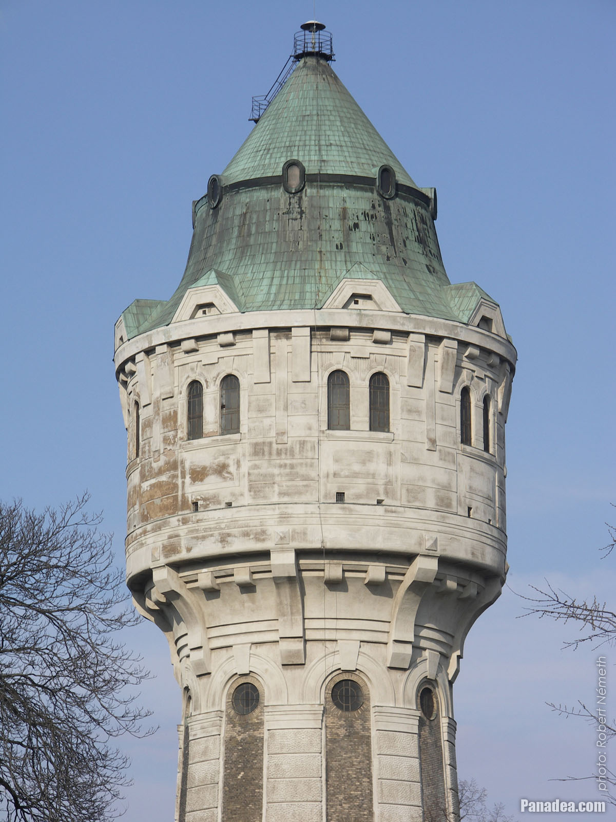
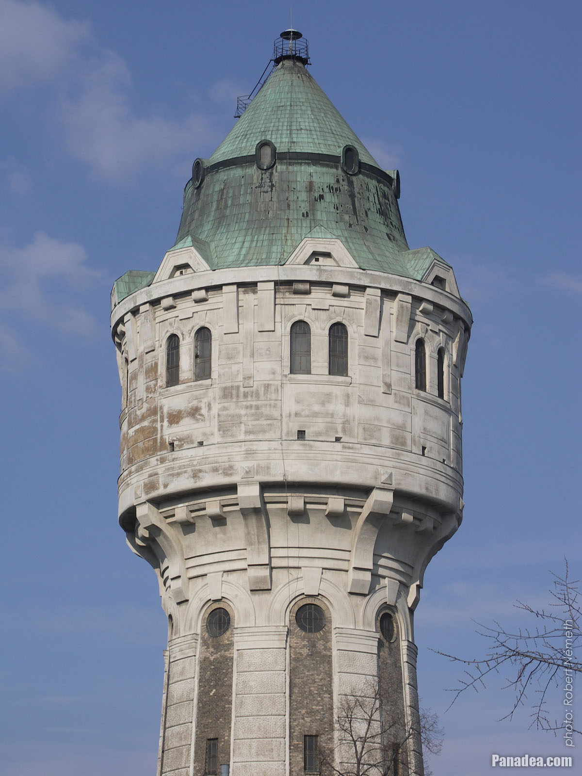
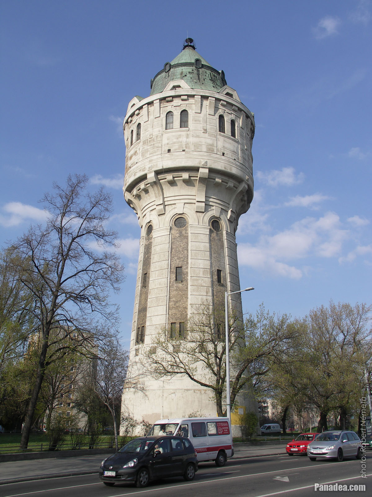
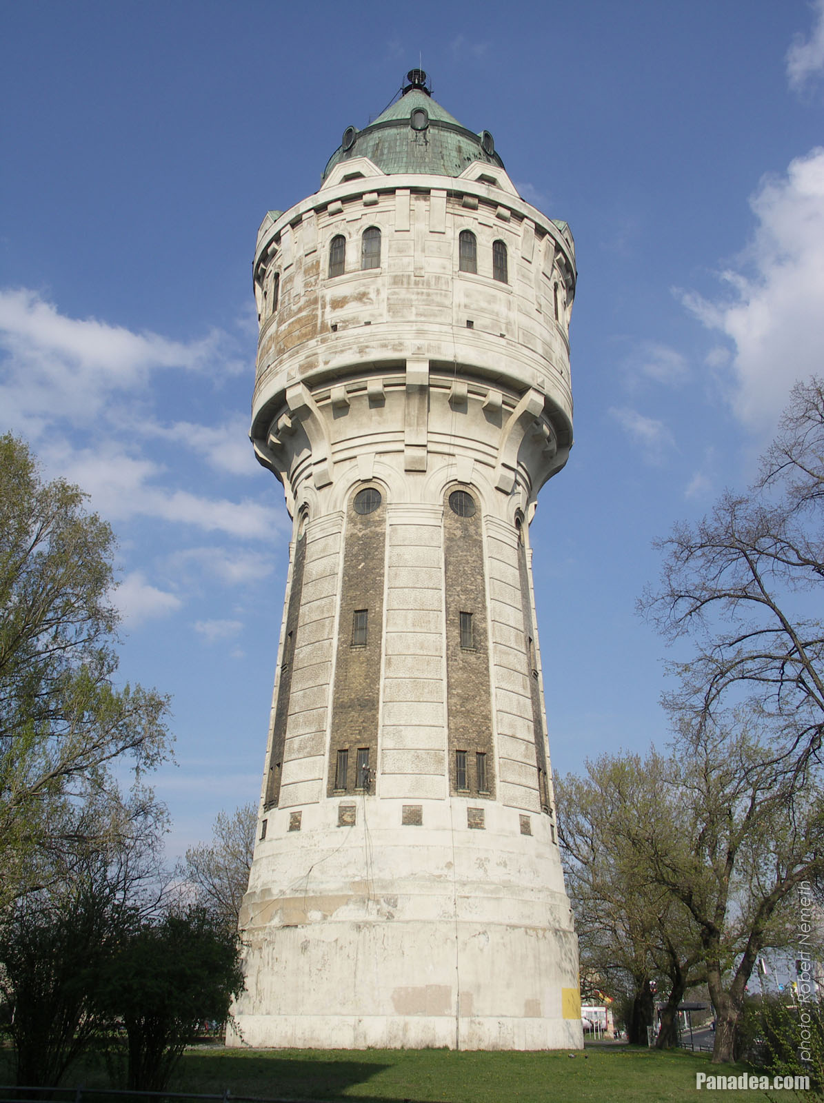
Water Tower of Újpest
날짜를 촬영: 20082008
에 의해 만들어: Robert Németh
카메라 모델: Konica Minolta Dimage A200
부다페스트, 헝가리
-

Könyves Kálmán High School
날짜를 촬영: 20132013
에 의해 만들어: Robert Németh
카메라 모델: Konica Minolta Dimage A200
부다페스트, 헝가리
-

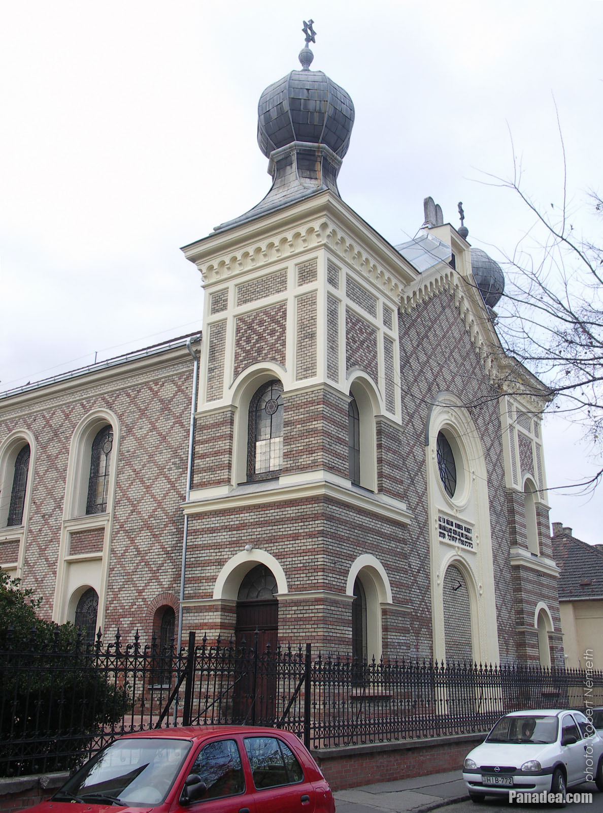
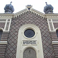
Ujpest Synagogue
This Neolog synagogue (Jewish house of prayer) was constructed between 1885-1886, designed probably by Jakob Gärtner.
날짜를 촬영: 2014년 11월 15일2014
에 의해 만들어: Robert Németh
카메라 모델: Konica Minolta Dimage A200
부다페스트, 헝가리
-
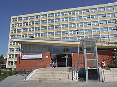
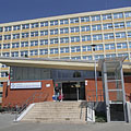
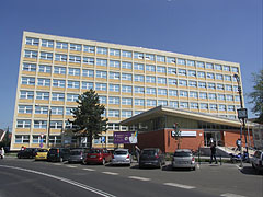
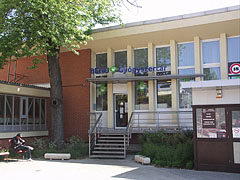
Polyclinic (outpatient specialist medical clinic) of Újpest
날짜를 촬영: 2014년 04월 30일2014
에 의해 만들어: Robert Németh
카메라 모델: Konica Minolta Dimage A200
부다페스트, 헝가리
-

Water Tower of Újpest
날짜를 촬영: 20082008
에 의해 만들어: Robert Németh
카메라 모델: Konica Minolta Dimage A200
부다페스트, 헝가리
-
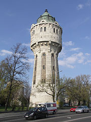
The 57-meter-high Water Tower is one of the symbols of Újpest District
날짜를 촬영: 20082008
에 의해 만들어: Robert Németh
카메라 모델: Konica Minolta Dimage A200
부다페스트, 헝가리
-

The Water Tower is now a listed building, it was built in 1912
날짜를 촬영: 20082008
에 의해 만들어: Robert Németh
카메라 모델: Konica Minolta Dimage A200
부다페스트, 헝가리
-

Unique rolling cloud-front is coming behind the Water Tower of Újpest
날짜를 촬영: 20042004
에 의해 만들어: Robert Németh
카메라 모델: Canon PowerShot A85
부다페스트, 헝가리
-

Könyves Kálmán High School
날짜를 촬영: 20132013
에 의해 만들어: Robert Németh
카메라 모델: Konica Minolta Dimage A200
부다페스트, 헝가리
-
Könyves Kálmán High School
날짜를 촬영: 20132013
에 의해 만들어: Robert Németh
카메라 모델: Konica Minolta Dimage A200
부다페스트, 헝가리
Könyves Kálmán High School - 부다페스트, 헝가리 -
Residental buildings and parking cars
날짜를 촬영: 20132013
에 의해 만들어: Robert Németh
카메라 모델: Konica Minolta Dimage A200
부다페스트, 헝가리
Residental buildings and parking cars - 부다페스트, 헝가리 -
Another residental building
날짜를 촬영: 20132013
에 의해 만들어: Robert Németh
카메라 모델: Konica Minolta Dimage A200
부다페스트, 헝가리
Another residental building - 부다페스트, 헝가리 -
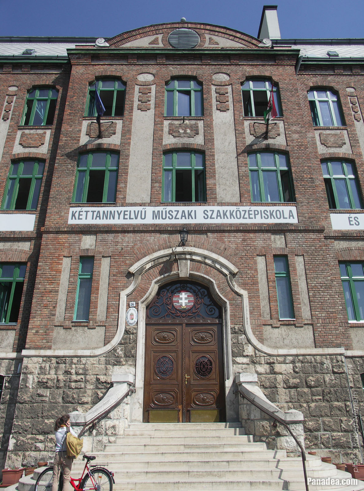
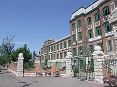
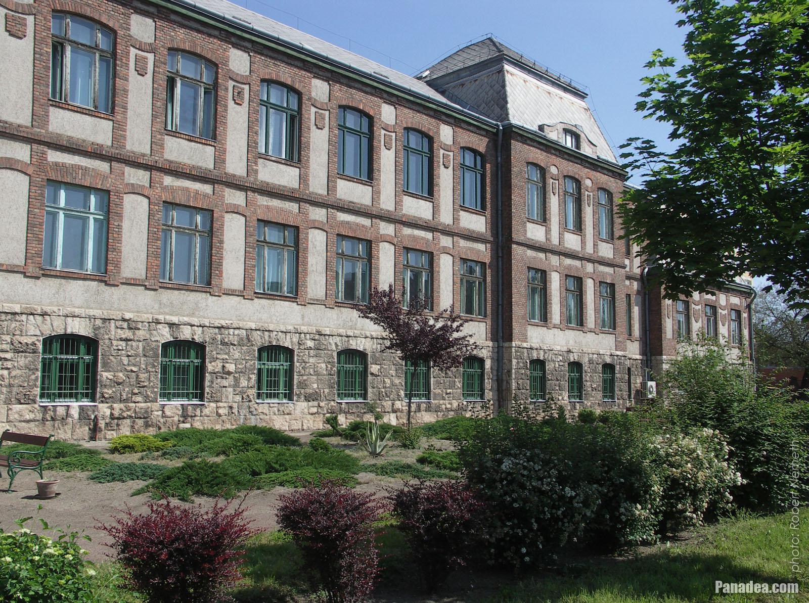
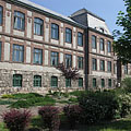
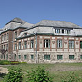
Bilingual Secondary Technical School of Újpest ("Újpesti Két Tanítási Nyelvű Műszaki Szakközépiskola, Szakiskola és Gimnázium")
날짜를 촬영: 2014년 04월 30일2014
에 의해 만들어: Robert Németh
카메라 모델: Konica Minolta Dimage A200
부다페스트, 헝가리
Bilingual Secondary Technical School of Újpest ("Újpesti Két Tanítási Nyelvű Műszaki Szakközépiskola, Szakiskola és Gimnázium") - 부다페스트, 헝가리 -
Bilingual Secondary Technical School of Újpest
The impressive school-palace was designed by Ernő Foerk architect, built in 1927.
날짜를 촬영: 2014년 04월 30일2014
에 의해 만들어: Robert Németh
카메라 모델: Konica Minolta Dimage A200
부다페스트, 헝가리
Bilingual Secondary Technical School of Újpest - 부다페스트, 헝가리 -
Bilingual Secondary Technical School
The predecessor of current school was the first vocational school of wood industry, it was established in 1895.
날짜를 촬영: 2014년 04월 30일2014
에 의해 만들어: Robert Németh
카메라 모델: Konica Minolta Dimage A200
부다페스트, 헝가리
Bilingual Secondary Technical School - 부다페스트, 헝가리 -
The entrance of the Bilingual Secondary Technical School
날짜를 촬영: 2014년 04월 30일2014
에 의해 만들어: Robert Németh
카메라 모델: Konica Minolta Dimage A200
부다페스트, 헝가리
The entrance of the Bilingual Secondary Technical School - 부다페스트, 헝가리 -
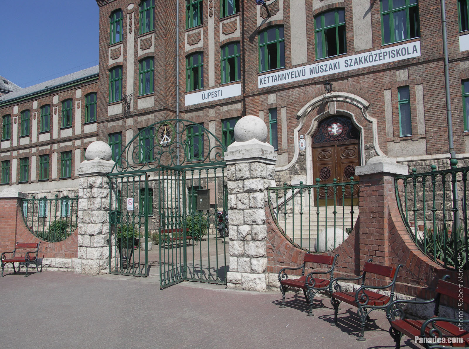
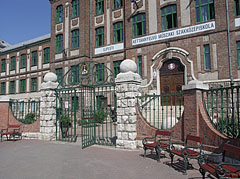
The gate of the Bilingual Secondary Technical School with benches in front of it
날짜를 촬영: 2014년 04월 30일2014
에 의해 만들어: Robert Németh
카메라 모델: Konica Minolta Dimage A200
부다페스트, 헝가리
The gate of the Bilingual Secondary Technical School with benches in front of it - 부다페스트, 헝가리 -
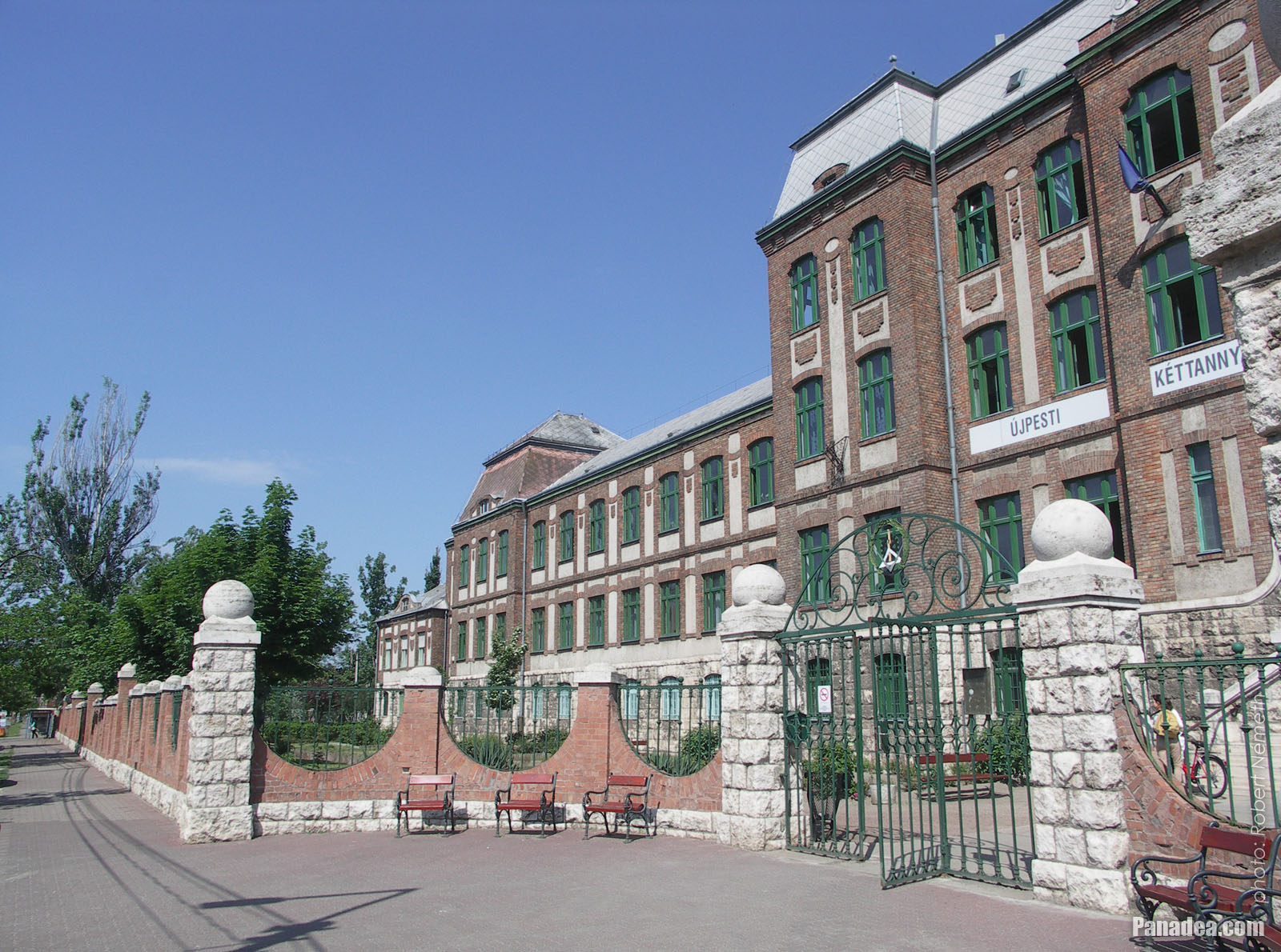
The Görgey Artúr Road at the former vocational school of wood industry
날짜를 촬영: 2014년 04월 30일2014
에 의해 만들어: Robert Németh
카메라 모델: Konica Minolta Dimage A200
부다페스트, 헝가리
The Görgey Artúr Road at the former vocational school of wood industry - 부다페스트, 헝가리 -
Bilingual Secondary Technical School, Vocational School and High School of Újpest
날짜를 촬영: 2014년 04월 30일2014
에 의해 만들어: Robert Németh
카메라 모델: Konica Minolta Dimage A200
부다페스트, 헝가리
Bilingual Secondary Technical School, Vocational School and High School of Újpest - 부다페스트, 헝가리 -
Bilingual Secondary Technical School, Vocational School and High School of Újpest
날짜를 촬영: 2014년 04월 30일2014
에 의해 만들어: Robert Németh
카메라 모델: Konica Minolta Dimage A200
부다페스트, 헝가리
Bilingual Secondary Technical School, Vocational School and High School of Újpest - 부다페스트, 헝가리 -
The gorgeous palace of the Bilingual Secondary Technical School of Újpest ("Kéttannyelvű Műszaki Szakközépiskola és Gimnázium")
Built in 1927
날짜를 촬영: 2014년 04월 30일2014
에 의해 만들어: Robert Németh
카메라 모델: Konica Minolta Dimage A200
부다페스트, 헝가리
The gorgeous palace of the Bilingual Secondary Technical School of Újpest ("Kéttannyelvű Műszaki Szakközépiskola és Gimnázium") - 부다페스트, 헝가리 -
Polyclinic (outpatient specialist medical clinic) of Újpest
날짜를 촬영: 2014년 04월 30일2014
에 의해 만들어: Robert Németh
카메라 모델: Konica Minolta Dimage A200
부다페스트, 헝가리
Polyclinic (outpatient specialist medical clinic) of Újpest - 부다페스트, 헝가리 -
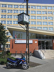
Street clock in front of the Újpest Polyclinic (outpatient specialist medical clinic)
날짜를 촬영: 2014년 04월 30일2014
에 의해 만들어: Robert Németh
카메라 모델: Konica Minolta Dimage A200
부다페스트, 헝가리
Street clock in front of the Újpest Polyclinic (outpatient specialist medical clinic) - 부다페스트, 헝가리 -
The "BENU" Pharmacy near the polyclinic
Somewhat ironically there is a so-called National Tobacco Shop ("Nemzeti Dohánybolt") right next to the pharmacy.
날짜를 촬영: 2014년 04월 30일2014
에 의해 만들어: Robert Németh
카메라 모델: Konica Minolta Dimage A200
부다페스트, 헝가리
The "BENU" Pharmacy near the polyclinic - 부다페스트, 헝가리 -
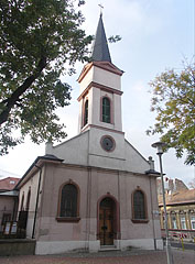
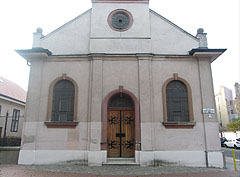
The modern renaissance style Lutheran (Evangelical) Church of Újpest
Its construction works were begun in 1874, but it was fully completed in 1911.
날짜를 촬영: 2014년 11월 15일2014
에 의해 만들어: Robert Németh
카메라 모델: Konica Minolta Dimage A200
부다페스트, 헝가리
The modern renaissance style Lutheran (Evangelical) Church of Újpest - 부다페스트, 헝가리 -
Evangelical Lutheran Church of Ujpest
Initially it had just an iron tower due to the lack of money.
날짜를 촬영: 2014년 11월 15일2014
에 의해 만들어: Robert Németh
카메라 모델: Konica Minolta Dimage A200
부다페스트, 헝가리
Evangelical Lutheran Church of Ujpest - 부다페스트, 헝가리 -
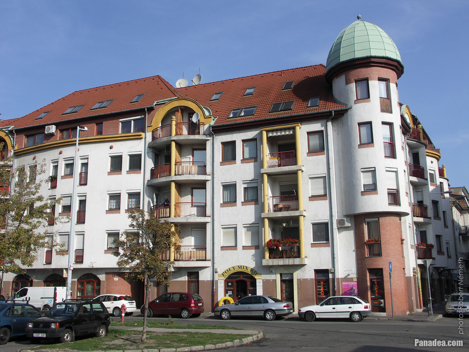
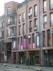
New modern apartment building
날짜를 촬영: 2014년 11월 15일2014
에 의해 만들어: Robert Németh
카메라 모델: Konica Minolta Dimage A200
부다페스트, 헝가리
New modern apartment building - 부다페스트, 헝가리 -
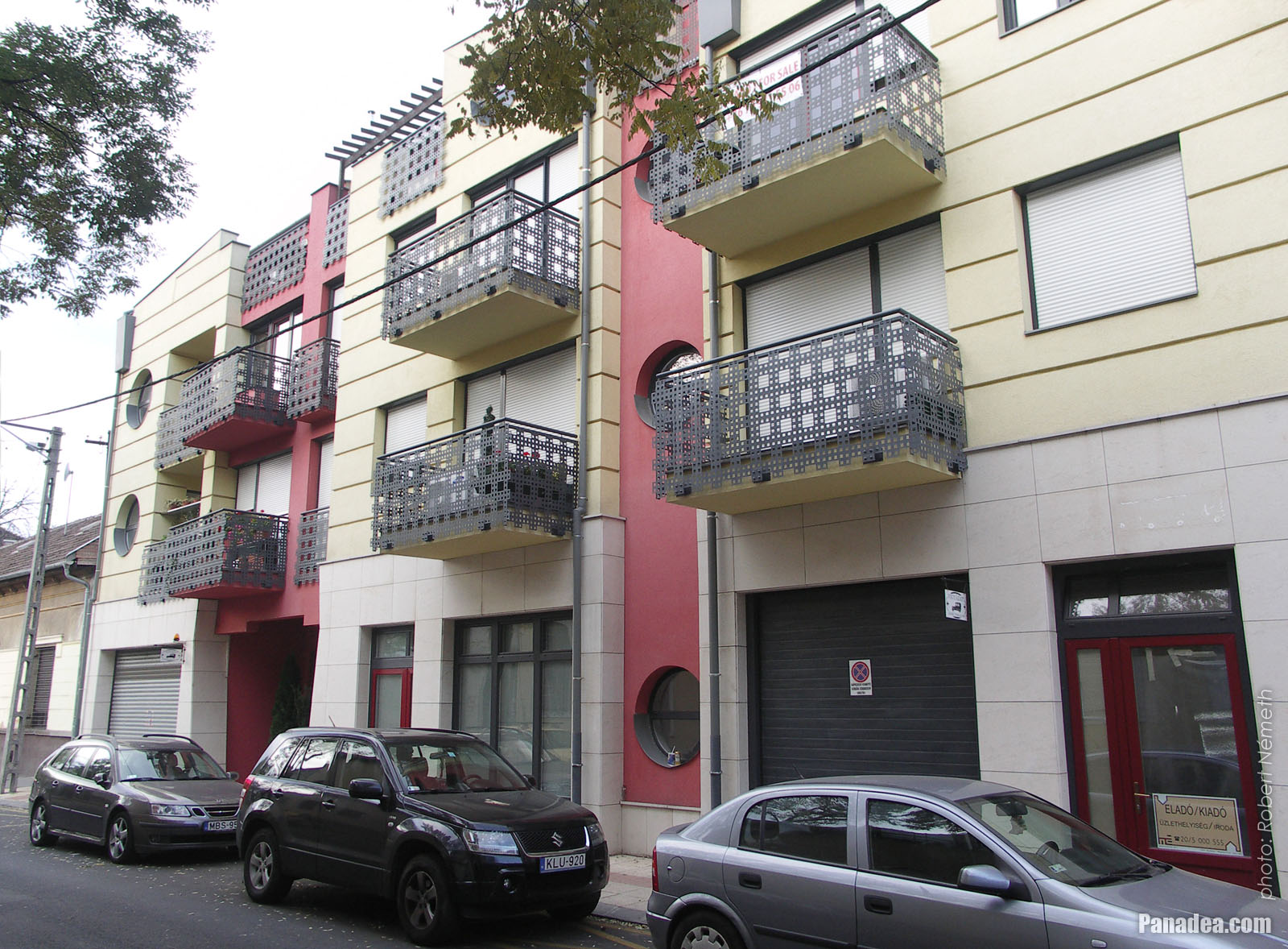
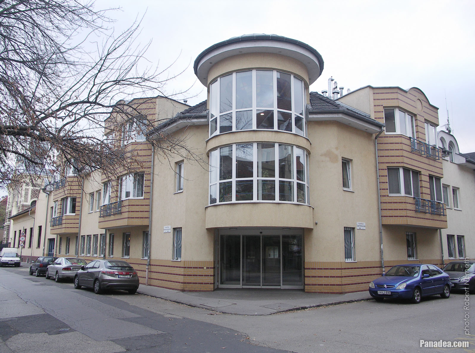
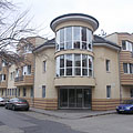
Newer apartment building with circular windows and interesting balconies
날짜를 촬영: 2014년 11월 15일2014
에 의해 만들어: Robert Németh
카메라 모델: Konica Minolta Dimage A200
부다페스트, 헝가리
Newer apartment building with circular windows and interesting balconies - 부다페스트, 헝가리 -
Newer residental building
날짜를 촬영: 2014년 11월 15일2014
에 의해 만들어: Robert Németh
카메라 모델: Konica Minolta Dimage A200
부다페스트, 헝가리
Newer residental building - 부다페스트, 헝가리 -
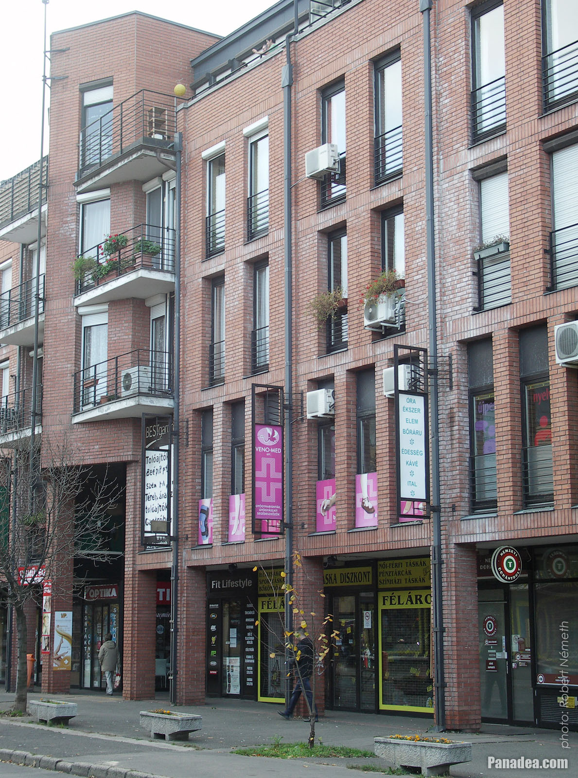
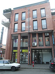
Red brick building with flats and shop premises
날짜를 촬영: 2014년 11월 15일2014
에 의해 만들어: Robert Németh
카메라 모델: Konica Minolta Dimage A200
부다페스트, 헝가리
Red brick building with flats and shop premises - 부다페스트, 헝가리 -
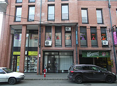
Shop premises in a newer residental building
날짜를 촬영: 2014년 11월 15일2014
에 의해 만들어: Robert Németh
카메라 모델: Konica Minolta Dimage A200
부다페스트, 헝가리
Shop premises in a newer residental building - 부다페스트, 헝가리 -
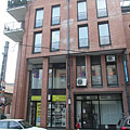
Four-storey new apartment building with shops on its ground florr
날짜를 촬영: 2014년 11월 15일2014
에 의해 만들어: Robert Németh
카메라 모델: Konica Minolta Dimage A200
부다페스트, 헝가리
Four-storey new apartment building with shops on its ground florr - 부다페스트, 헝가리 -
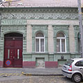
Pale green painted older dwelling house
날짜를 촬영: 2014년 11월 15일2014
에 의해 만들어: Robert Németh
카메라 모델: Konica Minolta Dimage A200
부다페스트, 헝가리
Pale green painted older dwelling house - 부다페스트, 헝가리 -
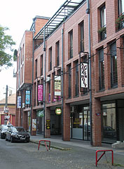
Multi-storey newer block of flats with shops
날짜를 촬영: 2014년 11월 15일2014
에 의해 만들어: Robert Németh
카메라 모델: Konica Minolta Dimage A200
부다페스트, 헝가리
Multi-storey newer block of flats with shops - 부다페스트, 헝가리 -
This building seems to be a cozy three-story block of flats
날짜를 촬영: 2014년 11월 15일2014
에 의해 만들어: Robert Németh
카메라 모델: Konica Minolta Dimage A200
부다페스트, 헝가리
This building seems to be a cozy three-story block of flats - 부다페스트, 헝가리 -
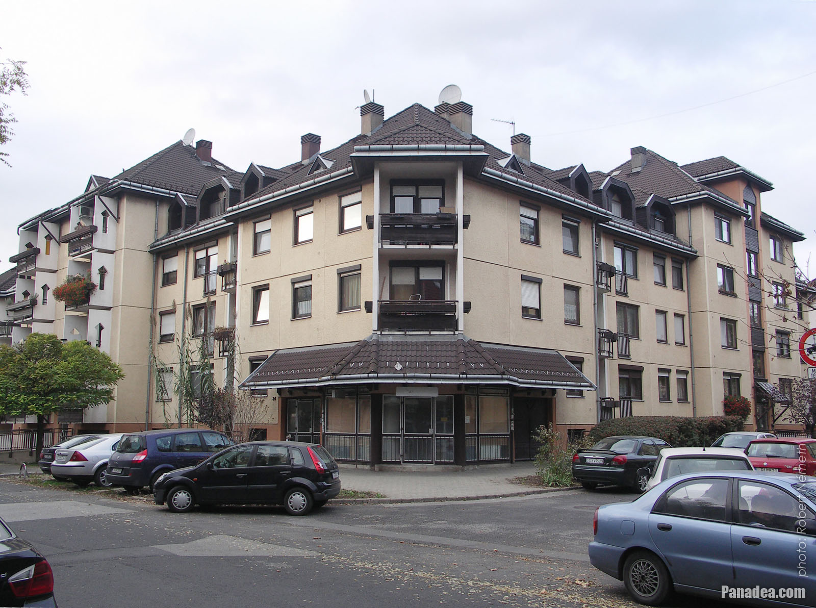
All kinds of apartment houses
날짜를 촬영: 2014년 11월 15일2014
에 의해 만들어: Robert Németh
카메라 모델: Konica Minolta Dimage A200
부다페스트, 헝가리
All kinds of apartment houses - 부다페스트, 헝가리 -
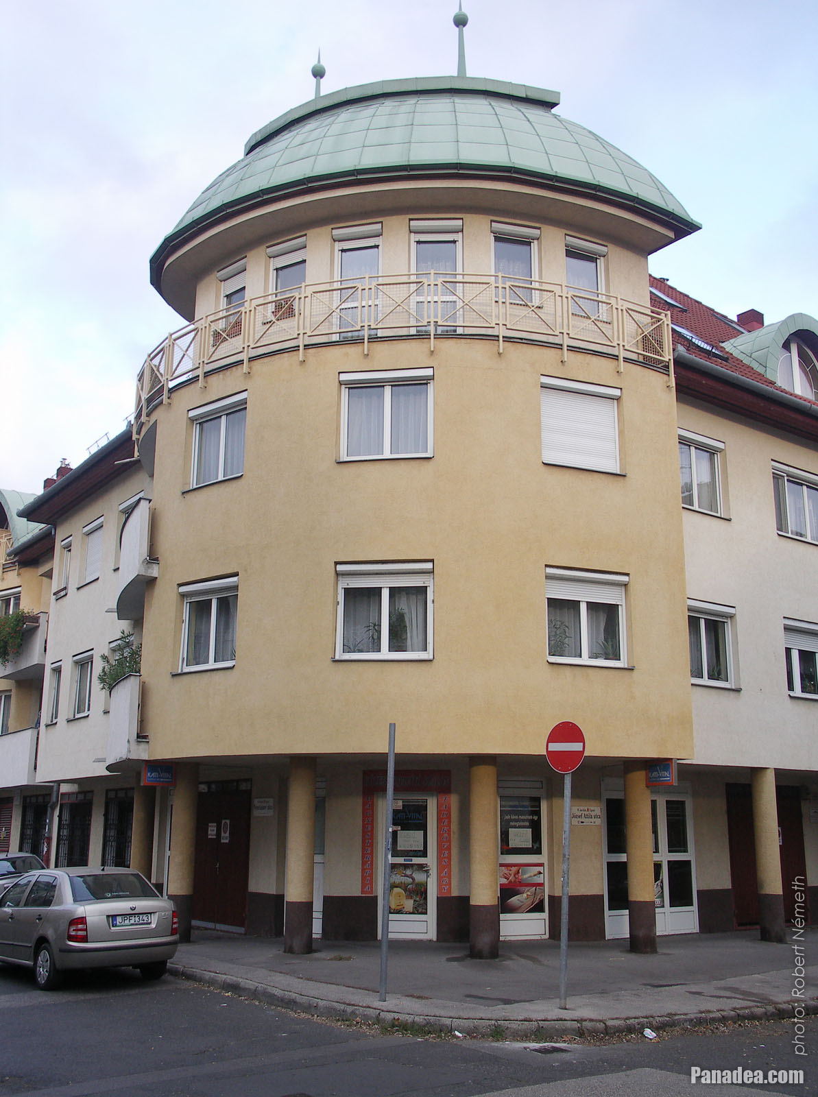
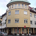
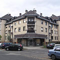
Rounded corner building
날짜를 촬영: 2014년 11월 15일2014
에 의해 만들어: Robert Németh
카메라 모델: Konica Minolta Dimage A200
부다페스트, 헝가리
Rounded corner building - 부다페스트, 헝가리 -
Three-story block of flats with additional apartments on the attic floor
날짜를 촬영: 2014년 11월 15일2014
에 의해 만들어: Robert Németh
카메라 모델: Konica Minolta Dimage A200
부다페스트, 헝가리
Three-story block of flats with additional apartments on the attic floor - 부다페스트, 헝가리 -
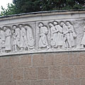
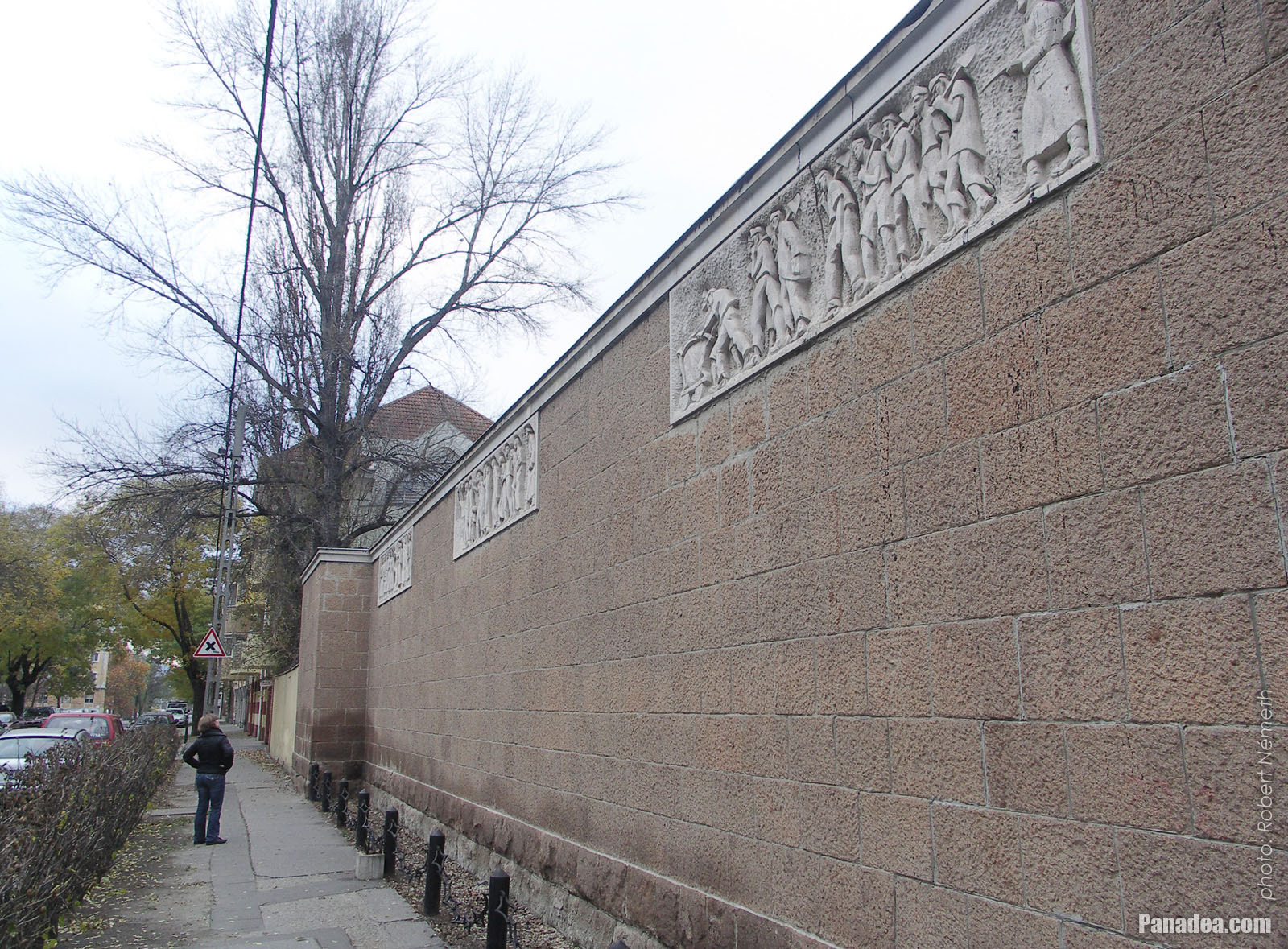
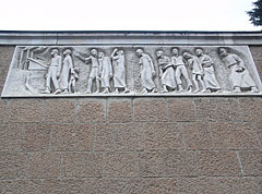
Limestone relief on the fence wall of the Újpest Synagogue (it is a Jewish martyrs' monument)
날짜를 촬영: 2014년 11월 15일2014
에 의해 만들어: Robert Németh
카메라 모델: Konica Minolta Dimage A200
부다페스트, 헝가리
Limestone relief on the fence wall of the Újpest Synagogue (it is a Jewish martyrs' monument) - 부다페스트, 헝가리 -
The neolog synagogue of Újpest
Considering the interior structure it is a three-nave hall with choirs on the sides.
날짜를 촬영: 2014년 11월 15일2014
에 의해 만들어: Robert Németh
카메라 모델: Konica Minolta Dimage A200
부다페스트, 헝가리
The neolog synagogue of Újpest - 부다페스트, 헝가리 -
The main facade of the Ujpest Synagogue
날짜를 촬영: 2014년 11월 15일2014
에 의해 만들어: Robert Németh
카메라 모델: Konica Minolta Dimage A200
부다페스트, 헝가리
The main facade of the Ujpest Synagogue - 부다페스트, 헝가리 -
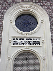
Újpest synagogue with an inscription on the main facade: "My house is the house of prayer of every nation"
날짜를 촬영: 2014년 11월 15일2014
에 의해 만들어: Robert Németh
카메라 모델: Konica Minolta Dimage A200
부다페스트, 헝가리
Újpest synagogue with an inscription on the main facade: "My house is the house of prayer of every nation" - 부다페스트, 헝가리 -
Synagogue of Újpest
The current church organ was brought here from the Kecskemét Synagogue, after the original one of the Újpest Synagoge was damaged in the world war.
날짜를 촬영: 2014년 11월 15일2014
에 의해 만들어: Robert Németh
카메라 모델: Konica Minolta Dimage A200
부다페스트, 헝가리
Synagogue of Újpest - 부다페스트, 헝가리 -
The garden of the Újpest Synagogue
날짜를 촬영: 2014년 11월 15일2014
에 의해 만들어: Robert Németh
카메라 모델: Konica Minolta Dimage A200
부다페스트, 헝가리
The garden of the Újpest Synagogue - 부다페스트, 헝가리 -
Újpest Synagogue
날짜를 촬영: 2014년 11월 15일2014
에 의해 만들어: Robert Németh
카메라 모델: Konica Minolta Dimage A200
부다페스트, 헝가리
Újpest Synagogue - 부다페스트, 헝가리 -
A limestone relief of the Jewish martyrs' memorial on the wall fence of the synagogue
Created by Edit Bán Kiss in 1947
날짜를 촬영: 2014년 11월 15일2014
에 의해 만들어: Robert Németh
카메라 모델: Konica Minolta Dimage A200
부다페스트, 헝가리
A limestone relief of the Jewish martyrs' memorial on the wall fence of the synagogue - 부다페스트, 헝가리 -
Memorial of the Jewish martyrs on the stone wall fence of the synagogue
Created by Edit Bán Kiss in 1947
날짜를 촬영: 2014년 11월 15일2014
에 의해 만들어: Robert Németh
카메라 모델: Konica Minolta Dimage A200
부다페스트, 헝가리
Memorial of the Jewish martyrs on the stone wall fence of the synagogue - 부다페스트, 헝가리 -
Monument of the Jewish martyrs on the stone fence of the synagogue (a World War II Holocaust memorial)
Created by Edit Bán Kiss in 1947
날짜를 촬영: 2014년 11월 15일2014
에 의해 만들어: Robert Németh
카메라 모델: Konica Minolta Dimage A200
부다페스트, 헝가리
Monument of the Jewish martyrs on the stone fence of the synagogue (a World War II Holocaust memorial) - 부다페스트, 헝가리 -
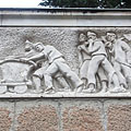
Jewish martyrs' monument on the fence wall of the synagogue, detail of one of the limestone reliefs
Created by Edit Bán Kiss in 1947
날짜를 촬영: 2014년 11월 15일2014
에 의해 만들어: Robert Németh
카메라 모델: Konica Minolta Dimage A200
부다페스트, 헝가리
Jewish martyrs' monument on the fence wall of the synagogue, detail of one of the limestone reliefs - 부다페스트, 헝가리 -
Memorial of the Jewish martyrs on the fence wall of the synagogue, detail of a limestone relief
Created by Edit Bán Kiss in 1947
날짜를 촬영: 2014년 11월 15일2014
에 의해 만들어: Robert Németh
카메라 모델: Konica Minolta Dimage A200
부다페스트, 헝가리
Memorial of the Jewish martyrs on the fence wall of the synagogue, detail of a limestone relief - 부다페스트, 헝가리 -
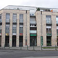
A newer multi-unit residential building
날짜를 촬영: 2014년 11월 15일2014
에 의해 만들어: Robert Németh
카메라 모델: Konica Minolta Dimage A200
부다페스트, 헝가리
A newer multi-unit residential building - 부다페스트, 헝가리 -
Balcony on an older dwelling house
날짜를 촬영: 2014년 11월 15일2014
에 의해 만들어: Robert Németh
카메라 모델: Konica Minolta Dimage A200
부다페스트, 헝가리
Balcony on an older dwelling house - 부다페스트, 헝가리 -
Older residental building
날짜를 촬영: 2014년 11월 15일2014
에 의해 만들어: Robert Németh
카메라 모델: Konica Minolta Dimage A200
부다페스트, 헝가리
Older residental building - 부다페스트, 헝가리


그림을 클릭
특성, 특징
위치:
GPS 좌표: 위도 47°33'39", 경도 19°5'37" (N47 33.65 - E19 5.62)
정보, 짧은 이야기, 흥미로운 사실들
 The Water Tower is now a listed building, it was built in 1912
The water level of the Újpest Water Tower is 40 meters above the nearby Árpád Road, as well as 54 meters above the "0" level of the River Danube at Budapest. The total of 1500 cubic meters of capacity is practically enough to support even a complete settlement with population of 100,000 persons (at 150 liters/day/person water demand). The water was taken from the wells of the Népsziget ("People's Island"). Right until 2003 the tower provided the water for the surrounding factories as well, but since then it is not operating and now it is an industrial monument.
 Water Tower of Újpest
The water tower in Újpest was designed by dr. Győző Mihailich and Ödön Dümmerling, the brick and ferro-concrete building was completed in 1912. If the resistance groups wouldn't prevent the plan of the retreating German troops in 1944, then this beautiful water tower probably would not exist today, because the Germans wanted to simply blow it up like many other building in Budapest.
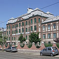
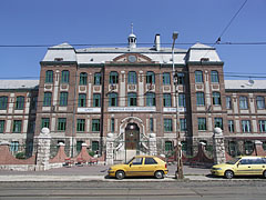
 Könyves Kálmán High School
The current neoclassical style building of the Könyves Kálmán High School of Újpest was built in 1914, designed by Emil Tory and Móric Pogány. During the Hungarian Revolution of 1956 the building was hit by mortar and it suffered severe damage, but for today it is completely restored. Moreover there is an astronomical observatory on the top of the building, it is the so-called Kulin Observatory which was built between 1950-1954 and named after the Hungarian astronomer György Kulin, who was also a teacher in this school between 1949-1953.
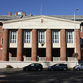
 Polyclinic (outpatient specialist medical clinic) of Újpest
In Hungary the specialist medical clinics (outpatient polyclinics) were called "SZTK" for long time and sometimes even today. However in reality this acronym didn't mean the medical institution but the health insurance bureau behind it, this abbreviation stucked to the outpatient polyclinic buildings. The word "SZTK" means: "Center of Social Security of the Trade Unions" (in Hungarian "Szakszervezeti Társadalombiztosítási Központ"), it was established in 1950 after the hospitals and other assets of the predecessor "National Social Security Institute" ("Országos Társadalombiztosítási Intézet" or OTI) were deprivatized. The new organization was supervised by the National Council of Trade Unions ("Szakszervezetek Országos Tanácsa" or SZOT).
Otherwise from the 1960s all agricultural workers and from 1975 every Hungarian citizen got automatic entitlement to health care in Hungary, and the insurance-based system was ceased.
After the political system change of Hungary in 1989 the "SZTK" as a bureau was ceased, its successor is the National Health Insurance Fund (in Hungarian "Országos Egészségbiztosítási Pénztár" or OEP), which brought back the insurance-based health care system, although in a different form. Nevertheless, the "SZTK" acronym is still existing even today in the form mentioned above.
부다페스트 - 더 많은 사진 갤러리:
당신은 또한에 관심이있을 수 있습니다 (관련 페이지):
여행 가이드의 목적지:
부다페스트 (8,468 사진 + 21 파노라마 이미지)
Buda Hills (Budai-hegység) (8,632 사진 + 21 파노라마 이미지)
Pest megye (county) (15,122 사진 + 50 파노라마 이미지)
부다페스트와 그 주변 (15,989 사진 + 52 파노라마 이미지)
헝가리 (27,287 사진 + 163 파노라마 이미지)
추가적으로:
(여기에 내부: Buda Hills)
Budakeszi (88 사진)
Pilisszentiván (76 사진)
여기에 모든 파노라마 사진:
부다페스트 (21 사진)
Pest megye (county) (50 사진)
부다페스트와 그 주변 (52 사진)
헝가리 (163 사진)
유럽 (165 사진)
여기에 모든 일반 사진:
부다페스트 (8,468 사진 / 122 갤러리)
Buda Hills (Budai-hegység) (8,632 사진 / 124 갤러리)
Pest megye (county) (15,122 사진 / 221 갤러리)
부다페스트와 그 주변 (15,989 사진 / 234 갤러리)
헝가리 (27,287 사진 / 462 갤러리)
유럽 (30,494 사진 / 523 갤러리)
https://www.panadea.com/ko/guidebook/budapest/photos/gal-102

즐겨 찾기에 추가 북마크에 추가
친구들과 공유하세요!
기타


우리의 여행 가이드가 포함되어 있습니다:
많은 사진과 파노라마 이미지, 정보와 흥미로운 사실을 많이가 부속됩니다.
- 214 여행 목적지
- 165 파노라마 이미지
- 30,494 다른 사진
선택한 사진의 큰 컬렉션: 우수한 품질, 높은 해상도와 자연 색상
회사 소개 - 법적 고지 & 면책 조항 -
모든 권리 보유
- ©2010-2022
Neuronit Creative Studio - Mogyoród / 부다페스트 / 헝가리