
(Optimoitu pieni näyttö laitteisiin)
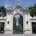
Angyalföld, Lehel Street - Budapest, Unkari
Kun klikkaat:
Klikkaa kuvia!
-
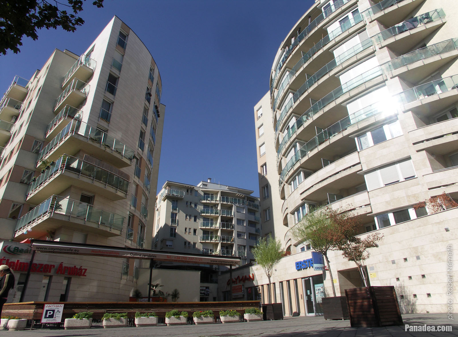
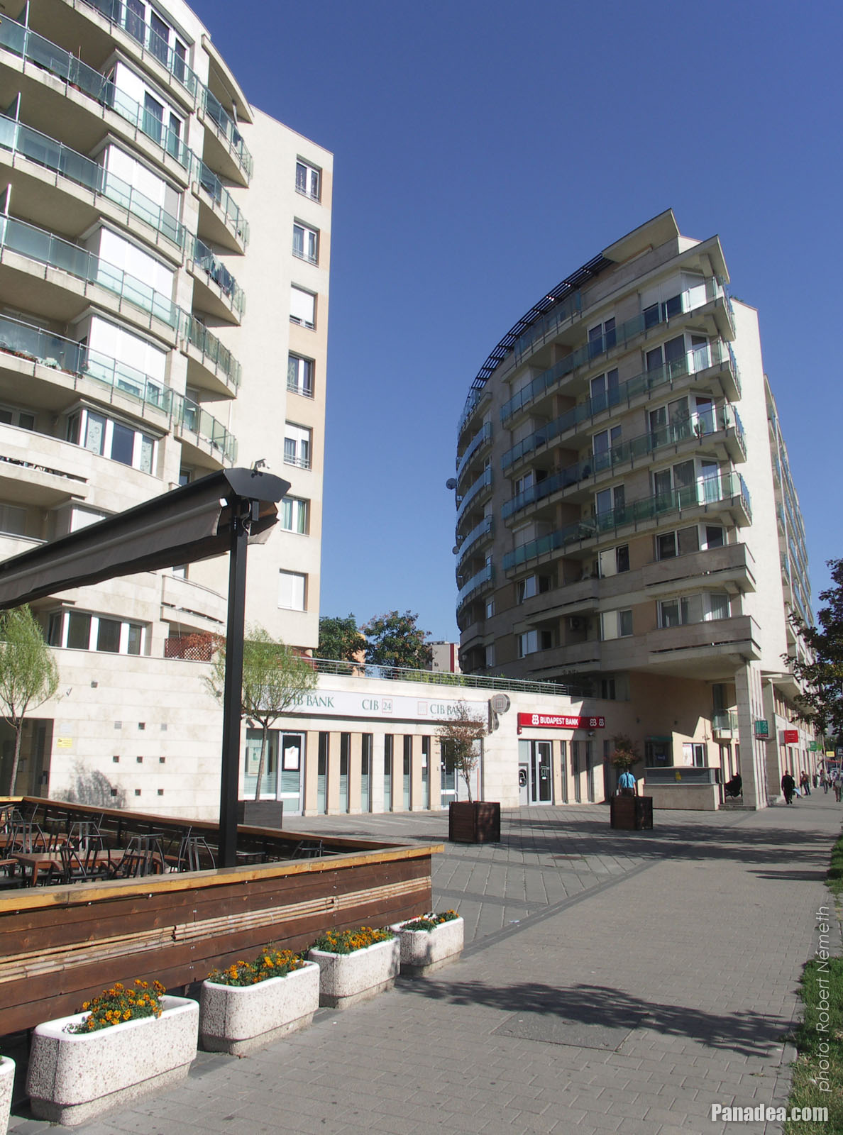
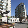
Newly built housing complex
Kuvauspäivämäärän: 20132013
Luonut: Robert Németh
Kameran malli: Konica Minolta Dimage A200
Budapest, Unkari
-

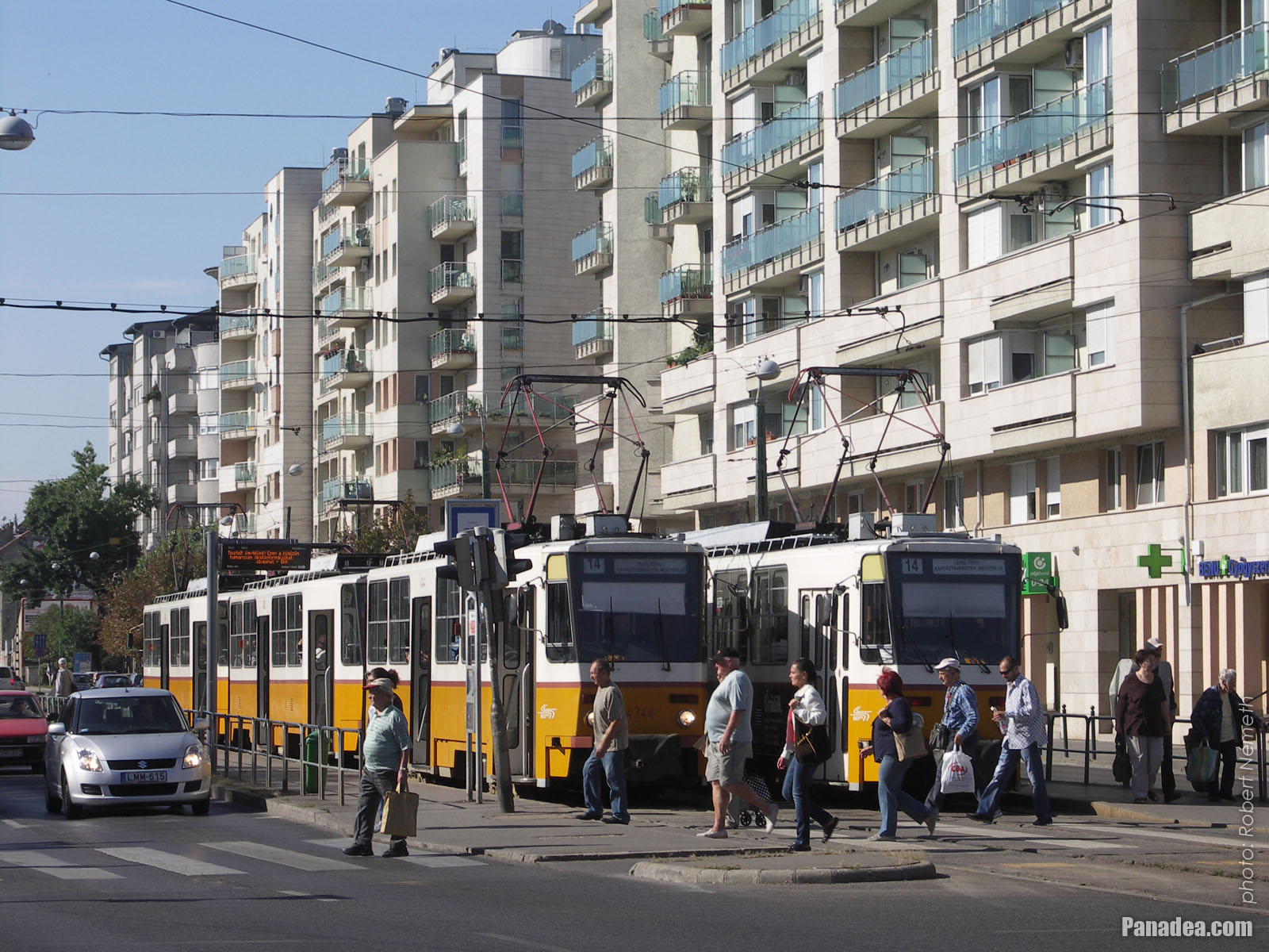
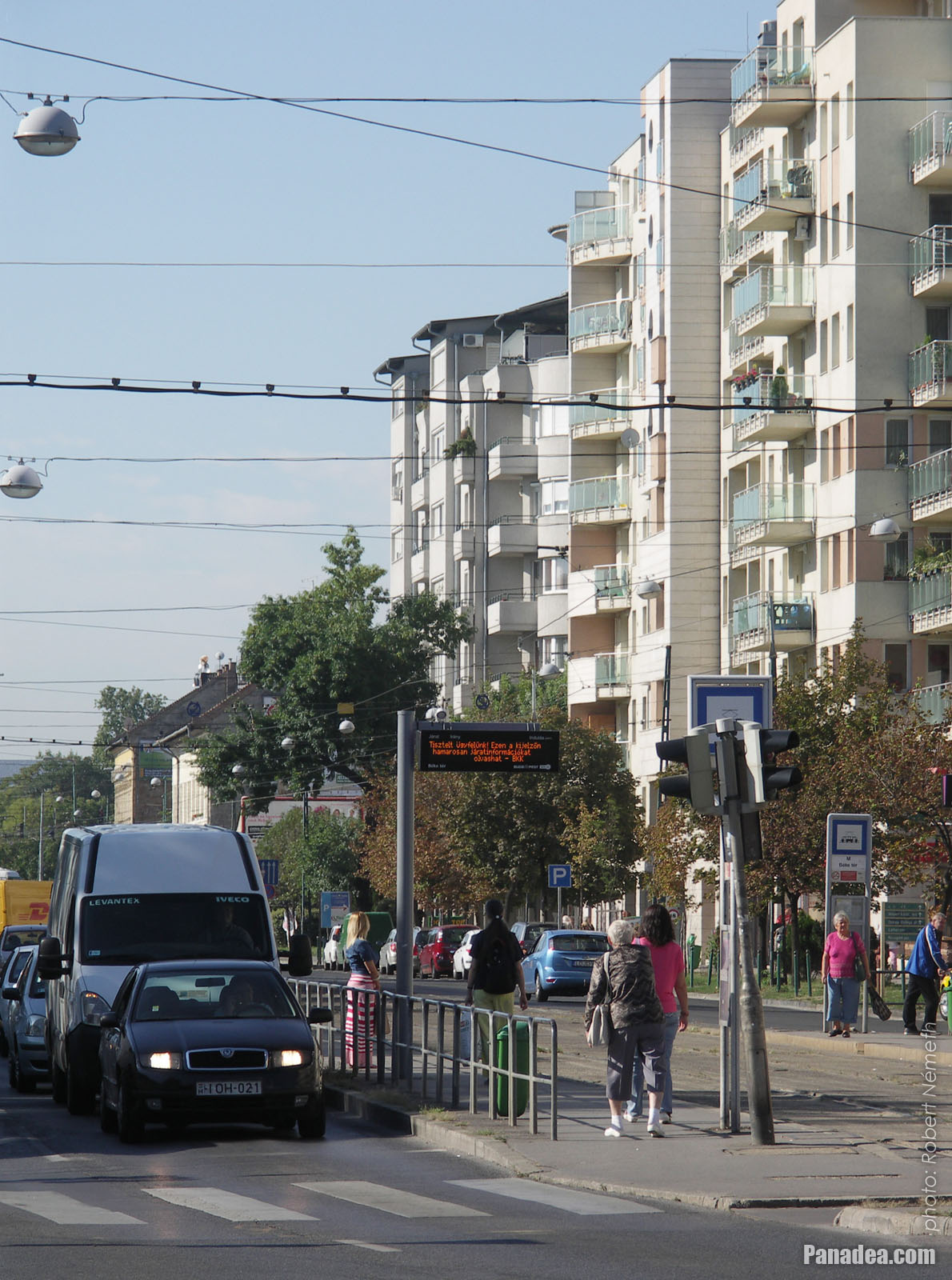
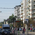
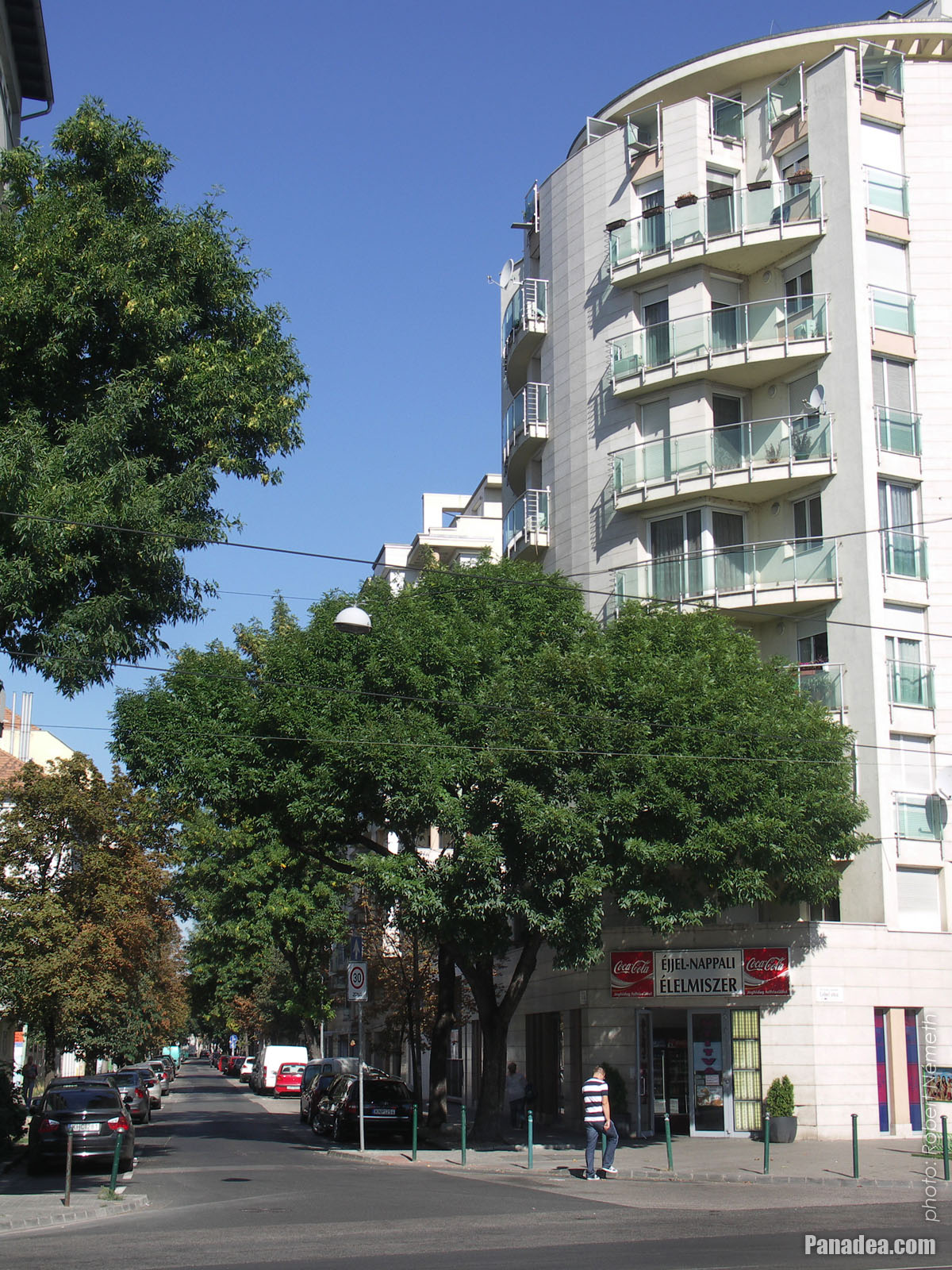
Tram stop and modern residental buildings
Kuvauspäivämäärän: 20132013
Luonut: Robert Németh
Kameran malli: Konica Minolta Dimage A200
Budapest, Unkari
-
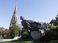
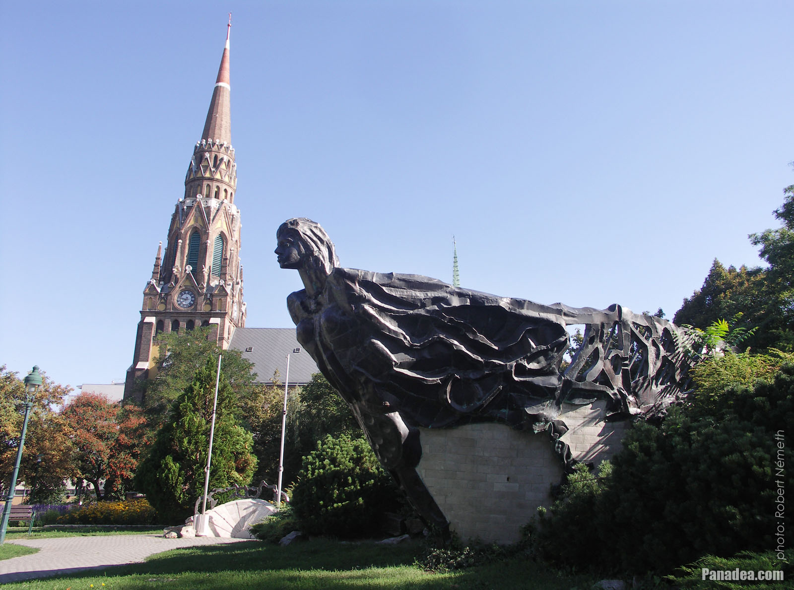
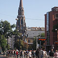
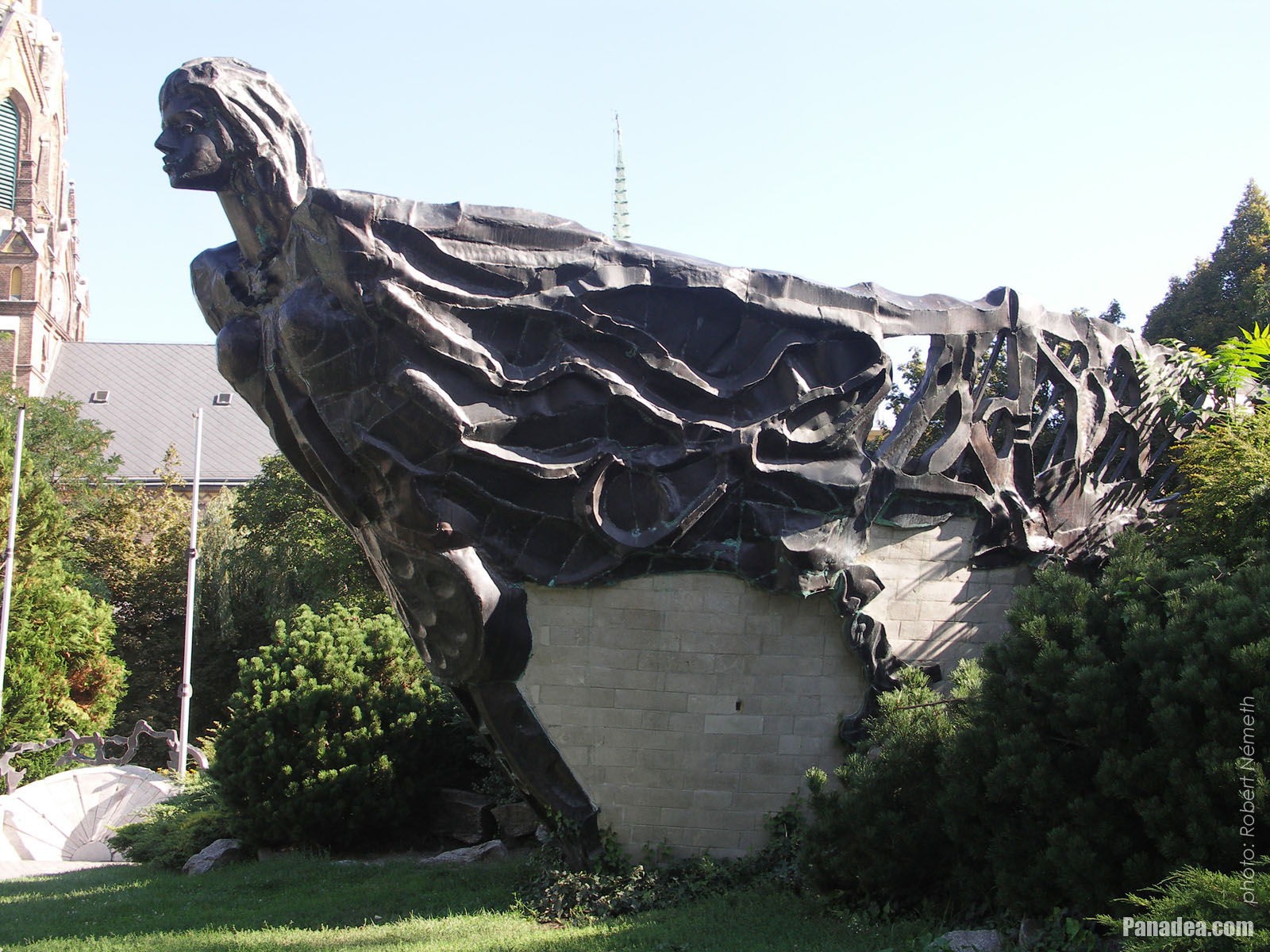
The St. Ladislaus Parish Church and the ship-like "Őshajó" (literally "Ancient ship") sculpture
Kuvauspäivämäärän: 20132013
Luonut: Robert Németh
Kameran malli: Konica Minolta Dimage A200
Budapest, Unkari
-

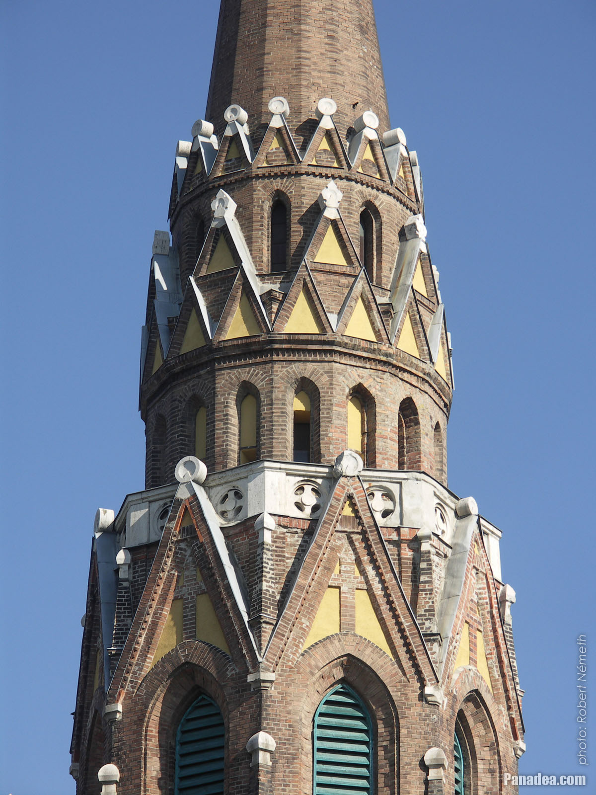
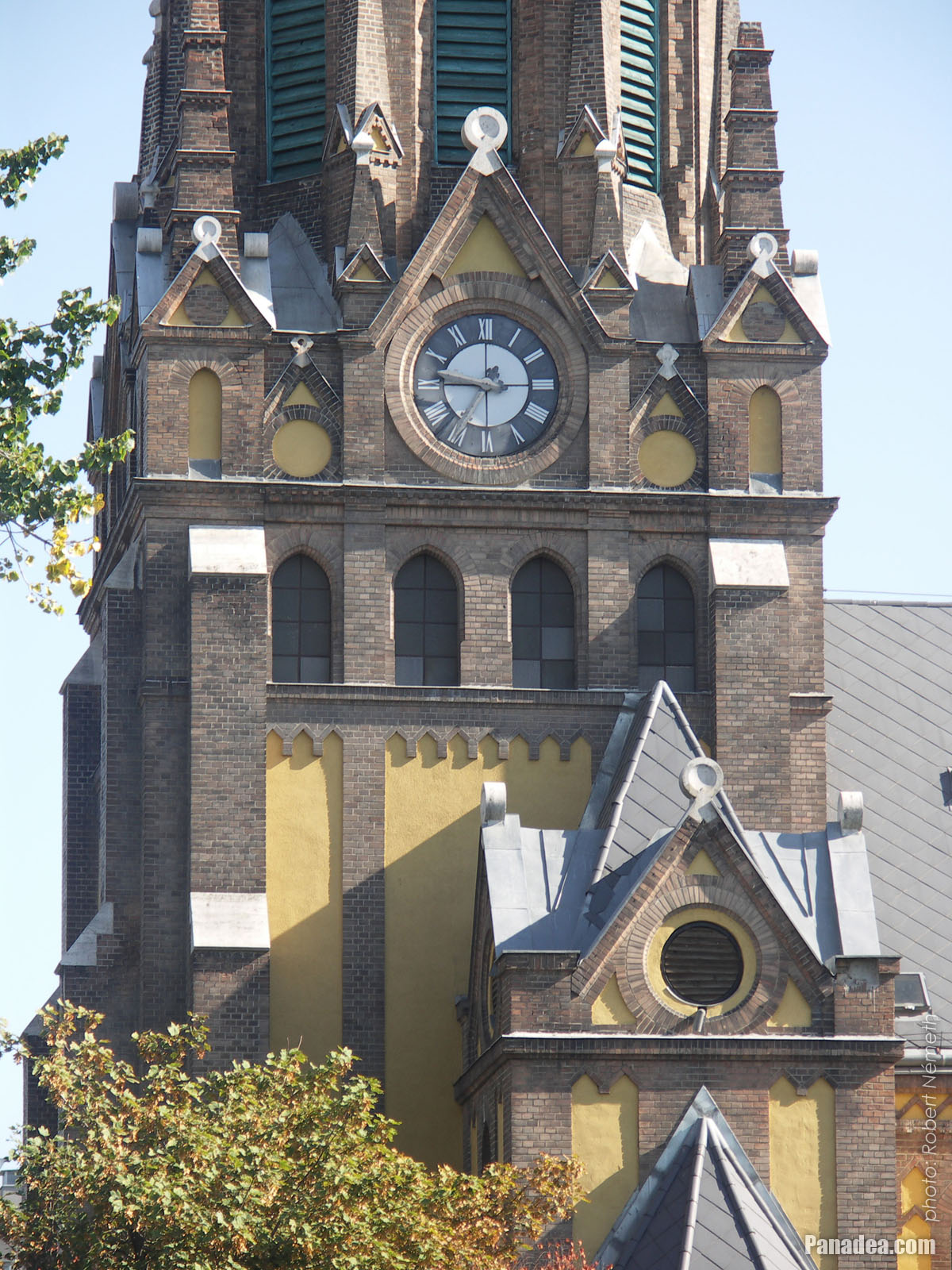
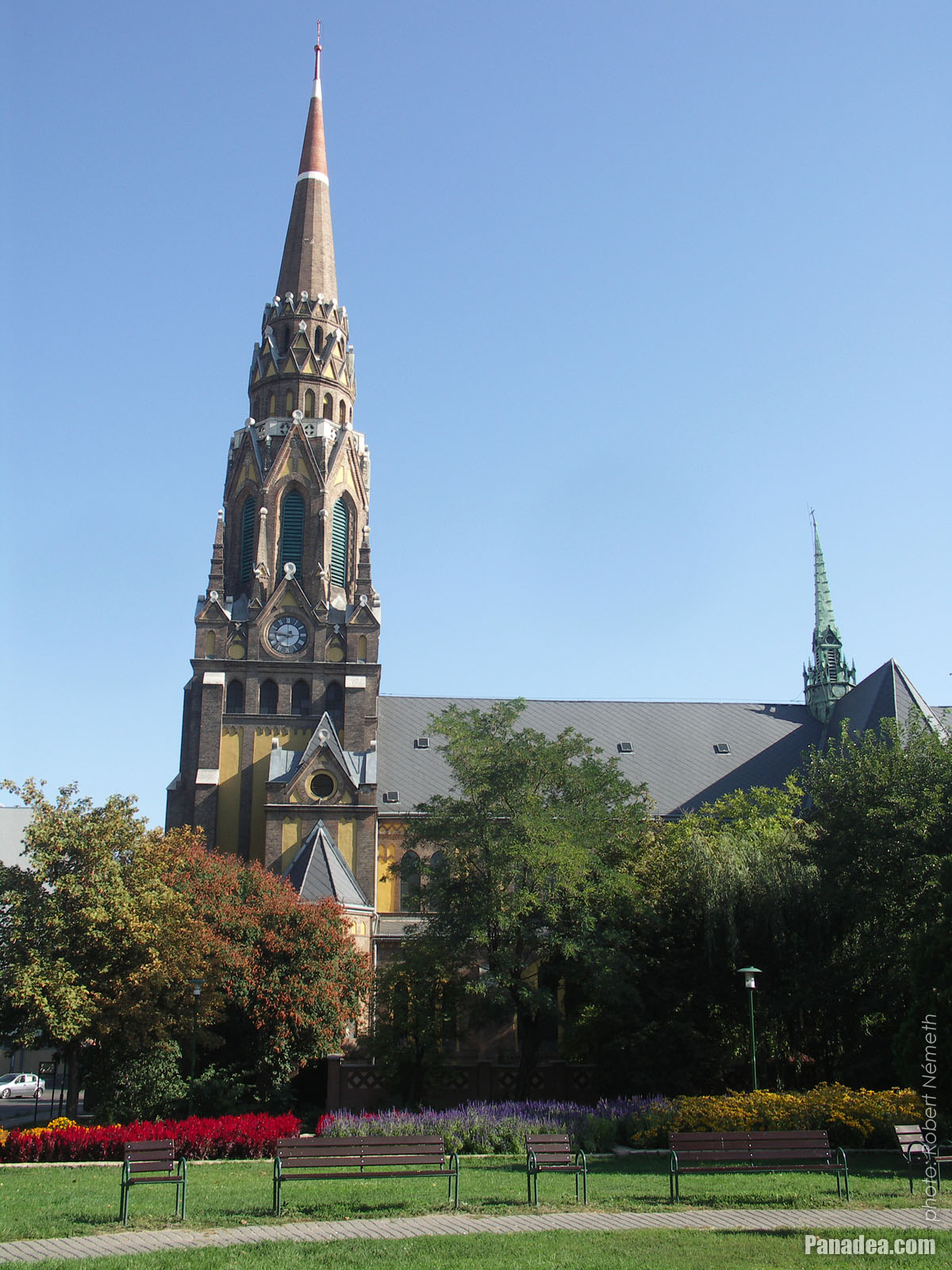
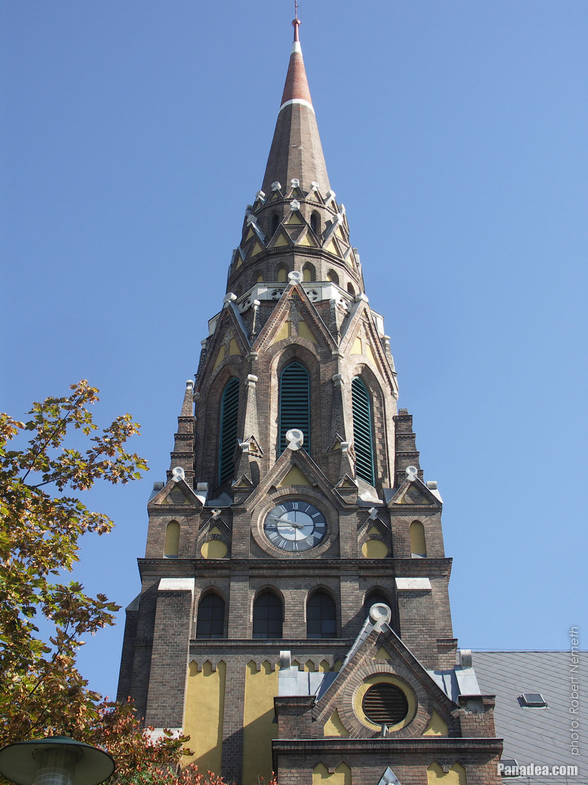
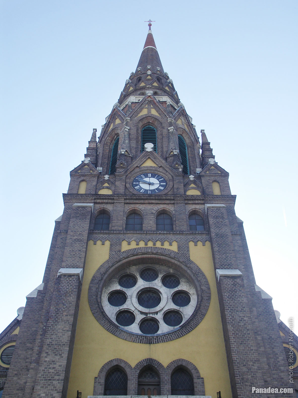
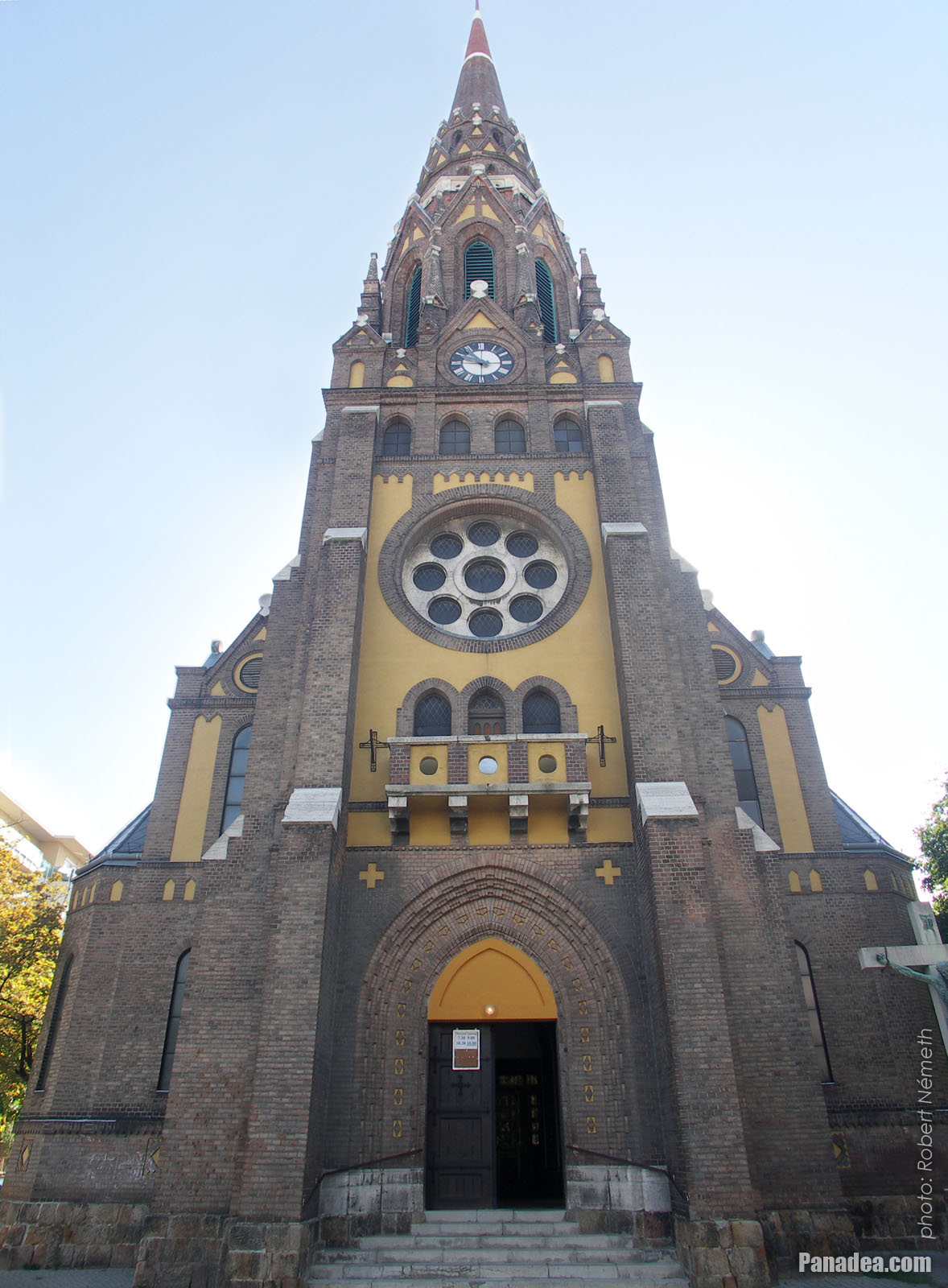
The spire on the tower of the neo-gothic style St. Ladislaus Parish Church ("Szent László-templom")
It was built in 1929 and this was the first parish church in Angyalföld district.
Kuvauspäivämäärän: 20132013
Luonut: Robert Németh
Kameran malli: Konica Minolta Dimage A200
Budapest, Unkari
-

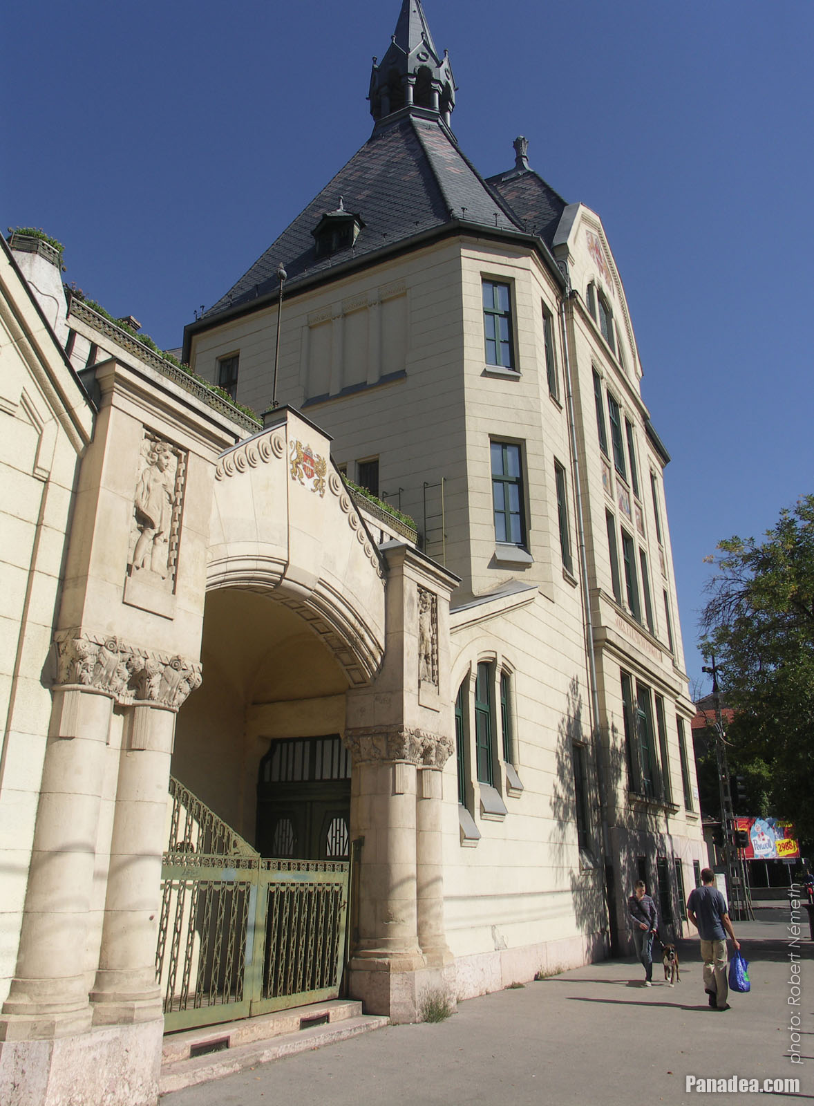
Monumental school palace in the Lehel Street (Primary or Elementary School of Musical and Physical Education)
The building is older than 100 years, architect: Lóránd A. Balogh
Kuvauspäivämäärän: 20132013
Luonut: Robert Németh
Kameran malli: Konica Minolta Dimage A200
Budapest, Unkari
-

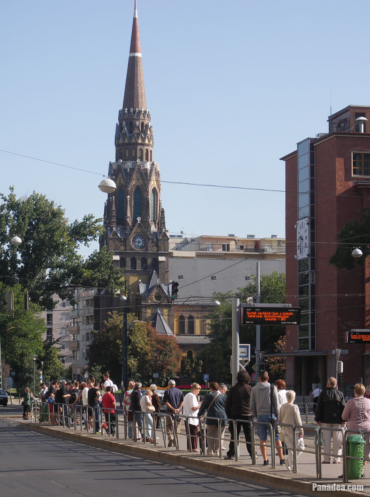
The stop of the tram 14 and the St. Ladislaus Church
Kuvauspäivämäärän: 20132013
Luonut: Robert Németh
Kameran malli: Konica Minolta Dimage A200
Budapest, Unkari
-

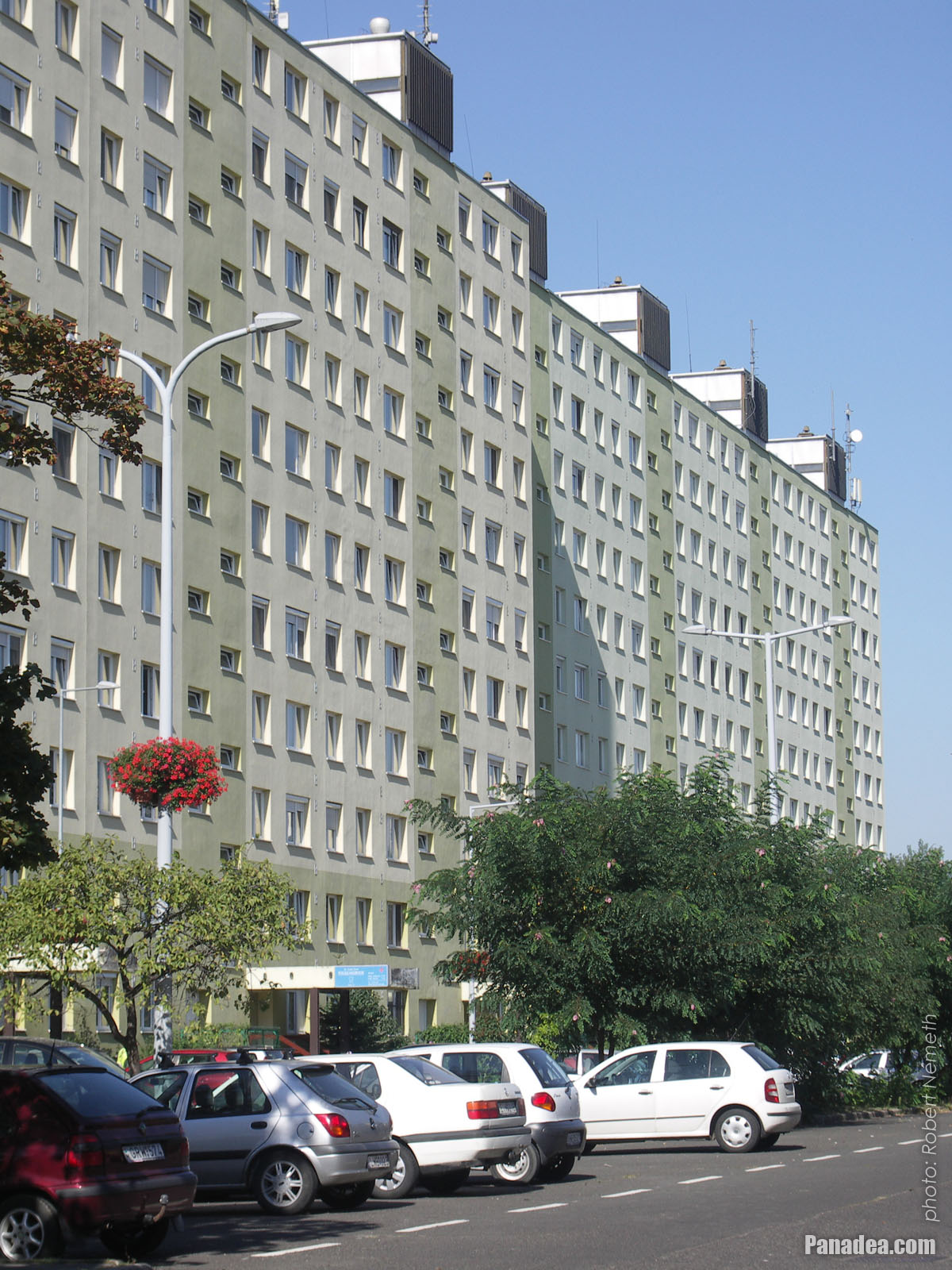
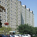
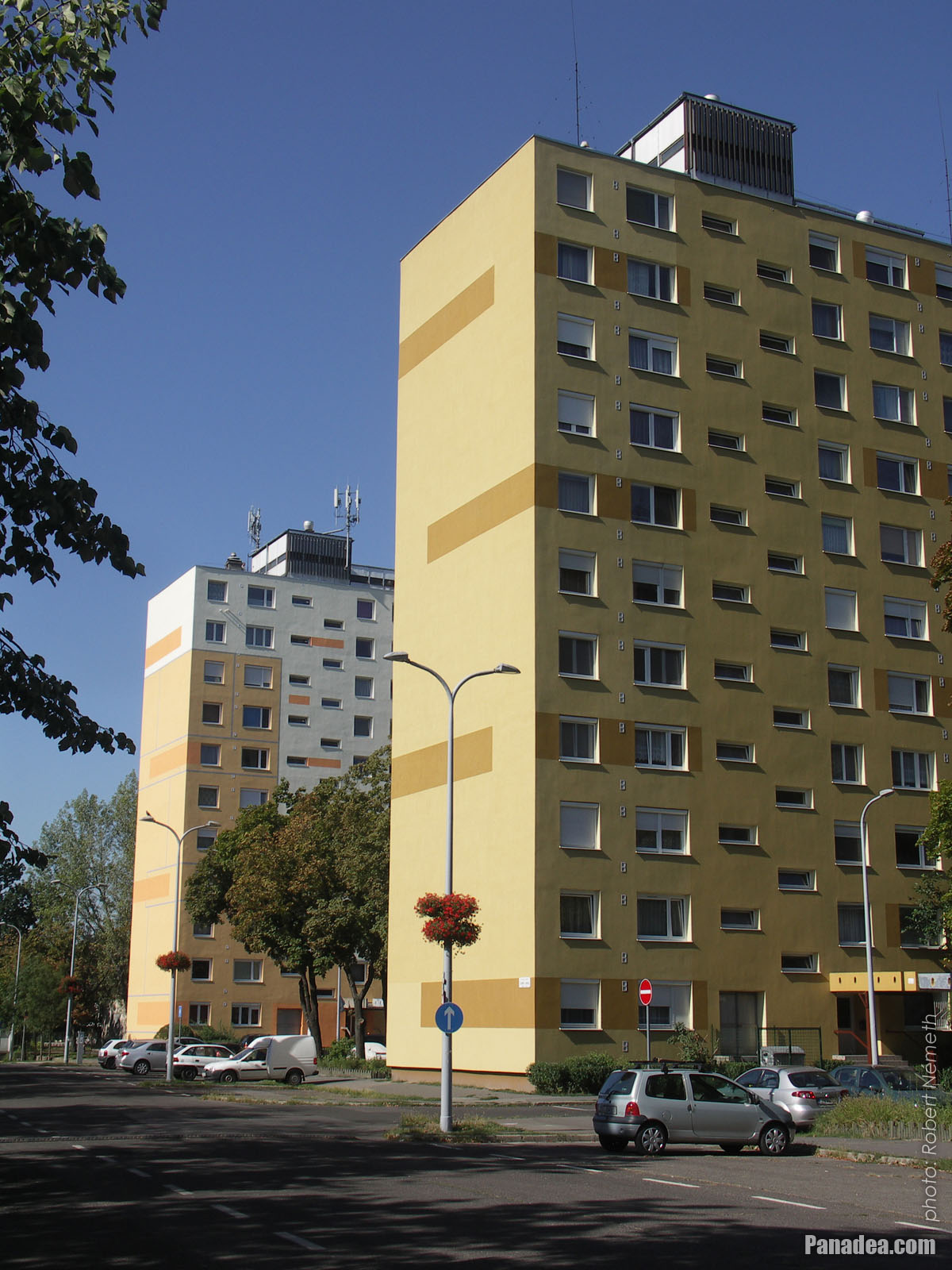
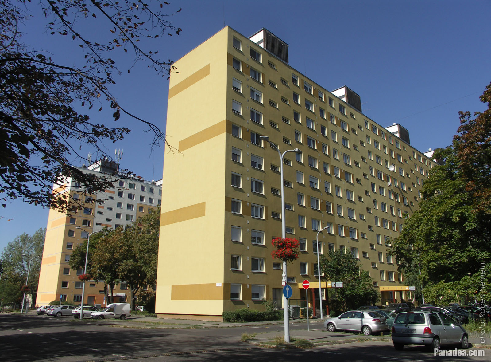
High-rise panel buildings (block of flats) in the housing estate, they were built in the socialist era
Kuvauspäivämäärän: 20132013
Luonut: Robert Németh
Kameran malli: Konica Minolta Dimage A200
Budapest, Unkari
-

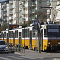
Tram stop
Kuvauspäivämäärän: 20132013
Luonut: Robert Németh
Kameran malli: Konica Minolta Dimage A200
Budapest, Unkari
-

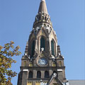
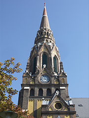
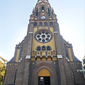
St. Ladislaus Parish Church (in Hungarian "Szent László-plébániatemplom")
Kuvauspäivämäärän: 20132013
Luonut: Robert Németh
Kameran malli: Konica Minolta Dimage A200
Budapest, Unkari
-

St. Ladislaus Parish Church
Kuvauspäivämäärän: 20132013
Luonut: Robert Németh
Kameran malli: Konica Minolta Dimage A200
Budapest, Unkari
-
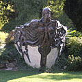
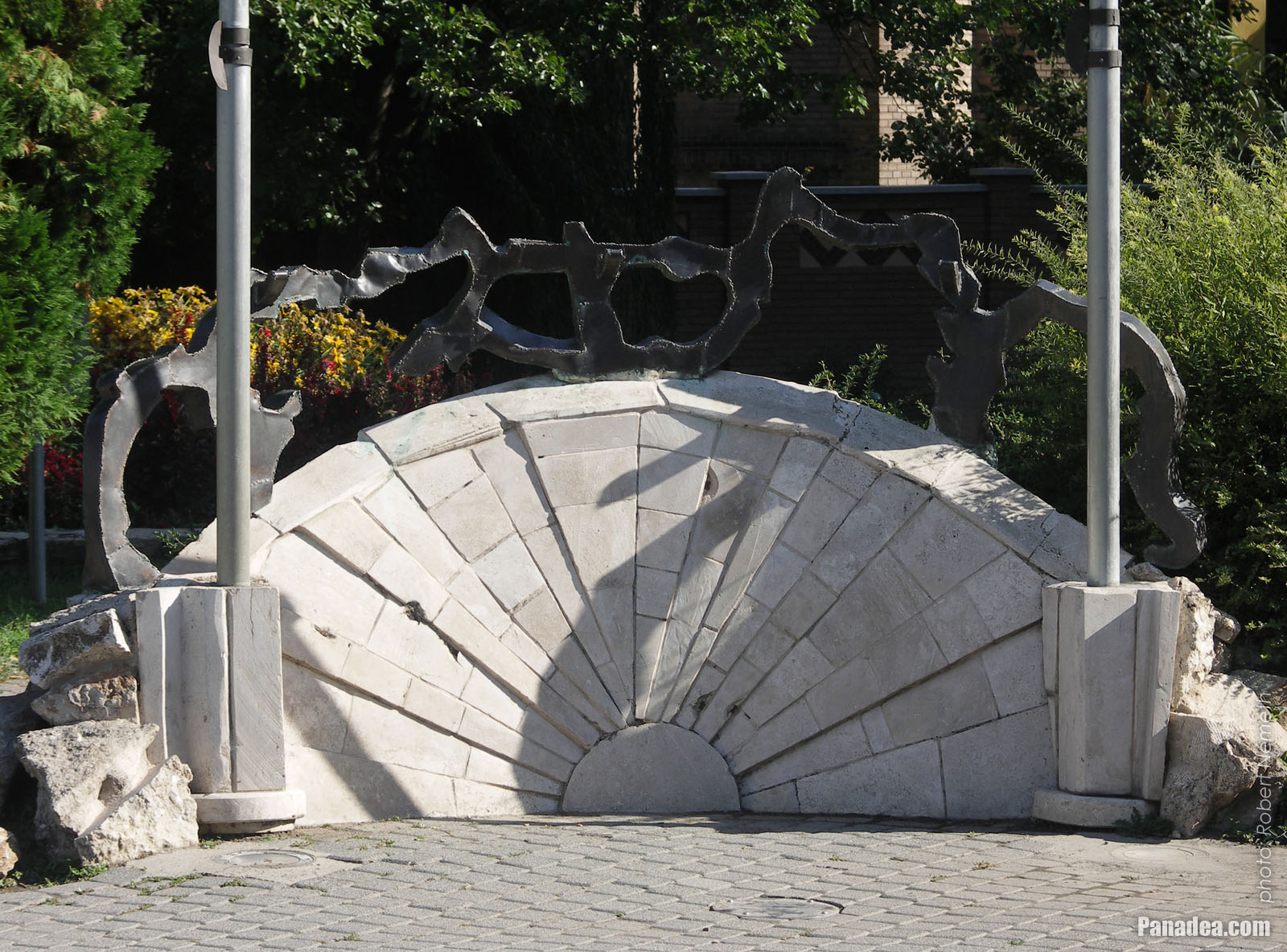
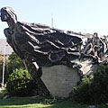
Bronze and limestone sculpture by Tamás Varga: "Ancient ship" ("Őshajó")
Kuvauspäivämäärän: 20132013
Luonut: Robert Németh
Kameran malli: Konica Minolta Dimage A200
Budapest, Unkari
Bronze and limestone sculpture by Tamás Varga: "Ancient ship" ("Őshajó") - Budapest, Unkari -
St. Ladislaus Parish Church
Kuvauspäivämäärän: 20132013
Luonut: Robert Németh
Kameran malli: Konica Minolta Dimage A200
Budapest, Unkari
St. Ladislaus Parish Church - Budapest, Unkari -
Tamás Varga: "Ancient ship" ("Őshajó"), bronze and limestone sculpture
Kuvauspäivämäärän: 20132013
Luonut: Robert Németh
Kameran malli: Konica Minolta Dimage A200
Budapest, Unkari
Tamás Varga: "Ancient ship" ("Őshajó"), bronze and limestone sculpture - Budapest, Unkari -
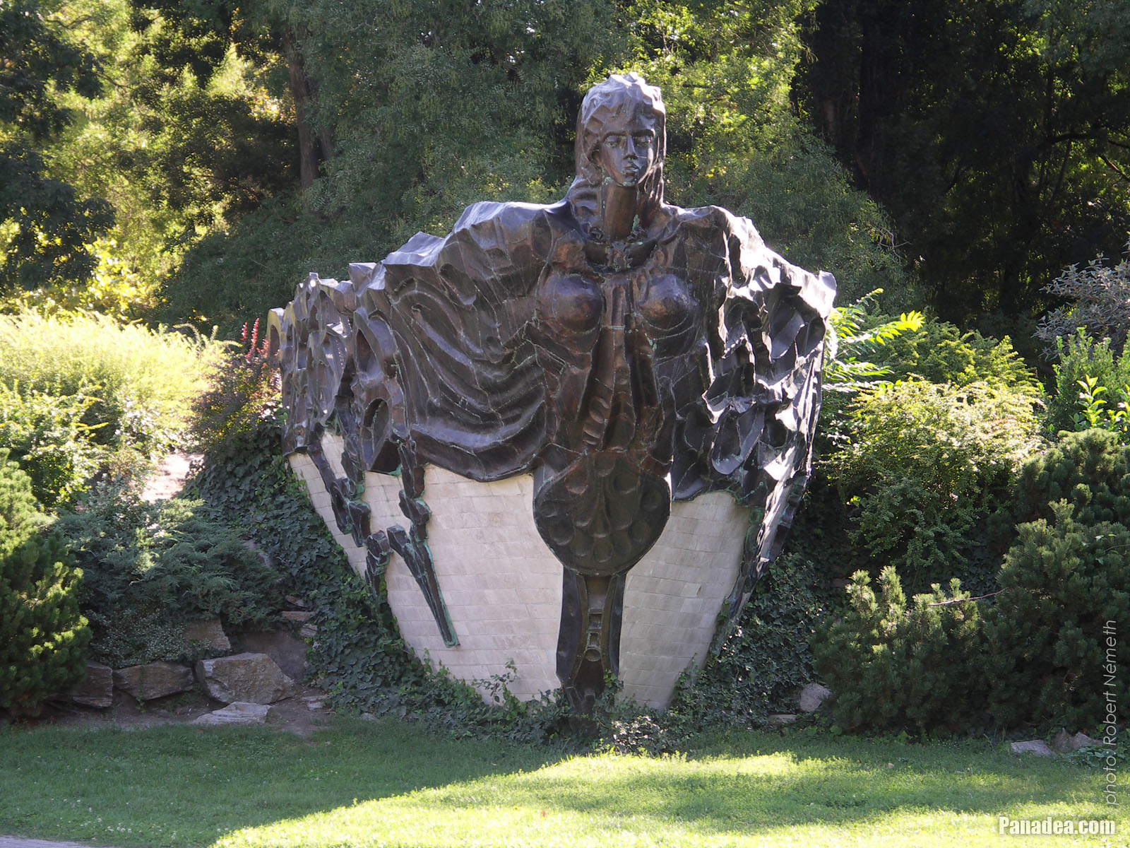
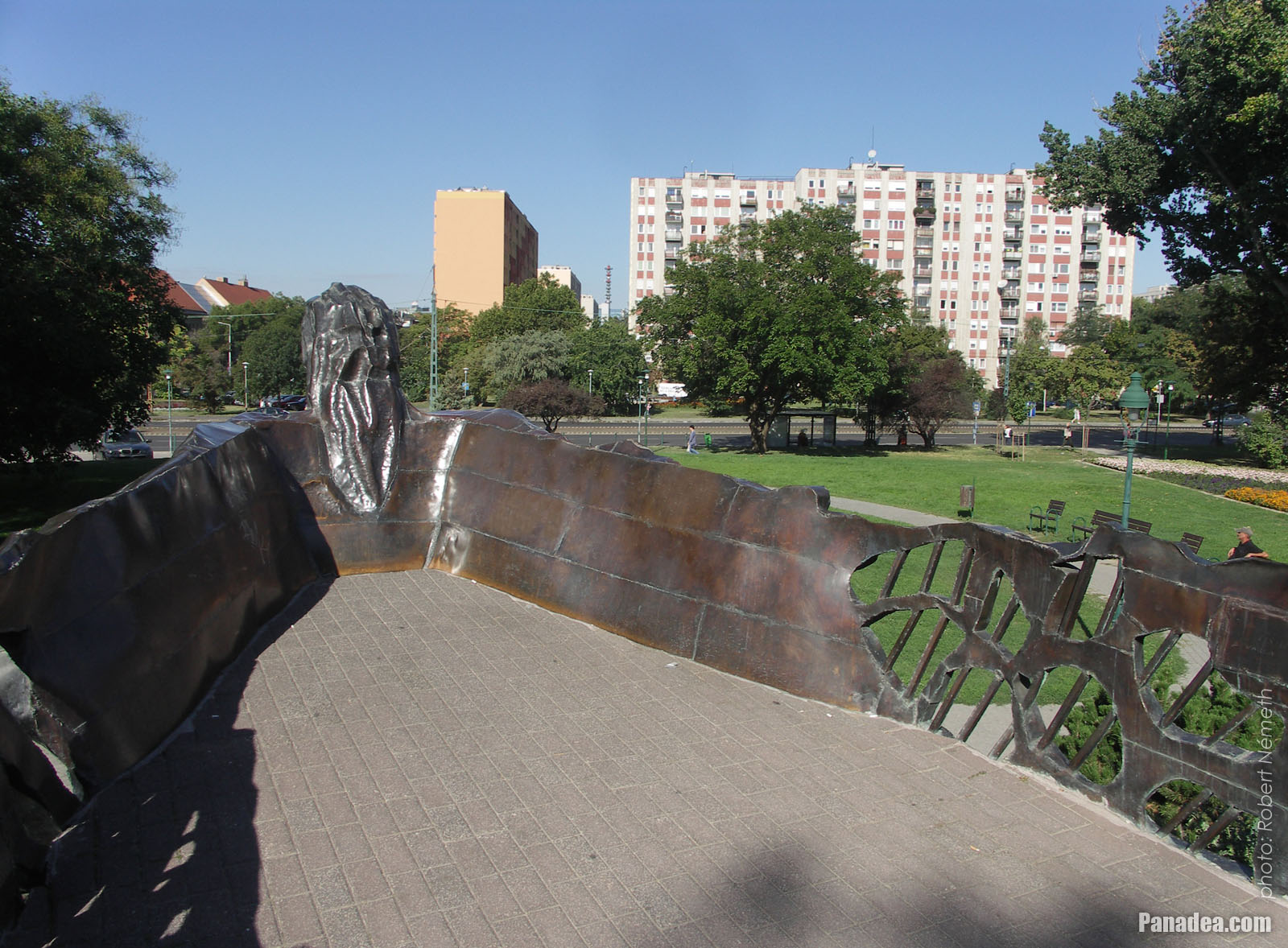
The "Ancient ship" ("Őshajó") sculpture
The bronze-limestone work of art was created by Tamás Varga in 2001.
Kuvauspäivämäärän: 20132013
Luonut: Robert Németh
Kameran malli: Konica Minolta Dimage A200
Budapest, Unkari
The "Ancient ship" ("Őshajó") sculpture - Budapest, Unkari -
The "Ancient ship" ("Őshajó") bronze and limestone sculpture (by Tamás Varga)
Kuvauspäivämäärän: 20132013
Luonut: Robert Németh
Kameran malli: Konica Minolta Dimage A200
Budapest, Unkari
The "Ancient ship" ("Őshajó") bronze and limestone sculpture (by Tamás Varga) - Budapest, Unkari -
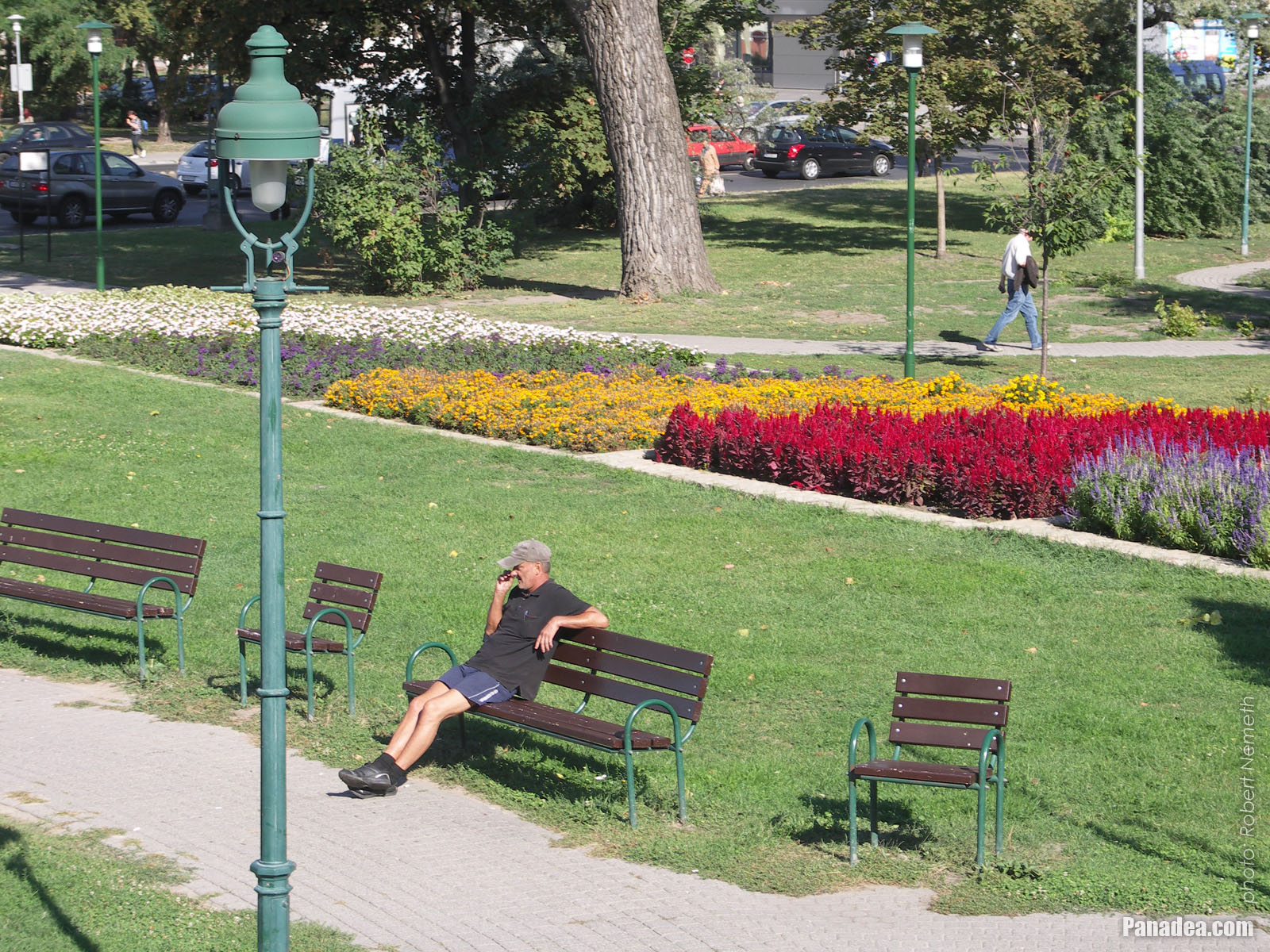
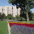
Park with lawn and flowers
Kuvauspäivämäärän: 20132013
Luonut: Robert Németh
Kameran malli: Konica Minolta Dimage A200
Budapest, Unkari
Park with lawn and flowers - Budapest, Unkari -
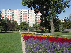
Flowered park at the
Kuvauspäivämäärän: 20132013
Luonut: Robert Németh
Kameran malli: Konica Minolta Dimage A200
Budapest, Unkari
Flowered park at the - Budapest, Unkari -
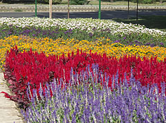
Flowers in the park
Kuvauspäivämäärän: 20132013
Luonut: Robert Németh
Kameran malli: Konica Minolta Dimage A200
Budapest, Unkari
Flowers in the park - Budapest, Unkari -
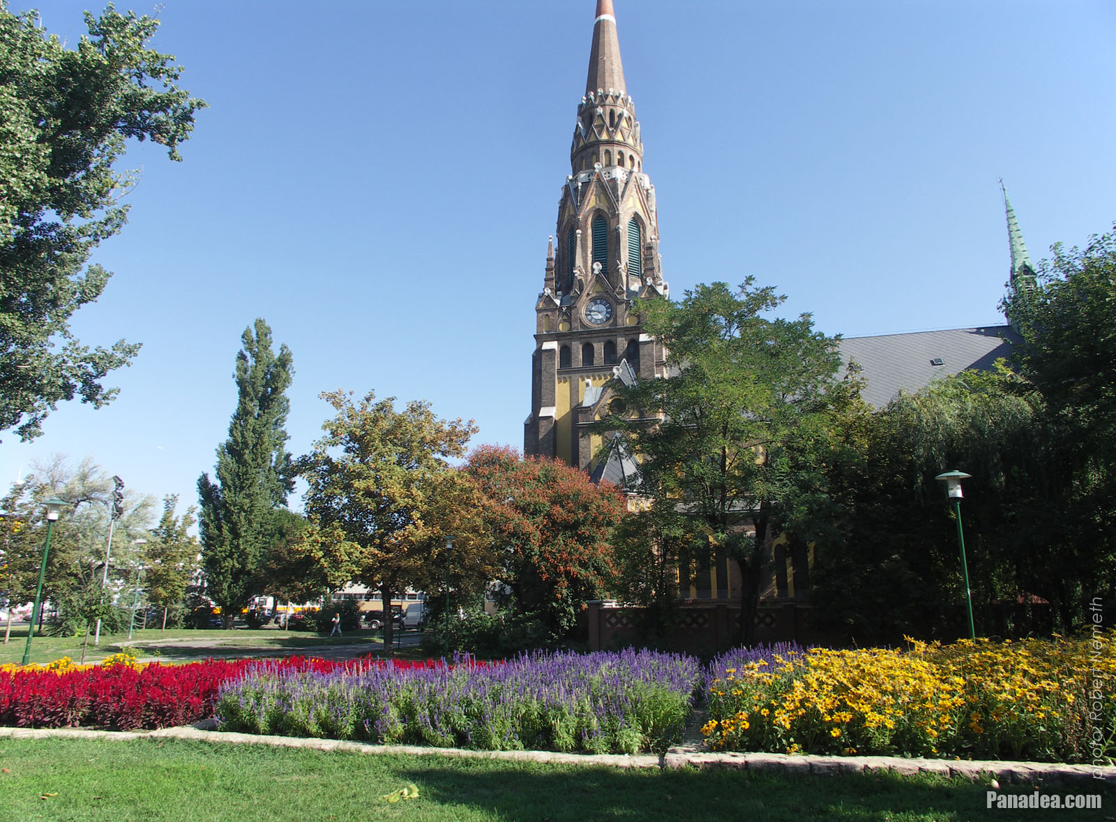
Flowers in the park at the St. Ladislaus Church
Kuvauspäivämäärän: 20132013
Luonut: Robert Németh
Kameran malli: Konica Minolta Dimage A200
Budapest, Unkari
Flowers in the park at the St. Ladislaus Church - Budapest, Unkari -
St. Ladislaus Parish Church (in Hungarian "Szent László-plébániatemplom")
Kuvauspäivämäärän: 20132013
Luonut: Robert Németh
Kameran malli: Konica Minolta Dimage A200
Budapest, Unkari
St. Ladislaus Parish Church (in Hungarian "Szent László-plébániatemplom") - Budapest, Unkari -
St. Ladislaus Parish Church (in Hungarian "Szent László-plébániatemplom")
Kuvauspäivämäärän: 20132013
Luonut: Robert Németh
Kameran malli: Konica Minolta Dimage A200
Budapest, Unkari
St. Ladislaus Parish Church (in Hungarian "Szent László-plébániatemplom") - Budapest, Unkari -
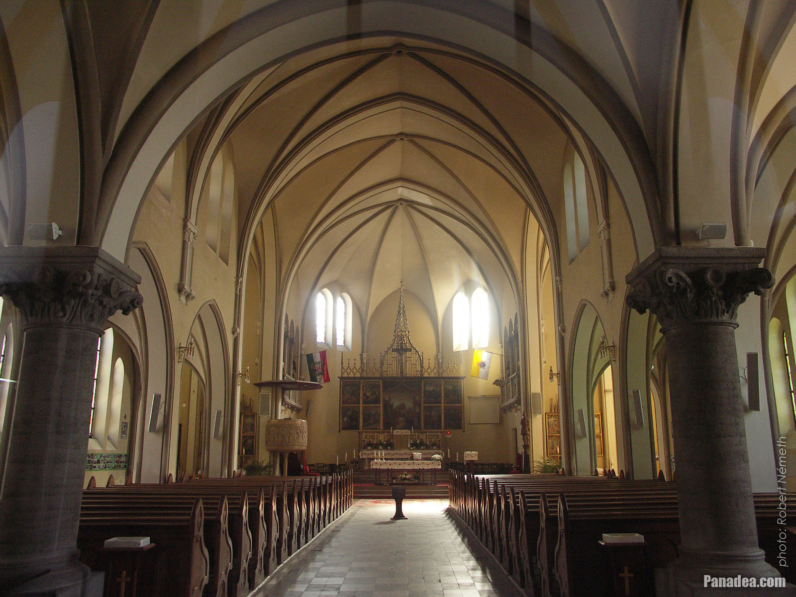
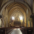
Interior of the St. Ladislaus Church
Kuvauspäivämäärän: 20132013
Luonut: Robert Németh
Kameran malli: Konica Minolta Dimage A200
Budapest, Unkari
Interior of the St. Ladislaus Church - Budapest, Unkari -
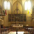
The main altar of the St. Ladislaus Church
Kuvauspäivämäärän: 20132013
Luonut: Robert Németh
Kameran malli: Konica Minolta Dimage A200
Budapest, Unkari
The main altar of the St. Ladislaus Church - Budapest, Unkari -
St. Ladislaus Parish Church
Kuvauspäivämäärän: 20132013
Luonut: Robert Németh
Kameran malli: Konica Minolta Dimage A200
Budapest, Unkari
St. Ladislaus Parish Church - Budapest, Unkari -
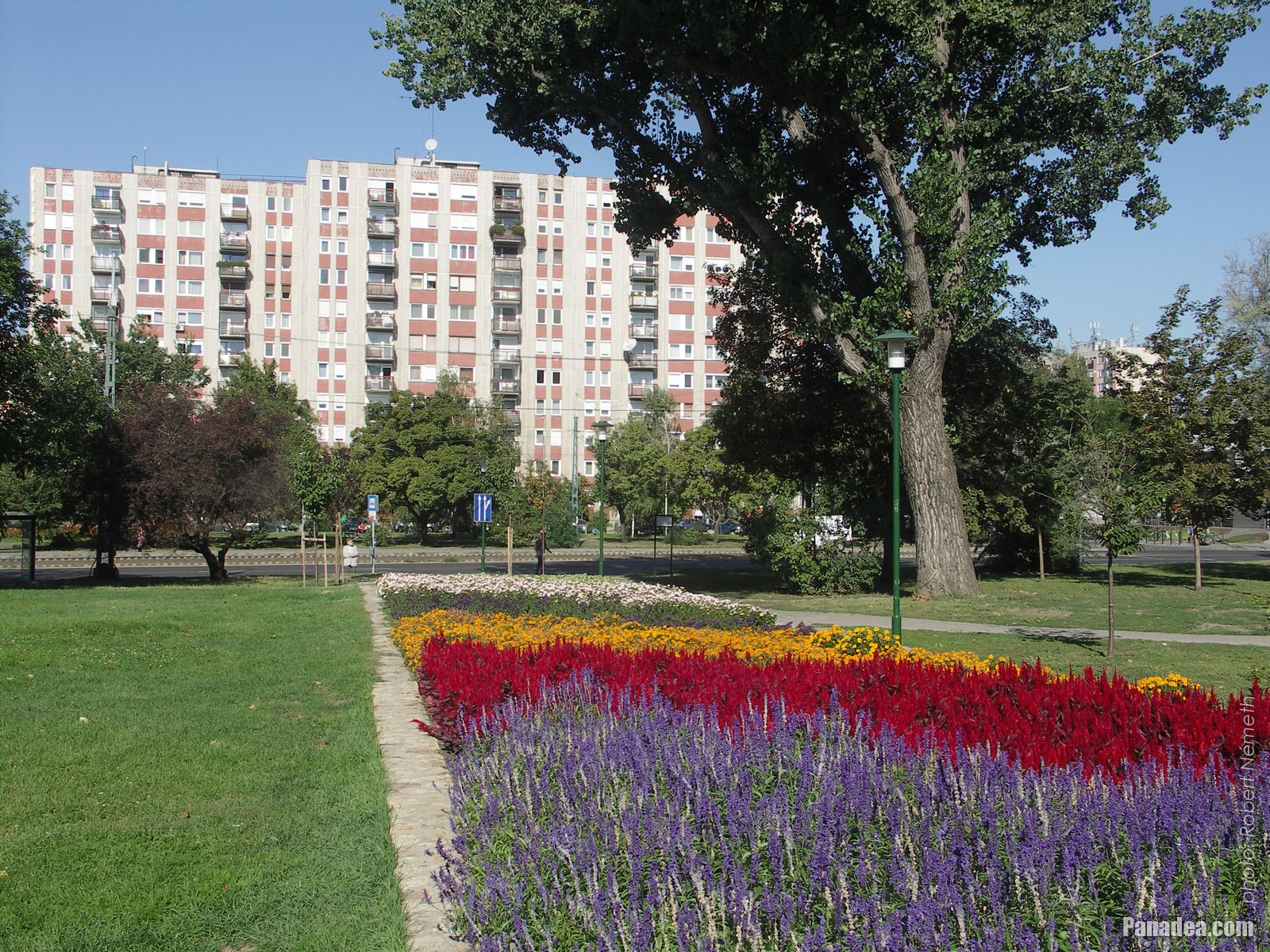
Residential park
Kuvauspäivämäärän: 20132013
Luonut: Robert Németh
Kameran malli: Konica Minolta Dimage A200
Budapest, Unkari
Residential park - Budapest, Unkari -
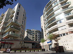
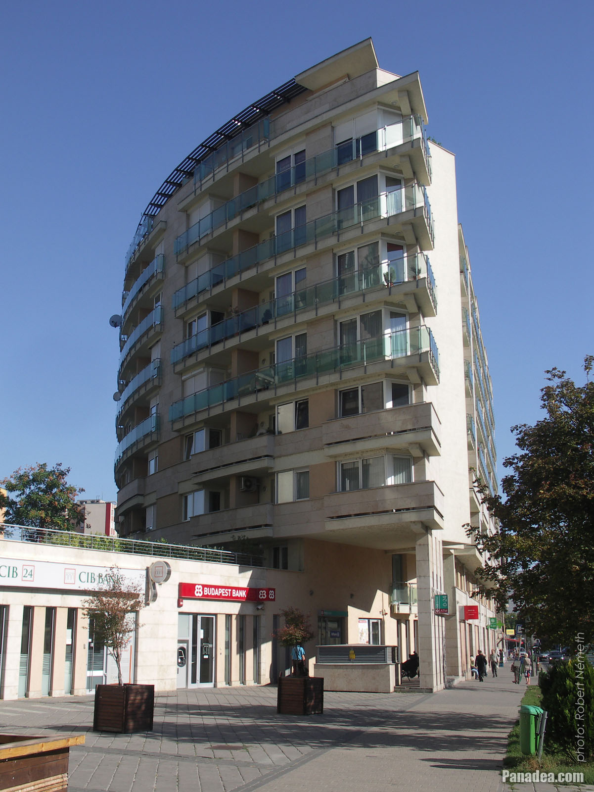
Bank branches and flats in the modern residental complex
Kuvauspäivämäärän: 20132013
Luonut: Robert Németh
Kameran malli: Konica Minolta Dimage A200
Budapest, Unkari
Bank branches and flats in the modern residental complex - Budapest, Unkari -
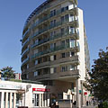
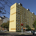
Modern residental building
Kuvauspäivämäärän: 20132013
Luonut: Robert Németh
Kameran malli: Konica Minolta Dimage A200
Budapest, Unkari
Modern residental building - Budapest, Unkari -
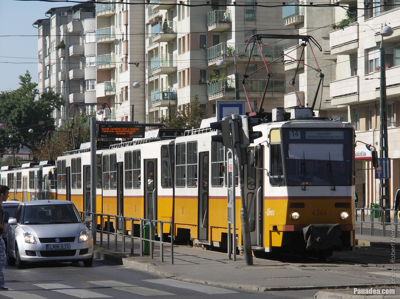
A yellow tram 14 in the tram stop
Kuvauspäivämäärän: 20132013
Luonut: Robert Németh
Kameran malli: Konica Minolta Dimage A200
Budapest, Unkari
A yellow tram 14 in the tram stop - Budapest, Unkari -
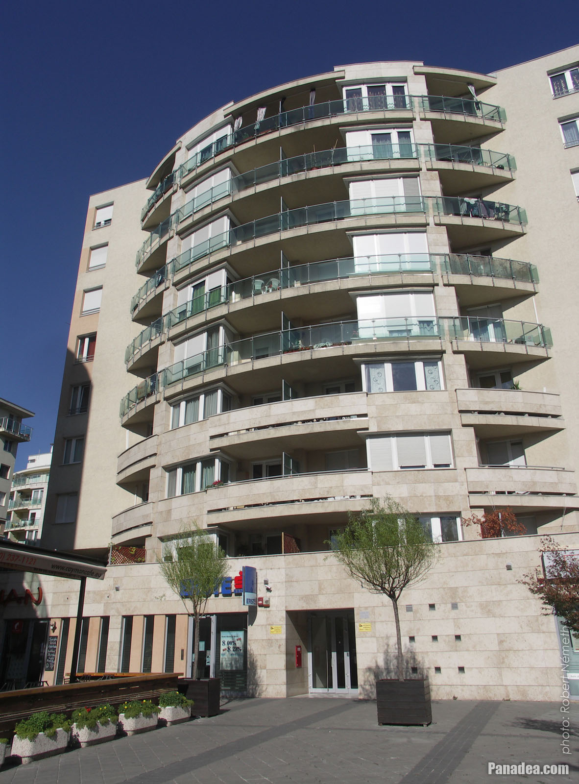
Residental house
Kuvauspäivämäärän: 20132013
Luonut: Robert Németh
Kameran malli: Konica Minolta Dimage A200
Budapest, Unkari
Residental house - Budapest, Unkari -
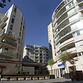
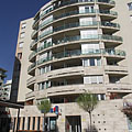
Residental buildings at the corner of the Gömb Street
Kuvauspäivämäärän: 20132013
Luonut: Robert Németh
Kameran malli: Konica Minolta Dimage A200
Budapest, Unkari
Residental buildings at the corner of the Gömb Street - Budapest, Unkari -
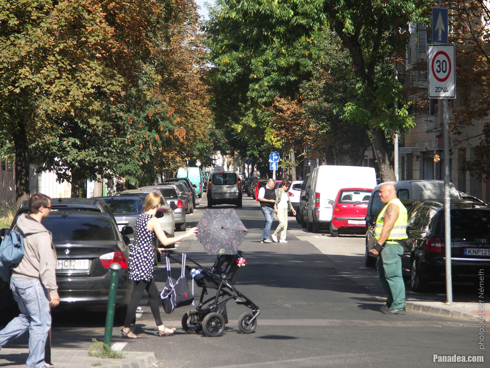
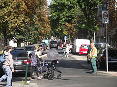
Traffic in the Gömb Street
Kuvauspäivämäärän: 20132013
Luonut: Robert Németh
Kameran malli: Konica Minolta Dimage A200
Budapest, Unkari
Traffic in the Gömb Street - Budapest, Unkari -
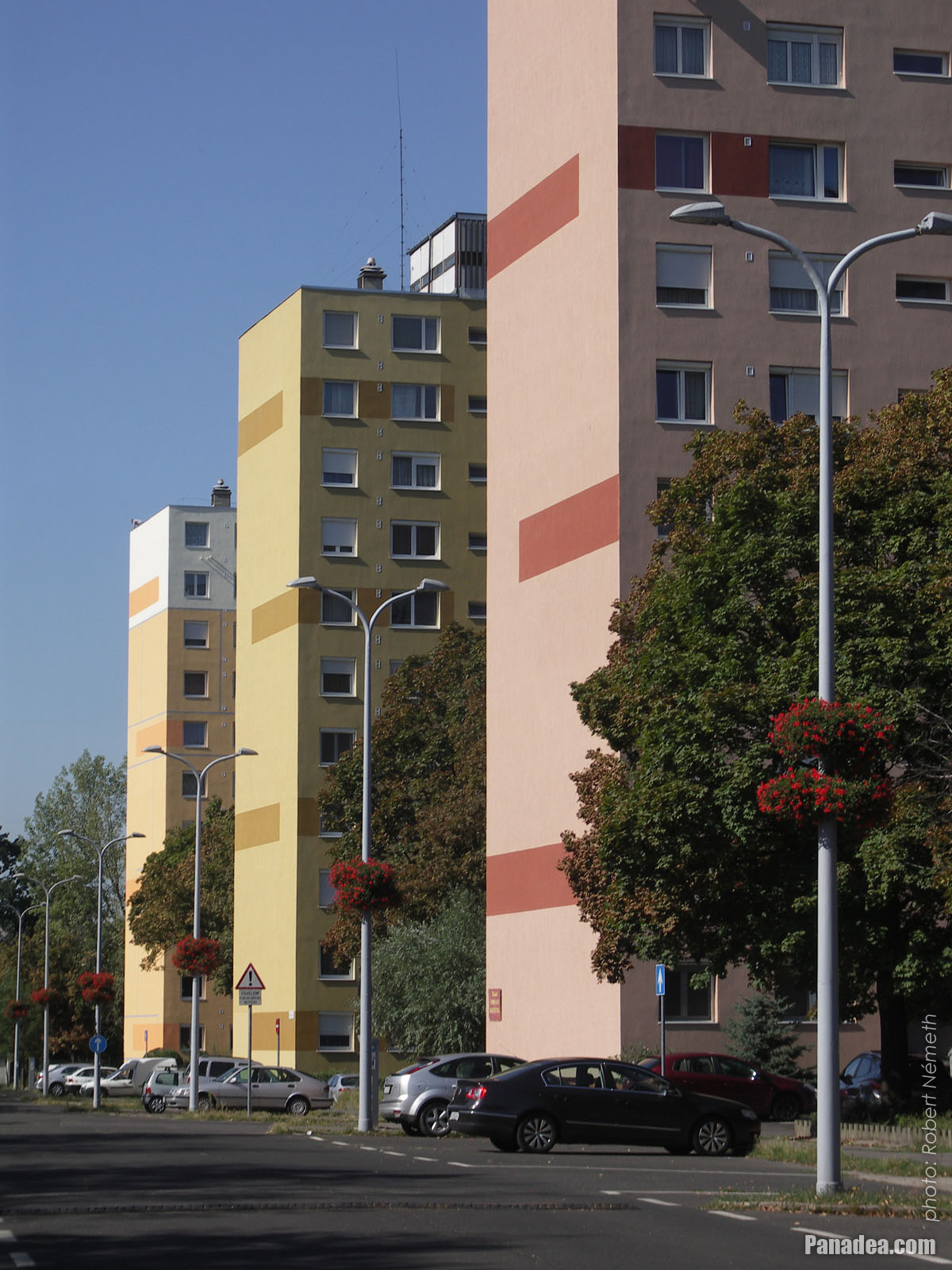
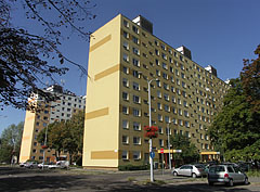
Renovated panel block apartment buildings ("tower blocks") in the special housing estate complex, the so-called "microdistrict"
Kuvauspäivämäärän: 20132013
Luonut: Robert Németh
Kameran malli: Konica Minolta Dimage A200
Budapest, Unkari
Renovated panel block apartment buildings ("tower blocks") in the special housing estate complex, the so-called "microdistrict" - Budapest, Unkari -
Colorful panel buildings in the so-called microdistrict (a kind of residential complex)
Kuvauspäivämäärän: 20132013
Luonut: Robert Németh
Kameran malli: Konica Minolta Dimage A200
Budapest, Unkari
Colorful panel buildings in the so-called microdistrict (a kind of residential complex) - Budapest, Unkari -
Renovated blocks of flats in the housing estate
Kuvauspäivämäärän: 20132013
Luonut: Robert Németh
Kameran malli: Konica Minolta Dimage A200
Budapest, Unkari
Renovated blocks of flats in the housing estate - Budapest, Unkari -
Colorful panel buildings (block of flats)
Kuvauspäivämäärän: 20132013
Luonut: Robert Németh
Kameran malli: Konica Minolta Dimage A200
Budapest, Unkari
Colorful panel buildings (block of flats) - Budapest, Unkari -
Streetscape
Kuvauspäivämäärän: 20132013
Luonut: Robert Németh
Kameran malli: Konica Minolta Dimage A200
Budapest, Unkari
Streetscape - Budapest, Unkari -
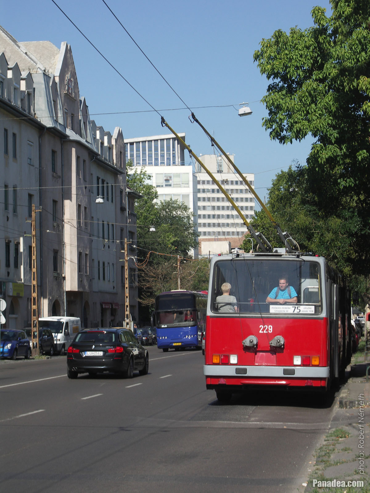
Tolleybus in the stop
Kuvauspäivämäärän: 20132013
Luonut: Robert Németh
Kameran malli: Konica Minolta Dimage A200
Budapest, Unkari
Tolleybus in the stop - Budapest, Unkari -
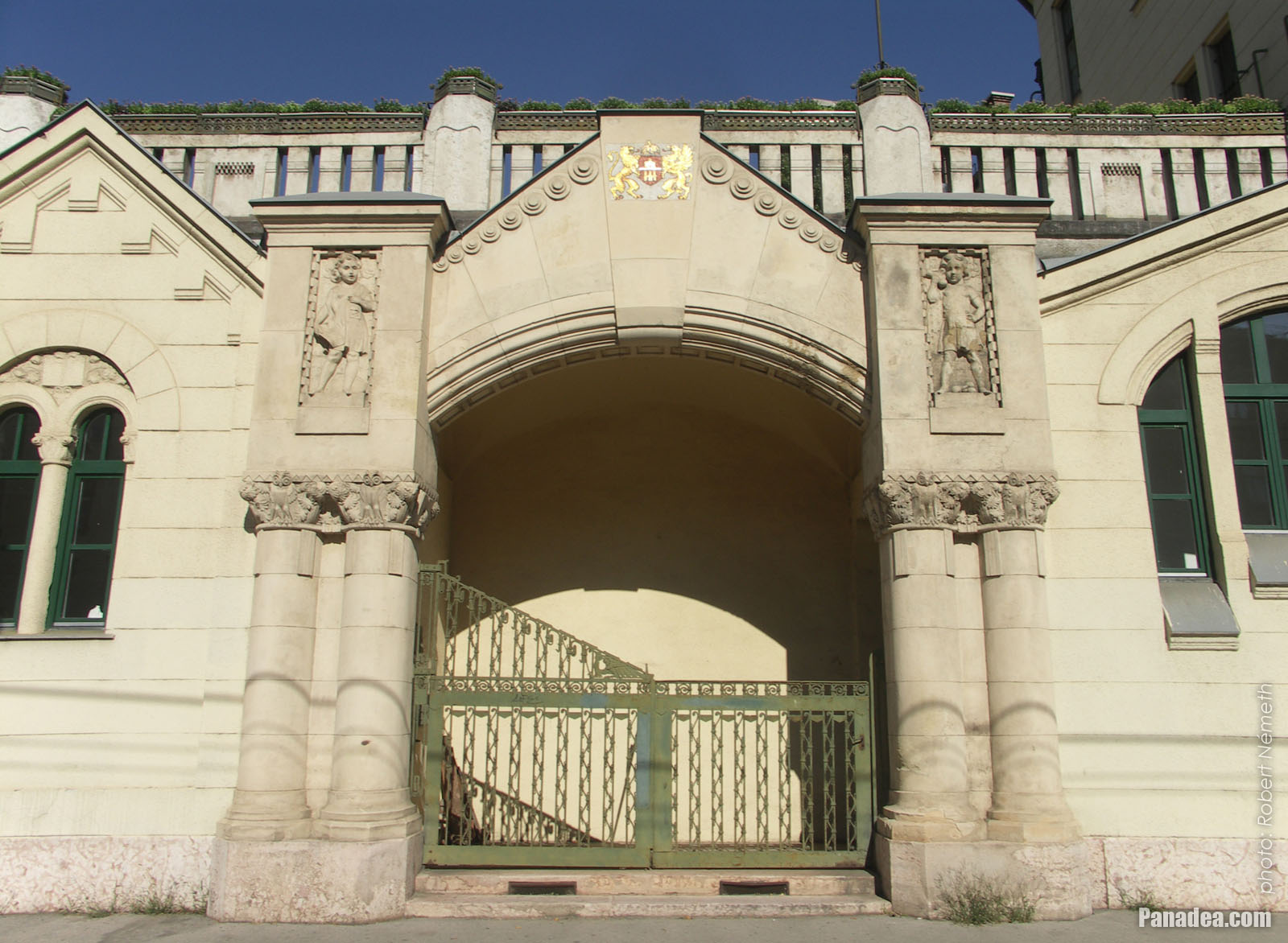
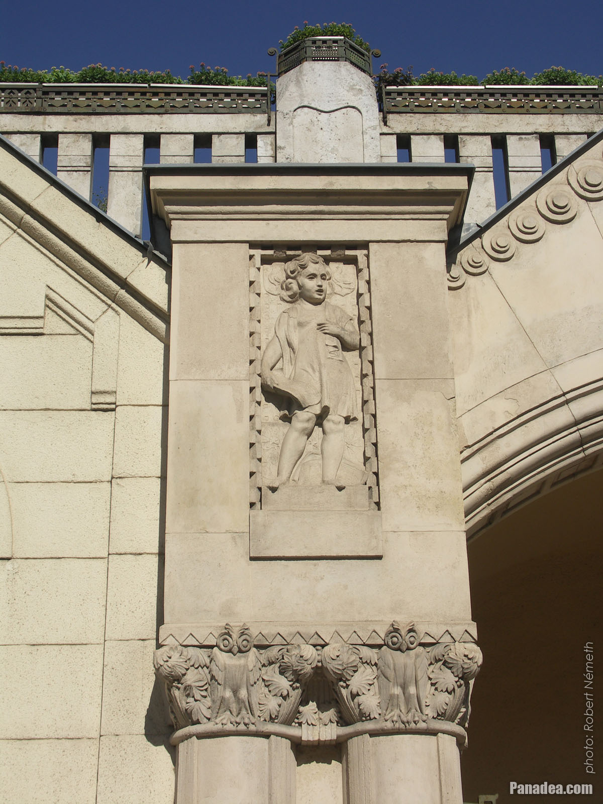
Primary School of Musical and Physical Education (Lehel Street Primary School)
Kuvauspäivämäärän: 20132013
Luonut: Robert Németh
Kameran malli: Konica Minolta Dimage A200
Budapest, Unkari
Primary School of Musical and Physical Education (Lehel Street Primary School) - Budapest, Unkari -
Primary School of Musical and Physical Education
Kuvauspäivämäärän: 20132013
Luonut: Robert Németh
Kameran malli: Konica Minolta Dimage A200
Budapest, Unkari
Primary School of Musical and Physical Education - Budapest, Unkari -
Primary School of Musical and Physical Education
Kuvauspäivämäärän: 20132013
Luonut: Robert Németh
Kameran malli: Konica Minolta Dimage A200
Budapest, Unkari
Primary School of Musical and Physical Education - Budapest, Unkari -
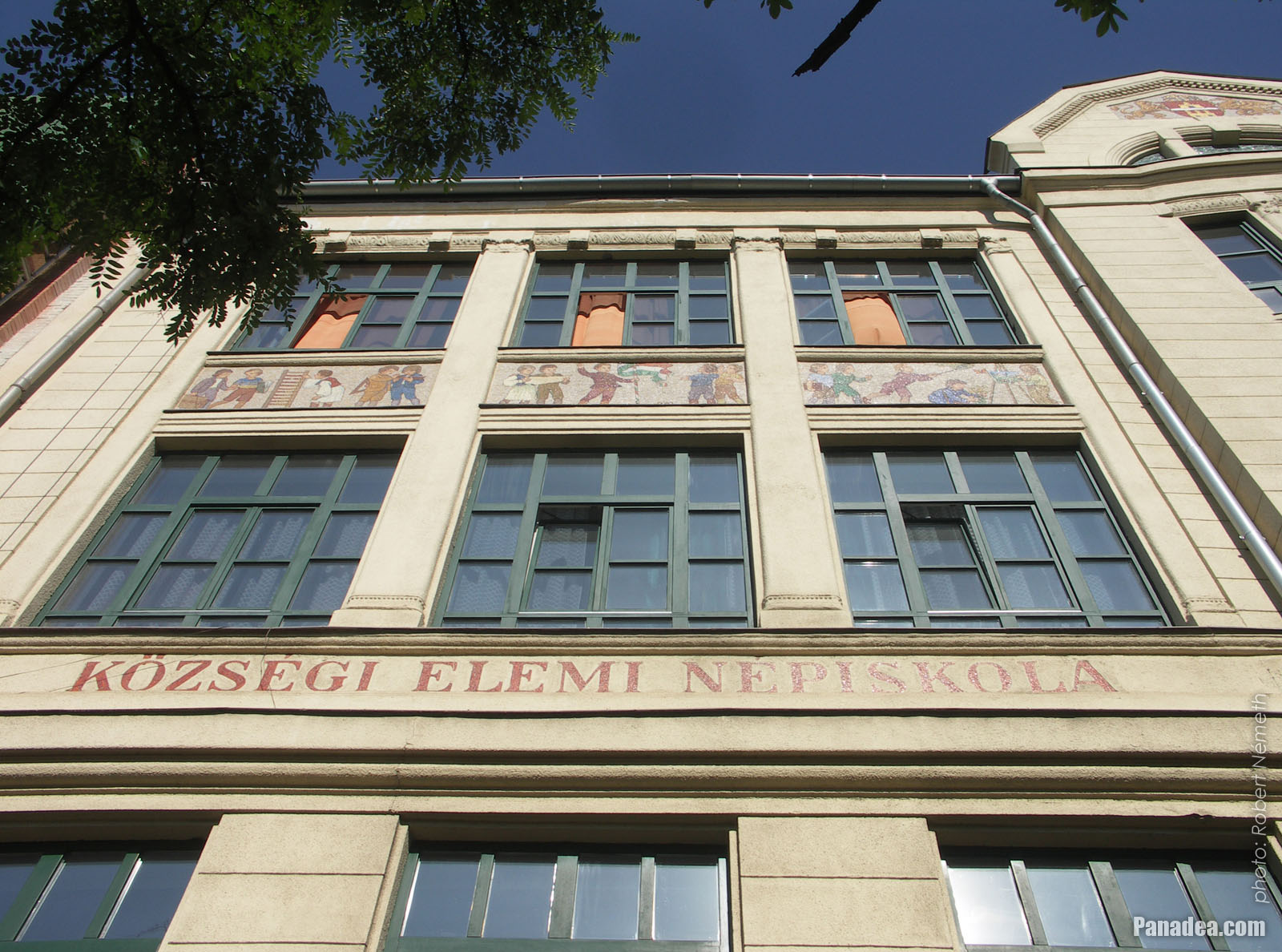
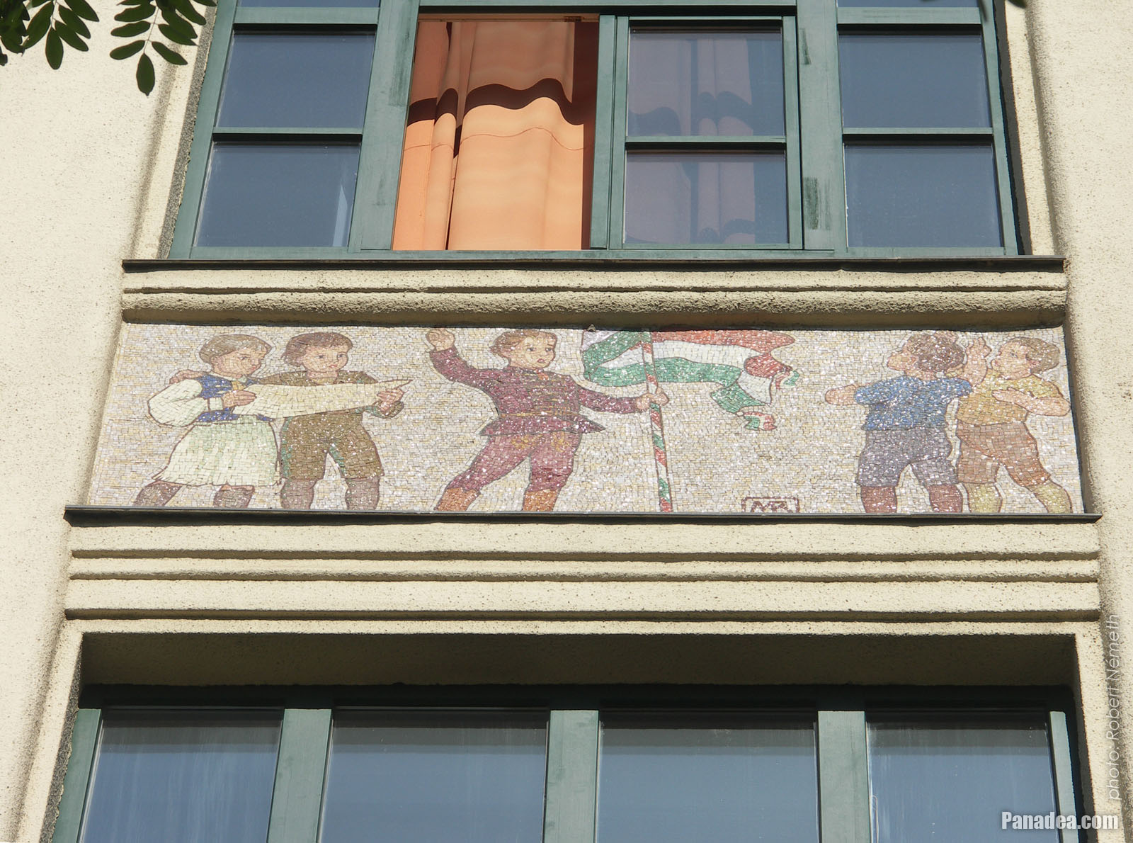
Colorful mosaic tiles on the wall of the Lehel Street Primary School
Kuvauspäivämäärän: 20132013
Luonut: Robert Németh
Kameran malli: Konica Minolta Dimage A200
Budapest, Unkari
Colorful mosaic tiles on the wall of the Lehel Street Primary School - Budapest, Unkari -
Four-storey residental building
Kuvauspäivämäärän: 20132013
Luonut: Robert Németh
Kameran malli: Konica Minolta Dimage A200
Budapest, Unkari
Four-storey residental building - Budapest, Unkari -
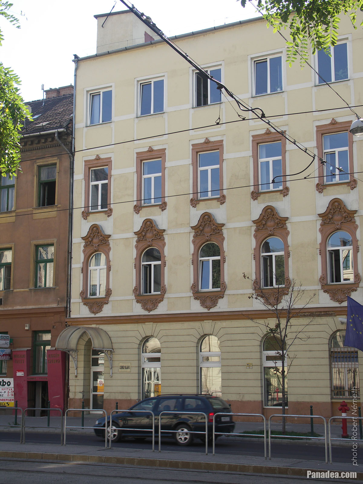
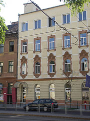
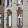
Decorated windows on a house
Kuvauspäivämäärän: 20132013
Luonut: Robert Németh
Kameran malli: Konica Minolta Dimage A200
Budapest, Unkari
Decorated windows on a house - Budapest, Unkari -
Junction of two main roads
Kuvauspäivämäärän: 20132013
Luonut: Robert Németh
Kameran malli: Konica Minolta Dimage A200
Budapest, Unkari
Junction of two main roads - Budapest, Unkari -
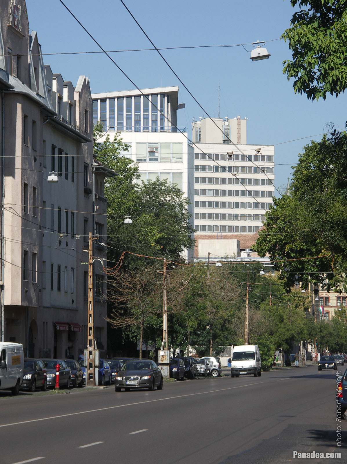
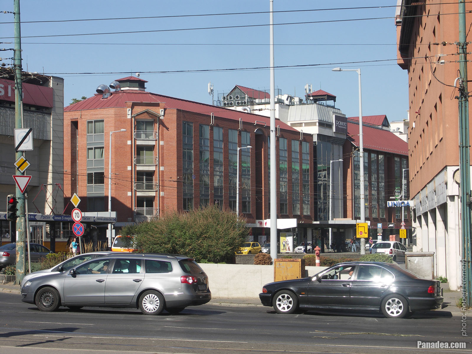
Tram station and the "Róbert" Office Building
Kuvauspäivämäärän: 20132013
Luonut: Robert Németh
Kameran malli: Konica Minolta Dimage A200
Budapest, Unkari
Tram station and the "Róbert" Office Building - Budapest, Unkari -
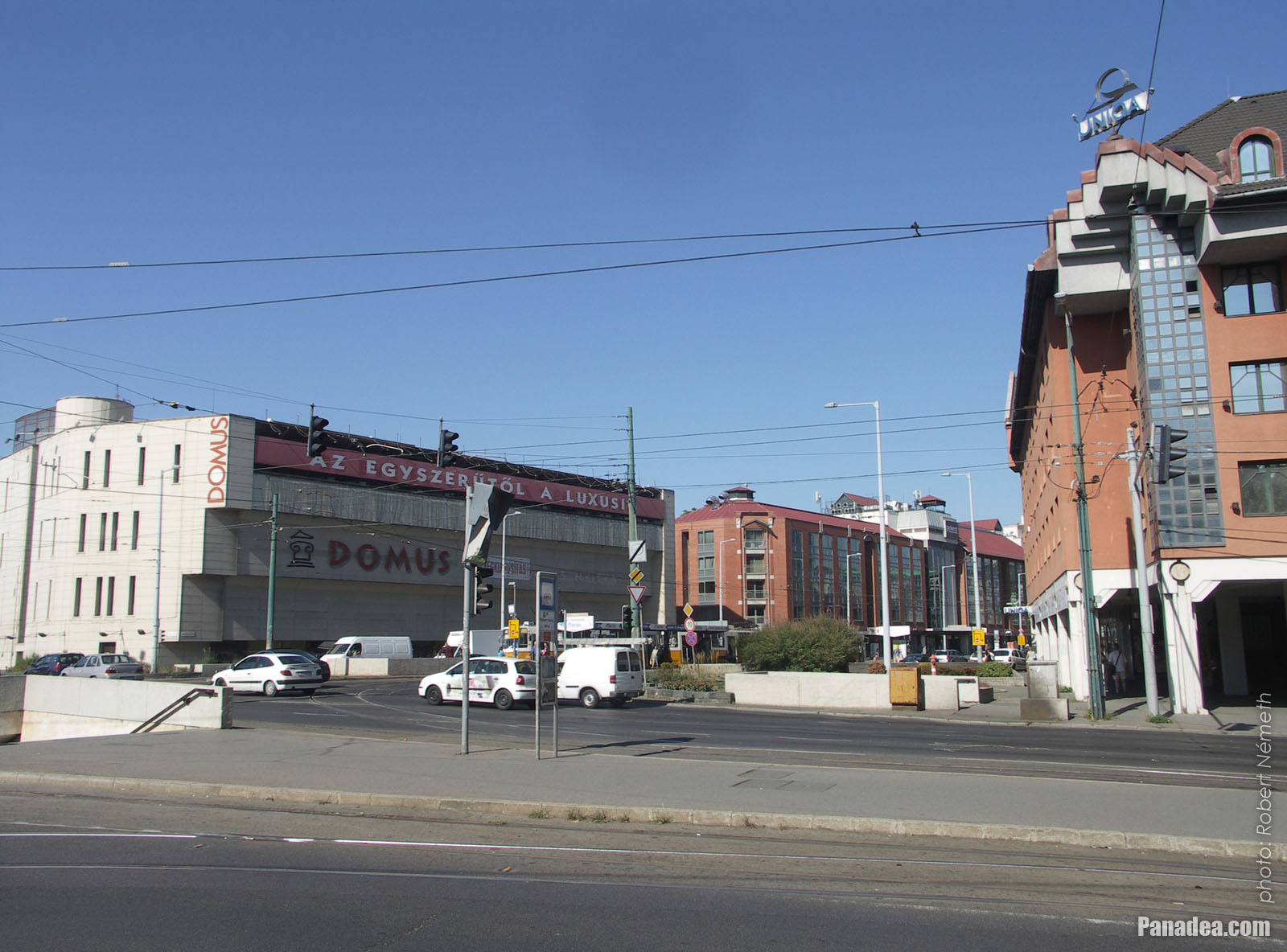
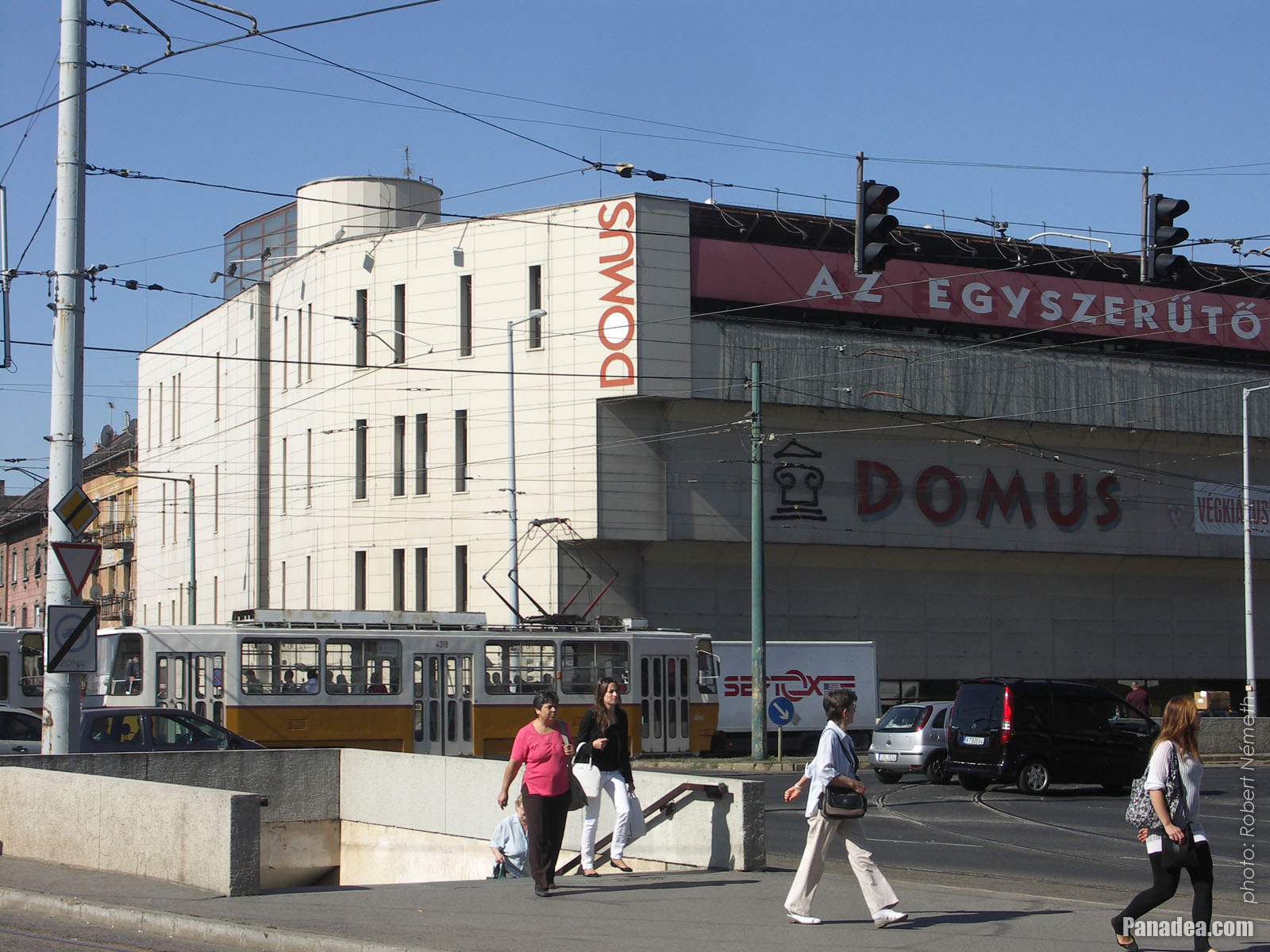
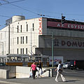
Stairs down to the underpass, and the "Domus" home furnishings store
Kuvauspäivämäärän: 20132013
Luonut: Robert Németh
Kameran malli: Konica Minolta Dimage A200
Budapest, Unkari
Stairs down to the underpass, and the "Domus" home furnishings store - Budapest, Unkari

Klikkaa kuvia!
Ominaisuudet, piirteet
Sijainti:
GPS-koordinaatit: Leveysaste 47°31'45", Pituusaste 19°4'48" (N47 31.75 - E19 4.8)
Yhteystiedot, lyhyitä tarinoita, mielenkiintoiset
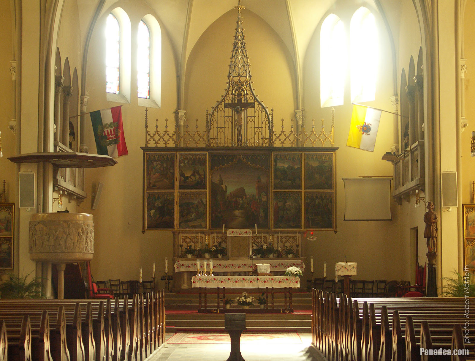 The main altar of the St. Ladislaus Church
The three-paneled winged altarpiece (so-called triptych) together with the two also multi-panel (polyptych) side altars were created by Pál Molnár C. between 1939-1942. The main altar represents scenes from the life of St. Ladislaus of Hungary (King Ladislaus I), for example the birth of the "knight-king", his battle with the Cumans and King Solomon of Hungary, as well as the legend of the origin of Torda Gap (in Hungarian "Tordai-hasadék", in Romanian "Cheile Turzii", in German "Thorenburger Schlucht") whish is situated in Transylvania, in present-day Romania. The larger central picture represents the event when King Ladislaus I was invited to lead the crusade (but he couldn't participate in it because he died before it).
Budapest - Lisää kuvagallerioita:
Saatat myös olla kiinnostunut (Liittyviä sivuja):
Kohteet matkaopas:
Budapest (8 468 valokuvaa + 21 panoraamakuvia)
Buda Hills (Budai-hegység) (8 632 valokuvaa + 21 panoraamakuvia)
Pest megye (county) (15 122 valokuvaa + 50 panoraamakuvia)
Budapest ja sen ympärillä (15 989 valokuvaa + 52 panoraamakuvia)
Unkari (27 287 valokuvaa + 163 panoraamakuvia)
ja lisäksi:
(sisällä tässä: Buda Hills)
Budakeszi (88 valokuvaa)
Pilisszentiván (76 valokuvaa)
Kaikki panoraamakuva tästä:
Budapest (21 valokuvaa)
Pest megye (county) (50 valokuvaa)
Budapest ja sen ympärillä (52 valokuvaa)
Unkari (163 valokuvaa)
Eurooppa (165 valokuvaa)
Jokainen normaali valokuva tästä:
Budapest (8 468 valokuvaa / 122 galleriat)
Buda Hills (Budai-hegység) (8 632 valokuvaa / 124 galleriat)
Pest megye (county) (15 122 valokuvaa / 221 galleriat)
Budapest ja sen ympärillä (15 989 valokuvaa / 234 galleriat)
Unkari (27 287 valokuvaa / 462 galleriat)
Eurooppa (30 494 valokuvaa / 523 galleriat)
https://www.panadea.com/fi/guidebook/budapest/photos/gal-036

Lisää Suosikkeihin Lisää Kirjanmerkkeihin
Jaa ystäviesi kanssa!
jne.


Meidän matkaopas sisältää:
Suuri määrä valokuvia ja panoraamakuvia, jossa on paljon tietoa ja mielenkiintoisia faktoja.
- 214 matkakohteet
- 165 panoraamakuvia
- 30 494 muut kuvaa
Suuri kokoelma valittu kuvia: erinomainen laatu, korkea resoluutio ja luonnolliset värit
Tietoa meistä - Yleiset ehdot ja Tietosuoja -
Kaikki oikeudet pidätetään
- ©2010-2022
Neuronit Creative Studio - Mogyoród / Budapest / Unkari